Marcahuasi is a high-altitude Andean plateau known in Spanish as Meseta de Marcahuasi. Situated east of Lima in the Peruvian mountains, this geological formation rises above the Rímac River valley. Wikidata identifies it as Q2778547. The site attracts visitors for its unusual rock formations and expansive summit views. OpenStreetMap records its boundary as relation/10677703. Its remote setting requires preparation. Marcahuasi belongs in this actual displayed route because it remains one of the city's highest-ranked published stops. The useful visit keeps attention on the place itself and current conditions on arrival.
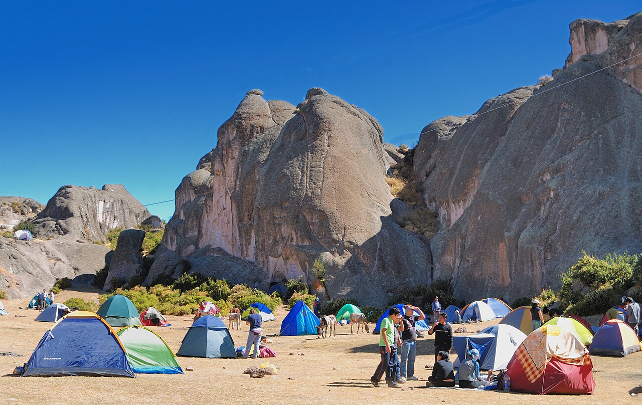
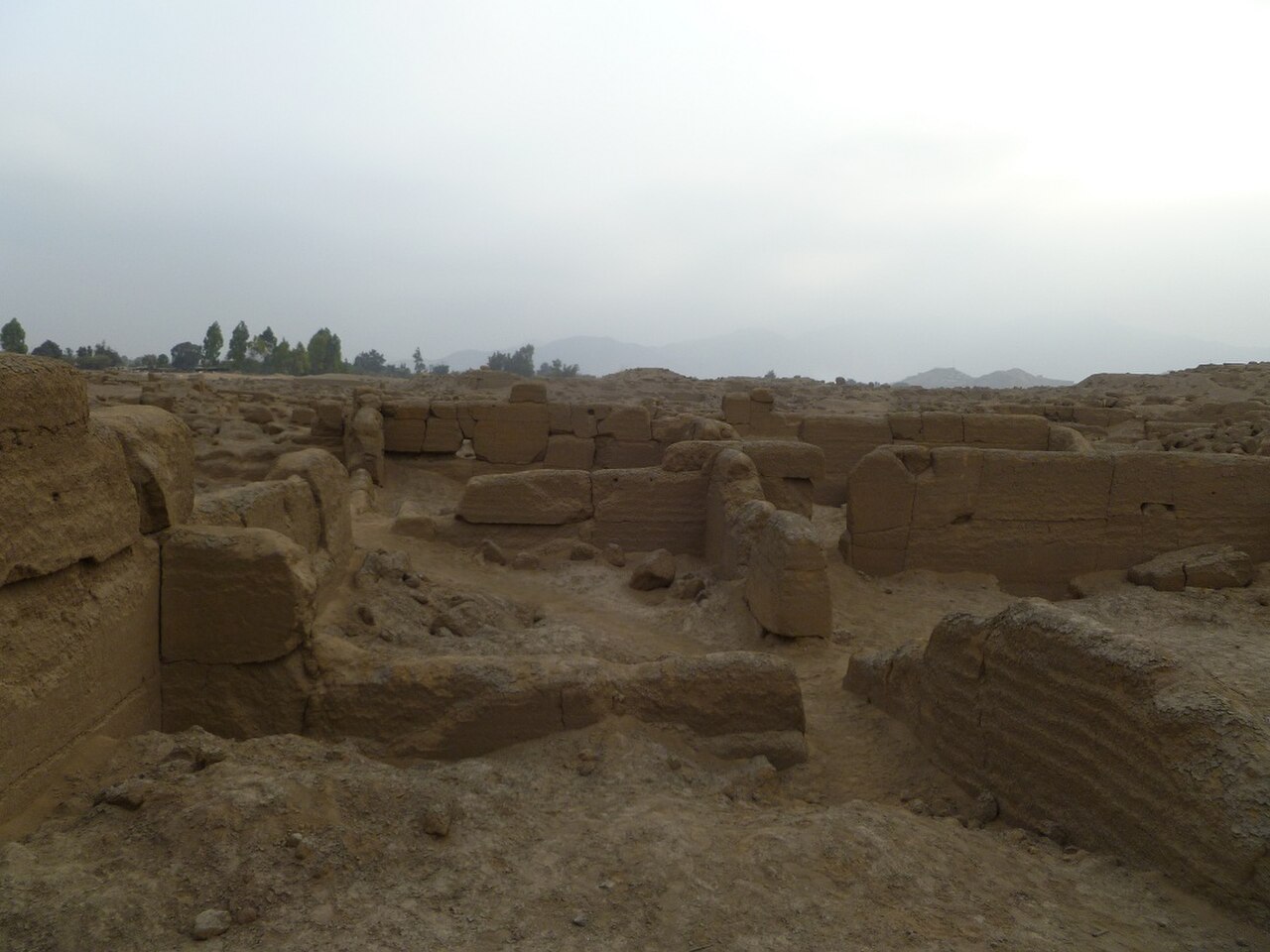
The plateau features distinctive granite rock formations shaped by erosion, some resembling human or animal profiles. Visitors report scattered archaeological remains including stone structures and terraces. The terrain encompasses grassy highland zones, rocky outcrops, and panoramic overlooks. Specific archaeological inventories are Not recorded. No permanent facilities exist on the meseta itself. Water sources are unreliable. The landscape demands self-sufficiency from all who venture there. Check the operator's own site for the travel date before relying on a schedule or fare.
Most visitors allocate two to three days for the complete Marcahuasi experience, including approach trekking and summit exploration. The hike from the nearest settlement, San Pedro de Casta, typically requires four to six hours ascending steep mountain trails. Summit exploration varies by fitness and interest. Some travellers extend stays for acclimatisation or photography. Exact durations depend on individual pace and weather conditions encountered. Marcahuasi belongs in this actual displayed route because it remains one of the city's highest-ranked published stops. The useful visit keeps attention on the place itself and current conditions on arrival.
The dry season, roughly May through October, generally offers more stable conditions for mountain trekking in this region. Rainy months increase trail difficulty and landslide risk. Temperatures drop significantly at night due to extreme elevation. No official opening or closing times are documented in the supplied sources. Visitors must verify current conditions independently before departure. A flexible plan lets travellers connect Marcahuasi with nearby ranked stops without inventing practical details that the available source pointers do not confirm. Check the operator's own site for the travel date before relying on a schedule or fare.
No formal admission system for Marcahuasi is documented in the supplied sources. San Pedro de Casta may collect community fees, though amounts and collection methods are unverified. Visitors should carry sufficient cash for potential local payments, supplies, and emergency needs. No advance booking platforms are confirmed. All financial arrangements require on-site verification with local authorities. Check the operator's own site for the travel date before relying on a schedule or fare.
Marcahuasi lies approximately 80-100 kilometres east of Lima. Public transport reaches San Pedro de Casta from Lima's Chosica district, though schedules are irregular and infrequent. The final approach requires strenuous hiking. Road conditions vary seasonally. Private vehicle access is possible to San Pedro de Casta but not onto the meseta itself. No established taxi or rideshare services operate to this remote destination. Self-arranged transport is essential. A flexible plan lets travellers connect Marcahuasi with nearby ranked stops without inventing practical details that the available source pointers do not confirm.
Altitude sickness poses serious risk above 4,000 metres; acclimatisation is essential. Weather changes rapidly with little warning. Trails are unmarked and poorly maintained in sections. No rescue services operate reliably in this area. Water purification is necessary. Mobile phone coverage is absent or extremely limited. Solo trekking is inadvisable. Inform local authorities of your itinerary. Emergency evacuation would be difficult and time-consuming to arrange. Marcahuasi belongs in this actual displayed route because it remains one of the city's highest-ranked published stops. The useful visit keeps attention on the place itself and current conditions on arrival.
The granite sculptures and expansive Andean vistas offer compelling subjects. Dawn and dusk provide dramatic lighting on rock formations. Night photography benefits from minimal light pollution, though cold temperatures drain batteries rapidly. Wide-angle lenses capture the scale of formations; telephoto lenses isolate distant peaks. No drone regulations are documented in supplied sources. Tripods assist in low-light conditions. Weather protection for equipment is mandatory. A flexible plan lets travellers connect Marcahuasi with nearby ranked stops without inventing practical details that the available source pointers do not confirm.
Geprüft 2026-08-28
Häufige Fragen
What is the exact elevation of Marcahuasi for Marcahuasi in Lima?
Not recorded in the supplied sources.
Are there guided tours available for Marcahuasi in Lima?
Not recorded in the supplied sources; independent arrangements may be possible in San Pedro de Casta.
Is camping permitted on the meseta for Marcahuasi in Lima?
Not recorded in the supplied sources; visitors should confirm with local authorities.
What is the best way to prevent altitude sickness for Marcahuasi in Lima?
Gradual acclimatisation is essential; specific medical advice is beyond the scope of this guide.
Are there restaurants or shops at Marcahuasi for Marcahuasi in Lima?
Not recorded; the meseta itself has no permanent facilities. San Pedro de Casta may offer basic supplies.
Is the site accessible for visitors with limited mobility for Marcahuasi in Lima?
Not recorded; the steep unpaved trails and high altitude present significant barriers.
Nichts Essenzielles wird gesetzt, bevor Sie wählen, in Regionen, in denen eine Zustimmung erforderlich ist. Wenn Sie ablehnen, erscheinen Werbeanzeigen weiterhin, und Analysen werden vollständig ausgeschaltet.