
01
1 hour
South Bank Parklands
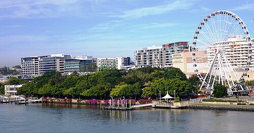
South Bank Parklands is Brisbane’s riverside public parkland on the southern bank of the Brisbane River, beside the city’s cultural precinct.
- Must see
- Nature site
Language · 11 published
City guide · Australia

Brisbane bends around its river, so places that look close on a map may sit on opposite banks or around a long curve. The city centre faces South Bank across the water, while Fortitude Valley and New Farm extend northeast along different corridors. Moreton Bay and its islands lie beyond the urban river network. Sightseeing works best when each bank and river reach is treated as a deliberate sequence.
Reviewed by Elena Voss · Roavina Travel Editor
Set your days, your pace and the hours you actually want to be out. The planner works around closing days and travel time, and leaves room to eat.
Ranked by importance — sitelinks, pageviews and heritage status, not editor preference.
40 places match
Category
Typical visit duration
Interests
South Bank Parklands is Brisbane’s riverside public parkland on the southern bank of the Brisbane River, beside the city’s cultural precinct.
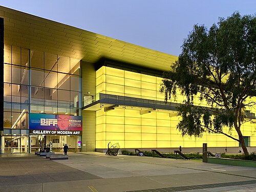
Gallery of Modern Art, known as GOMA, is Brisbane's modern and contemporary art museum within the Queensland Art Gallery | Gallery of Modern Art complex.
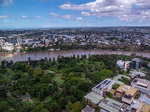
Brisbane City Botanic Gardens
City Botanic Gardens is a historic riverside botanic garden in Brisbane. The current curated ranking identifies the exact production place and prioritises it for garden paths, mature planting, lawns, and a river-edge setting beside central Brisbane.
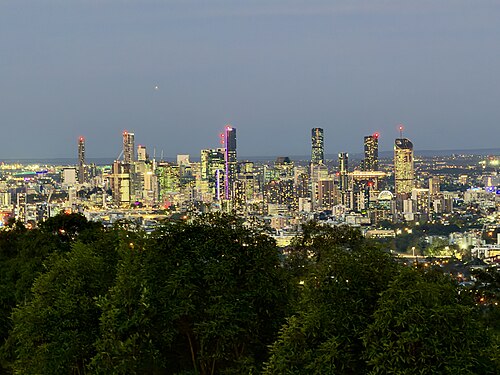
Mount Coot-tha Lookout is a prominent elevated viewing platform situated in the western suburbs of Brisbane, Queensland.
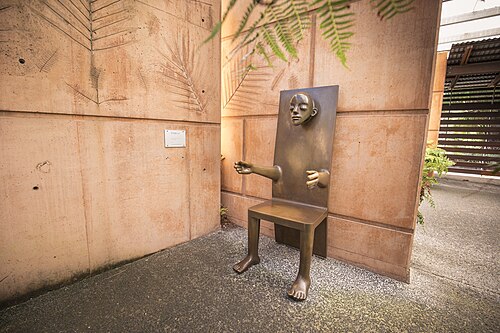
Mount Coot-tha Botanic Gardens
Brisbane Botanic Gardens Mount Coot-tha is a major botanical garden located in the western suburbs of Brisbane, Queensland. It serves as Brisbane's premier botanical collection and is distinct from the city's other green spaces.
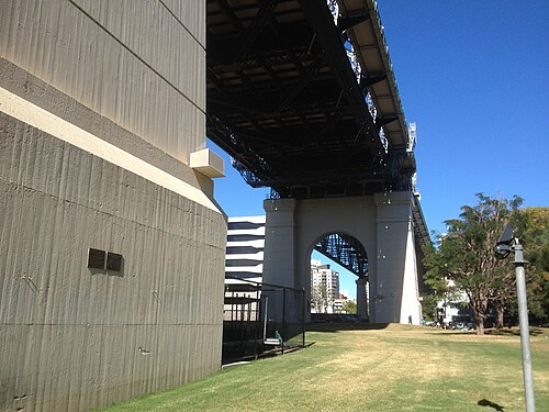
Story Bridge is Brisbane’s 1,072-metre steel road bridge across the Brisbane River, linking the central city side with Kangaroo Point.
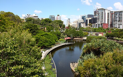
Roma Street Parklands
Roma Street Parklands is a landscaped urban parkland in central Brisbane, immediately beside Roma Street station and the Brisbane Coach Terminal. Its character comes from connected planted areas, lawns, paths, hillside levels, the Spectacle Garden and the Rainforest Walk.

Queensland Art Gallery is a public art gallery in Brisbane. The current curated ranking identifies the exact production place and prioritises it for art collections and exhibitions within Brisbane's South Bank cultural precinct.

Kangaroo Point Cliffs is Brisbane’s distinctive river-edge recreation landscape: a band of red-brown cliffs rising beside the Brisbane River, with the city centre spread across the water.
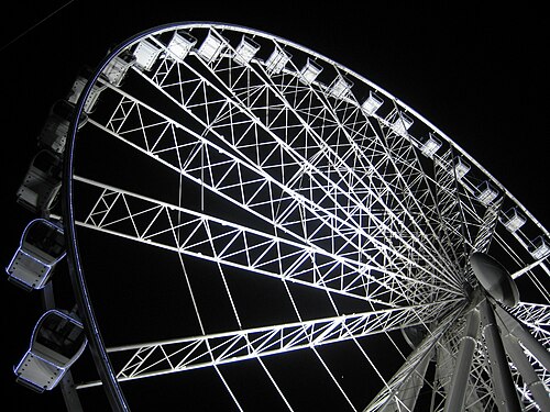
The Wheel of Brisbane
The Wheel of Brisbane is a prominent observation wheel situated in the South Bank Parklands area of Brisbane, Queensland.
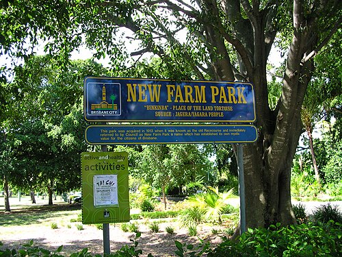
New Farm Park is a public park in Brisbane, situated in the inner suburb of New Farm. The park occupies a prominent riverside position along the Brisbane River, making it one of the city's more notable green spaces.

Anzac Square
ANZAC Square is a war memorial and public park in central Brisbane, Queensland. It commemorates Australian and New Zealand Army Corps personnel who served in conflicts.
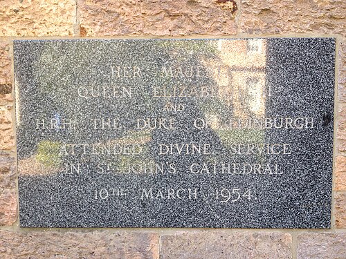
St John's Cathedral is a Gothic Revival cathedral in Brisbane, Queensland. It serves as the cathedral church of the Anglican Diocese of Brisbane and stands as a prominent religious and architectural landmark in the city.

Parliament House Queensland is the meeting place of the Parliament of Queensland, located in Brisbane. The building occupies a prominent position on the corner of George and Alice Streets in the CBD, overlooking the Brisbane River.
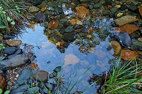
D'Aguilar National Park is a protected natural area situated in the vicinity of Brisbane, Queensland.
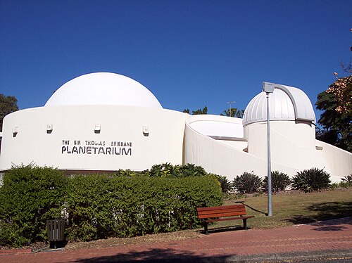
Sir Thomas Brisbane Planetarium is a public astronomy education facility located within the Brisbane Botanic Gardens at Mount Coot-tha. Named after the astronomer governor of New South Wales, it serves as a cultural and scientific institution for the metropolitan area.
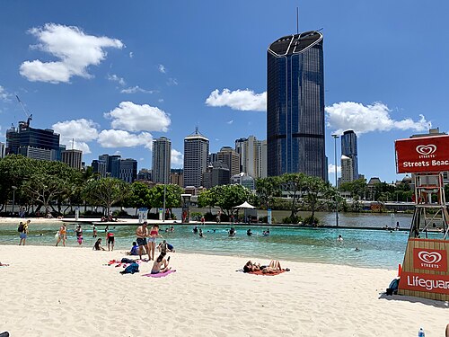
Streets Beach is an artificial swimming beach in South Bank Parklands, a rare city-centre lagoon where sand, water and Brisbane’s urban skyline meet.
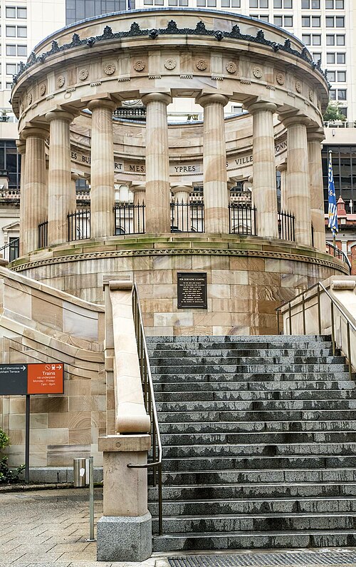
Shrine of Remembrance
The Shrine of Remembrance is a war memorial located in Brisbane, Queensland. It stands as a commemorative structure dedicated to honoring military personnel who served and sacrificed in armed conflicts.
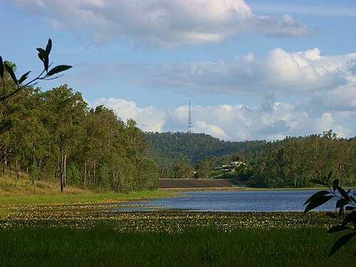
Enoggera Reservoir is a heritage-listed water supply reservoir located in Brisbane's north-western suburbs. Constructed in the 1860s, it represents one of Queensland's earliest major public water infrastructure projects.
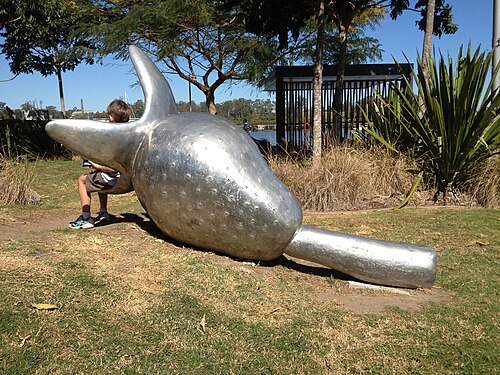
Northshore Riverside Park is a public riverside green space located along the Brisbane River in Brisbane, Queensland.
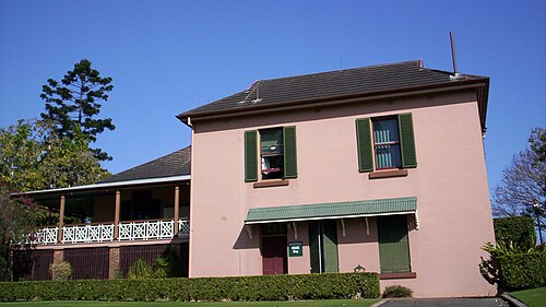
Newstead House
Newstead House is a heritage property situated in the Brisbane suburb of Newstead. It stands as one of Queensland's surviving nineteenth-century residences, positioned on the Brisbane River with grounds that form part of the broader riverside parkland.
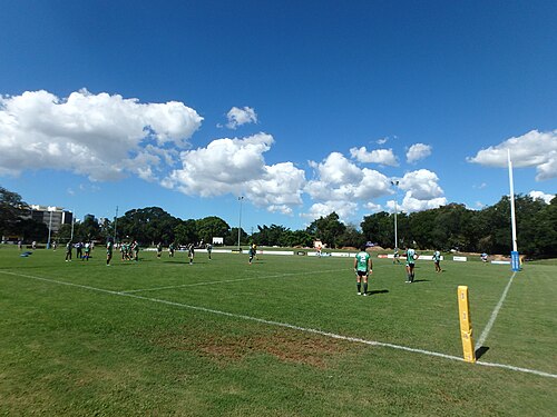
Davies Park is a public park in Brisbane, Queensland, managed by Brisbane City Council. It serves as recreational green space within the metropolitan area and is included in curated visitor rankings for the city.
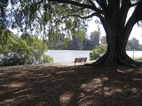
Orleigh Park is a public park situated in the inner-western suburbs of Brisbane, Queensland. It occupies a riverside position along the Brisbane River within the West End locality.
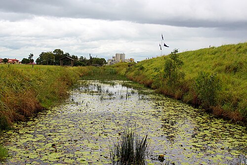
Fort Lytton National Park is a heritage-listed military precinct located at the mouth of the Brisbane River. Established in 1881, the site served as Brisbane's principal coastal defence fortification until the end of World War II.
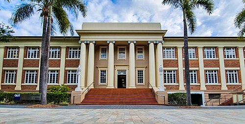
QUT Art Museum is a contemporary art museum located in Brisbane, Queensland. It forms part of the Queensland University of Technology's cultural precinct at Gardens Point campus.

The Institute of Modern Art is a contemporary art institution located in Brisbane. It serves as a venue for the exhibition and promotion of modern and contemporary art practices.

Rocks Riverside Park is a public park in Brisbane, Queensland. The park sits along the Brisbane River and provides open space for recreation and leisure.

Sherwood Arboretum is a public park and botanical collection in the Sherwood suburb of Brisbane, Queensland. Established in the 1920s, it occupies riverside land along the Brisbane River.
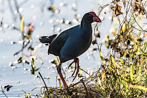
Minnippi Parklands is a public park area in Brisbane, included in curated metropolitan visitor rankings as a notable green space. The parklands form part of Brisbane's broader network of recreational areas accessible to residents and visitors.
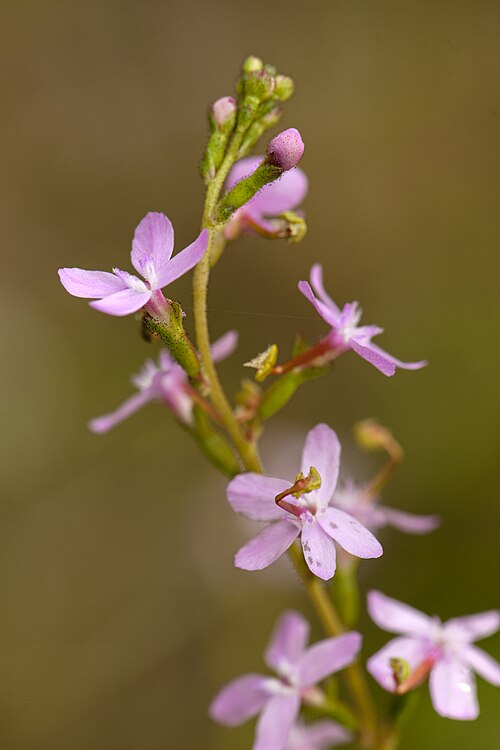
Seven Hills Bushland Reserve is a protected natural area within the Brisbane metropolitan region. It forms part of the city's network of bushland reserves managed for conservation and passive recreation.

Bunyaville Conservation Park is a protected natural area located within the Greater Brisbane metropolitan region. The park preserves remnant bushland and provides habitat for native flora and fauna.
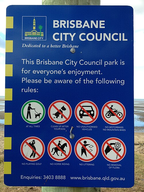
Nudgee Beach is a coastal locality and beach area within the greater Brisbane metropolitan region in Queensland, Australia. It sits on the shores of Moreton Bay, forming part of the city's north-eastern coastline.
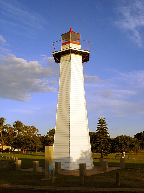
Cleveland Point Lighthouse
Cleveland Point Lighthouse is a navigational aid structure located at Cleveland Point in the Brisbane metropolitan area. The lighthouse sits within the broader network of parks and gardens that characterise Brisbane's coastal and riverside landscape.
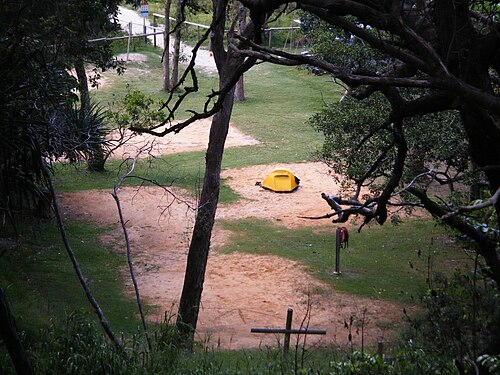
Cylinder Beach is a coastal locality on North Stradbroke Island, part of the Moreton Bay region associated with Brisbane. The beach lies within a recognised natural coastal environment that forms part of the broader Stradbroke Island landscape.

Tangalooma Wrecks is a collection of deliberately sunk vessels located off the coast of Moreton Island, near Brisbane. These shipwrecks were scuttled to create a breakwall for small boats and have since become a significant marine attraction.
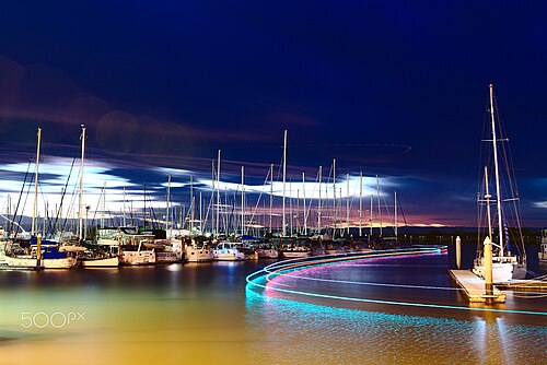
Scarborough Beach Park is a coastal parkland in the Brisbane metropolitan area, situated within the Moreton Bay Region. The park takes its name from Scarborough Beach, a sandy foreshore on the Redcliffe Peninsula facing Moreton Bay.
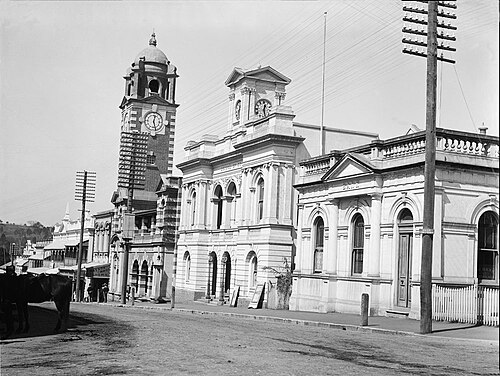
Ipswich Art Gallery is a public art museum in the centre of Ipswich, about 40 kilometres west of Brisbane's central business district.
Nerima Gardens is a Japanese-style garden located in Brisbane, Queensland. It forms part of the broader network of parks and gardens across the Brisbane metropolitan area.
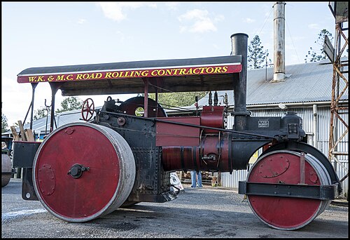
Old Petrie Town is a heritage precinct in Brisbane's northern suburbs, preserving historical buildings and rural Queensland character. The site functions as an open-air museum and community gathering place, showcasing relocated and restored structures from the region's pioneering era.
Source: OpenStreetMap contributors, Wikidata ·
Pair the city centre with its nearest river stops, then cross once for South Bank's museums and parkland. Fortitude Valley and New Farm can form a second inner-city route ending beside the river. Moreton Bay islands require an outward connection and ferry timetable, while hinterland trips use another direction entirely. Avoid crossing the river repeatedly simply to follow a numerical attraction list.
Checked 2026-08-26
Translink combines buses, trains and ferries in one metropolitan network. River ferries can be useful transport rather than a sightseeing extra, particularly when the next stop is on another reach of the Brisbane River. Walk along one bank or within one precinct, then consult Translink for the connecting leg. Island ferries and hinterland routes sit outside a simple central loop and need separate return checks.
Checked 2026-08-26
No official stay length is recorded for Brisbane. Start with the city centre and South Bank, add Fortitude Valley or New Farm as an inner-city route, and allow a separate day when Moreton Bay is part of the visit.
Follow the river rather than jumping between distant map points. Keep central Brisbane on one side of a crossing, group South Bank's institutions, and connect Fortitude Valley with New Farm on another route.
Use Translink buses and trains for land corridors and ferries for suitable river crossings. The official journey planner and service notices show which combination works for the chosen bank and time of day.
The city centre, South Bank and individual riverside precincts reward walking, but the river's bends lengthen cross-city routes. Use a bridge, ferry or other Translink service when moving between separate reaches.
Moreton Bay islands need a dedicated outward-and-return plan. Hinterland destinations also leave the river network, so verify both legs before sacrificing a central Brisbane day to the excursion.