
1 min walk
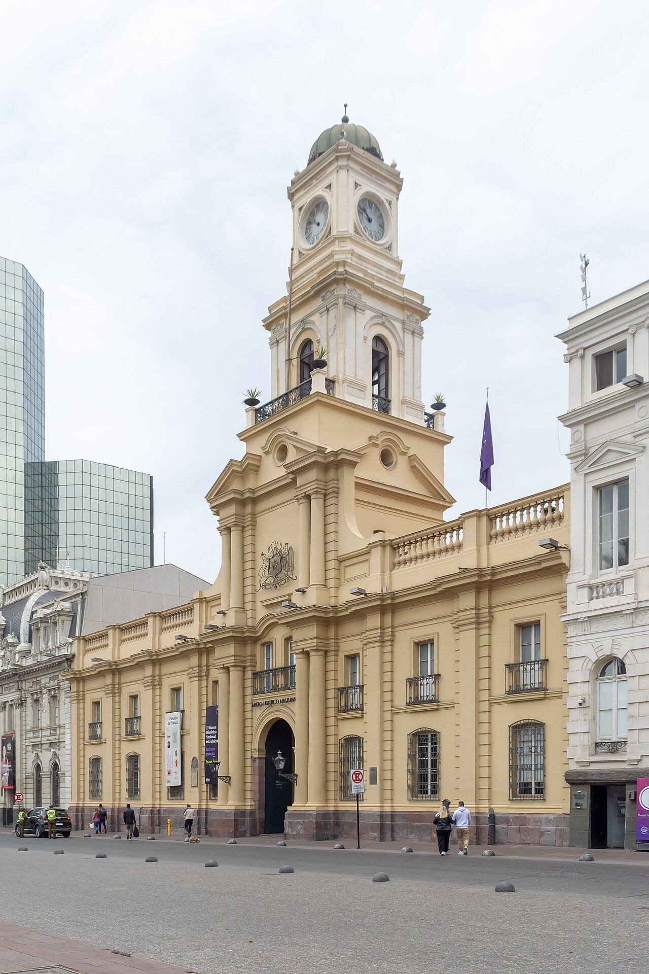
Chilean National History Museum
- Must see · Heritage site
- Museum
Historic monument · Santiago
Plaza de Armas de Santiago de Chile
| Monday | 00:00 – 23:59 |
|---|---|
| Tuesday | 00:00 – 23:59 |
| Wednesday | 00:00 – 23:59 |
| Thursday | 00:00 – 23:59 |
| Friday | 00:00 – 23:59 |
| Saturday | 00:00 – 23:59 |
| Sunday | 00:00 – 23:59 |
Checked 2026-08-31 · Source
| Per person | Free entry |
|---|
Checked 2026-08-31 · Source
Read from the OpenStreetMap access tags; anything not listed has no tag recorded.
Set the group type to family in the planner and the day window contracts to about three quarters of a solo day.
Plaza de Armas is Santiago's principal historic square and the city's Kilometre Zero. Santiago Turismo describes it as the heart of the capital, set among Merced, Ahumada, Monjitas and Estado, while Visit Santiago places it at the origin of the historic centre. The square is an open civic space, not an enclosed monument: its significance comes from the city institutions and public life gathered around it. Use Plaza de Armas as the starting point for understanding Santiago's colonial foundation and its present-day central district. The responsible operator publishes a definite status and admission position. The public square is accessible 24 hours daily; civic events, demonstrations and maintenance can restrict sections. Square access is free.
Checked 2026-08-31 · Source
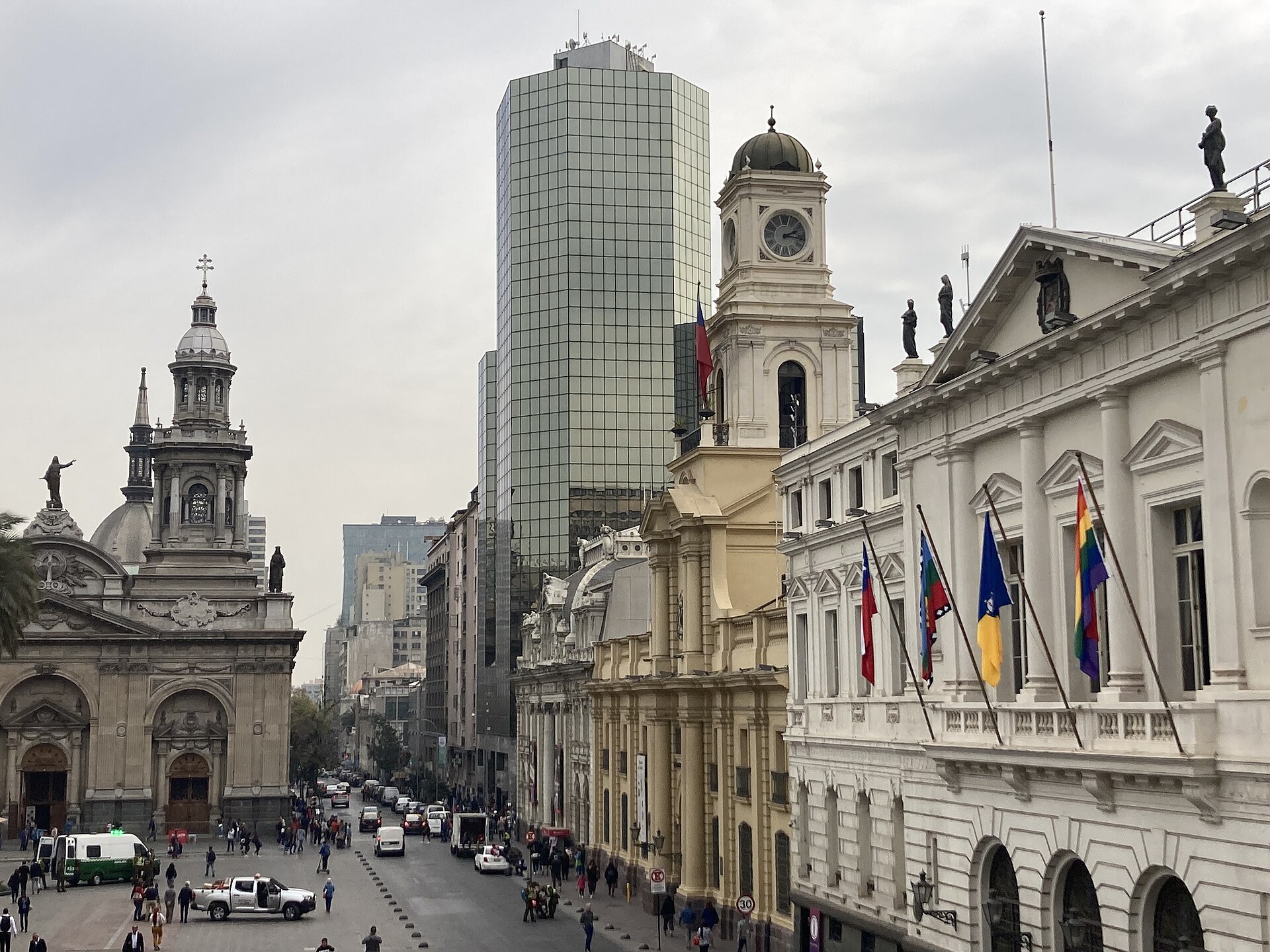
The square is framed by the Catedral Metropolitana, the Municipalidad de Santiago in the former Cabildo, the Museo Histórico Nacional in the former Real Audiencia and the Correo Central in the former governors' house. Santiago Turismo also identifies the equestrian statue of Pedro de Valdivia, the Cardinal José María Caro statue and monuments in the square's landscaping. The visitor experience is therefore a sequence of exterior observation and separately managed institutions. Arrival and physical access are described separately. Metro Plaza de Armas station is directly beneath the square. Step-free entrances or public approaches, lifts where required, and accessible toilets serve principal visitor areas.
Checked 2026-08-31 · Source
Allow one hour to walk the square, read the surrounding buildings and begin the adjacent historic-centre streets. Add separate time for the cathedral, museum, post office area or a longer Centro Histórico walk. It works well as an orientation stop at the start of a walking route rather than as the only destination for a half-day itinerary. Ordinary entry differs from premium products. No. Special tours, transport and exhibitions use separate tickets.
Checked 2026-08-31 · Source
The public square is accessible 24 hours daily; civic events, demonstrations and maintenance can restrict sections. Events, worship, maintenance and security measures can alter ordinary access. Visit in daylight when the surrounding architecture and pedestrian streets can be read clearly, then adapt the route to current civic activity. Santiago Turismo describes the plaza as a living social centre with artists, photographers and street performers, so atmosphere can change with the day and events. Check local conditions if you need a quiet visit or are planning a fixed meeting point, especially during public gatherings in the historic centre.
Checked 2026-08-31 · Source
Square access is free. Premium products and organised activities use separate terms. The Plaza de Armas is a public square and no separate entry ticket is recorded for walking through it. The cathedral, museums and any tours around the square are independent visits with their own current terms. Do not treat a free public square as evidence that every doorway around it is open or free. Check the institution you intend to enter before building it into the day.
Checked 2026-08-31 · Source
Metro Plaza de Armas station is directly beneath the square. This is the named public-transport approach for an independent visit. Plaza de Armas is in Santiago's Centro Histórico at Kilometre Zero. Chile Travel identifies Plaza de Armas station on Metro Lines 5 and 3 as directly connecting travellers with the historic centre's main points of interest. Arrive by Metro for the clearest orientation, then continue on foot through the central grid. The square is also a practical reference point for taxis and walking directions.
Checked 2026-08-31 · Source
Step-free entrances or public approaches, lifts where required, and accessible toilets serve principal visitor areas. The access description applies to principal visitor areas rather than every historic or operational space. This is a busy central public space rather than a controlled attraction. Keep valuables secure, stay aware of street movement and avoid blocking workers, performers or worshippers while looking for photographs. The surrounding institutions have different dress, conduct, security and photography rules; confirm those rules at each entrance. A respectful visit leaves room for ordinary city life and treats the plaza as a shared civic space, not a private backdrop. Plan your route, meeting point and onward Metro connection before separating from companions in the crowd.
Checked 2026-08-31 · Source
The useful compositions are wide enough to show the square's relationship with the cathedral, historic façades and daily pedestrian life. The licensed Commons lead image is a recent view of Plaza de Armas, recorded with its author and Creative Commons attribution licence. Photograph people considerately and ask before close portraits of artists, vendors or worshippers. Do not obstruct the square's paths or ignore staff instructions inside the cathedral or museums.
Checked 2026-08-31 · Source
The public square is accessible 24 hours daily; civic events, demonstrations and maintenance can restrict sections.
Square access is free.
Step-free entrances or public approaches, lifts where required, and accessible toilets serve principal visitor areas.
Metro Plaza de Armas station is directly beneath the square.
Yes. Worship, events, maintenance, weather and security can change ordinary access.
No. Special tours, transport and exhibitions use separate tickets.
Loading the interactive map…
The interactive map could not be loaded.

Last updated:
Source: OpenStreetMap contributors, Wikidata ·