

.jpg)
8 min walk
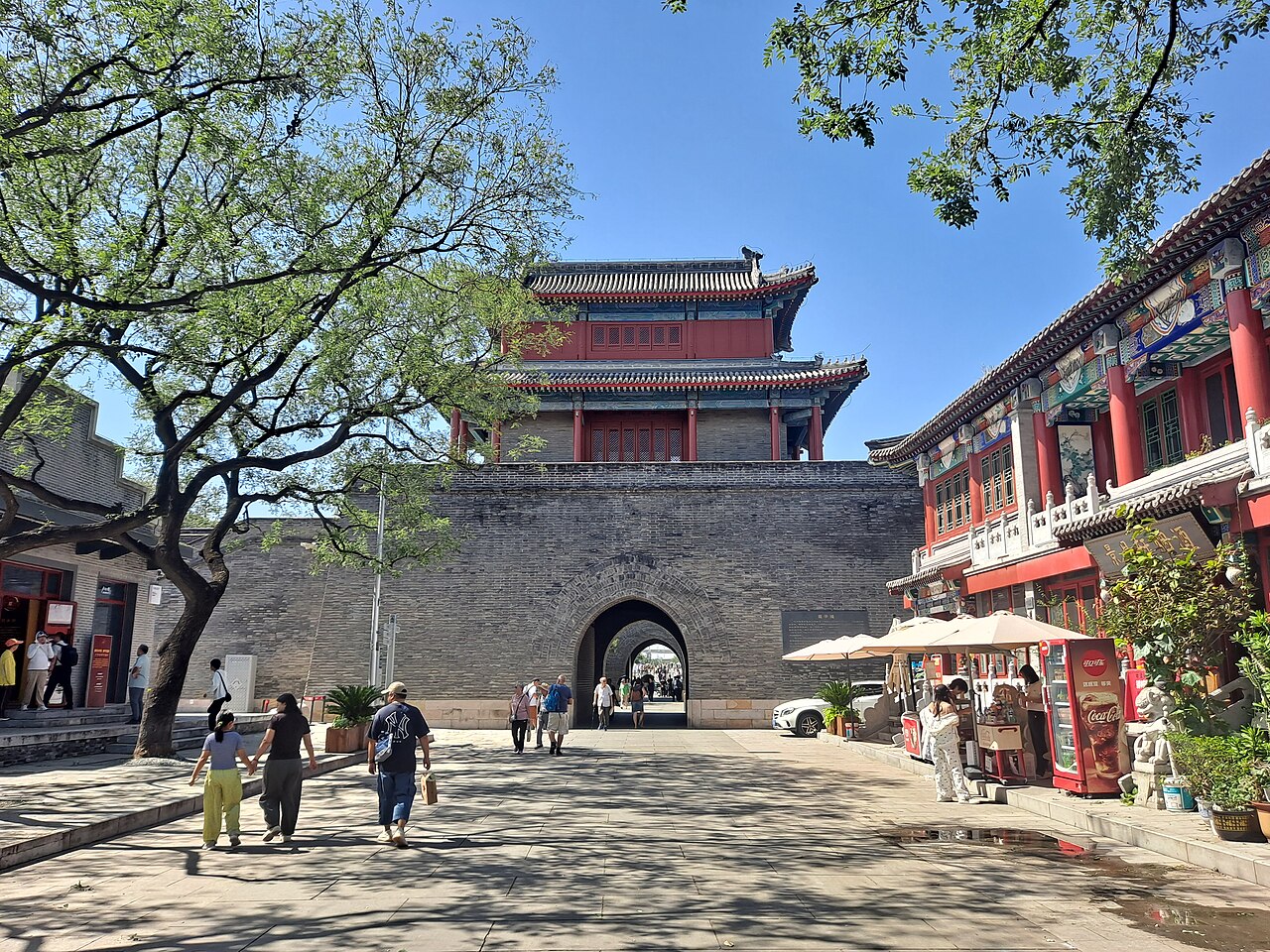
Wanping Fortress
- High · Heritage site
- Historic monument
Language · 11 published
Viewpoint · Beijing
卢沟桥
Reviewed by Elena Voss · Roavina Travel Editor
This place is a Viewpoint.
Marco Polo Bridge, also called Lugou Bridge, is a historic stone crossing over the Yongding River in Beijing’s Fengtai District. Its name became famous in European writing after Marco Polo described the bridge during his account of China, while its modern historical importance comes from the incident of 7 July 1937. That confrontation at the bridge marked the beginning of full-scale war between China and Japan and made Lugou Bridge a powerful place of national remembrance. A visit therefore combines architecture, sculpture, river landscape, and twentieth-century history in one outdoor site.
Checked 2026-08-26 · Source
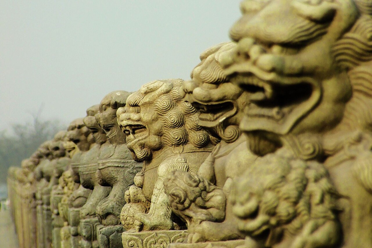
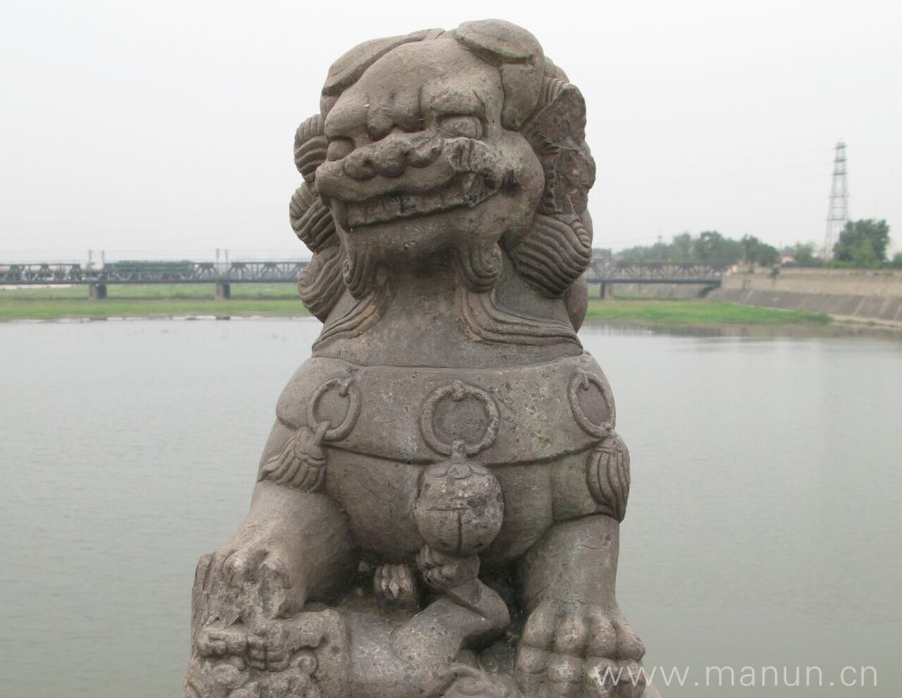
The bridge itself is the main experience. Walk along the stone structure and study the carved lions arranged on the parapets; their forms vary because the sculptures belong to different periods and restorations. Notice the bridge’s repeated openings, stone surfaces, and long perspective across the river. Commemorative markers in the surrounding area connect the medieval crossing with the 1937 conflict. The site is most meaningful when you read its layers together: the engineering of an old bridge, the decorative language of the lions, Marco Polo’s association with its fame, and the memory of a war that changed modern China.
Checked 2026-08-26 · Source
Set aside about one to two hours. That is enough time to cross the bridge at a measured pace, pause for the stone lions, and take in the Yongding River setting. Add time if you want to study individual carvings, make photographs from several angles, or include nearby commemorative features in the same stop. The bridge is compact compared with Beijing’s palace and park complexes, but its significance rewards attention rather than a quick pass. A calm walk gives you time to notice how the decorative details and the site’s historical associations shape the atmosphere.
Checked 2026-08-26 · Source
Spring and autumn are comfortable seasons for walking across the exposed bridge and spending time beside the river. Summer can be hot and humid, so plan outdoor time with water, sun protection, and a pace that leaves room for shade or rest. Winter brings cold air and shorter daylight, while wet or icy conditions can make the stone surface more difficult underfoot. Around the anniversary of 7 July 1937, commemorative activity may deepen the site’s solemn atmosphere. Choose a time when you can give the bridge and its history your full attention.
Checked 2026-08-26 · Source
This guide does not assign an admission price to Marco Polo Bridge. Plan for an outdoor heritage visit and keep some flexibility for any arrangements associated with the bridge or nearby commemorative facilities. The strongest reason to come is the combination of a historic crossing, carved stone lions, the Yongding River, and the 1937 memory attached to the site. Carry identification suitable for travel and choose payment methods that work for your wider Beijing day, especially if the bridge is one stop among several in Fengtai District.
Checked 2026-08-26 · Source
Marco Polo Bridge lies southwest of central Beijing in Fengtai District, so allow more travel time than you would for sights clustered around the historic center. Beijing’s subway and bus networks serve the wider district, while a taxi or ride-hailing car can simplify the final approach. Use Lugou Bridge, Marco Polo Bridge, and the Chinese name as search terms if one map label is incomplete. Once you arrive, expect an outdoor walk rather than a single indoor entrance. Plan the return journey before leaving central Beijing, because traffic can make a cross-city trip longer than the distance suggests.
Checked 2026-08-26 · Source
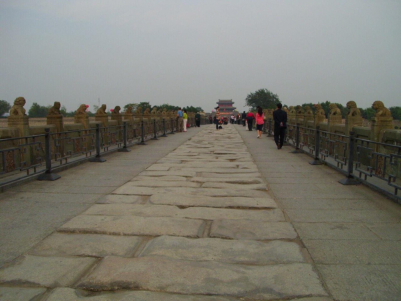
The historic stone surface can be uneven or slippery after rain, and winter ice can make the crossing harder. Wear shoes with secure grip and keep your pace measured near the parapets. Summer sun is strong on an open bridge, while wind and cold are more noticeable in winter. Treat the 1937 associations with respect: this is a place of national memory as well as a scenic historic structure. Crowds may increase during holidays or commemorative events. Keep belongings close, follow any barriers or signs, and give other visitors room at viewpoints and beside the carved lions.
Checked 2026-08-26 · Source
The bridge offers several strong subjects: rows of stone lions, repeating arches, weathered masonry, and the open river setting. Photograph along the bridge for a sense of depth, then move your attention to individual lions whose differences become clearer at close range. Morning and late afternoon light can bring out texture on the stone, while changing weather gives the river and structure different moods. Keep compositions considerate when the bridge is busy, avoid blocking the crossing, and treat commemorative areas with restraint. The site’s best photographs usually combine architectural lines with the layered atmosphere of history and landscape.
Checked 2026-08-26 · Source
The Marco Polo Bridge Incident took place on 7 July 1937. It marked the beginning of full-scale conflict between China and Japan and is remembered as the start of the Second Sino-Japanese War.
The English name comes from Marco Polo’s account of the bridge, which brought the structure fame in European writing. Its Chinese name is Lugou Bridge.
You can walk across the historic stone structure, examine its carved lions, look across the Yongding River, and see commemorative elements connected with the 1937 incident.
The bridge is a pedestrian experience: visitors walk across it, examine the stone lions, and observe the historic construction and river setting along the way.
The lions are the bridge’s most distinctive decorative feature. Their varied forms and ages show the long artistic and historical life of the crossing.
Marco Polo Bridge is in Fengtai District, southwest of central Beijing, spanning the Yongding River and sitting away from the city’s main central sightseeing cluster.
Loading the interactive map…
The interactive map could not be loaded.
Last updated:
Source: OpenStreetMap contributors ·