
24 min walk
HQB Museum
- Must see
- Historic monument
Language · 11 published
Nature site · Shenzhen
笔架山公园
Reviewed by Elena Voss · Roavina Travel Editor
| Monday | 06:00 – 23:00 |
|---|---|
| Tuesday | 06:00 – 23:00 |
| Wednesday | 06:00 – 23:00 |
| Thursday | 06:00 – 23:00 |
| Friday | 06:00 – 23:00 |
| Saturday | 06:00 – 23:00 |
| Sunday | 06:00 – 23:00 |
Parsed from OpenStreetMap opening hours on 2026-09-09.
This place is a Park.
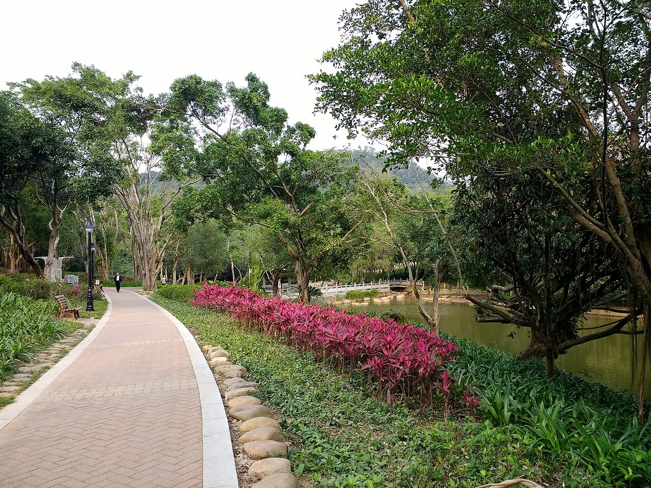
Bijia Mountain Park, known locally as 笔架山公园, is an urban mountain park in Shenzhen. Its name refers to the mountain’s resemblance to a traditional Chinese brush rest, giving the landscape a distinctive identity among the city’s green spaces. The park provides a place for walking, viewpoints and a change of pace from surrounding urban streets. It suits travellers who want mountain scenery and outdoor exercise without committing to a remote excursion. Bijia Mountain Park, known locally as 笔架山公园, is a municipal park situated in Shenzhen. The park takes its name from its distinctive mountain formation resembling a traditional Chinese writing brush rest. It functions as an urban green space offering recreational opportunities for residents and visitors. The park is part of Shenzhen's network of public parks that contribute to the city's reputation for integrating natural landscapes within a major metropolitan environment. Its location provides accessibility from various districts of the city. The park contains mountain terrain with varying difficulty levels. Lower paths may accommodate visitors with limited mobility, while steeper sections present challenges. Individual assessment of physical capability is advised.
Checked 2026-08-26 · Source
The park centres on mountain slopes, walking paths, subtropical vegetation and views across Shenzhen’s urban landscape. The brush-rest form of the mountain is part of the visual experience, while the routes provide opportunities for both casual walking and more energetic climbing. Greenery, changes in elevation and open viewpoints create the main variety. Visit for a straightforward outdoor park experience, using the paths and natural contours rather than expecting a museum-style attraction. The park contains natural mountain terrain with established walking paths and trails. Vegetation coverage includes subtropical plant species typical of the Pearl River Delta region. Visitors will find viewpoints that offer perspectives of the surrounding urban landscape. The park infrastructure includes basic amenities for public use.
Checked 2026-08-26 · Source
A two-to-four-hour visit allows time for walking, climbing selected sections, pausing at viewpoints and taking photographs. Visitors seeking a simple green-space break can spend less time on lower paths. Those who want a fuller exploration should allow more time for uphill sections and rests. Weather, fitness and crowd levels influence the pace. Bijia Mountain Park can fit naturally into a Shenzhen day when you want physical activity between urban sightseeing stops.
Checked 2026-08-26 · Source
Early morning and late afternoon are comfortable periods for walking because Shenzhen’s subtropical heat is less intense than at midday. Summer brings humidity, rain and possible typhoon disruption, while cooler seasons make uphill sections easier. Look for dry conditions when planning a longer route, since wet mountain surfaces reduce footing. The park’s elevated viewpoints also benefit from clearer air, although haze and cloud can change the skyline from one visit to the next.
Checked 2026-08-26 · Source
The available place information does not establish a separate admission arrangement for Bijia Mountain Park. Plan for the visit as an urban outdoor excursion, with the main practical considerations being your route, walking time and supplies. Carry water and sun protection, especially in warm weather. If you are combining the park with other Shenzhen sights, leave a generous time margin for walking, viewpoints and the return to the surrounding city transport network.
Checked 2026-08-26 · Source
Bijia Mountain Park sits within Shenzhen’s urban transport network, so reach it using the current metro, bus and map information for your starting point. A transit journey may finish with a walk to one of the park entrances, while taxi and ride-hailing services provide a direct alternative. Enter 笔架山公园 in Chinese-language navigation when useful. Keep the return route in mind if you plan to stay for late-afternoon light or a longer walk.
Checked 2026-08-26 · Source
The park combines urban convenience with mountain terrain, so visitors still need shoes suited to uneven surfaces and steep sections. Heat and humidity make hydration and sun protection important. Rain can create slippery paths, and thunderstorms require leaving exposed areas. Stay on established routes, take care on descents and choose a distance that matches your group. Vegetated sections may contain mosquitoes, so light long clothing can improve comfort during a slower walk.
Checked 2026-08-26 · Source
Bijia Mountain Park’s strongest images combine Shenzhen’s skyline with green foregrounds, winding paths and the mountain’s distinctive profile. Morning and evening light can add depth to urban views, while overcast conditions reduce harsh contrast among the trees. Use stable ground for camera work and keep equipment compact on walking routes. Respect other visitors when photographing busy viewpoints, and avoid letting a tripod or bag block narrow paths.
Checked 2026-08-26 · Source
The park takes its name from a mountain shape resembling a traditional Chinese brush rest and combines that landscape with urban greenery and walking routes.
Allow two to four hours for walking, viewpoints and photography. A shorter visit works for lower paths, while a fuller climb needs more time.
Early morning and late afternoon reduce the strongest heat. Cooler seasons are also comfortable, while summer rain and humidity can make slopes harder.
Bring water, sun protection and shoes with good grip. Light long clothing can make the vegetated sections more comfortable in warm weather.
Yes. Shenzhen’s metro and bus network can bring you to the surrounding area, followed by a walk or local ride to an entrance.
Photograph the Shenzhen skyline against green slopes, the mountain’s distinctive profile, walking paths, vegetation and elevated urban viewpoints.
Loading the interactive map…
The interactive map could not be loaded.
Last updated:
Source: OpenStreetMap contributors, Wikidata ·