

01
1 hour
KLCC Park
KLCC Park is a public park located in the Kuala Lumpur City Centre district, situated at the base of the Petronas Twin Towers.
- Must see
- Nature site
City guide · Malaysia
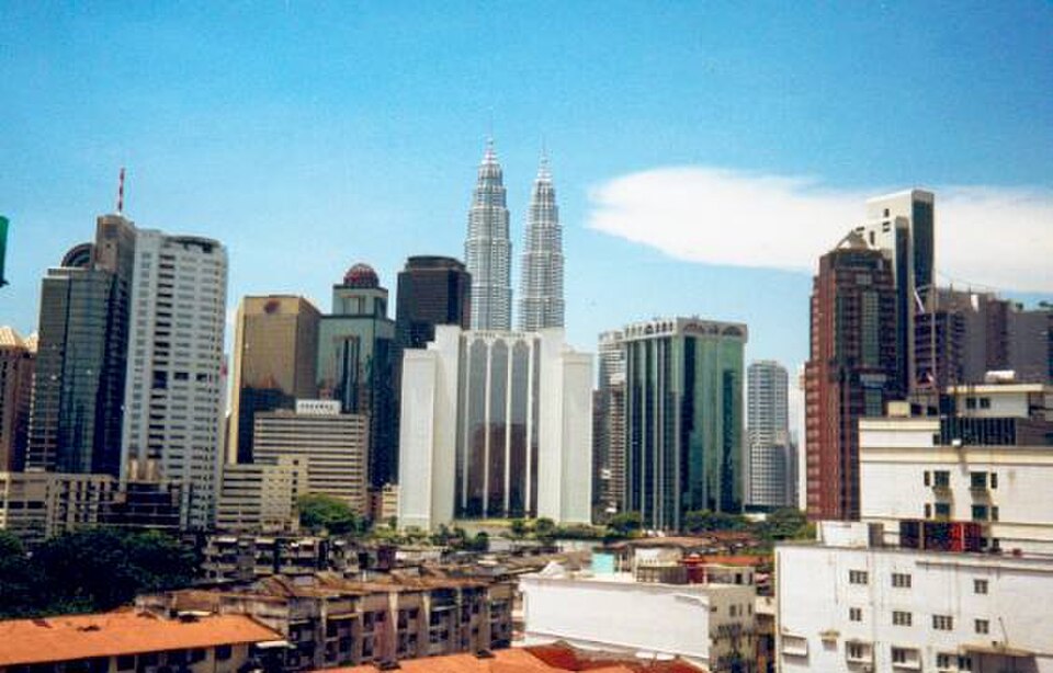
Kuala Lumpur is Malaysia's national capital and its principal urban centre, developed around the meeting of the Klang and Gombak rivers. The visitor city is pol...
Photograph · thomasgl · Public domain
Set your days, your pace and the hours you actually want to be out. The planner works around closing days and travel time, and leaves room to eat.
Reviewed by Elena Voss · Roavina Travel Editor
Kuala Lumpur is Malaysia's national capital and its principal urban centre, developed around the meeting of the Klang and Gombak rivers. The visitor city is polycentric: the colonial-era core around Merdeka Square, Chinatown and the river confluence sits west of the modern towers at KLCC, while Bukit Bintang forms the main shopping and evening district between them. Museums, markets, religious sites, parks and high-rise viewpoints are spread across these adjoining centres rather than enclosed in one old town.
Checked 2026-08-26
September · September in Kuala Lumpur has mean high 32.1°C, mean low 23.2°C, rainfall 192.8 mm, and 13 rain days. Frequent heavy rain can disrupt a day built around outdoor sights. Build in indoor stops for September in Kuala Lumpur rather than relying on an all-day outdoor route.
Ranked by importance — sitelinks, pageviews and heritage status, not editor preference.
12 places match
Category
Typical visit duration
Interests
KLCC Park is a public park located in the Kuala Lumpur City Centre district, situated at the base of the Petronas Twin Towers.
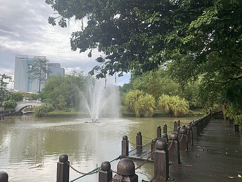
Taman Botani Perdana
Perdana Botanical Gardens, known locally as Taman Botani Perdana, is a major green space in Kuala Lumpur. Established in 1888, it is the city's oldest public park.
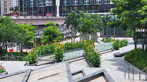
Merdeka Boulevard At 118
Merdeka Boulevard at 118 is a named outdoor point of interest in Kuala Lumpur, represented in the map as a specific way rather than as a museum, monument, enclosed venue, or documented indoor attraction.

Kepong Botanical Garden is a landscaped green space in Kuala Lumpur’s Kepong area, offering a nature-focused break from the city centre.
Taman Tugu Lawn is a green outdoor space within Kuala Lumpur’s Taman Tugu park network. It offers an uncomplicated break from the city: open grass, fresh air and room to pause between urban sights.
Hutan Pendidikan Bukit Gasing is an urban forest and outdoor learning landscape in Kuala Lumpur. It gives travellers a chance to exchange dense city streets for shaded tropical vegetation, walking routes and a more natural setting.
Use three central clusters. Merdeka Square, the river confluence, Central Market and Chinatown form the historic western core. KLCC lies to the east around the Petronas Twin Towers, Suria KLCC, the convention centre and the park. Bukit Bintang sits southwest of KLCC and links major shopping streets, food areas and entertainment. The wider city continues into lake gardens, museum districts and residential suburbs, while Batu Caves and Putrajaya are separate excursions outside the compact central pattern. Plan routes around rail stations because major roads can interrupt apparently short walks.
Checked 2026-08-26
Rapid KL rail and bus services are the practical backbone for moving between the central clusters. The network joins LRT, MRT, monorail and bus routes, and the official journey planner reports current service information. Walk within Chinatown, the Merdeka area, KLCC or Bukit Bintang, but use rail between them when heat, rain or large road junctions make a direct walk uncomfortable. Airport rail and intercity services are separate products, so confirm the correct operator and ticket before departure rather than assuming an urban pass covers them.
Checked 2026-08-26
A fixed stay length is not recorded. Plan by clusters: the historic Merdeka and Chinatown area, KLCC, Bukit Bintang, then any museum, garden or out-of-centre excursion that matters to you.
The historic cluster is around Merdeka Square, the Klang-Gombak river confluence, Central Market and Chinatown. KLCC and Bukit Bintang are separate modern centres to the east and southeast.
Use Rapid KL rail between central districts and walk within each cluster. The official journey planner combines current rail and bus information and should be checked before travel.
The districts are connected through the city, but heat, rain and major roads can make the walk less practical than the map suggests. Rail is the reliable default between clusters.
No. Both are separate excursions outside the compact Merdeka, KLCC and Bukit Bintang pattern. Plan their transport independently rather than adding them to a central walking route.