
3 min walk
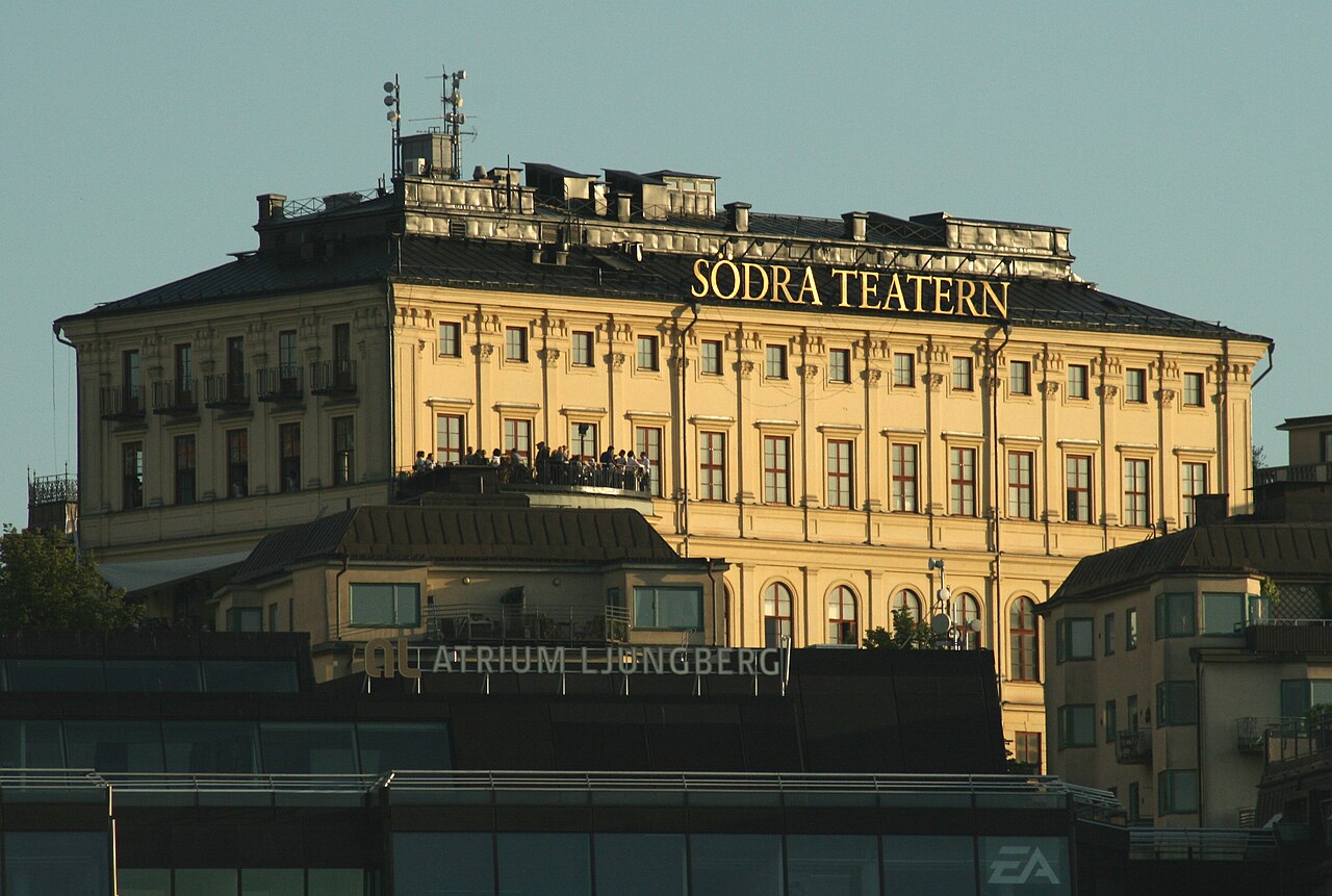
Södra Teatern
- High · Heritage site
- Art and culture venue
Language · 11 published
Viewpoint · Stockholm
Katarinahissen
Reviewed by Elena Voss · Roavina Travel Editor
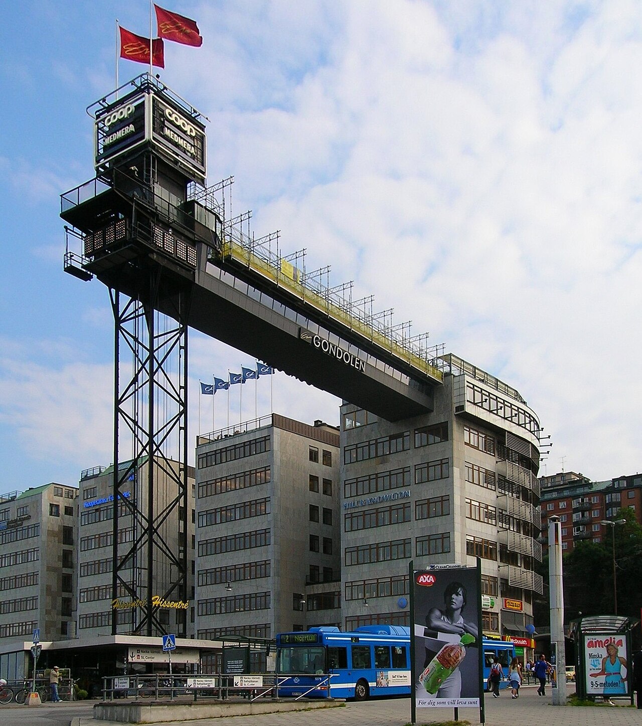
This place is a Viewpoint. It was established in 1936. It was designed by Eskil Sundahl.
Katarina Elevator, or Katarinahissen, is a historic vertical transport landmark in Stockholm’s Södermalm district. It links the lower area around Slussen with the higher ground near Mosebacke. The structure is useful both as an urban landmark and as a way to understand Stockholm’s dramatic changes in elevation. Its upper setting also creates views across the city, waterways and historic districts. Katarinahissen is a historic passenger elevator in Stockholm's Södermalm district. The structure connects the lower streets near Slussen to the heights of Mosebacke and Södermalm's upper terrain. Originally opened in the 1880s, the current elevator structure represents a rebuilt version. It serves as both functional transport and a recognized landmark in Stockholm's urban landscape. The elevator offers visitors a practical means to navigate the significant elevation change between these areas while providing views over the surrounding cityscape and waterways. Operational status should be verified through current local sources before visiting. Public infrastructure may experience maintenance periods. The upper area provides perspectives across Stockholm's waterways and toward Gamla Stan, with visibility dependent on weather conditions.
Checked 2026-08-26 · Source
The lift car and its vertical route form the main experience. Stairways run beside the structure, offering a demanding alternative for travellers who prefer to walk uphill. At the higher level, paved paths and open viewpoints lead into the Mosebacke area. The surroundings have a practical industrial character rather than museum galleries or curated displays, so the visit is centred on movement, architecture and the city panorama. The elevator mechanism itself constitutes the primary interior feature. Visitors enter a lift car designed for vertical transport between the upper and lower stations. The surrounding structure includes stairways that parallel the elevator route, offering alternative passage on foot. At the upper level, visitors emerge onto a plateau area with vantage points. The immediate vicinity contains paved walkways and seating areas. The architectural character reflects industrial heritage with functional rather than decorative emphasis. No commercial establishments, exhibition spaces, or interpretive displays are housed within the elevator structure itself.
Checked 2026-08-26 · Source
The lift journey itself takes only a few minutes. Allow fifteen to thirty minutes for a short ride, a look around the upper viewpoint and photographs. Add more time if you continue through Mosebacke Square or explore Södermalm’s surrounding streets and cafés. Travellers using the elevator as part of a route between Slussen and the upper district may spend less time at the landmark itself. A complete visit duration depends on individual purpose.
Checked 2026-08-26 · Source
Summer provides long daylight hours and comfortable opportunities to enjoy the upper views into the evening. Winter brings shorter days, colder weather and a different atmosphere around Stockholm’s waterways. Choose a clear, calm period for the widest city outlook, while changing weather can add atmosphere to the industrial structure. The upper area is exposed, so wind and rain influence comfort more than they do at street level.
Checked 2026-08-26 · Source
Katarina Elevator is associated with public urban transport rather than a conventional ticketed museum visit. The practical experience is the connection between Slussen and the heights of Södermalm, followed by the open views above. Travellers should treat any current fare arrangement as part of Stockholm’s local transport system. The nearby viewpoint and streets remain the main reasons to include the landmark in a sightseeing route.
Checked 2026-08-26 · Source
The elevator is beside Slussen, one of central Stockholm’s major transport interchanges. Reach the lower area by metro, bus or on foot from Gamla Stan across the nearby bridges. From Medborgarplatsen and other parts of Södermalm, approach through the district’s streets toward the lower station or upper plateau. The surrounding roads are complex, so use marked pedestrian crossings. Continue uphill toward Mosebacke after reaching the higher level.
Checked 2026-08-26 · Source
Slussen has busy roads and complicated junctions, so cross only at designated pedestrian points. The upper station and viewpoint are exposed to wind, rain and cold. Stone paths and steep terrain demand steady footing, particularly in poor weather. Keep children close near open edges and give priority to residents or visitors using the lift for mobility. Maintenance can interrupt historic infrastructure, while evening conditions require ordinary urban awareness.
Checked 2026-08-26 · Source
The upper level looks across Stockholm’s waterways toward Gamla Stan and the wider city. The elevator’s industrial framework supplies a strong foreground, especially when contrasted with modern Slussen and historic buildings. Morning and evening light add colour and long shadows, while clear weather improves distant views. A wide lens suits the panorama; a telephoto lens isolates landmarks across the water. Secure equipment carefully in the wind.
Checked 2026-08-26 · Source
It connects the lower streets around Slussen with the higher ground of Södermalm near Mosebacke.
The upper area offers views across Stockholm’s waterways, Gamla Stan and the surrounding cityscape.
Stairways run beside the elevator, but the steep climb can be physically demanding.
Allow fifteen to thirty minutes for the ride, viewpoint and photographs, or longer for Mosebacke and Södermalm.
Katarina Elevator is close to Slussen, Gamla Stan and Mosebacke, making it easy to combine with a Södermalm walk.
Morning and evening light suit the city views, while clear conditions provide the best visibility across the waterways.
Loading the interactive map…
The interactive map could not be loaded.
Last updated:
Source: OpenStreetMap contributors, Wikidata ·