
6 min walk
Baphuon
- Must see
- Place of worship
Language · 11 published
Historic monument · Siem Reap
អង្គរធំ
Reviewed by Elena Voss · Roavina Travel Editor
This place is a Archaeological site.
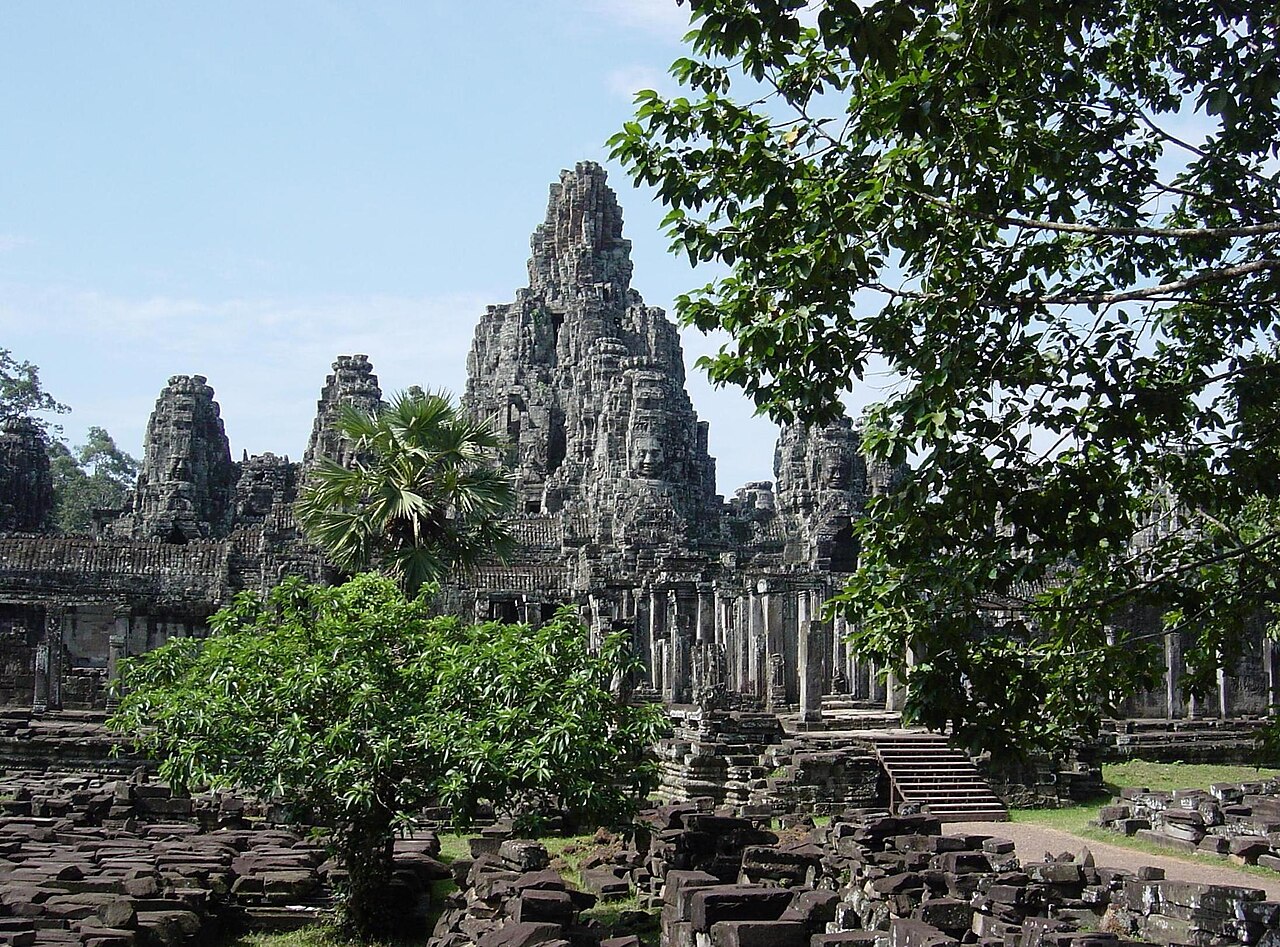
Angkor Thom is a vast walled city and former Khmer imperial capital inside the Angkor Archaeological Park near Siem Reap. Built mainly during the late twelfth and early thirteenth centuries under King Jayavarman VII, Angkor Thom covers about nine square kilometres. Laterite walls and a moat surround the city, while the Bayon stands at its centre with towers carved with monumental stone faces. Angkor Thom belongs to the UNESCO-listed Angkor heritage site and gives visitors a broad view of Khmer urban planning, religion and royal power. Angkor Thom is a vast walled city complex and former capital of the Khmer Empire, located within the Angkor Archaeological Park near Siem Reap. Constructed in the late twelfth and early thirteenth centuries under King Jayavarman VII, it represents one of Southeast Asia's most significant archaeological sites. The site covers approximately nine square kilometres and is enclosed by laterite walls and a moat. No. Angkor Thom is a walled city complex containing multiple temples including the Bayon. Angkor Wat is a separate temple located approximately two kilometres south, though both lie within the Angkor Archaeological Park.
Checked 2026-08-26 · Source
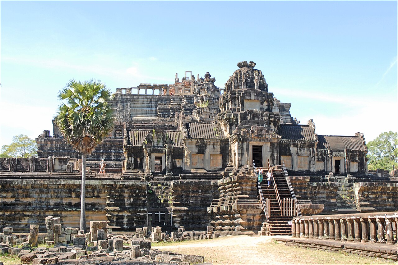
The Bayon is the central focus, but Angkor Thom contains several major monuments. The Baphuon rises northwest of the Bayon as a large temple mountain. Along the eastern side, the Terrace of the Elephants served as a royal viewing platform, and the Terrace of the Leper King carries detailed carved reliefs. Five monumental gates cross the city walls, each crowned by four faces. Preah Palilay, the Preah Pithu group, ponds, shrines and scattered foundations add quieter stops between the principal monuments.
Checked 2026-08-26 · Source
Allow two to four hours for Angkor Thom's principal monuments. A focused visit can cover the Bayon, Baphuon and both terraces, while a slower route adds the gates, smaller temples and parts of the enclosure. The central area involves substantial walking between structures, with stone paths, exposed ground and stairways. Angkor Thom works well alongside Angkor Wat in one day, although combining both creates an intensive schedule. Travelers who study bas-reliefs or architectural details will benefit from extra time.
Checked 2026-08-26 · Source
November to March usually brings drier conditions for exploring Angkor Thom's large outdoor spaces, but this period also draws the greatest visitor numbers. The wet season adds vivid greenery and can feel quieter, while rain may make paths and steps slippery. Early morning and late afternoon offer softer light and lower heat than the middle of the day. Angkor Thom rewards an early start because the walls, gates and terraces require walking in open conditions. Set aside time for shade and water breaks.
Checked 2026-08-26 · Source
Angkor Thom is visited with an Angkor Archaeological Park pass rather than a monument-specific ticket. Park passes are offered in one-day, three-day and seven-day formats, and the multi-day options cover visits across their stated validity periods. Carry the pass throughout the archaeological zone because it is presented at checkpoints. The ticket centre is the place to arrange admission before entering the park. Angkor Thom's monuments do not function as separate paid attractions within the enclosure.
Checked 2026-08-26 · Source
Angkor Thom lies about eight kilometres north of central Siem Reap. A tuk-tuk, motorbike taxi, private car, bicycle or organised tour can reach the complex by the main route that passes Angkor Wat before arriving at the southern gate. Arrange return transport for the full archaeological day, since onward rides inside the park are not always easy to find. Vehicles connect the principal monuments, while some approaches are better explored on foot. Cycling requires attention to distance, heat and navigation.
Checked 2026-08-26 · Source
Expect uneven stone, worn paths and steep temple stairs throughout Angkor Thom. Heat and dehydration can become serious because many routes have limited shade, so carry water and protect yourself from the sun. Monkeys live around the forested areas; keep valuables secure, maintain distance and never feed them. Vendors may approach near parking areas. Wear clothing that covers shoulders and knees, and behave quietly at religious places. Stay on visitor routes and do not climb fragile carved surfaces or walls.
Checked 2026-08-26 · Source
Photography for personal use captures Angkor Thom's strongest subjects: the Bayon's face towers, the city gates, the Terrace of the Elephants and the carved surfaces of the Terrace of the Leper King. Morning and late afternoon produce softer light across the stone. Drone flights are prohibited within the Angkor Archaeological Park, while commercial photography and filming require advance authorisation from the APSARA National Authority. Use discretion around worshippers and local residents, and follow staff directions about tripods or restricted positions.
Checked 2026-08-26 · Source
Angkor Thom is a walled city containing several monuments, including the Bayon. Angkor Wat is a separate temple about two kilometres south, and both lie within the Angkor Archaeological Park.
The Bayon is the central temple and the best-known monument inside Angkor Thom. Its towers carry the distinctive monumental stone faces associated with the city.
The Baphuon, Terrace of the Elephants, Terrace of the Leper King, Preah Palilay and Preah Pithu are among the principal additional sites inside the enclosure.
A visit involves considerable walking between the central monuments, together with uneven ground, weathered paths and temple stairways. A two- to four-hour visit allows time for the principal features.
Wear clothing covering the shoulders and knees, with sturdy footwear for uneven stone and stairs. Sun protection and sufficient drinking water are important during the outdoor visit.
No. Drone operation is prohibited within the Angkor Archaeological Park. Commercial photography and filming require advance authorisation from the APSARA National Authority.
Loading the interactive map…
The interactive map could not be loaded.

Last updated:
Source: OpenStreetMap contributors, Wikidata ·