
6 min walk
Egyptian Museum
- Must see
- Museum
Language · 11 published
Nature site · Cairo
ميدان التحرير
Reviewed by Elena Voss · Roavina Travel Editor
Read from the OpenStreetMap access tags; anything not listed has no tag recorded.
Set the group type to family in the planner and the day window contracts to about three quarters of a solo day.
This place is a Park.
Tahrir Square is the central civic square of Cairo, Egypt. Its Arabic name, ميدان التحرير, translates to Liberation Square. The square functions as a major traffic intersection and public gathering space in downtown Cairo. It connects several important thoroughfares and serves as a symbolic and functional heart of the city. The square gained significant global attention during political demonstrations in 2011. Open public square; no visitor timetable applies. No scheduled weekly closure day applies to the square itself. Surrounding museums and buildings keep separate hours. Free public access; no admission ticket applies to the square itself. Nearby museums and other attractions have separate admission arrangements.
Checked 2026-08-31 · Source
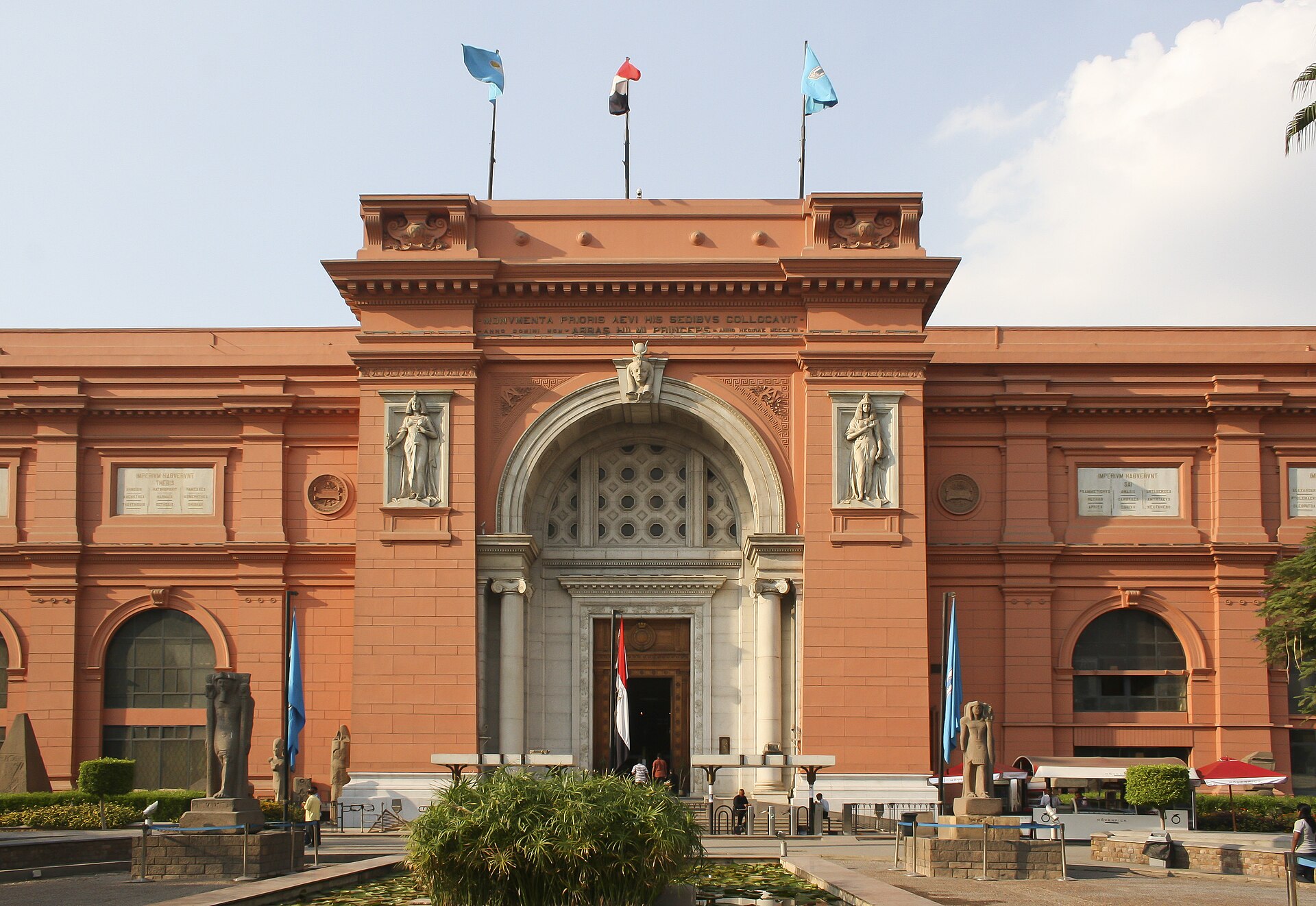
The square itself contains the large central traffic circle with the Omar Makram Mosque and an underground parking structure. The Egyptian Museum stands at its northern edge, housing extensive collections of ancient Egyptian artifacts. Surrounding the square are various government buildings, commercial establishments, and hotels. The Mogamma government administrative building is located nearby. The area includes pedestrian spaces, though these are interspersed with heavy vehicular traffic. No scheduled weekly closure day applies to the square itself. Surrounding museums and buildings keep separate hours. Free public access; no admission ticket applies to the square itself. Nearby museums and other attractions have separate admission arrangements.
Checked 2026-08-31 · Source
A visit to Tahrir Square itself requires minimal dedicated time, as it functions primarily as a thoroughfare and meeting point. Most visitors pass through en route to the Egyptian Museum or other downtown destinations. A brief stop to observe the square's layout and atmosphere may take fifteen to thirty minutes. Those combining the square with museum visits should allocate several hours for the full experience. Free public access; no admission ticket applies to the square itself. Nearby museums and other attractions have separate admission arrangements.
Checked 2026-08-31 · Source
The square is accessible at all times as an open urban space, though conditions vary significantly. Daytime hours offer better visibility of surrounding architecture and safer conditions for pedestrian navigation. Evening and night bring reduced visibility and different security considerations. Political demonstrations or gatherings may occur unpredictably, altering accessibility. Open public square; no visitor timetable applies. Use Sadat station, the interchange between Cairo Metro Lines 1 and 2; the metro operator identifies it as the station for Tahrir Square. Street approaches include Talaat Harb Street, Mohamed Mahmoud Street, Qasr Al-Aini Street and the route from Qasr Al-Nil Bridge.
Checked 2026-08-31 · Source
No admission fee exists for the public square itself. The Egyptian Museum at the square's edge requires separate paid entry. Surrounding commercial establishments set their own pricing. Visitors should not pay any unofficial charges for square access. Budget considerations should focus on transportation to the area, museum entry if desired, and any food or services from surrounding businesses. Free public access; no admission ticket applies to the square itself. Nearby museums and other attractions have separate admission arrangements. Cairo Governorate states that accessibility needs were considered when Tahrir Square and Downtown sidewalks were upgraded.
Checked 2026-08-31 · Source
Tahrir Square sits at a major transportation nexus in central Cairo. Multiple bus routes and microbuses serve the area, though navigation requires local knowledge. The Sadat Metro Station on lines one and two provides underground access directly beneath the square. Signage and local inquiry assist orientation. Use Sadat station, the interchange between Cairo Metro Lines 1 and 2; the metro operator identifies it as the station for Tahrir Square. Street approaches include Talaat Harb Street, Mohamed Mahmoud Street, Qasr Al-Aini Street and the route from Qasr Al-Nil Bridge. The landscaped public areas include paved concrete walkways and fixed concrete or marble seating.
Checked 2026-08-31 · Source
Traffic poses the most consistent hazard, with vehicles moving through the square's multiple lanes and limited pedestrian protection. Political gatherings may emerge with little warning, potentially disrupting access or creating tense situations. Vigilance regarding personal belongings is essential in crowded conditions. Air quality reflects central Cairo's congestion. Unofficial guides or service providers may approach visitors near the museum entrance. Cairo Governorate states that accessibility needs were considered when Tahrir Square and Downtown sidewalks were upgraded. The responsible public-body pages do not identify a continuous step-free route to the central monument area, an accessible toilet, or step-free facilities at Sadat station.
Checked 2026-08-31 · Source
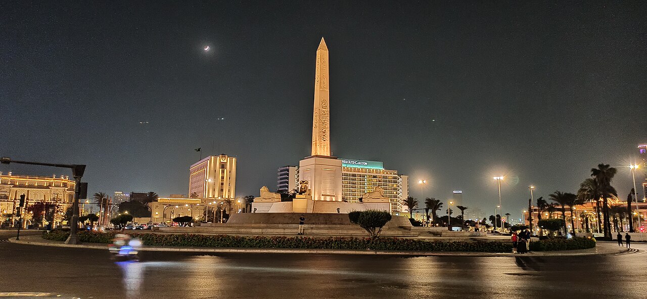
Photography in the open square is generally possible, though sensitivity to local conditions and individuals is advisable. Military or government buildings in the vicinity may have restrictions on photographic documentation. The Egyptian Museum maintains its own photography policies requiring separate attention. Drone use would face significant regulatory barriers in this central and politically sensitive location. Crowded conditions complicate composition and equipment security. Lighting conditions vary throughout the day, with harsh midday sun and softer morning or evening options. A 90-ton pink-granite obelisk of Ramesses II stands above a three-level fountain, accompanied by four ancient ram statues.
Checked 2026-08-31 · Source
A 90-ton pink-granite obelisk of Ramesses II stands above a three-level fountain, accompanied by four ancient ram statues.
The obelisk was moved from San Al-Hagar, the ancient city of Tanis, in Sharqia Governorate.
It was originally called Ismailia Square after Khedive Ismail; the name Tahrir became established after the monarchy ended and the republic was proclaimed in 1952.
Named landmarks include the Egyptian Museum, the Arab League headquarters, Omar Makram Mosque, the former Mugamma administrative complex and the Nile Ritz-Carlton.
The project added paved walkways, concrete and marble seating, palms and olive trees, landscaped beds, ground lighting and decorative illumination.
Egypt's official tourism authority highlights the illuminated square as an evening-stroll sight, when the atmospheric lighting around the obelisk and ram statues is visible.
Loading the interactive map…
The interactive map could not be loaded.
Last updated:
Source: OpenStreetMap contributors, Wikidata ·