
18 min walk
Bingin Beach
- Must see
- Nature site
Language · 11 published
Nature site · Denpasar
Pantai Padang Padang
Reviewed by Elena Voss · Roavina Travel Editor
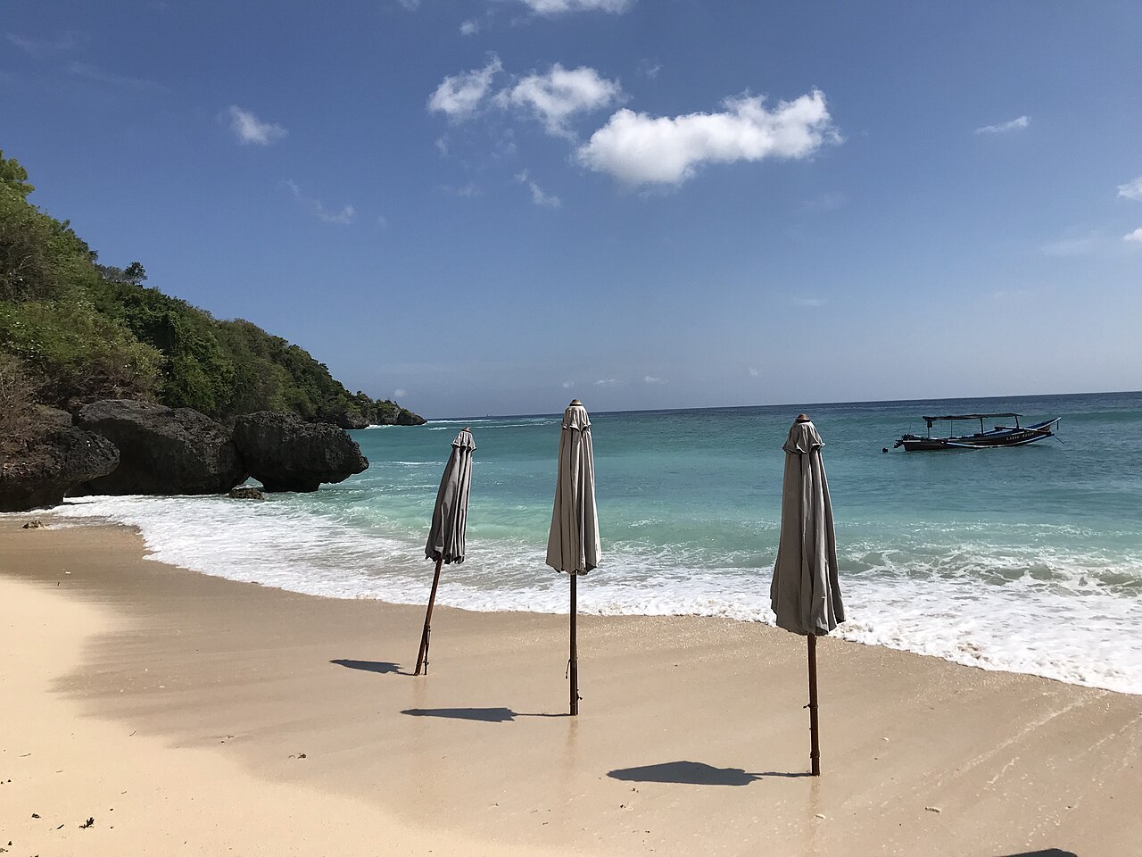
Padang Padang Beach, also called Pantai Padang Padang, is a small cove on Bali’s Bukit Peninsula in the Pecatu area. Limestone cliffs frame the sandy shore and give the beach a more enclosed character than the peninsula’s open coastal stretches. The place became internationally recognisable through cinema exposure, but its immediate appeal is physical: a narrow approach, pale sand, rock walls, tidal water, and an Indian Ocean setting. It suits travellers seeking a compact coastal stop within a southern Bali day. Padang Padang Beach, known locally as Pantai Padang Padang, is a coastal visitor destination situated on the Bukit Peninsula in southern Bali. Ocean conditions vary with tides and seasons near reef areas. Visitors should assess personal capability against current conditions and exercise caution without documented lifeguard presence.
Checked 2026-08-26 · Source
The beach occupies a compact sandy cove enclosed by coral limestone formations. Rocky outcrops and tidal pools shape the shoreline, while reef proximity influences the water and swimming conditions. The narrow passage between the rocks is part of the beach’s identity and concentrates visitors as they enter and leave. Natural formations provide some enclosure but little dependable shade. The immediate shore is oriented toward swimming, sitting, sea views, and photography rather than extensive walking. Expect a small coastal space whose atmosphere changes significantly with tide, swell, weather, and crowd levels.
Checked 2026-08-26 · Source
A simple swim or beach break often takes one to two hours. Visitors who want to relax, photograph the cove, and wait for a preferred tide can stay for half a day. The compact shore does not require a long walking circuit, so the time is shaped by water conditions and how much you want to sit, swim, or compose images. Padang Padang works well as one stop among the Bukit Peninsula’s beaches and viewpoints, with extra time needed for traffic and the stair descent.
Checked 2026-08-26 · Source
April through October is Bali’s drier season and usually offers more predictable beach weather. November through March brings more rain and greater variation in coastal conditions. Morning can offer calmer water before afternoon wind develops, although the tide remains the key factor for the amount of usable sand. Check the day’s sea conditions before entering the water and leave room for weather changes. Popular periods bring heavy crowding in the confined cove, so an early arrival gives more space for swimming and photography.
Checked 2026-08-26 · Source
The beach is reached through a managed access point, and local beach fees may apply. Carry Indonesian rupiah in small denominations for coastal access and nearby everyday purchases. The exact amount and accepted payment method can vary by local arrangement, so do not build a precise budget around a single figure. There is no need to plan for advance online booking as part of an ordinary beach visit. Keep the admission process separate from expenses for transport, food, rentals, or other southern Bali activities.
Checked 2026-08-26 · Source
Padang Padang Beach lies on the Bukit Peninsula south of Ngurah Rai International Airport, reached through the Jimbaran and Pecatu areas. Motorbikes and cars are common choices for independent travel, while taxis and ride-hailing services can provide a direct journey when available. The final approach descends from the cliff top through stairs and a narrow passage. There is no direct public transport route described for the beach entrance. Traffic through southern Bali can be heavy, so start early when visiting during busy periods.
Checked 2026-08-26 · Source
Treat the water as an active ocean environment: waves, currents, tides, reef surfaces, coral, and sea urchins can all create hazards. There is no documented lifeguard presence, so choose swimming conditions within your ability and stay alert. The stair route and rocky approach need secure footwear, especially when wet. The cove becomes crowded and offers limited room as the tide rises. Protect valuables while swimming, use sun protection, and leave the water if weather or swell deteriorates. The climb back to the cliff top can be tiring in heat.
Checked 2026-08-26 · Source
The cove’s limestone walls create natural frames around the sand and sea. Tide level changes the foreground, while morning light can reveal texture before afternoon shadows spread across the beach. A wide lens suits the confined space; a normal lens can isolate rock layers, swimmers, or the narrow entrance. Protect cameras from spray and sand. The beach is strongly associated with film imagery, but the most reliable compositions come from its geometry, changing waterline, and contrast between pale sand and dark stone. Wait patiently for a clear frame during crowded periods.
Checked 2026-08-26 · Source
Conditions vary with tide, swell, currents, and reef proximity. There is no documented lifeguard presence, so beginners should remain cautious and enter only water conditions within their ability.
No direct public transport route is described for the beach entrance. Motorbike or car rental, taxis, and ride-hailing provide the practical road options through Jimbaran and Pecatu.
The route descends from the cliff top through stairs and a narrow passage between rocks. This makes the approach physically demanding for wheelchair users and visitors with strollers.
Bring secure footwear for the stair and rock approach, sun protection, drinking water, and a way to protect valuables and camera equipment from sand and sea spray.
No. It is a compact cove, so the experience centres on swimming, sitting, photography, and the changing shoreline rather than a long coastal walk.
The beach gained international recognition through appearances in feature-film productions. Its limestone-framed cove and narrow entrance remain the defining features visitors encounter on site.
Loading the interactive map…
The interactive map could not be loaded.
Last updated:
Source: OpenStreetMap contributors, Wikidata ·