City guide · Portugal
Lisbon
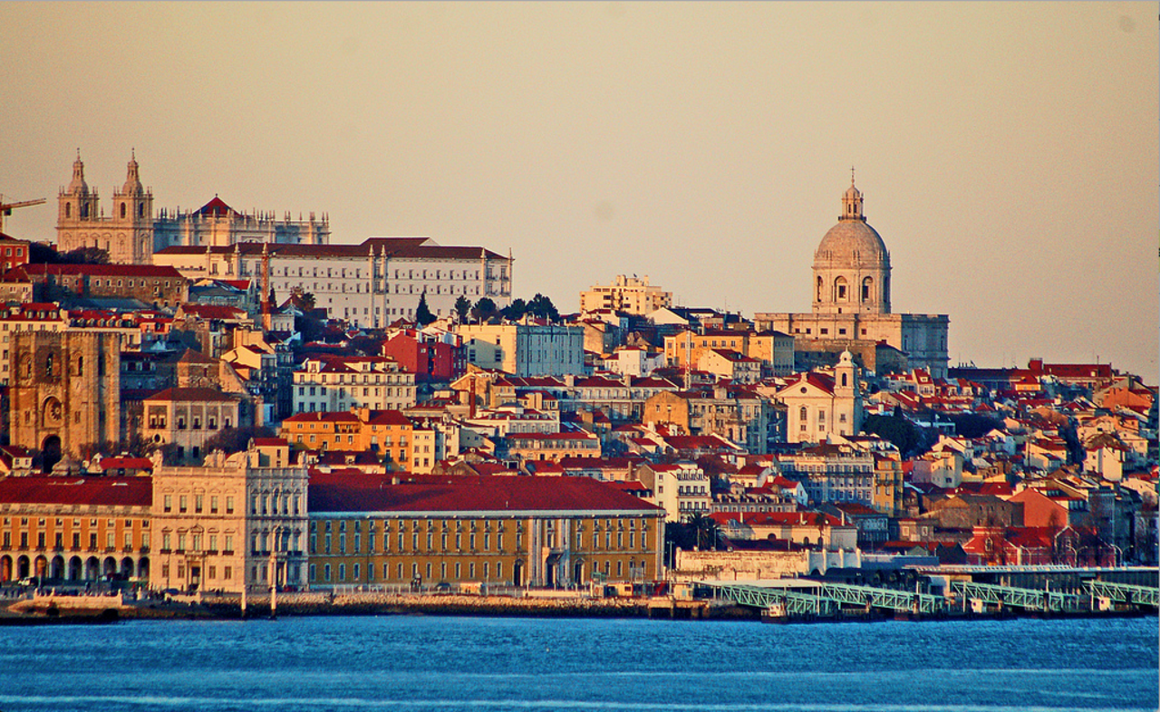

Lisbon is Portugal's capital, built on hills along the north bank of the Tagus estuary. The lower Baixa grid forms the central hinge between the older slopes of Alfama and Mouraria to the east and Chiado, Bairro Alto and Estrela to the west. Belém is a separate riverside monument cluster farther west, while Parque das Nações occupies a modern eastern waterfront. Viewpoints, steep lanes, tiled facades and river crossings make the city's geography part of the visit rather than a background to isolated monuments.
Reviewed by Elena Voss · Roavina Travel Editor
Practical information
Practical information
- Language spoken
- Portuguese
- National practical orientation; regional and minority languages may also be used
- Dialling code
- +351
- International calling code; local area and mobile prefixes still apply
- Currency
- Euro (EUR)
- Use the official local currency; card acceptance varies by place
- Emergency number
- 112
- Use only for an emergency; tourist assistance may use a separate number
- Plug type
- Type C and F · 230 V
- Check that chargers support the recorded voltage before using an adapter
- Tap water
- Not recorded
- No verified nationwide visitor statement was recorded
Turn this list into a plan
Set your days, your pace and the hours you actually want to be out. The planner works around closing days and travel time, and leaves room to eat.
Planning a visit
- Suggested stay
- Not recorded
- Getting around
- Walk, metro, Carris and ferry
- January: viable with meaningful trade-offs
- February: good time to visit
- March: good time to visit
- April: best time to visit
- May: best time to visit
- June: best time to visit
- July: best time to visit
- August: best time to visit
- September: best time to visit — current month
- October: good time to visit
- November: viable with meaningful trade-offs
- December: viable with meaningful trade-offs
- Best time
- Good time
- Viable with trade-offs
- Difficult conditions
Sources
- www.ipma.pt Checked 2026-08-28
Top things to see
Ranked by importance — sitelinks, pageviews and heritage status, not editor preference.
Filter the list
0 places match
0 places match
Nothing in Lisbon matches all of those filters
The list is built from real place data, so an empty result means the combination genuinely has no match — not that the page failed. Loosen one filter and the ranking returns.
Clear all filtersSource: OpenStreetMap contributors, Wikidata ·
How the city is laid out
Baixa lies in the low central valley between Lisbon's hills and is the easiest orientation point. Alfama and the castle climb east from the river; Mouraria and Graça continue around the northern side of that ridge. Chiado and Bairro Alto rise west of Baixa, with Cais do Sodré below them on the waterfront. Belém is well west of the centre and should be treated as its own cluster. Across the Tagus, Cacilhas is reached by ferry and gives a different riverbank perspective rather than another central neighbourhood.
Checked 2026-08-26
Getting around
Walk within Baixa, Chiado and each hill district, but combine metro, Carris buses, trams and funiculars when elevation or distance makes walking inefficient. Lisbon City Council identifies Carris as the operator for buses, trams and elevators, while Metropolitano de Lisboa runs the metro. Urban trains serve routes such as Cascais and Sintra, and Transtejo or Soflusa ferries cross the Tagus. These are related but distinct services, so verify the current fare product and operator coverage before relying on one ticket for an entire itinerary.
Checked 2026-08-26
Common questions
How many days should I spend in Lisbon?
A fixed stay length is not recorded. Plan separate clusters for Baixa and the central hills, Belém, and any river crossing or regional rail excursion that fits your priorities.
Which district is easiest for orientation?
Baixa is the low central grid. Alfama and Graça rise east, Chiado and Bairro Alto rise west, and the riverfront runs below them toward Belém.
Do I need public transport in central Lisbon?
Yes for some journeys. The centre is walkable in clusters, but hills and changes in elevation make the metro, trams, buses and funiculars useful even over modest map distances.
Is Belém part of the central walking route?
Treat Belém as a separate western riverfront cluster. It is connected by public transport but sits beyond the Baixa, Chiado and Alfama sightseeing core.
How do I cross the Tagus from Lisbon?
Transtejo and Soflusa operate passenger ferries within the metropolitan transport system. Check the current route and timetable for the crossing you need rather than assuming every waterfront terminal serves the same destinations.