26 min walk · Salihli
Tumulus of Gyges
- Must see
- Historic monument
Historic monument · Salihli, Manisa
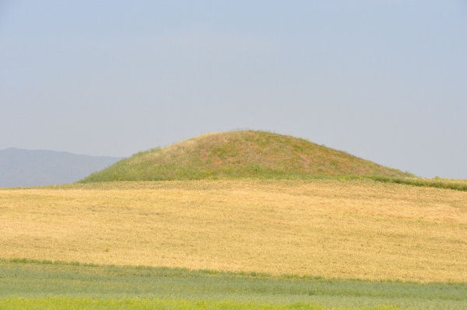
Ahlatlı Tepecik is a höyük, or settlement mound, on Marmara Lake’s southern shore, about 800 metres west of Tekelioğlu Mahallesi in Manisa’s Salihli area. Its significance lies in the archaeological evidence preserved within a modest rise beside the lake. The site records repeated human activity across a long period, while its rural setting helps explain the relationship between settlement, water and surrounding ground. This is an outdoor archaeological place rather than a museum complex or conventional recreational attraction. The visit is about recognising the mound in its landscape and understanding how an apparently simple rise can preserve evidence of past communities.
Checked 2026-09-02 · Source
The archaeological value of Ahlatlı Tepecik lies in its settlement layers and burial evidence, not in display rooms. Reported stratigraphy extends from the Early Bronze Age to the first millennium BC, indicating occupation or use across successive periods. Excavation identified Early Bronze Age pithos burials and stone cist graves, giving the mound a human dimension as well as a chronological one. At the site, pay attention to the form of the rise, the surrounding open terrain and its position beside Marmara Lake. The physical setting is essential to understanding why this location was suitable for settlement and burial.
Checked 2026-09-02 · Source
Allow around 30 to 60 minutes for Ahlatlı Tepecik itself, including the final walk, a careful look at the terrain and time to take in the mound’s position beside Marmara Lake. The stop is best planned as part of a wider Salihli or lakeside outing. Visitors unfamiliar with the area should allow extra time for locating the approach and walking slowly across open ground. People with a strong interest in archaeology may spend longer comparing the visible landscape with the reported excavation sequence, especially the long chronological span and the evidence for Early Bronze Age burials.
Checked 2026-09-02 · Source
Visit Ahlatlı Tepecik in daylight, when the low mound, open ground and lakeside relationship are easiest to see. Weather and ground conditions shape the experience: dry conditions may make rural terrain easier to cross, while rain can leave the approach uneven or muddy. On hot days, an earlier or later visit may feel more comfortable on exposed ground. These are outdoor planning considerations, not a published timetable. Allow flexibility around the approach and choose a time when you can examine the site without rushing. Clear visibility also makes it easier to understand the mound as part of the wider lake landscape.
Checked 2026-09-02 · Source
Plan Ahlatlı Tepecik as an outdoor archaeological stop centred on the mound, its setting and respectful observation of the terrain. The visit is not structured like a museum entrance sequence, so preparation should focus on reaching the site and allowing enough time for the open-air approach. The archaeological context is the main reason to come: the mound’s value is in its place within the landscape and in the evidence associated with earlier settlement and burial practices.
Checked 2026-09-02 · Source
Ahlatlı Tepecik is about 800 metres west of Tekelioğlu Mahallesi on Marmara Lake’s southern shore. The municipal record says Tekelioğlu does not have regular public transport, so plan the final approach with a private vehicle followed by a walk across open terrain. Save the route while reception is available. Leave the vehicle in a way that does not obstruct local access, then allow more time than the distance alone suggests because the approach is not described as a signed visitor path. The village area is the practical starting point for orienting yourself toward the mound.
Checked 2026-09-02 · Source
Treat Ahlatlı Tepecik as open archaeological ground and walk carefully across uneven terrain. Do not dig, climb unstable surfaces, move objects or collect anything from the mound. Keep vehicles and walking lines clear for local use, and avoid actions that could damage the surface or archaeological material. Stable footwear is sensible for the rural approach. Stay attentive near the lake and to changing ground conditions, particularly after wet weather. The site rewards quiet observation: its archaeological meaning depends on preserving the mound and reading the relationship between the rise, the shore and the surrounding land.
Checked 2026-09-02 · Source
Photograph Ahlatlı Tepecik as a relationship between archaeology and landscape. Wide views can place the mound against Marmara Lake’s southern shore, the surrounding rural ground and, where useful, the direction of Tekelioğlu Mahallesi. Because the mound’s profile may be subtle, changing daylight and a low viewpoint can help show its form. Choose firm ground before composing a shot, keep a respectful distance from visible archaeological material and never move objects or reshape the terrain for a photograph. The strongest images explain why the site matters: a settlement mound situated within an open lakeside environment.
Checked 2026-09-02 · Source
Ahlatlı Tepecik is about 800 metres west of Tekelioğlu Mahallesi on the southern shore of Marmara Lake, in Manisa’s Salihli area.
It is a höyük, or settlement mound, documented as an archaeological research area beside Marmara Lake.
The reported archaeological sequence extends from the Early Bronze Age to the first millennium BC.
Excavations identified Early Bronze Age pithos burials and stone cist graves.
Excavation work at Ahlatlı Tepecik was carried out between 1966 and 1968.
The municipal record says Tekelioğlu does not have regular public transport, so the final approach requires a private vehicle and a walk.
Loading the interactive map…
The interactive map could not be loaded.
Last updated:
Source: OpenStreetMap contributors ·