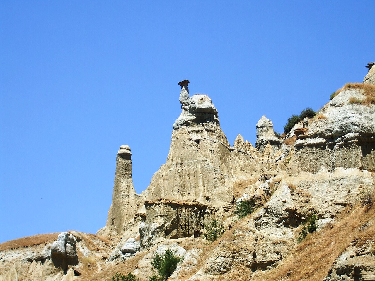
111 min walk · Kula
Kula Fairy Chimneys Viewing Terrace
- Must see
- Viewpoint
Historic monument · Kula, Manisa
Hoca Seyfettin Köprüsü
Hoca Seyfettin Bridge is a historic stone crossing in the Gediz River valley, about 13 kilometres north of Kula in Manisa Province. The bridge was built between the 15th and 16th centuries and was commissioned by Hoca Seyfettin İbni El-Hac Saruhan. It belongs to the cultural landscape of the Kula-Salihli UNESCO Global Geopark, where a historic route meets a striking volcanic setting. At approximately 50 metres long and 4 metres wide, Hoca Seyfettin Bridge is substantial enough to understand as an engineered crossing, yet compact enough to visit as part of a wider countryside excursion. Manisa’nın Kula ilçesinin 13 km kuzeyinde, Gediz Nehri vadisindedir. Köprü, Hoca Seyfettin İbni El-Hac Saruhan tarafından yaptırılmıştır. It is in the Gediz River valley, about 13 kilometres north of Kula in Manisa, toward Damatlı Mahallesi. The bridge was commissioned by Hoca Seyfettin İbni El-Hac Saruhan.
Checked 2026-09-02 · Source
The attraction is the surviving masonry structure rather than an enclosed museum, exhibition or visitor centre. Hoca Seyfettin Bridge has four pointed arches: two larger openings and two smaller openings on the southern side. Two arches were closed during earlier repairs, making the present form part of the monument’s conservation story. The stone deck, arch profiles and valley-facing elevations are the main details to examine. Beyond the bridge, the setting explains its location: basaltic lava from Kula Divlit Cone narrowed the Gediz valley and created a natural constriction suitable for a crossing.
Checked 2026-09-02 · Source
Allow around 30 to 45 minutes for a focused visit to Hoca Seyfettin Bridge once you are in the Damatlı area. This is enough time to approach the crossing, inspect the four pointed arches, study the stonework and look through the Gediz valley. Visitors interested in historic construction or volcanic geology may want longer for observation and photography. The bridge is a compact outdoor monument, not a large museum complex, so the main time consideration is the rural approach. Add a little margin if uneven ground requires slow, careful movement.
Checked 2026-09-02 · Source
Hoca Seyfettin Bridge can be viewed from outside throughout the day because it is an open-air historic structure. Daylight is the practical choice, since it reveals the stone arches, the river valley and the volcanic landform that frames the crossing. Dry, bright weather should make the approach and photography more comfortable, while wet conditions may make old stone and rural ground slippery. Plan the visit before darkness because no evening visitor arrangement is stated.
Checked 2026-09-02 · Source
The responsible geopark information does not state a ticket or admission charge for Hoca Seyfettin Bridge. There is no described ticket office, timed-entry system or booking procedure for the bridge itself, so it functions as a free outdoor heritage sight on the information currently available. Separate attractions, organised excursions, guiding services or transport in the wider Kula-Salihli UNESCO Global Geopark may have their own arrangements, however. A visitor joining a special programme should confirm that programme’s terms separately rather than assuming every activity in the geopark is free.
Checked 2026-09-02 · Source
Hoca Seyfettin Bridge is in the Gediz River valley, approximately 13 kilometres north of Kula, in the direction of Damatlı Mahallesi. The official geopark description identifies the bridge’s rural setting but does not name a public-transport line serving it. Use Kula and Damatlı as the geographic references when planning the excursion, and expect the destination to feel separate from central Kula. The valley location is part of the experience, but it also means that the final approach may include uneven countryside ground rather than a fully level, purpose-built visitor route.
Checked 2026-09-02 · Source
Hoca Seyfettin Bridge is a historic stone structure in a natural valley, not a modern visitor facility with a complete set of services. The four arches remain important to the bridge’s identity, although two were closed during previous repairs. Bring water and meet basic needs before leaving Kula, especially when visiting independently.
Checked 2026-09-02 · Source
The strongest photographs combine Hoca Seyfettin Bridge with the Gediz valley rather than treating the masonry as an isolated object. From a short distance, frame the pointed arches against the valley and the volcanic terrain created where basaltic lava from Kula Divlit Cone narrows the landscape. Closer views can show the stone deck, construction texture and the distinction between the open arches and the two arches closed during repairs. Daylight will define the structure more clearly. Keep secure footing on uneven surfaces, remain attentive near the valley and never trade safety for a lower viewpoint.
Checked 2026-09-02 · Source
It is in the Gediz River valley, about 13 kilometres north of Kula in Manisa, toward Damatlı Mahallesi.
The bridge was commissioned by Hoca Seyfettin İbni El-Hac Saruhan.
It was built between the 15th and 16th centuries.
It is approximately 50 metres long and 4 metres wide.
It has four pointed arches: two large openings and two smaller openings on the southern side.
It stands on a constriction where basaltic lava from Kula Divlit Cone narrows the Gediz valley.
Loading the interactive map…
The interactive map could not be loaded.
Last updated:
Source: OpenStreetMap contributors, Wikidata ·