
3 min walk
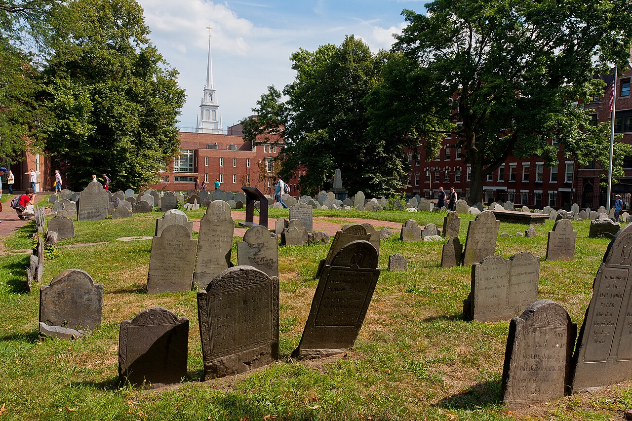
Copps Hill
- Notable
- Viewpoint
Language · 11 published
Historic monument · Boston
Reviewed by Elena Voss · Roavina Travel Editor
| Monday | 00:00 – 23:59 |
|---|---|
| Tuesday | 00:00 – 23:59 |
| Wednesday | 00:00 – 23:59 |
| Thursday | 00:00 – 23:59 |
| Friday | 00:00 – 23:59 |
| Saturday | 00:00 – 23:59 |
| Sunday | 00:00 – 23:59 |
Checked 2026-08-31 · Source
Read from the OpenStreetMap access tags; anything not listed has no tag recorded.
Set the group type to family in the planner and the day window contracts to about three quarters of a solo day.
This place is a Attraction. It was established in 1951. It is run by Freedom Trail Foundation.
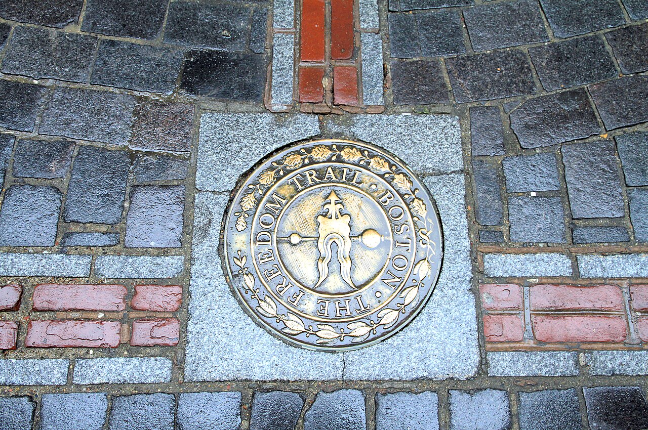
The Freedom Trail is a 2.5-mile (4-kilometre) marked walking route linking 16 historic sites across central Boston, the North End and Charlestown. A red brick or painted line leads through streets, public spaces and historic precincts, turning a large Revolutionary-era story into a walkable sequence. Its identity is the route itself: Boston Common, the North End, the harbour crossing and Charlestown are connected as one continuous urban experience. The trail is therefore best understood as an outdoor orientation framework, with individual churches, meetinghouses, burying grounds, ships and monuments encountered along the way rather than as one enclosed attraction.
Checked 2026-09-02 · Source
There is no single interior to enter. The route threads through Boston Common and the downtown civic core before reaching meetinghouses, churches, burying grounds and Faneuil Hall. It continues through the North End, then crosses to the Charlestown Navy Yard, where the sequence finishes at Bunker Hill Monument. This changing urban setting is the attraction’s main content: outdoor markers provide continuity, while the 16 linked historic sites supply the possible interior visits. Because those places are separately operated, their rooms, exhibits, vessels and visitor facilities can have different hours, queues, access arrangements or admission rules.
Checked 2026-09-02 · Source
Walking the marked route without entering historic sites takes about 90 minutes, according to the operator’s visitor information. That is a moving-time estimate, so a useful visit usually needs longer. Add roughly 20 to 40 minutes for each interior or museum stop you choose, then allow for photographs, street crossings, toilets, food and the transfer into Charlestown. A focused walk can cover the line in one session, while a history-heavy day should select a few interiors in advance instead of assuming that all 16 sites can be explored deeply at the same pace.
Checked 2026-09-02 · Source
The marked outdoor route is recorded as open every day, 24 hours, with no scheduled closure day. Start early if you want clearer orientation and quieter photographs, but remember that the trail passes through ordinary working streets and public spaces rather than a controlled park enclosure. Weather affects the exposed walking sections, harbour edges, ships and viewpoints. Individual historic sites may keep seasonal or programme-specific schedules and can close independently, so the route’s all-day status does not guarantee that every church, museum, monument interior or vessel will be open when you arrive.
Checked 2026-09-02 · Source
Walking the Freedom Trail itself is free: the operator records no per-person admission charge for the route, and the marked line can be followed without an entrance pass. Some of the 16 historic sites along it are separately operated and may charge for entry, tours or special experiences. Treat those as optional additions to the free walk, with their own policies and schedules. If a particular interior matters to your plan, check that institution’s current admission and reservation information before setting a tightly timed route.
Checked 2026-09-02 · Source
For the customary start at Boston Common, use Park Street station on the MBTA Red and Green lines. State station, served by the Orange and Blue lines, is useful for the central trail near Faneuil Hall. At the Charlestown end, North Station on the Green and Orange lines is about a 20-minute walk from Bunker Hill Monument; MBTA bus 93 reaches Constitution Road, and the Charlestown Ferry runs from Long Wharf to Pier 4, where you can join the Navy Yard section. Follow the red line from Boston Common in the conventional direction, or reverse the walk when a Charlestown start fits your day better.
Checked 2026-09-02 · Source
The route uses city sidewalks, crossings, brick paving and some stairs, so the continuous line is not a promise of uniform access. The responsible public body identifies step-free detours near the Robert Gould Shaw Memorial, Granary Burying Ground and Old North Church, while access varies at the Old State House, Copp’s Hill and the historic ships. Expect uneven or loose bricks, cobbles, hills, traffic and weather exposure. Plan rest points across the 2.5-mile distance, keep clear of working streets and respect barriers, services and institutional instructions at each separately operated site.
Checked 2026-09-02 · Source
The trail offers a varied photographic sequence rather than one signature viewpoint: the red brick marker, Boston Common, North End streets, church towers, harbour edges, the Charlestown Navy Yard and the skyline around Bunker Hill. Photograph from public areas and stop beside the walking line so other visitors can pass. Outdoor light changes sharply between narrow streets and open waterfront spaces. Inside the linked churches, museums, ships or monuments, follow the relevant institution’s posted rules; permission for flash, tripods, commercial work or photography during services is not implied by the free outdoor route.
Checked 2026-09-02 · Source
The marked route is 2.5 miles (4 kilometres) from end to end.
The Freedom Trail connects 16 historic sites in downtown Boston, the North End and Charlestown.
Walking the route without entering sites takes about 90 minutes; each site visit can add roughly 20–40 minutes.
The customary route runs from Boston Common to Bunker Hill Monument, but visitors may start anywhere and walk in either direction.
A red brick or painted line on the ground marks the route through the city.
Facilities are available at Faneuil Hall, Old North Church when open, the Charlestown Navy Yard Visitor Center, USS Constitution Museum and Bunker Hill Museum; ticket holders can also use facilities at Old State House, Old South Meeting House and Paul Revere House.
Loading the interactive map…
The interactive map could not be loaded.

Last updated:
Source: OpenStreetMap contributors, Wikidata ·