
12 min walk · Donaustadt
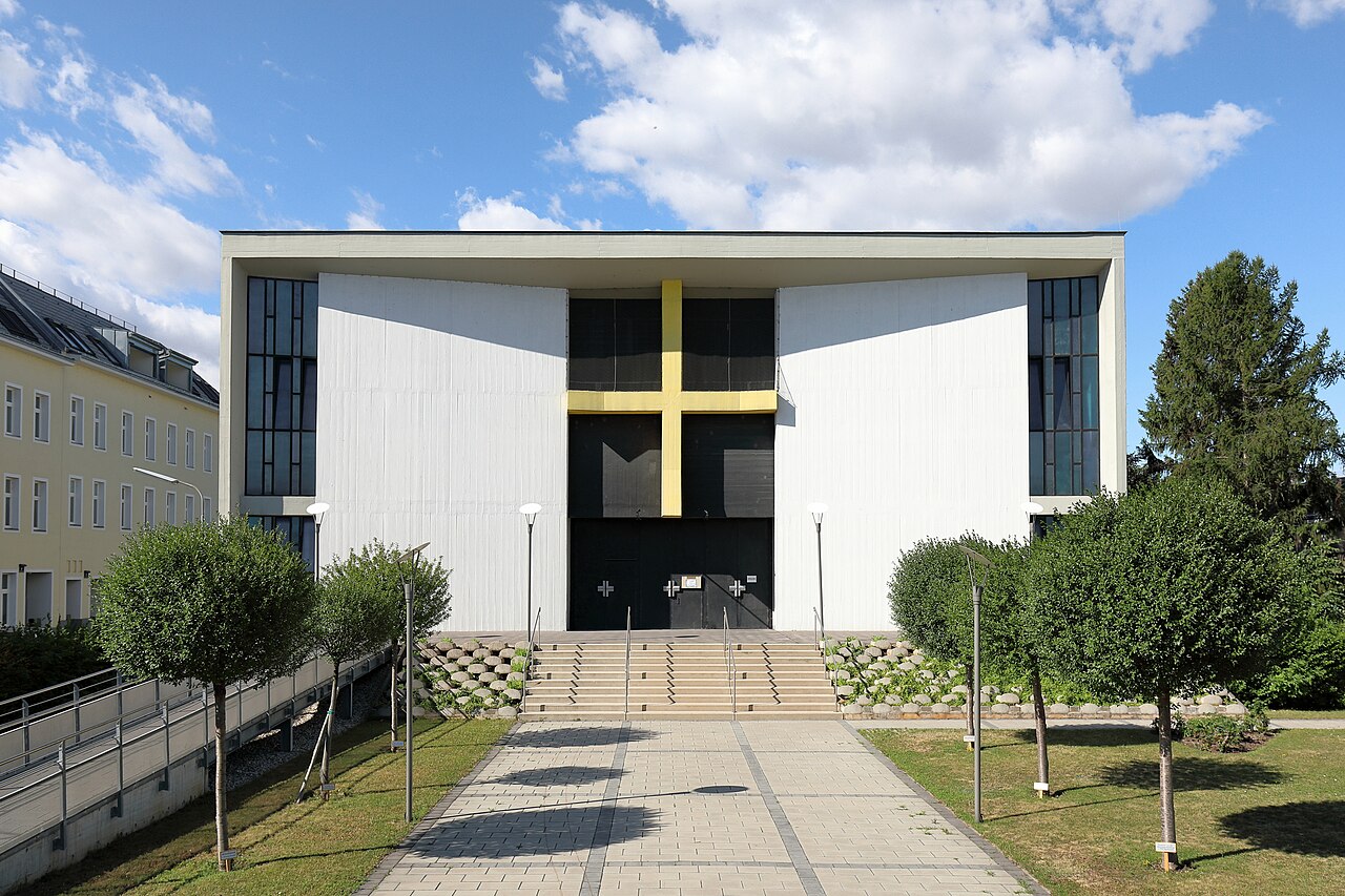
Maria Goretti
- High · Heritage site
- Place of worship
Language · 11 published
Nature site · Donaustadt, Vienna
Reviewed by Elena Voss · Roavina Travel Editor
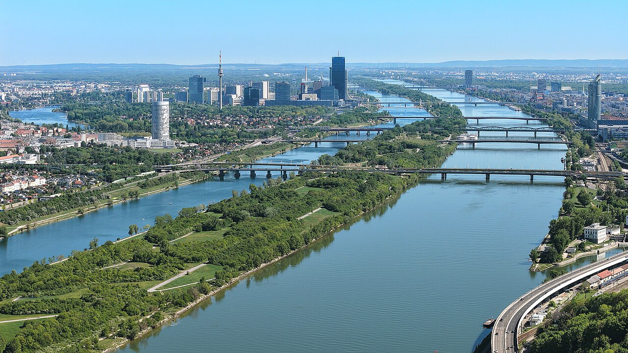
This place is a Park. It was established in 1988.
Donauinsel, the Danube Island, is a 21.1-kilometre artificial island built between the 1970s and early 1980s as a flood-relief channel, running as a narrow strip between the Danube itself and a new parallel channel, the Neue Donau, dug specifically to relieve the river during high water.
The project's dual purpose was flood protection for Vienna and the creation of a long recreational green space, and both functions still hold: the Neue Donau channel diverts flood volume away from the city centre, while the island above it has become one of Vienna's most heavily used outdoor spaces.
It hosts the Donauinselfest each June, a free open-air music festival that is one of the largest of its kind in Europe by attendance.
Checked 2026-08-24 · Source
The island's length is split between swimming areas along the Neue Donau's calmer inner bank, cycling and walking paths running its full 21 kilometres, and beach bars and kiosks (Strandbars) that open seasonally in spring and close in autumn.
A section at the northern end of the island is designated for nude bathing (FKK), separate from the clothed swimming beaches further south, and is marked by signage rather than a physical barrier.
Twenty-one bridges connect the island to the surrounding city districts on both sides of the Danube, which is why it functions as a through-route for cyclists and pedestrians as much as a destination in itself.
Checked 2026-08-24 · Source
A short stretch near the U1 Donauinsel station — a swim, a walk along the bank, a drink at a Strandbar — takes half a day at most.
Cycling the island's full 21-kilometre length, out and back or in a loop using the bridges, is a full-day outing for a casual rider and closer to two to three hours of riding time for a fast one, and the flat, straight terrain makes it an easy distance to underestimate when planning around the return trip.
Checked 2026-08-24
Summer is the swimming and beach-bar season; the Strandbars operate roughly from spring through early autumn and are shut for winter.
The Donauinselfest runs each June and draws crowds across the whole island rather than one stage, so a visitor wanting a quiet island visit should avoid that weekend specifically.
Spring and autumn suit walking and cycling without the summer crowds, though the swimming areas and most kiosks are not staffed outside the warm months, and the island can feel genuinely empty on a weekday in late autumn or winter.
Checked 2026-08-24
Access to the island is free at all times; there is no entry fee or gate.
The Donauinselfest is also free to attend, funded by the City of Vienna rather than ticketed, which is part of why its attendance runs into the millions across the festival weekend.
Checked 2026-08-24 · Source
U1 Donauinsel station sits directly on the island, the most direct public transport access point. U6 Neue Donau station is also close, on the mainland side near one of the northern bridges.
Cyclists reach the island from bike paths running along both banks of the Danube from the city centre, and several of the 21 bridges are open to pedestrians and cyclists even where they carry road traffic.
Checked 2026-08-24 · Source
The Danube's main channel, on the outer side of the island opposite the Neue Donau, carries a strong current and significant shipping traffic; the designated swimming areas are on the calmer Neue Donau side for that reason, and swimming in the main river channel is far more dangerous than it looks.
Most of the island has no lifeguard presence, so swimmers are responsible for judging conditions themselves.
The cycling path is shared with pedestrians, runners and skaters and gets genuinely congested on warm weekends, particularly near the U1 station, and there is little shade along most of the island's length in the middle of summer.
Checked 2026-08-24
Sunset over the Neue Donau near the Reichsbrücke, looking back toward the city skyline including the UNO-City towers, is the island's best-known shot and draws photographers specifically for that view in the evening.
A wide shot along the straight cycling path, taken low to the ground, captures the island's unusual scale — 21 kilometres in a nearly unbroken line — better than any single framed view of one section, and the reeds along the calmer Neue Donau bank give a softer foreground than the open water itself.
Checked 2026-08-24
As a flood-relief measure in the 1970s and early 1980s: a new channel, the Neue Donau, was dug alongside the Danube to divert flood volume, and the island sits between the two.
Yes, there is no gate or entry fee at any point along its 21 kilometres.
A designated FKK section at the northern end of the island, separate from the clothed swimming beaches further south.
No. The main Danube channel on the outer side carries strong current and shipping traffic; designated swimming areas are on the calmer Neue Donau side, and most of the island has no lifeguard.
A free open-air music festival held each June, one of the largest of its kind in Europe by attendance.
21.1 kilometres end to end.
Loading the interactive map…
The interactive map could not be loaded.
Last updated:
Source: OpenStreetMap contributors, Wikidata ·