.jpg)
.jpg)



9 min walk
Distillery District
- Must see · Heritage site
- Historic monument
Language · 11 published
Nature site · Toronto
Corktown Common
Reviewed by Elena Voss · Roavina Travel Editor

This place is a Park. It is run by Toronto Parks, Forestry and Recreation Division.
Corktown Common is a large public park in Toronto’s West Don Lands. It combines recreation, habitat, and flood protection for the lower Don River area. The park formed part of the regeneration of a formerly industrial district, turning infrastructure into a walkable landscape. Its identity comes from this union of open public space with practical climate-resilience engineering. Corktown Common is an award-winning public park in Toronto's West Don Lands neighbourhood. It serves dual purposes as recreational green space and critical flood protection infrastructure for the lower Don River area. The park was developed as part of the broader regeneration of the formerly industrial West Don Lands district. Its design integrates stormwater management systems with accessible public amenities, representing a significant example of contemporary urban landscape architecture that addresses climate resilience while serving community needs. A flexible visit lets travellers connect Corktown Common with the rest of the day without treating one room, viewpoint or photograph as the whole experience. The useful pace depends on personal interest and conditions on arrival. Yes, the park includes a playground and open green spaces appropriate for family visits. The terrain includes some elevation changes from the flood-protection berms, which may require supervision for younger children.
Checked 2026-08-26 · Source
Visitors find walking and cycling paths, open lawns, seating areas, shade structures, naturalized plantings, wetland areas, and a playground. Elevated berms create changes in level while helping protect the surrounding West Don Lands from flooding. The planting and water-management features support biodiversity and stormwater filtration, so the park offers both everyday recreation and a clear example of contemporary urban landscape design. The park contains extensive green spaces, walking and cycling paths, and a playground area. An elevated berm system provides flood protection while creating varied topography across the site. Naturalized plantings and wetland areas support biodiversity and stormwater filtration. The landscape includes open lawns suitable for informal recreation, along with seating areas and shade structures. The design deliberately merges engineered infrastructure with ecological function, creating habitat corridors while maintaining public accessibility throughout the changing seasons.
Checked 2026-08-26 · Source
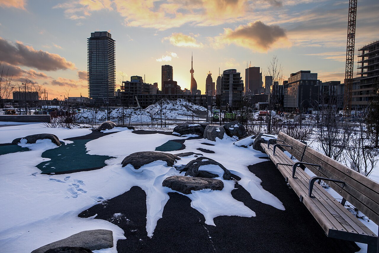
A short walk through the main paths takes about twenty to thirty minutes. Allow thirty minutes to two hours if you want to use the playground, sit on the lawns, picnic, or cycle through the connected waterfront routes. Corktown Common works especially well as part of a longer walk linking the West Don Lands, the Distillery District, and Toronto’s waterfront. Visitors typically spend between thirty minutes and two hours at Corktown Common, depending on their activities. A casual walk through the park's path network takes approximately twenty to thirty minutes.
Checked 2026-08-26 · Source
Spring through autumn offers the most comfortable conditions for walking, cycling, and using the park’s open spaces. Early mornings and weekdays tend to provide a quieter atmosphere. Winter visits remain possible, but snow and ice can affect paths and the berms. Because much of the landscape is open, summer visitors should prepare for direct sun, while cooler days can bring wind across the site.
Checked 2026-08-26 · Source
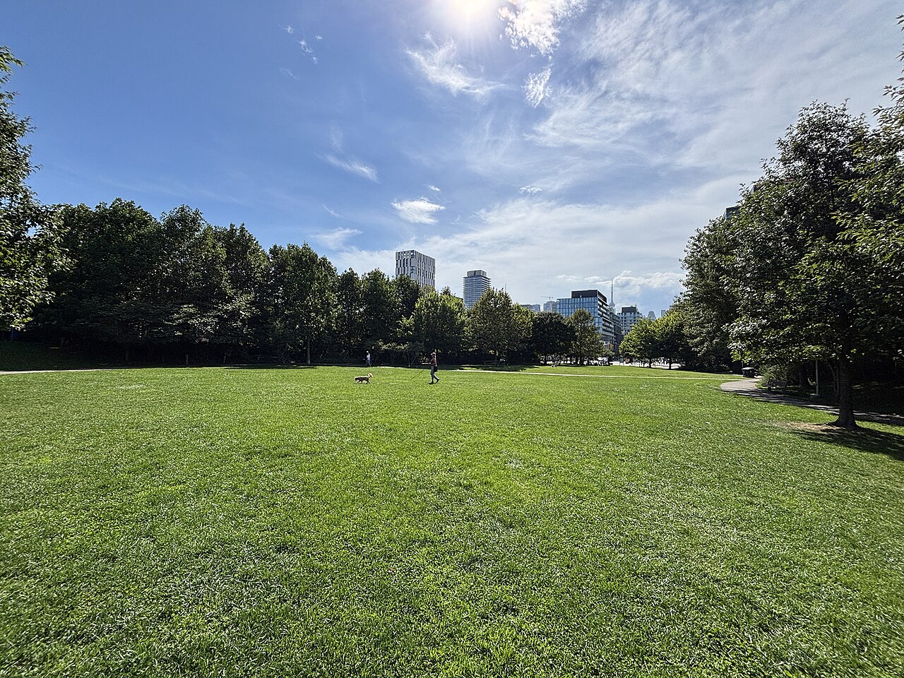
Corktown Common is a public park with free general access. No admission ticket is needed to walk the paths, use the lawns, view the landscape, or visit the playground. The park is municipal public infrastructure rather than a ticketed attraction. Any separate arrangement connected with a particular event would be distinct from ordinary access to the park.
Checked 2026-08-26 · Source
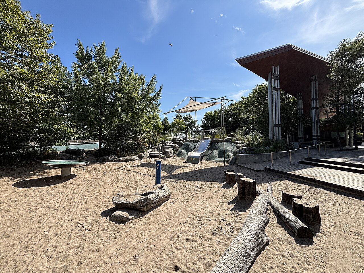
The park lies east of Toronto’s downtown core in the West Don Lands. It is reachable by public transit through streetcar and bus services in the surrounding streets. Cycling routes connect it with the waterfront trail network, and the site is walkable from the Distillery District. Limited on-street parking is available nearby, so arriving by bicycle, transit, or on foot is often the simpler choice.
Checked 2026-08-26 · Source
The flood-protection berms create slopes and elevation changes, while naturalized areas can have uneven ground. Rain may leave some paths wet, and the exposed landscape brings sun and wind. Carry water in warm weather and take care around cyclists on shared routes. After dark, the park can feel quieter than the central city, so plan your route with visibility and ordinary urban awareness in mind.
Checked 2026-08-26 · Source
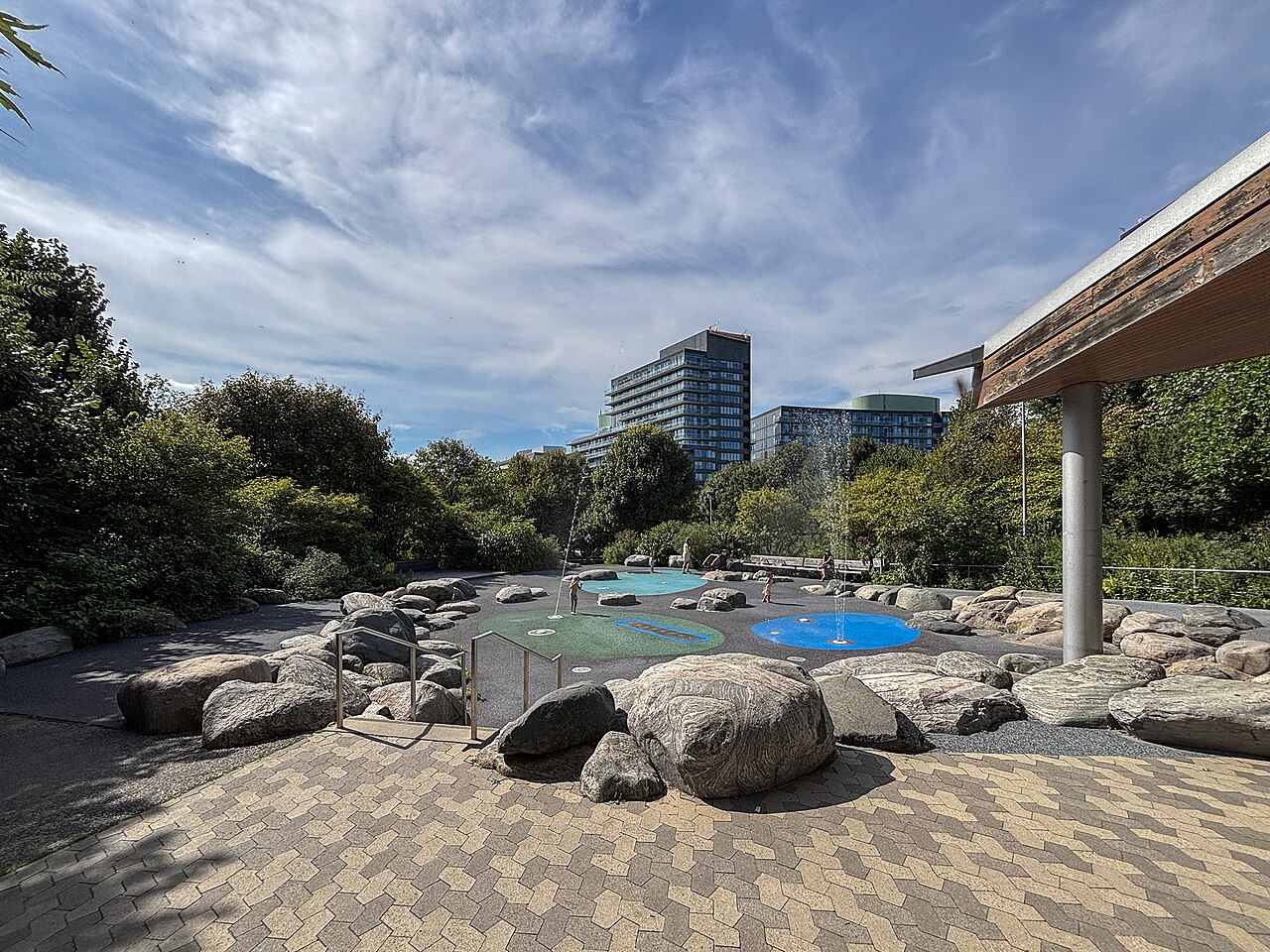
Corktown Common offers photographs of Toronto’s skyline, open lawns, wetland planting, engineered berms, and the meeting of ecological and built infrastructure. The elevated landscape creates viewpoints uncommon on the flatter waterfront. Morning and evening light can emphasize the park’s changing textures. Keep paths clear, respect other visitors’ privacy, and follow Canadian aviation rules and local restrictions for any drone activity.
Checked 2026-08-26 · Source
Yes. The park includes a playground, open lawns, and paths. The berms create slopes and changes in level, so younger children need ordinary supervision.
An elevated berm system helps contain and manage floodwaters from the Don River while also forming accessible landscape features across the park.
Yes. General access to the public park, its paths, lawns, landscape, and playground does not require an admission ticket.
A quick walk takes about twenty to thirty minutes. Allow up to two hours for a picnic, playground visit, cycling, or a slower exploration of the grounds.
Yes. Cycling infrastructure connects the park with broader waterfront routes, including connections toward Toronto’s waterfront trail system.
It combines public recreation, naturalized planting, wetland areas, and flood-protection infrastructure in one regenerated West Don Lands park.
Loading the interactive map…
The interactive map could not be loaded.
Last updated:
Source: OpenStreetMap contributors, Wikidata ·