
07
45 min
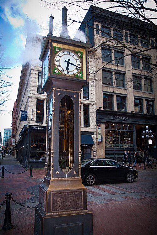
Gastown Steam Clock
The Gastown Steam Clock is a public landmark on a sidewalk in Vancouver’s historic Gastown district.
- Must see
- Historic monument
City guide · Canada
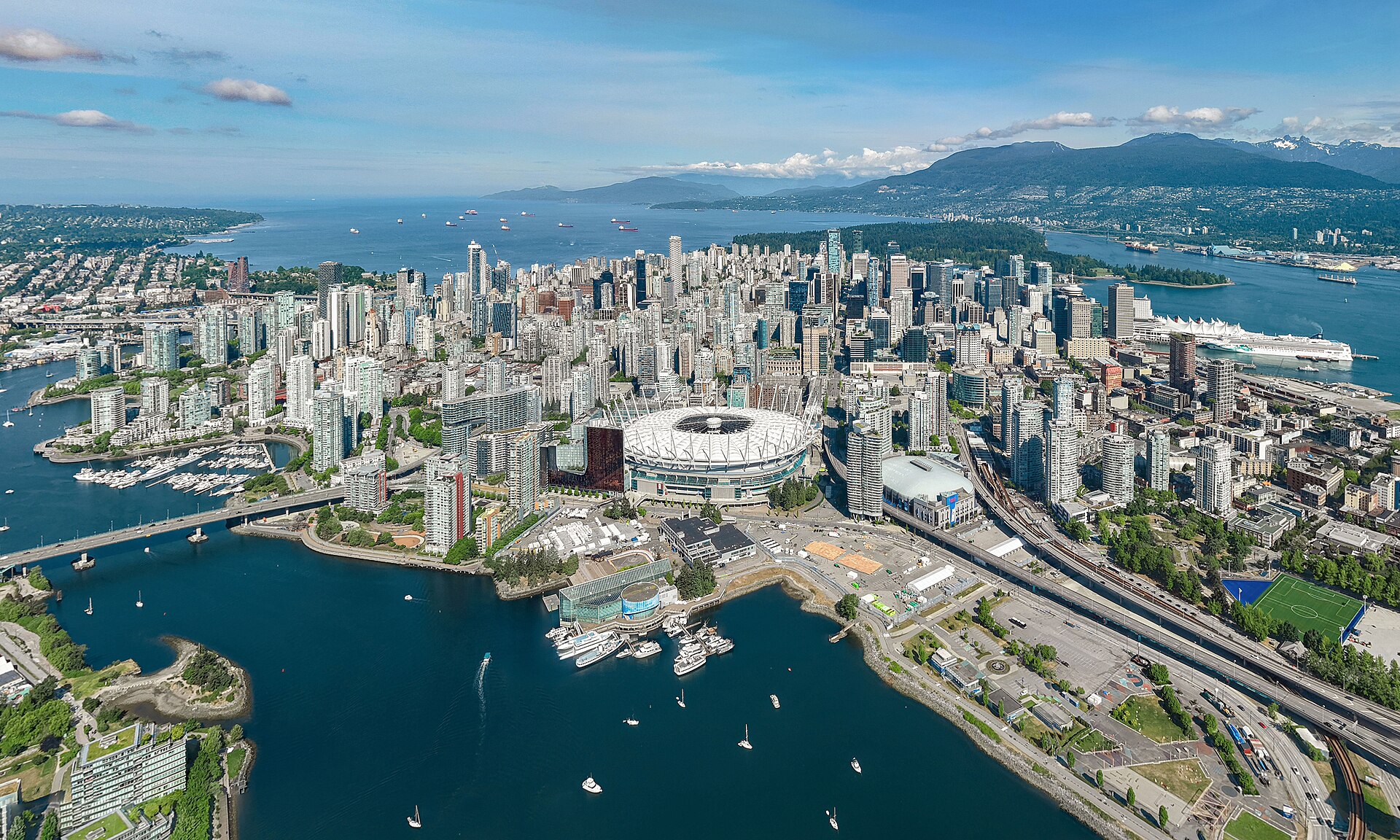
Vancouver is a compact waterfront core surrounded by distinct neighbourhoods, parks and mountains. Downtown contains the central business district, West End, Co...
Photograph · Quintin Soloviev · CC BY 4.0
Set your days, your pace and the hours you actually want to be out. The planner works around closing days and travel time, and leaves room to eat.
Reviewed by Elena Voss · Roavina Travel Editor
Vancouver is a compact waterfront core surrounded by distinct neighbourhoods, parks and mountains. Downtown contains the central business district, West End, Coal Harbour and Yaletown; Stanley Park forms its western edge. Gastown and Chinatown sit east, while False Creek separates downtown from Granville Island, Kitsilano and Mount Pleasant. North Vancouver is across Burrard Inlet and belongs to the wider visitor geography rather than the downtown walking grid.
Checked 2026-08-26
September · September in Vancouver has mean high 18.7°C, mean low 10.5°C, rainfall 53.5 mm, and 8.6 rain days. Mild weather remains favourable despite some rain days. A mixed indoor-outdoor plan keeps a September visit to Vancouver comfortable.
Ranked by importance — sitelinks, pageviews and heritage status, not editor preference.
11 places match
Category
Typical visit duration
Interests
The Gastown Steam Clock is a public landmark on a sidewalk in Vancouver’s historic Gastown district.
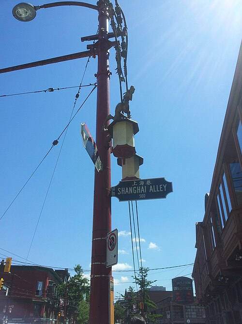
Chinatown Millennium Gate is a ceremonial landmark at the western entrance to Vancouver Chinatown. Its traditional Chinese architectural forms make it an immediate visual marker for the historic neighbourhood.
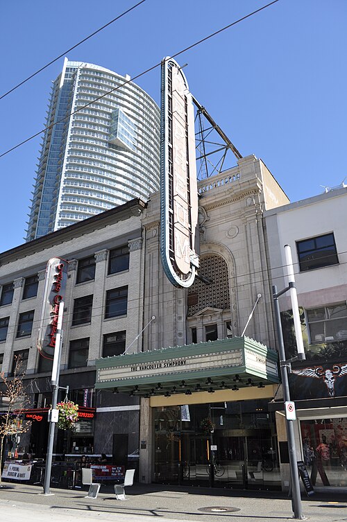
The Orpheum is a restored 1927 theatre on Granville Street in downtown Vancouver. It is a major concert hall and the home of the Vancouver Symphony Orchestra.
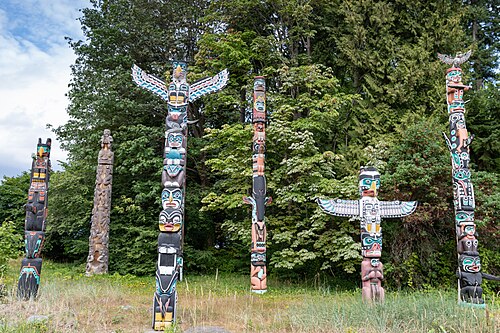
Brockton Point Totem Poles is a cultural landmark located within Stanley Park in Vancouver, British Columbia. The display features multiple totem poles representing Indigenous art and heritage from various First Nations of the Pacific Northwest.
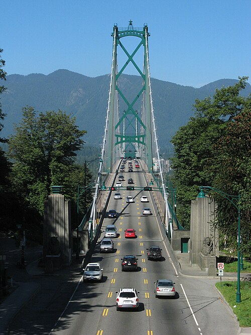
Lions Gate Bridge is a suspension bridge spanning the First Narrows of Burrard Inlet, connecting Stanley Park in downtown Vancouver to the North Shore municipalities.
The downtown peninsula is the easiest orientation point, bounded by Burrard Inlet, English Bay and False Creek. Stanley Park occupies the west; Gastown and Chinatown are east; Yaletown faces False Creek to the south. Granville Island and Kitsilano are across the water, while Commercial Drive and Mount Pleasant sit farther east and southeast. The North Shore requires a harbour crossing and should be planned separately from central neighbourhood walking.
Checked 2026-08-26
Walk and cycle within downtown and the seawall network, then use rapid transit and buses for longer city trips. SeaBus connects the waterfront with North Vancouver, while small passenger ferries cross False Creek between central stops and Granville Island. Regional ferries, floatplanes and intercity services leave the urban system for destinations beyond Vancouver. Check official schedules and service notices before any harbour or regional connection.
Checked 2026-08-26
A fixed stay length is not recorded. Plan downtown and Stanley Park first, then add Granville Island, neighbourhoods or the North Shore according to your priorities.
Yes. Downtown, the West End, Coal Harbour, Yaletown and the edge of Stanley Park form a compact peninsula suited to walking and cycling.
SeaBus crosses Burrard Inlet from the downtown waterfront. Treat North Shore attractions as a separate cluster and verify onward bus connections before departure.
No. It sits across False Creek from downtown. Reach it by bus, walking and cycling routes, or a small passenger ferry across the water.
No. Walking, cycling, rapid transit, buses and local ferries cover the central visitor districts. A car is more relevant for dispersed regional excursions.