
4 min walk
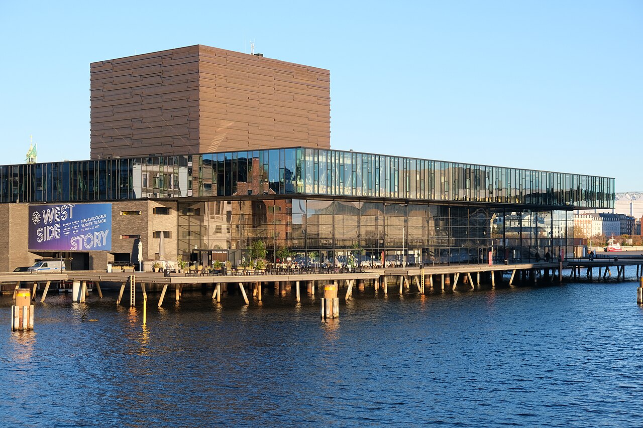
Royal Danish Playhouse
- High
- Art and culture venue
Language · 11 published
Historic monument · Copenhagen
Reviewed by Elena Voss · Roavina Travel Editor
| Monday | 00:00 – 23:59 |
|---|---|
| Tuesday | 00:00 – 23:59 |
| Wednesday | 00:00 – 23:59 |
| Thursday | 00:00 – 23:59 |
| Friday | 00:00 – 23:59 |
| Saturday | 00:00 – 23:59 |
| Sunday | 00:00 – 23:59 |
Checked 2026-08-31 · Source
Read from the OpenStreetMap access tags; anything not listed has no tag recorded.
Set the group type to family in the planner and the day window contracts to about three quarters of a solo day.
This place is a Attraction.
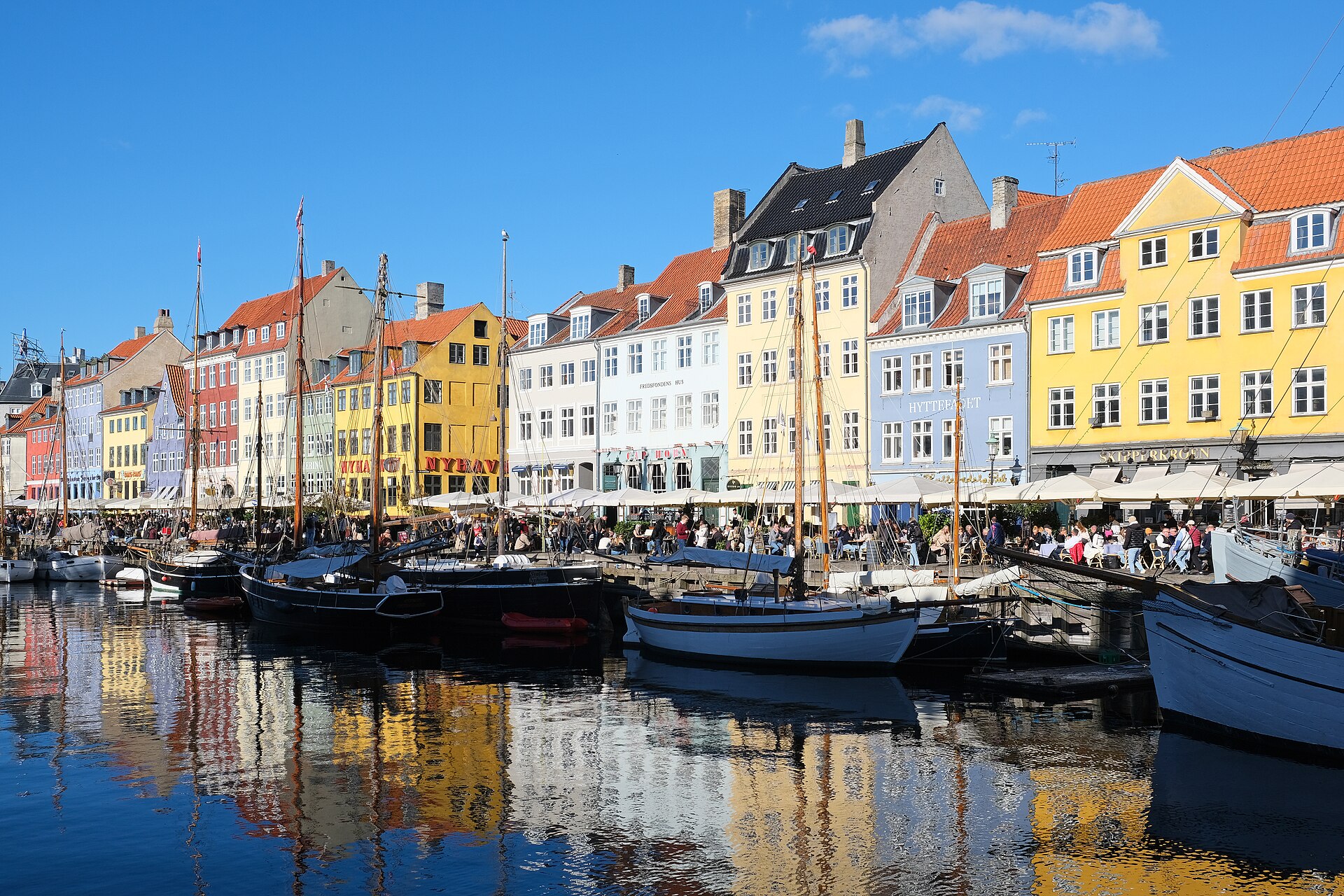
Nyhavn is a canal cut inland from Copenhagen's harbour with a quay down each side, addressed as Nyhavn 1-71, 1051 København K. It is a public street, not an attraction with a door, and understanding that changes how a visit is planned. The official Copenhagen guide describes it as a former working port where sailors from all over the world drank in its pubs and alehouses; the row of brightly painted seventeenth-century houses along the water is what survives of that trade. Continuous public-street and quayside access, daily.
Checked 2026-08-31 · Source
The canal is divided by the Nyhavn bridge, and the two halves are run by different bodies. Inside the bridge, on the landward side, all activity belongs to Nyhavnsforeningen, Nyhavns Skipperlaug, and the official guide is explicit that this stretch of water is a museum and veteran ship harbour: only members of the Association of Wooden Ships, or guests arriving in vessels of special historical interest, are admitted to moor there. That rule governs the boats, not the pavement. Nyhavn has no visitor opening schedule or regular closure day. Its cafés, restaurants, canal tours and temporary events operate separately.
Checked 2026-08-31 · Source
Allow an hour. No official visit duration is published for Nyhavn anywhere on the Copenhagen guide's pages for it, so this figure is the guide's judgement rather than a number read off a source, and it is built from the shape of the place. The quay is a few hundred metres long. Add substantially more if anything is booked or ordered. A visitor with only twenty minutes between other stops still gets the essential Nyhavn, because the essential Nyhavn is one view. Free: no admission ticket is required to walk Nyhavn’s public quays. Commercial tours, food, drinks and events are separate.
Checked 2026-08-31 · Source
Nyhavn has two distinct seasons and the official guide describes both. In summer the pavement cafes fill, live jazz plays outdoors, and the street is at its busiest and most sociable; the guide's own summary is people enjoying the sun at the many buzzing pavement cafes. Continuous public-street and quayside access, daily. Kongens Nytorv station is about a seven-minute walk from Nyhavn and is served by Metro lines M1, M2, M3 and M4. The station has six lifts, including two between the station and street level. The quays are generally level, but their historic granite and cobblestone surfaces are uneven.
Checked 2026-08-31 · Source
There is no admission charge and no ticket, because Nyhavn is a public street rather than a venue. What costs money at Nyhavn is what happens on it. The one product the official guide does point at is the Copenhagen Card, which it states covers canal tours, museum visits and public transport together. Free: no admission ticket is required to walk Nyhavn’s public quays. Commercial tours, food, drinks and events are separate. The quays are generally level, but their historic granite and cobblestone surfaces are uneven. Three smoother walking bands and guidance lines improve access between Toldbodgade and Skuespilhuset.
Checked 2026-08-31 · Source
The official guide gives one instruction for arriving: a short walk from Kongens Nytorv Metro station, which sits at the landward end of the canal. That is the whole journey. From Copenhagen Airport the train or metro reaches the city centre in about twelve minutes. Kongens Nytorv station is about a seven-minute walk from Nyhavn and is served by Metro lines M1, M2, M3 and M4. The station has six lifts, including two between the station and street level. Three smoother walking bands and guidance lines improve access between Toldbodgade and Skuespilhuset.
Checked 2026-08-31 · Source
The single most common misreading of Nyhavn is treating it as an attraction that can be entered. The wooden ships along the inner basin are a working veteran harbour with a membership rule, not a floating museum with a gangway, so a visitor who expects to board one will be disappointed. The second is price. Look for the painted lane before crossing. The quays are generally level, but their historic granite and cobblestone surfaces are uneven. Outdoor seating can narrow the designated pedestrian line. No visitor timetable applies; the public street and quayside have continuous daily access.
Checked 2026-08-31 · Source
The picture everyone comes for is the row of painted facades with masts in front of them, and it is taken from the opposite quay or from the bridge, not from among the houses themselves. Standing on the south side gives the full row across the water with the moored wooden ships in the foreground; standing on the bridge at the harbour end and looking inland compresses the canal, the boats and both terraces into one frame. Light decides the result. No visitor timetable applies; the public street and quayside have continuous daily access.
Checked 2026-08-31 · Source
No visitor timetable applies; the public street and quayside have continuous daily access.
Yes. Walking the public quays is free; canal tours, restaurants and other commercial activities cost separately.
Kongens Nytorv, about a seven-minute walk away, served by M1, M2, M3 and M4.
Only partly. The route is level, but historic cobbles and possible pedestrian bottlenecks make access limited; smoother walking bands are provided on the outer section.
Numbers 20, 67 and 18.
Members of the Association of Wooden Ships and guests arriving in vessels of special historical interest.
Loading the interactive map…
The interactive map could not be loaded.

Last updated:
Source: OpenStreetMap contributors, Wikidata ·