
16 min walk
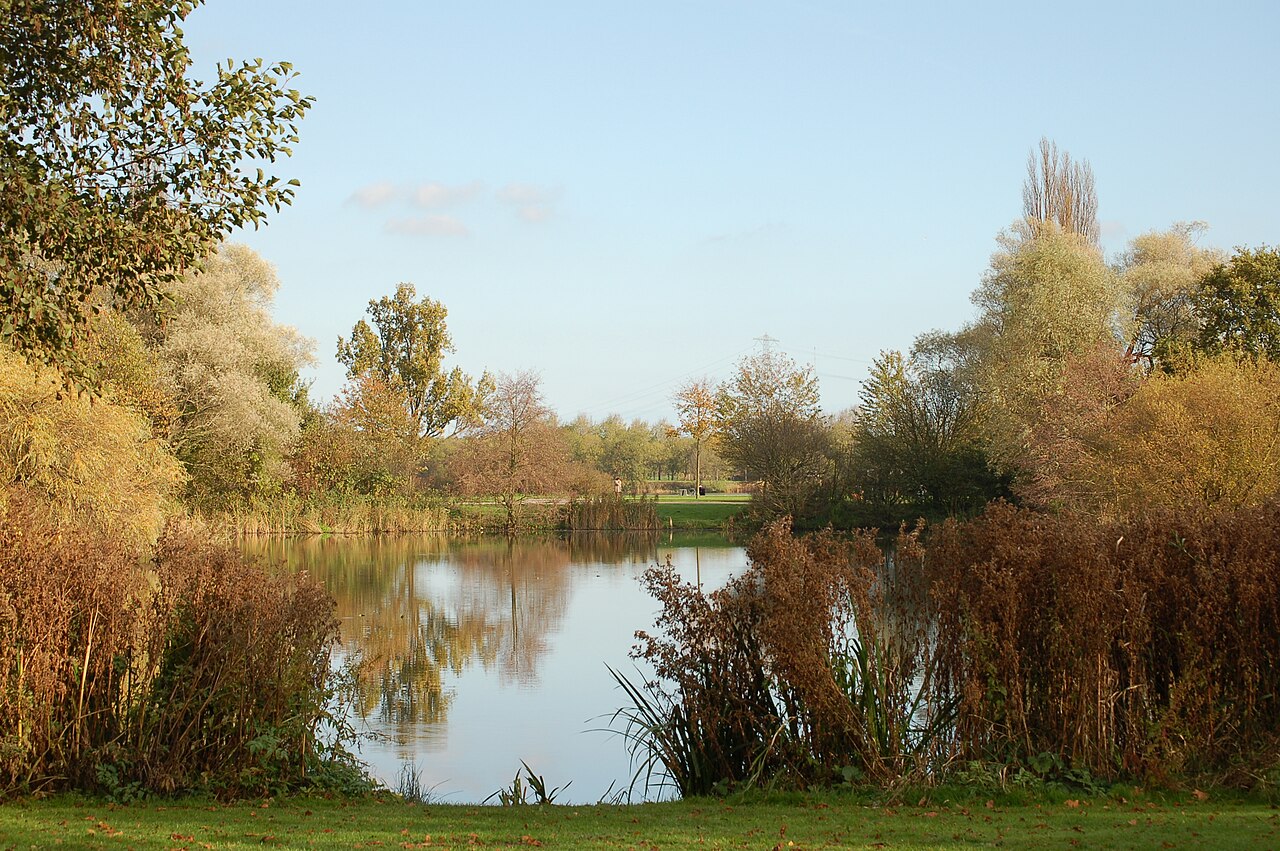
Flevopark
- High
- Nature site
Language · 11 published
Historic monument · Amsterdam
Pythonbrug
Reviewed by Elena Voss · Roavina Travel Editor
This place is a Attraction. It was established in 20.
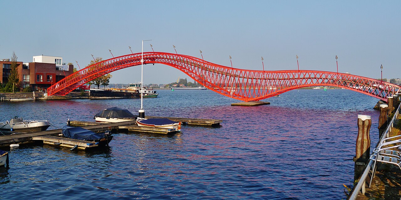
Python Bridge, known locally as Pythonbrug, is a pedestrian bridge in Amsterdam’s Eastern Docklands. The bridge is recognizable for its serpentine form, which gives the structure its English and Dutch names and distinguishes it from Amsterdam’s many straighter crossings. It spans a waterway within a redeveloped harbor district east of the historic center. Python Bridge is both practical infrastructure and a small piece of contemporary urban design: people use it to move through the waterfront area, while visitors notice its unusual shape, strong red railings, and relationship with the surrounding docklands. There is no enclosed attraction or formal entrance; the bridge is experienced as part of the public streets and paths.
Checked 2026-08-26 · Source
Python Bridge has no interior rooms or enclosed exhibition space. Its visitor experience is the open pedestrian deck, the repeated bends of the walkway, and the red railings that follow the bridge’s winding outline. Looking along the deck emphasizes the serpentine design, while looking outward brings the waterway and modern Eastern Docklands buildings into view. The bridge itself contains no recorded shops, restaurants, exhibition areas, toilets, ticket desk, or other visitor-service facilities. Its interest comes from crossing and observing the structure from different angles. The surrounding waterfront adds context, with public paths, residential architecture, and harbor scenery extending the experience beyond the bridge.
Checked 2026-08-26 · Source
A direct crossing of Python Bridge takes only a few minutes at an ordinary walking pace. Allow about fifteen to thirty minutes for a more complete stop that includes crossing, pausing on the approaches, and taking photographs of the curved structure. The bridge works particularly well as one element in a longer Eastern Docklands walk, when the surrounding waterfront can add substantially to the outing. There is no queue, ticket check, or timed admission procedure at the bridge. Plan the duration according to your purpose: it is a brief waypoint for walkers, but an architectural photography stop can merit several crossings and different viewpoints.
Checked 2026-08-26 · Source
Daylight is the most useful time to visit Python Bridge because the red railings, sinuous outline, waterway, and nearby architecture are easier to distinguish. The bridge is an outdoor public structure, so weather chiefly affects comfort and footing rather than an indoor visiting schedule. Rain, wind, or winter conditions may make the exposed crossing less pleasant. An evening visit offers a different atmosphere in the redeveloped harbor district, although the bridge’s form may be harder to see clearly in low light. Visit while exploring the Eastern Docklands and choose the time that best suits walking, architectural observation, or photography.
Checked 2026-08-26 · Source
Crossing Python Bridge is free and does not require a ticket. The bridge is public pedestrian infrastructure rather than a paid attraction, with no recorded admission gate, ticket office, timed-entry system, or organized access program. Any fare for public transport, cost of cycling services, parking expense, or purchase made elsewhere in the Eastern Docklands is separate from Python Bridge and is not an admission charge. Treat the bridge as a free stop within a wider Amsterdam route. Its value is the distinctive crossing, the waterfront setting, and the opportunity to see a memorable piece of urban design without an entry procedure.
Checked 2026-08-26 · Source
Python Bridge is in Amsterdam’s Eastern Docklands, east of the historic city center. Walking from another part of the Eastern Docklands and cycling through the district are also practical approaches to this pedestrian crossing. Use a current Amsterdam transport or navigation service for the final approach, then follow the waterfront paths to the bridge.
Checked 2026-08-26 · Source
Python Bridge is a working pedestrian connection, not a controlled museum or staffed attraction. Remain aware of other people using the crossing and avoid stopping in the narrowest part of the curved walkway when taking photographs. The bridge’s bends can restrict sight lines, so approaching pedestrians may appear later than on a straight bridge. The structure is beside water, which calls for ordinary attention near the edges and approaches. Rain, frost, or other wet conditions can affect footing. No attraction-specific hazard, emergency facility, or visitor service is recorded on Python Bridge, so plan for a self-directed outdoor visit.
Checked 2026-08-26 · Source
Python Bridge is most distinctive when a photograph shows the full sweep of its serpentine shape. A viewpoint from an adjacent waterfront path can reveal the red railings, the curved deck, the waterway, and the modern architecture of the Eastern Docklands in one composition. From the bridge itself, the successive bends create leading lines and closer geometric frames. Try a wider view from an approach, then a lower or more centered perspective on the deck if pedestrian space allows. Keep equipment out of the walking line, leave room for passers-by, and treat any aerial photography as subject to applicable Dutch aviation rules.
Checked 2026-08-26 · Source
Yes. Pythonbrug is the Dutch local name for the structure known in English as Python Bridge.
The available location information describes Python Bridge as a pedestrian bridge. Vehicle access is not indicated.
Python Bridge is presented as public infrastructure rather than an organized visitor program.
Python Bridge is in the Eastern Docklands, east of Amsterdam’s historic center, within a redeveloped harbor district.
Its serpentine shape and red railings give this pedestrian crossing a distinctive visual identity among Amsterdam’s many bridges.
Nearby establishments may be found elsewhere in the Eastern Docklands.
Loading the interactive map…
The interactive map could not be loaded.
Last updated:
Source: OpenStreetMap contributors, Wikidata ·