

68 min walk
Jewel Changi Airport
- Must see
- Market
Language · 11 published
Historic monument · Singapore
Chek Jawa Wetlands
Reviewed by Elena Voss · Roavina Travel Editor
This place is a Attraction.
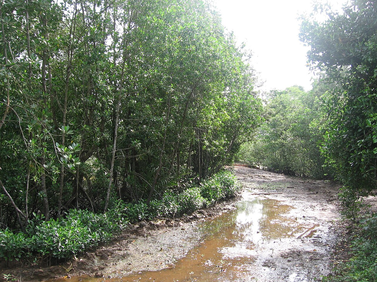
Chek Jawa is a coastal wetlands area on Pulau Ubin, an island off Singapore’s northeastern coast. The landscape brings together mangroves, sandy beach, rocky shore and coastal boardwalk in one nature-focused visit. Chek Jawa protects a relatively undisturbed coastal habitat and gives visitors a way to observe Singapore’s intertidal environment. The experience is shaped by tide, weather and the island journey, making this a destination for patient outdoor exploration rather than a quick urban stop. Chek Jawa is a coastal wetlands area located on Pulau Ubin, an island off Singapore's northeastern coast. It encompasses diverse ecosystems including mangroves, sandy beaches, rocky shores, and a coastal boardwalk. The site is managed as part of Singapore's nature conservation efforts and represents one of the country's remaining natural coastal habitats. Chek Jawa Wetlands serves as an important ecological zone where visitors can observe intertidal marine life and native vegetation in a relatively undisturbed setting. The boardwalk is accessible to visitors of various ages, though young children require supervision near water edges and on elevated structures. The route length and outdoor conditions should be considered against individual stamina and weather.
Checked 2026-08-26 · Source
The one-kilometre coastal boardwalk passes mangrove and shoreline habitats while keeping visitors above sensitive ground. Jejawi Tower rises seven storeys and provides a higher view over the canopy and sea. A viewing jetty extends above coastal water, and low tide can reveal intertidal flats, rock pools and seagrass lagoons. Mangrove plants, coastal vegetation and marine organisms define the visit. Stay on the established routes so the wetlands remain protected while you explore them. The wetlands feature a one-kilometre coastal boardwalk that allows visitors to traverse mangrove and coastal areas without disturbing sensitive habitats. A seven-storey Jejawi Tower provides elevated views of the surrounding canopy and sea. The visitor area includes a viewing jetty extending over coastal waters.
Checked 2026-08-26 · Source
Reserve half a day for Chek Jawa as an excursion from Singapore. The boardwalk itself takes roughly one to two hours at a measured pace, including pauses for wildlife and scenery. Add time for climbing Jejawi Tower, exploring the shore, travelling by bumboat and reaching the wetlands from Pulau Ubin’s jetty. Bicycle rental, walking or a hired van can extend the island portion. The complete outing commonly occupies four to six hours.
Checked 2026-08-26 · Source
Low tide offers the clearest chance to see Chek Jawa’s intertidal flats, marine life and exposed shoreline features, so plan the visit around tide conditions. Daylight is essential because the wetlands are outdoors without artificial lighting. Rain can make the boardwalk and tracks less comfortable. Weekends and public holidays are generally busier than weekdays. Arrive with enough daylight remaining for the return across Pulau Ubin and the boat journey from Changi Point Ferry Terminal.
Checked 2026-08-26 · Source
The Chek Jawa boardwalk and viewing facilities do not require a separate admission ticket. Reaching Pulau Ubin involves a bumboat journey from Changi Point Ferry Terminal, and visitors who cycle across the island pay for bicycle rental. Hired island transport can create another cost. Carry sufficient cash for these practical parts of the excursion. The wetlands themselves are experienced as a public nature area, with the main planning decisions involving transport, tide and daylight.
Checked 2026-08-26 · Source
Take a bumboat from Changi Point Ferry Terminal near Changi Village to Pulau Ubin; the crossing takes about 15 minutes. From the island jetty, continue to Chek Jawa by rented bicycle, on foot or in a hired van. The wetlands lie several kilometres from the jetty along paved and unpaved tracks. Follow island signage to the entrance, and arrange the return journey with the evening ferry service in mind because transport on Pulau Ubin is limited.
Checked 2026-08-26 · Source
Tide changes can cover shoreline features and affect how close visitors can safely approach intertidal areas. Wet boardwalk sections may be slippery, while the exposed route brings strong sun and insects. There is no potable water source at Chek Jawa itself, so carry enough water for the outing. Mobile coverage can be unreliable on Pulau Ubin. Keep to designated paths, avoid disturbing wildlife and supervise children near the jetty, shore and tower.
Checked 2026-08-26 · Source
Jejawi Tower gives photographers a high view over mangrove canopy, coastal vegetation and the sea. The boardwalk offers close perspectives of roots, tidal flats, rock pools and intertidal organisms when the water is low. Morning and late-afternoon light can soften the landscape, while exposed coastal conditions call for protection from rain and humidity. Avoid flash around wildlife, keep equipment out of the walking line and use the designated platforms for stable compositions.
Checked 2026-08-26 · Source
Allow four to six hours for the complete outing, including the bumboat, travel across Pulau Ubin and the one- to two-hour boardwalk visit.
The wetlands boardwalk and viewing facilities do not require separate admission. Budget for the bumboat, bicycle rental or hired island transport used to reach Chek Jawa.
Take a roughly 15-minute bumboat from Changi Point Ferry Terminal to Pulau Ubin, then continue several kilometres by bicycle, on foot or in a hired van.
Visit around low tide, when intertidal flats, rock pools, seagrass lagoons and marine organisms are more exposed. Daylight is needed for the outdoor wetlands route.
Chek Jawa is intended for nature observation and conservation, not swimming. Stay on designated routes and avoid entering the tidal habitats or disturbing marine life.
Depending on tide and conditions, you can see mangroves, coastal birds, crabs, molluscs, rock pools, seagrass lagoons and other intertidal organisms.
Loading the interactive map…
The interactive map could not be loaded.
Last updated:
Source: OpenStreetMap contributors, Wikidata ·