
24 min walk
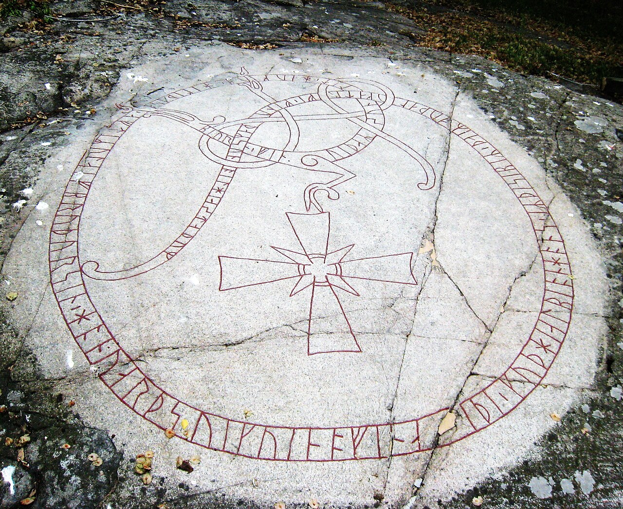
Uppland Runic Inscription 130
- High · Heritage site
- Historic monument
Language · 11 published
Nature site · Stockholm
Reviewed by Elena Voss · Roavina Travel Editor
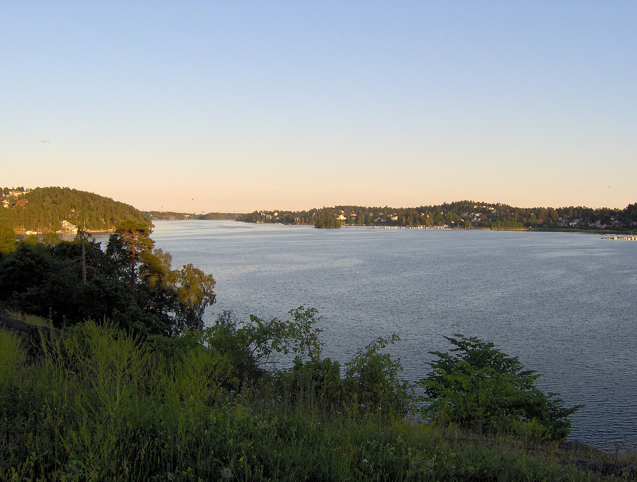
This place is a Body of water.
Edsviken is a sheltered inlet of the Baltic Sea in northern Stockholm, where coastal water, rocky Scandinavian terrain, vegetation, and residential surroundings meet. It is a landscape feature rather than a single enclosed attraction, so the experience comes from moving along legitimate shoreline approaches and taking in the changing relationship between water and land. Edsviken gives travelers a quieter view of Stockholm’s maritime character, away from the busiest central streets. The inlet is most rewarding for visitors who enjoy open air, reflective water, and an unhurried coastal walk. Edsviken is an inlet of the Baltic Sea located in northern Stockholm, forming part of the city's extensive archipelago landscape. The area represents a significant geographical feature within Stockholm's coastal environment, characterized by its marine setting and natural shoreline. It functions primarily as a natural inlet within Stockholm's coastal landscape, lacking the structured attractions, facilities, or promotional prominence of established tourism sites.
Checked 2026-08-26 · Source
There is no conventional interior at Edsviken. The place consists of marine water and shoreline areas shaped by coastal vegetation, mixed forest, rocky outcrops, and residential development. Portions of the inlet feel natural, while other stretches show how Stockholm’s communities sit close to the water. Use public viewpoints and shoreline routes as the structure of the visit, pausing to observe the surface of the inlet, the landform, and the coastal atmosphere. Edsviken’s appeal lies in this open setting rather than in buildings, displays, or a sequence of formal visitor facilities.
Checked 2026-08-26 · Source
Set aside fifteen to thirty minutes for a brief waterside pause, or one to two hours for a slower shoreline walk and landscape observation. The right length depends on whether Edsviken is your main outdoor stop or one part of a wider exploration of northern Stockholm. Leave extra time when you want to photograph changing light, watch birds, or sit quietly near the water. Since the inlet has no fixed exhibition route, you can shape the visit around the access point and the conditions of the day.
Checked 2026-08-26 · Source
Summer offers long daylight, milder conditions, and the easiest rhythm for a shoreline walk. Spring and autumn bring changeable weather and a more transitional landscape, while winter can transform the inlet with snow, ice, short daylight, and colder walking conditions. Choose the season according to the experience you want: bright summer water, quiet shoulder-season shores, or a stark winter coastline. Wear clothing suited to the weather and allow the available daylight to shape the length of an outdoor visit.
Checked 2026-08-26 · Source
Edsviken is a natural inlet, not a ticketed museum or enclosed attraction. Walking to public shoreline areas and observing the water does not form part of a conventional admission experience. The meaningful cost of this stop is the time and travel needed to reach the shoreline point you choose. Treat access as local and route-dependent: stay on public ways and respect residential property along the inlet. Because the landscape itself is the attraction, Edsviken can provide a low-cost outdoor change of pace within a Stockholm itinerary.
Checked 2026-08-26 · Source
Reach Edsviken through northern Stockholm’s public transport and road network, then continue on foot toward a legitimate shoreline access point. The exact walk depends on which part of the inlet you want to see, so plan around a chosen waterside destination rather than the name alone. Walking and cycling suit the landscape well, while buses and rail connections can bring you into the surrounding area before the final approach. Keep the route flexible enough to respond to weather, terrain, and the shoreline’s residential character.
Checked 2026-08-26 · Source
Edsviken is a coastal landscape, so water safety, weather, and uneven ground matter throughout the visit. Rocks and shoreline surfaces can be slippery, and Baltic water remains cold even during the warmer season. Wind can change the feel of the inlet quickly; bring layers and take care near the edge. Some stretches beside the water are residential or private, so remain on public routes and respect boundaries. Watch quietly for birds and other wildlife without feeding, chasing, or disturbing them.
Checked 2026-08-26 · Source
Edsviken is suited to landscape photography: use the inlet’s water, rocky shore, vegetation, and residential edges to show the meeting of nature and city. Summer provides long periods of soft light, while winter’s low sun, snow, and ice can create a more austere composition. Overcast skies suit quiet, low-contrast images of the shoreline. Public areas provide the natural setting for photography; do not intrude into private property or photograph residents as subjects without consent. Protect cameras and phones from moisture and sudden weather changes.
Checked 2026-08-26 · Source
Edsviken is a sheltered Baltic inlet in northern Stockholm, with marine water, rocky and wooded shoreline, and residential areas along parts of its edge.
Allow fifteen to thirty minutes for a short waterside pause, or one to two hours for a slower shoreline walk and landscape observation.
The inlet brings together coastal water, vegetation, mixed forest, rocky outcrops, and residential development, creating a varied northern Stockholm landscape.
Summer offers long daylight and milder walking conditions; spring, autumn, and winter provide distinct transitional, quiet, or snow-and-ice coastal scenery.
Edsviken is well suited to landscape photography from public areas, especially views of water, rocks, vegetation, seasonal light, and the urban shoreline.
Bring weather-appropriate layers and footwear with good grip, because wind, cold water, uneven rocks, and slippery shoreline surfaces can affect an outdoor visit.
Loading the interactive map…
The interactive map could not be loaded.
Last updated:
Source: OpenStreetMap contributors, Wikidata ·