.jpg)
527 min walk
Görvälnsbadet
- Notable
- Family attraction
Language · 11 published
Nature site · Stockholm
Reviewed by Elena Voss · Roavina Travel Editor

This place is a Body of water.
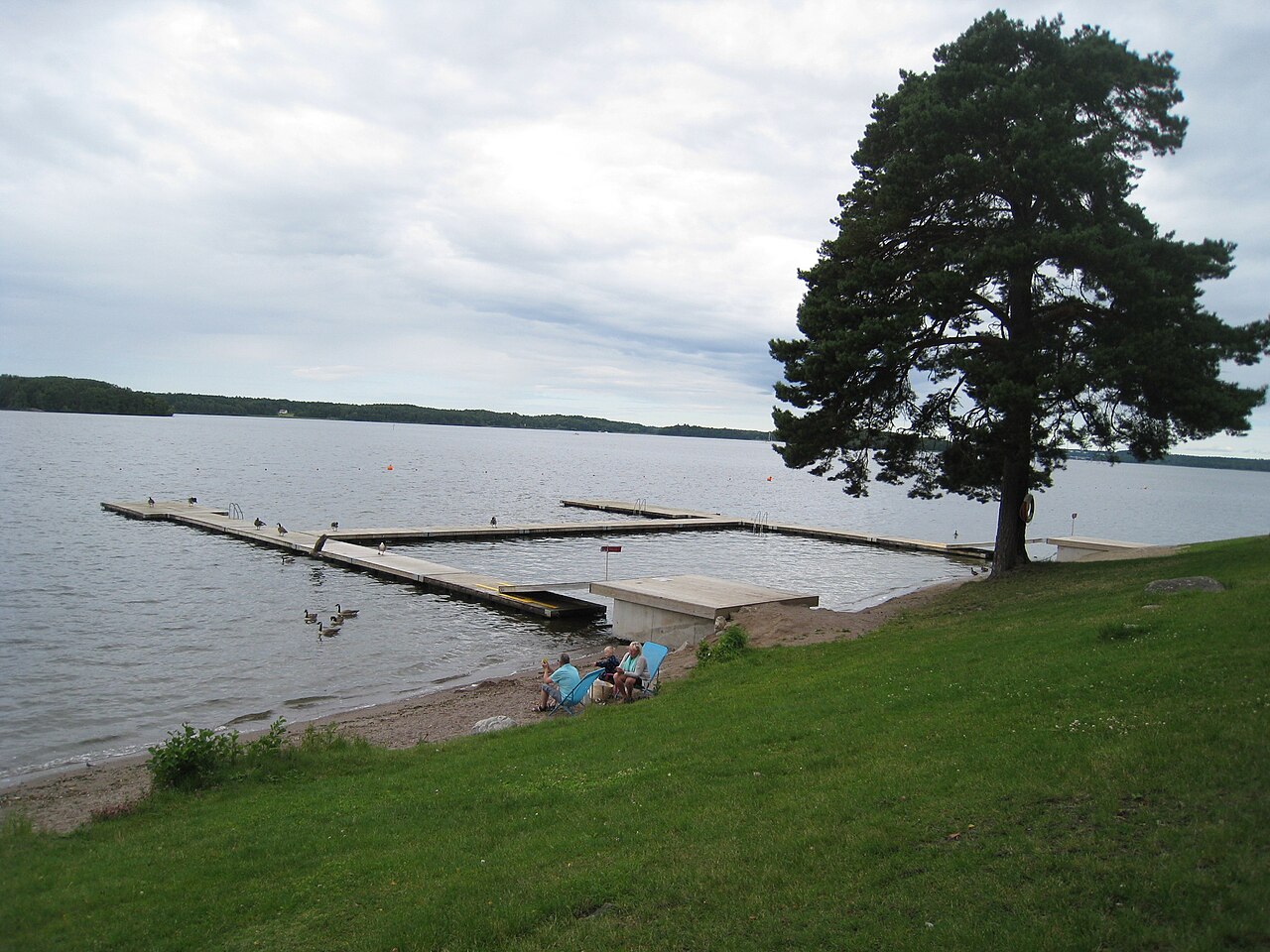
Mälaren is Sweden’s third-largest lake and one of the geographical features that defines Stockholm. Fresh water reaches the capital from the inland lake through a landscape of bays, islands and wooded shores. Mälaren has shaped settlement, trade and recreation around Stockholm, while its waterfronts give the city a changing mixture of urban views and open water. Travellers can experience the lake through a short shoreline walk, a boat journey or a full day outdoors. Mälaren is the third-largest lake in Sweden and a defining geographical feature of the Stockholm region. The lake stretches westward from the capital, connecting Stockholm to inland areas through an extensive archipelago and numerous bays. Its freshwater system has historically shaped settlement patterns, trade routes, and the development of communities around its shores. The lake's proximity to Stockholm makes it integral to the city's identity, recreational culture, and scenic character, with islands, waterfronts, and viewing points visible throughout the urban area. Swimming occurs in Mälaren during warmer months, but water quality and safety conditions vary by specific location. Visitors should assess local conditions, avoid isolated areas without supervision, and be aware of boat traffic. No comprehensive safety assessment is recorded.
Checked 2026-08-26 · Source
Mälaren is an open natural landscape rather than one enclosed attraction. Its waters include sheltered coves, broad lake views and rocky islands, while the shores alternate between woodland, wetlands, farmland and urban development. Ekerö, Lovön and Adelsö are among the notable islands connected with the lake’s cultural landscape. Fish and birdlife add to the experience, and the variety of shorelines means that a quiet natural scene can exist close to Stockholm’s built-up waterfront. The Mälaren system contains thousands of islands of varying sizes, from small rocky outcrops to substantial inhabited landmasses. The lake encompasses diverse environments including open water, sheltered coves, forested shorelines, and wetlands.
Checked 2026-08-26 · Source
A shoreline viewpoint or short walk can take less than an hour. A boat trip to an island turns Mälaren into a half-day or full-day outing, while kayaking and sailing support longer outdoor plans. The lake covers a large area, so choose one waterfront or island rather than trying to see the whole lake in one visit. In Stockholm, Mälaren also works well as a scenic pause between museums, historic streets and waterfront neighbourhoods.
Checked 2026-08-26 · Source
Summer offers the easiest conditions for boating, swimming and island visits, with long daylight for outdoor exploration. Spring and autumn bring changing weather and a quieter shoreline atmosphere. Winter can transform the lake with ice, but ice cover and stability vary from year to year. The season changes the experience substantially: warm-weather visits focus on water and islands, while colder months favour waterfront views, walking and winter scenery from land.
Checked 2026-08-26 · Source
Mälaren itself is free to experience from public shores and viewpoints. Costs arise from the chosen activity, such as a boat tour, ferry journey, equipment rental or admission to an island attraction. Public-transport fares also depend on the route used to reach the water. Treat the lake as a landscape with many entry points rather than as one ticketed site; the right budget depends on whether the day is spent walking, travelling by boat or renting equipment.
Checked 2026-08-26 · Source
Central Stockholm provides several ways to reach Mälaren. SL buses and commuter trains serve waterfront municipalities and communities, while ferries and boat services leave from central quays for selected islands. Roads reach many lakeside locations, and urban sections of the shore can be explored on foot or by bicycle. Private boats use marinas and launch points around the lake. Select the access point according to the intended activity, because the lake’s many shores are spread across the region.
Checked 2026-08-26 · Source
Conditions on Mälaren can change quickly. Wind and waves matter to boaters, swimmers and paddlers, while rocks and shore paths can become slippery. Boat traffic requires care near water access points. Winter ice is not automatically safe: thickness and stability vary, so walking or skating belongs only on routes supported by local conditions. Ticks inhabit vegetation around the lake. Carry water and food when visiting less populated islands, where services are limited.
Checked 2026-08-26 · Source
Mälaren gives photographers a broad range of subjects: open water, wooded islands, rocky coves, shoreline buildings and the meeting of Stockholm with nature. Early and late light creates reflections across the lake, while winter ice and changing weather alter the colour and texture of the scene. Elevated viewpoints offer wider compositions, and boat travel brings a low perspective close to the water. Protect cameras from spray and movement during boat-based photography.
Checked 2026-08-26 · Source
Mälaren is free to experience from public shores and viewpoints. Boat trips, ferries, rentals and individual attractions can cost extra.
Ekerö, Lovön and Adelsö are notable islands within the Mälaren landscape.
Yes. Stockholm’s SL buses and commuter trains serve waterfront areas, and ferries or boat services connect selected islands from central quays.
Summer generally offers the most accessible conditions for boating, swimming and island visits, together with long daylight hours.
The lake supports fish populations and birdlife, while its shores include woodland, wetlands and other habitats.
Ice formation varies annually. Winter may bring ice, but complete freezing and stable ice cannot be treated as an every-year condition.
Loading the interactive map…
The interactive map could not be loaded.
Last updated:
Source: OpenStreetMap contributors, Wikidata ·