_%E0%B8%A7%E0%B8%B1%E0%B8%94%E0%B8%AA%E0%B8%A3%E0%B8%B0%E0%B9%80%E0%B8%81%E0%B8%A8%E0%B8%A3%E0%B8%B2%E0%B8%8A%E0%B8%A7%E0%B8%A3%E0%B8%A1%E0%B8%AB%E0%B8%B2%E0%B8%A7%E0%B8%B4%E0%B8%AB%E0%B8%B2%E0%B8%A3_%E0%B9%80%E0%B8%82%E0%B8%95%E0%B8%9B%E0%B9%89%E0%B8%AD%E0%B8%A1%E0%B8%9B%E0%B8%A3%E0%B8%B2%E0%B8%9A%E0%B8%A8%E0%B8%B1%E0%B8%95%E0%B8%A3%E0%B8%B9%E0%B8%9E%E0%B9%88%E0%B8%B2%E0%B8%A2_%E0%B8%81%E0%B8%A3%E0%B8%B8%E0%B8%87%E0%B9%80%E0%B8%97%E0%B8%9E%E0%B8%A1%E0%B8%AB%E0%B8%B2%E0%B8%99%E0%B8%84%E0%B8%A3_(11).jpg)
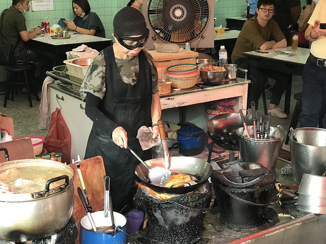
4 min walk · เขตพระนคร
Jay Fai
- Must see
- Restaurant or café
Language · 11 published
Place of worship · เขตป้อมปราบศัตรูพ่าย, Bangkok
วัดสระเกศราชวรมหาวิหาร
Reviewed by Elena Voss · Roavina Travel Editor

| Monday | 08:00 – 18:00 |
|---|---|
| Tuesday | 08:00 – 18:00 |
| Wednesday | 08:00 – 18:00 |
| Thursday | 08:00 – 18:00 |
| Friday | 08:00 – 18:00 |
| Saturday | 08:00 – 18:00 |
| Sunday | 08:00 – 18:00 |
Checked 2026-08-31 · Source
Read from the OpenStreetMap access tags; anything not listed has no tag recorded.
Set the group type to family in the planner and the day window contracts to about three quarters of a solo day.
This place is a Place of worship. It carries the registered Thai historic site heritage designation.
| Monday | 07:30 – 19:00 |
|---|---|
| Tuesday | 07:30 – 19:00 |
| Wednesday | 07:30 – 19:00 |
| Thursday | 07:30 – 19:00 |
| Friday | 07:30 – 19:00 |
| Saturday | 07:30 – 19:00 |
| Sunday | 07:30 – 19:00 |
Checked 2026-08-25 · Source
Recorded for The Golden Mount, Wat Saket, not for this site as a whole. View The Golden Mount, Wat Saket's guide
Wat Saket is a working royal monastery in Pom Prap Sattru Phai, on the eastern edge of the old royal island, and it is older than the city that grew around it. The monastery dates from the Ayutthaya period, when it was called Wat Sakae; King Rama I renovated it when Bangkok was made the capital and gave it the name it carries now, which means to wash the hair. That is the wrong way round. Daily 08:00–18:00. Open every day; no weekly closure day applies. General admission: THB 50.
Checked 2026-08-31 · Source
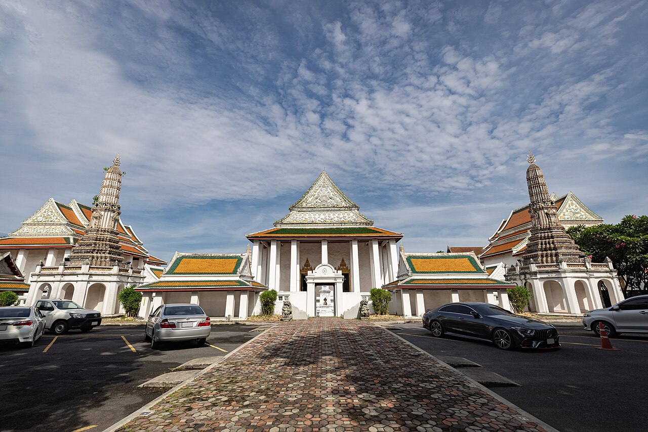
The compound has two halves that most itineraries treat as one attraction. The level ground holds the monastery proper: the ordination hall and its assembly hall, the monks' quarters, a crematorium still in use for funerals, and shaded walks between them where the temple cats outnumber the visitors before nine in the morning. Behind it rises the mound, and the gilded chedi on top is treated on its own page here rather than repeated on this one. Open every day; no weekly closure day applies. General admission: THB 50.
Checked 2026-08-31 · Source
Allow sixty minutes for Wat Saket. That covers the ordination hall, an unhurried loop of the level grounds, and the climb to the chedi and back down; it is not enough if the terrace is where the visit is really aimed and photographs are wanted from it, in which case treat the mount as its own forty-five-minute stop and add it to this hour. Two things stretch it in practice. General admission: THB 50. The Golden Mount summit route has 344 spiral steps. The official visitor information does not identify a lift or step-free route to the summit.
Checked 2026-08-31 · Source
November to February is the cool dry season and the right window for a visit whose second half is a stair climb in the open. Late afternoon is the opposite — the last hour before the 19:00 close is when the sunset crowd arrives, and the stair becomes single-file. Daily 08:00–18:00. Take the MRT Blue Line to Sam Yot station; Wat Saket is approximately a 15-minute walk from the station. The address is 344 Chakkraphatdi Phong Road, Ban Bat, Pom Prap Sattru Phai, Bangkok 10100. The Golden Mount summit route has 344 spiral steps.
Checked 2026-08-31 · Source
No admission figure is recorded for Wat Saket, because no operator source publishes one. The temple's own website carries no fee page; the only baht figure on it is the hundred-baht mosaic tile of the chedi restoration appeal, which is a donation and must not be read as an entry price. General admission: THB 50. The Golden Mount summit route has 344 spiral steps. The official visitor information does not identify a lift or step-free route to the summit. It is widely known as Wat Phu Khao Thong, meaning the Golden Mount temple.
Checked 2026-08-31 · Source
Wat Saket is reached on foot and no car is wanted. The nearest metro is MRT Sam Yot, roughly a kilometre away, and the walk east from it crosses the old quarter rather than skirting it, which is the better part of the approach. Take the MRT Blue Line to Sam Yot station; Wat Saket is approximately a 15-minute walk from the station. The address is 344 Chakkraphatdi Phong Road, Ban Bat, Pom Prap Sattru Phai, Bangkok 10100. The official visitor information does not identify a lift or step-free route to the summit.
Checked 2026-08-31 · Source
Dress as for any Thai temple, and this page carries the rule in full for the group of Bangkok temples around it: shoulders and knees covered for everyone, no vests, no short shorts, shoes off before entering the ordination hall or any shrine building, and feet never pointed toward a Buddha image — sit with the legs folded back. The Golden Mount summit route has 344 spiral steps. It is widely known as Wat Phu Khao Thong, meaning the Golden Mount temple. The artificial hill is 77 metres high. The summit route has 344 spiral steps.
Checked 2026-08-31 · Source
The photograph most people want from Wat Saket is taken from the terrace above and belongs to the mount. On the level ground the picture is a different one and needs different light: early, low and from the east, when the sun is coming over the compound wall and the ordination hall roofline is edge-lit against a sky that has not yet gone white. By eleven the light is vertical and the white walls blow out. The artificial hill is 77 metres high. The summit route has 344 spiral steps.
Checked 2026-08-31 · Source
It is widely known as Wat Phu Khao Thong, meaning the Golden Mount temple.
The artificial hill is 77 metres high.
The summit route has 344 spiral steps.
A golden chedi containing Buddhist relics stands at the top.
The summit provides a 360-degree view across Bangkok.
The temple, formerly called Wat Sakae, was renamed Wat Saket after the Bangkok kingdom was established in 1782.
MRT Sam Yot is about a kilometre away on foot. The Khlong Saen Saep canal boat ends at Phan Fa Lilat pier, a short walk from the temple, which is the fastest crossing from the Sukhumvit side at rush hour. Buses run along Ratchadamnoen Klang. Driving is the worst option: narrow lanes, little parking and a one-way system.
Loading the interactive map…
The interactive map could not be loaded.
Last updated:
Source: OpenStreetMap contributors, Wikidata ·