

24 min walk
Lakeside
- Notable
- Nightlife venue
Language · 11 published
Viewpoint · Phuket
Reviewed by Elena Voss · Roavina Travel Editor
| Monday | 00:00 – 23:59 |
|---|---|
| Tuesday | 00:00 – 23:59 |
| Wednesday | 00:00 – 23:59 |
| Thursday | 00:00 – 23:59 |
| Friday | 00:00 – 23:59 |
| Saturday | 00:00 – 23:59 |
| Sunday | 00:00 – 23:59 |
Checked 2026-08-31 · Source
Read from the OpenStreetMap access tags; anything not listed has no tag recorded.
Set the group type to family in the planner and the day window contracts to about three quarters of a solo day.
This place is a Viewpoint.
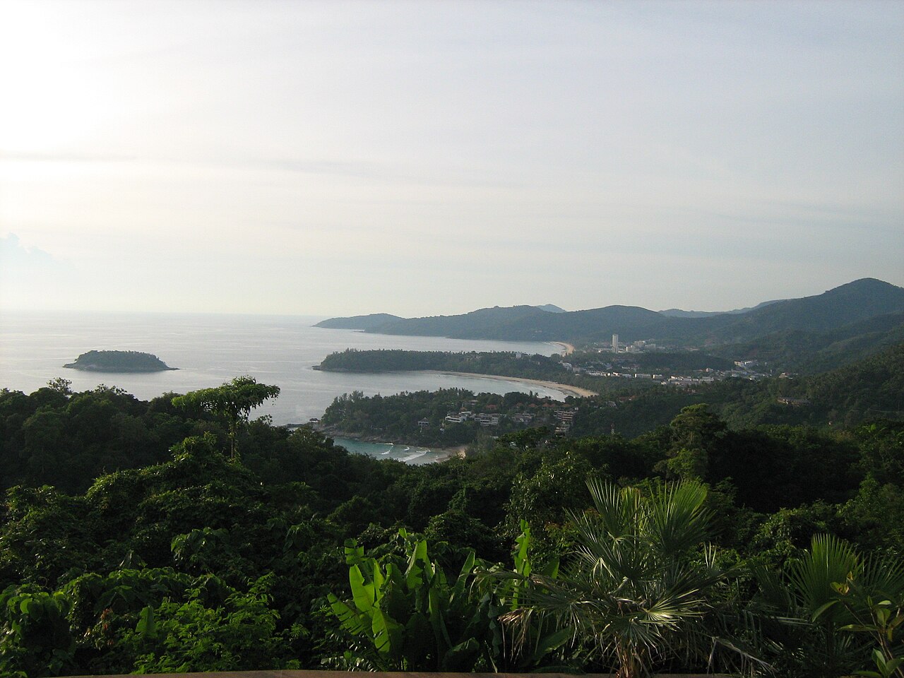
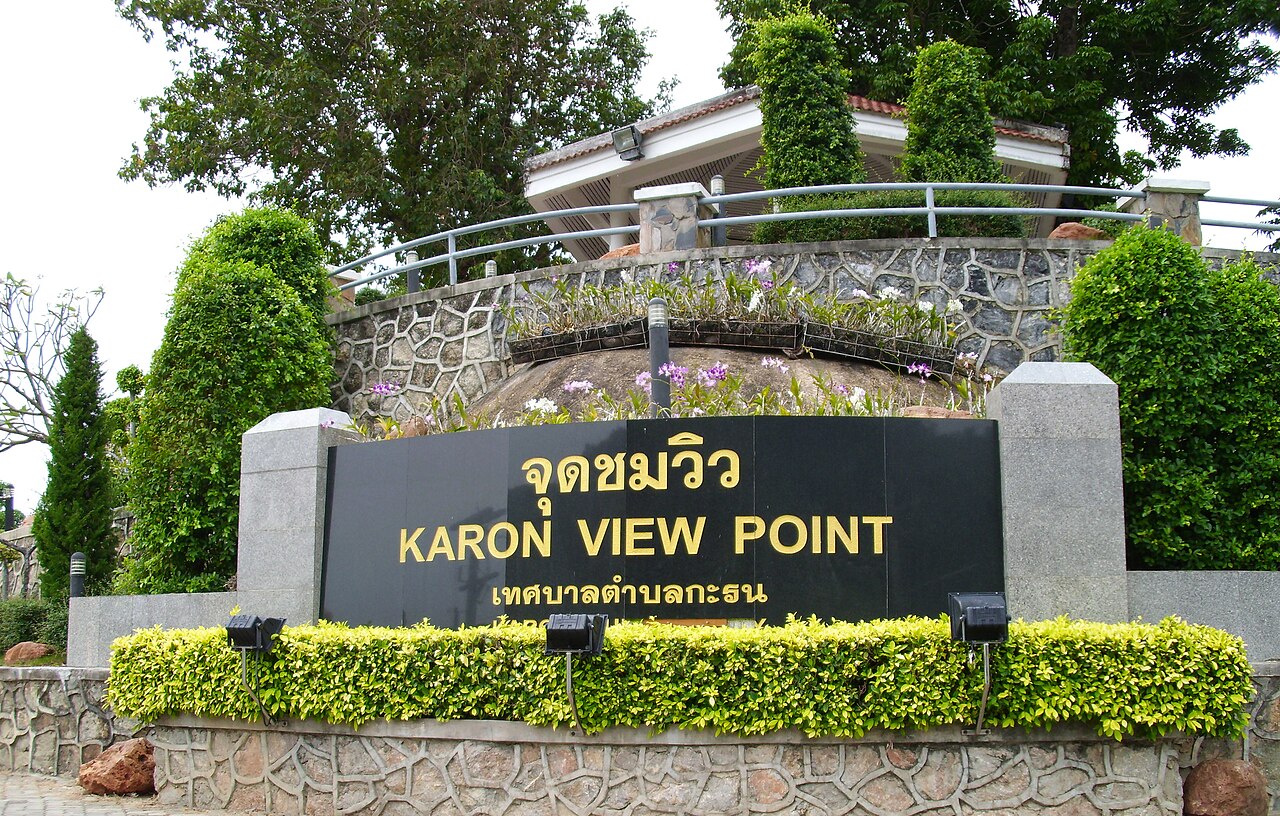
Karon Viewpoint is a roadside observation point on Phuket's southwestern coast. It offers a celebrated outlook over three adjacent bays: Kata Noi, Kata, and Karon. The site functions as an informal stop rather than a developed attraction, with no substantial built infrastructure beyond a basic shelter and parking area. Its reputation rests entirely on the scenic composition of the curved beaches and Andaman Sea visible from the elevated position. The viewpoint has become one of Phuket's most photographed locations, frequently referenced in tourism itineraries as an essential coastal panorama.
Checked 2026-08-26 · Source
The viewpoint contains minimal permanent structures. A simple roofed shelter provides partial shade for visitors. A parking area accommodates cars and tour vehicles along the roadside. No visitor centre, museum, or interpretive displays are present. The immediate surroundings consist of natural hillside vegetation. Several informal vendor stalls may operate intermittently, though these are not permanent fixtures. The experience centres on the unobstructed coastal vista from the concrete viewing platform. No seating, restrooms, or drinking water facilities are reliably available. Visitors should expect a raw, undeveloped stopping point rather than a managed tourist facility with amenities.
Checked 2026-08-26 · Source
A typical visit requires fifteen to thirty minutes, sufficient for photography and appreciation of the panorama. Tour groups often allocate brief stops of ten to fifteen minutes. Independent travellers may linger longer during favourable light conditions. No activities, trails, or sequential exhibits extend the duration. The experience is entirely self-directed and stationary. Traffic conditions and parking availability may affect total time spent, particularly during peak visitor periods when roadside congestion occurs. Many visitors incorporate the viewpoint as one component within a broader coastal itinerary rather than making a dedicated excursion. Early morning or late afternoon visits may encourage longer stays.
Checked 2026-08-26 · Source
Clear atmospheric conditions substantially improve visibility across the three bays. Morning hours often provide calmer seas and more stable light for observation. The southwest monsoon season, approximately May through October, may bring reduced visibility, overcast skies, and rougher seas. The roadside location implies theoretical twenty-four-hour accessibility, though safety and visibility considerations make daylight hours preferable. Sunset timing attracts visitors seeking golden-hour photography, though cloud cover during monsoon months may disappoint. December through February generally offers the most reliable weather conditions.
Checked 2026-08-26 · Source
No entrance fee is documented for this informal roadside viewpoint. Tour operators may include the stop within packaged excursion pricing. Visitors should carry small denomination currency for any incidental vendor purchases. The absence of formal management suggests no advance booking requirement. Group tours and independent travellers alike appear to access the site without payment verification. Financial arrangements for any future development remain unspecified.
Checked 2026-08-26 · Source
The viewpoint lies along Route 4233, the coastal road connecting Kata and Nai Harn beaches. Private vehicle, rental scooter, or taxi represent the most common access methods. The route involves hillside driving with curves requiring caution. No public bus service directly serves the location. Many visitors arrive via organised tour circuits covering multiple southern Phuket viewpoints. Signage along the road identifies the stopping point. Parking space is limited and may require roadside positioning during busy periods. Walking from nearby beaches involves steep elevation gain and is not recommended. Navigation applications identify the location consistently. Allow extra time for traffic congestion near the viewpoint.
Checked 2026-08-26 · Source
Roadside parking creates vehicle collision risk with passing traffic. The concrete platform edges lack protective barriers, presenting fall hazard particularly for children. Intense tropical sun exposure occurs with minimal shade coverage beyond the small shelter. Informal vendors may approach visitors aggressively. No emergency services or first aid facilities are present. The isolated position may attract opportunistic theft from unattended vehicles. Scooter parking on slopes risks tipping. Tour bus congestion during mid-morning and late afternoon peak periods complicates access and departure. Weather deterioration can reduce visibility unexpectedly. No drinking water is reliably available. Mobile telephone coverage may be intermittent on the hillside location.
Checked 2026-08-26 · Source
The three-bay composition offers a classic layered landscape with Kata Noi foreground, Kata middle distance, and Karon extending to the horizon. Wide-angle lenses capture the full sweep effectively. Morning light illuminates the beaches from the east, while afternoon backlighting creates silhouette effects. Tripod use is feasible though space may be constrained during crowds. The shelter roof may intrude at certain angles. Polarising filters reduce sea glare and enhance water colour differentiation between bays. Long exposures require stable positioning away from platform edge vibration. Drone operation faces regulatory restrictions in Thailand and proximity to populated beaches. Sunset timing requires advance arrival for positioning.
Checked 2026-08-26 · Source
Both names refer to the same location. The viewpoint overlooks Kata Noi, Kata, and Karon beaches, leading to interchangeable naming in visitor materials.
No permanent dining facilities are present. Intermittent vendor stalls may operate, though reliability is not guaranteed. Visitors should not depend on food or beverage availability.
The terrain and parking arrangement present challenges. No accessibility infrastructure is documented. Cautious assessment of individual capability is advised.
The distance involves substantial elevation gain along a winding road without pedestrian pathways. Walking is not recommended due to traffic hazard and physical exertion requirements.
No lighting is present. Roadside parking increases collision risk. The unbarriered platform edge creates fall hazard. Daylight visits are strongly preferred for safety reasons.
No booking mechanism exists for this informal roadside stop. No capacity limitation or entry control is operational.
Loading the interactive map…
The interactive map could not be loaded.
Last updated:
Source: OpenStreetMap contributors ·