
36 min walk
Phuket Mining Museum
- Must see
- Museum
Language · 11 published
Nature site · Phuket
Reviewed by Elena Voss · Roavina Travel Editor
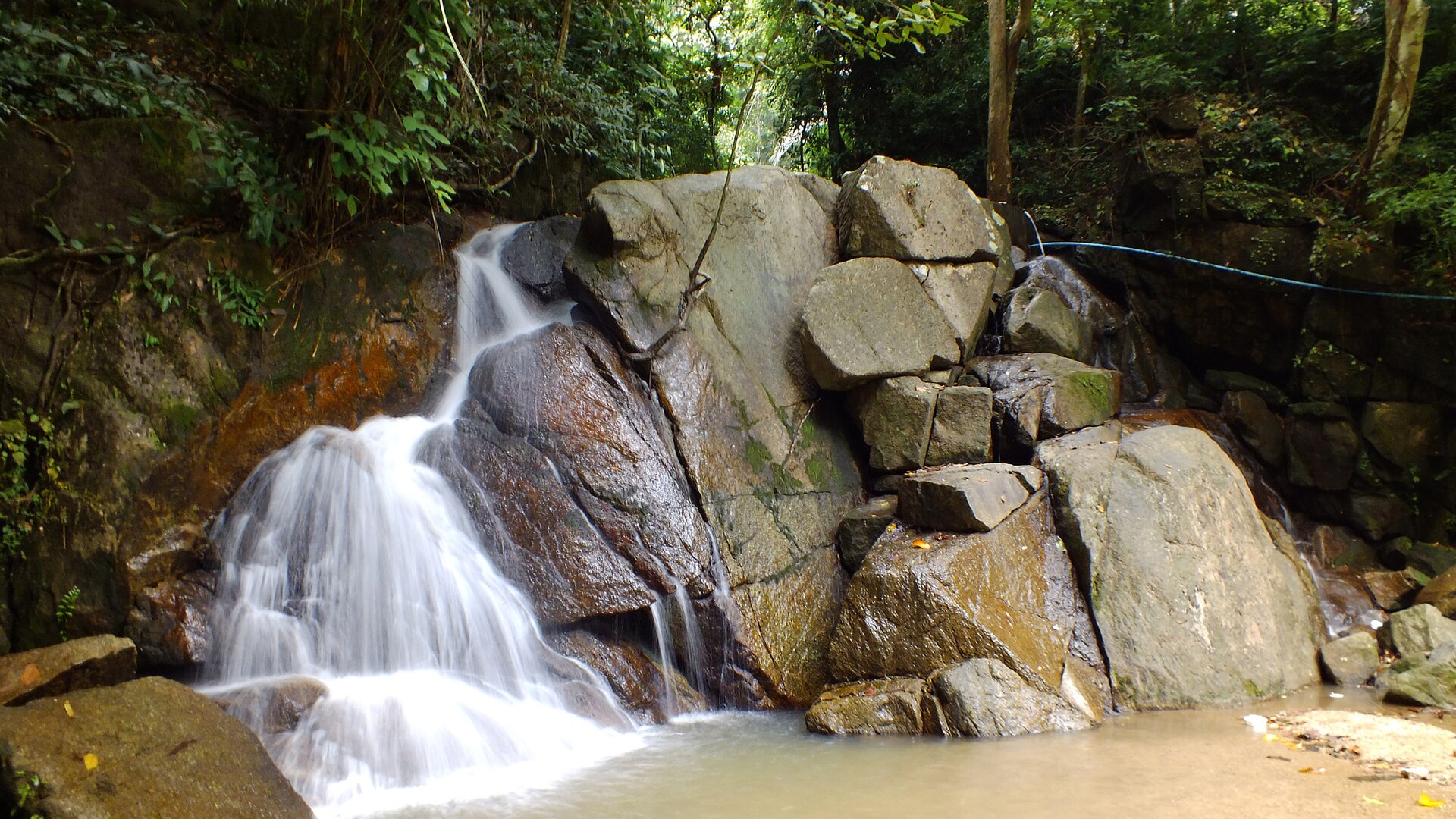
Kathu Waterfall is a natural waterfall in Kathu district, inland from Phuket’s better-known west-coast beaches. The site gives a Phuket day a forest setting, with falling water, tropical vegetation, rock and pools replacing the developed shoreline. It is a useful choice for travellers who want a nature stop close to the island’s built-up resort areas. The waterfall is a landscape experience rather than a museum or staged attraction, so the character of the visit comes from the terrain, vegetation, water and changing seasonal flow. Kathu Waterfall also provides a contrast with Patong, Karon and Kata: the atmosphere is quieter, greener and more physically involved than a beach promenade.
Checked 2026-08-26 · Source
The waterfall is formed by a multi-tiered cascade running through forested terrain. Visitors encounter natural rock formations, flowing water and pools shaped by the descent of the stream, together with tropical vegetation characteristic of Phuket’s interior. The setting remains more natural than the island’s commercial beach districts, making the surrounding greenery part of the attraction rather than a backdrop to a built facility. The visit is best understood as a short outdoor exploration: follow the terrain, pause beside the water, and look at how the cascade changes from one level to the next. Uneven ground and damp rock are part of the experience.
Checked 2026-08-26 · Source
Allow roughly one to two hours at Kathu Waterfall for walking, pauses beside the water and photographs. The complete outing takes longer when travel from Patong, Karon, Kata or another coastal base is included. A brief visit can focus on the cascade and its nearest surroundings; a slower visit leaves time to watch the water, explore the forest edge and rest in the tropical shade. Treat Kathu Waterfall as a half-day component when it is combined with road travel and another inland stop. The right pace depends on how comfortably each visitor handles uneven outdoor ground.
Checked 2026-08-26 · Source
The waterfall changes with Phuket’s wet and dry seasons. Rain from roughly May through October can increase the volume and drama of the cascade, while damp conditions also make natural paths and rocks more difficult to cross. The drier months generally offer easier walking conditions but can bring less water. Morning is a comfortable time for an outdoor visit because temperatures are lower than later in the day and forest shade is more useful. Weather matters directly here: heavy rain can alter footing, water movement and the comfort of the approach.
Checked 2026-08-26 · Source
Bring Thai baht in small denominations for ordinary travel needs around Phuket, including transport or food before and after the visit. Keep the waterfall in a flexible day plan because the value of the stop comes from the landscape rather than a timed exhibition or booked performance. A simple visit involves reaching the waterfall, spending time beside the cascade and leaving enough margin for the journey back to the coast.
Checked 2026-08-26 · Source
Kathu Waterfall lies in Kathu district, inland from Phuket’s western resort belt. A rental motorbike or car gives the most control over the journey and the time spent at the site. Taxi or tuk-tuk travel can also connect the waterfall with Patong and other tourist areas; arrange the return part of the journey before setting out if using a driver for a one-way drop-off. Phuket roads can become busy, and interior routes may include slopes. Build extra travel time into a day plan, especially when moving between the coast and Kathu.
Checked 2026-08-26 · Source
Wear shoes with dependable grip because wet rocks and uneven ground can make the waterfall area unstable underfoot. Water movement and pool depth vary across natural cascades, so stay on secure ground and keep children close. Tropical forest conditions make insect repellent, drinking water and sun protection useful additions to a small day bag. Humidity and spray can affect phones and cameras. Keep the visit within your physical comfort, particularly after rain, and take care near the water’s edge. The natural setting rewards a slower pace, but it does not provide the predictable surfaces of a paved attraction.
Checked 2026-08-26 · Source
Kathu Waterfall offers photographs of falling water, tropical forest, wet rock and the layered shape of the cascade. Water volume changes the image from a delicate stream to a stronger seasonal flow, so the same viewpoint can feel different at different times of year. A fast shutter speed freezes spray; a slower exposure can soften the water when the camera is stable. Forest shade creates patches of contrast, while spray and humidity call for protection for lenses and phones. Work from firm ground, keep equipment away from the water and let the landscape remain the subject.
Checked 2026-08-26 · Source
Kathu Waterfall is a natural, multi-tiered cascade in tropical forest in Kathu district. The visit centres on flowing water, rock, pools and inland greenery rather than a built exhibition.
Allow about one to two hours at the waterfall, with additional time for travel from Phuket’s coastal resort areas. A half-day plan suits visitors combining the stop with road travel and another inland attraction.
Choose sturdy footwear with good grip and clothing that allows comfortable movement. Shoes and clothes that tolerate moisture are useful around wet rock, forest paths and spray.
Phuket’s rainy season, roughly May through October, can produce stronger waterfall flow. Rain also makes rocks and paths wetter, while the dry season generally brings easier footing and less water.
Kathu Waterfall is an inland forest attraction with flowing water, rock and tropical vegetation. It offers a greener and more active setting than Phuket’s developed coastal beaches and promenades.
Photograph the multi-tiered cascade, water spray, tropical foliage, wet rock and forest shade. The appearance of the waterfall changes with seasonal rainfall and the amount of water moving through the tiers.
Loading the interactive map…
The interactive map could not be loaded.
Last updated:
Source: OpenStreetMap contributors ·


.jpeg)