

203 min walk
Balbura
- Notable
- Historic monument
Language · 11 published
Historic monument · Muğla
Oinoanda
Reviewed by Elena Voss · Roavina Travel Editor
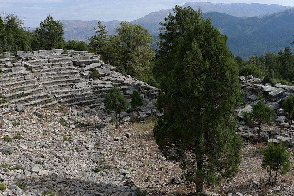
This place is a Archaeological site.
Oenoanda is a remote ancient city of northern Lycia near İncealiler village in Seydikemer, Muğla, occupying an isolated mountain ridge rather than a compact monument. Its identity comes from the way ancient civic remains are scattered across a difficult slope: the settlement is understood by moving through a landscape, not by following one enclosed building. Hellenistic, Roman and later evidence survives among the ruins, while the ridge setting keeps the ancient city visibly connected to the wider Lycian terrain. The long approach is therefore part of the place itself, revealing why Oenoanda feels like an archaeological expedition rather than a brief roadside sight.
Checked 2026-09-02 · Source
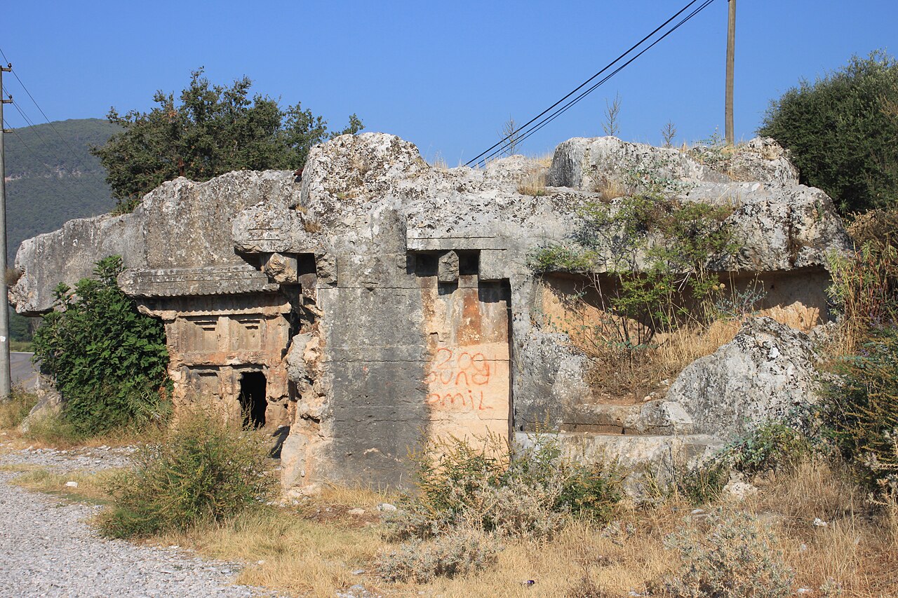
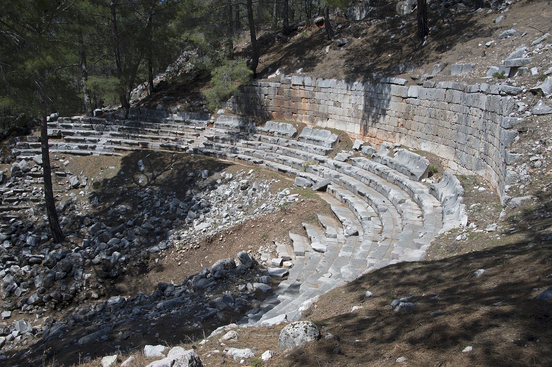
The dispersed remains include Hellenistic fortification walls, an agora, a theatre, a temple, two bath complexes, an aqueduct and funerary structures. The site is especially associated with fragments of the long Greek inscription connected with the Epicurean philosopher Diogenes, whose text presented philosophical ideas publicly. Begin with the southern fortifications, identified in the research as the earliest securely dated structures and placed in the second century BC, then read the surviving city through its different building types. Oenoanda offers no intact museum-like sequence of rooms; its interest lies in comparing civic, religious and funerary remains with the slope on which they were built.
Checked 2026-09-02 · Source
Allow at least half a day for the excursion, including the road journey towards İncealiler village, the uphill approach and time among Oenoanda’s scattered remains. The final walk is narrow and steep, and the ruins extend across rough, uneven ground, so the visit involves more than looking around one central landmark. Visitors who study the inscription fragments, locate the principal civic buildings and pause to understand the ridge landscape may need longer. Reserve time for the return journey as well as the ascent. A slower circuit makes the ancient urban layout legible and gives the mountain setting room to shape the experience.
Checked 2026-09-02 · Source
Plan Oenoanda as a daylight outdoor visit, because both the steep approach and the scattered ruins lie on a high, isolated ridge. Choose a clear, stable-weather day when uneven ground is easier to read and the surrounding Lycian landscape can be understood from the site. Begin early enough to complete the road approach, uphill walk, exploration and return before daylight fades. Weather matters here not as a timetable published by the site, but because it changes the effort and footing of the excursion. The best moment is consequently a well-prepared daylight window suited to the mountain route and a self-directed archaeological walk.
Checked 2026-09-02 · Source
This is a remote, dispersed archaeological landscape rather than a conventional museum threshold, but that description must not be treated as proof of free admission. Plan for the documented physical effort instead: the ridge is reached by a demanding walk, and the ruins are spread over uneven ground. Carry the essentials for an outdoor excursion, protect the remains and keep ticket assumptions separate from the verified information available for this site.
Checked 2026-09-02 · Source
Reach Oenoanda by road via Seki and the Fethiye–Antalya route, continuing towards İncealiler village. The responsible cultural-tourism listing gives the address as Ceylan, 48850 Seydikemer/Muğla. Leave the vehicle around the village, then continue on foot along the narrow, steep path to the high ridge. Public transport does not reach the final section described in the research. Treat the journey as two linked stages: road travel to the village followed by a demanding uphill walk. This approach makes Oenoanda unsuitable as a quick roadside stop and requires the ascent, site circuit and return to be included in the day’s plan.
Checked 2026-09-02 · Source
The final approach to Oenoanda is narrow and steep, and the remains are distributed across rugged, uneven ground. Wear firm footwear, carry water and prepare for an outdoor walk without depending on visitor facilities. Take care on ascent and descent, avoid unstable-looking stones and do not climb the ancient remains. The site’s isolation makes preparation important, since terrain, weather and daylight shape the visit once you leave İncealiler village. Allow enough energy for the return journey, since the uphill approach is part of the visit rather than a separate transfer.
Checked 2026-09-02 · Source
Photograph Oenoanda as a mountain city, not simply as a collection of isolated stones. Use wider frames to place the fortification walls, theatre or inscription fragments within the high ridge and surrounding Lycian landscape, then add close details of carved or inscribed surfaces from stable ground. Morning or late-afternoon light can reveal texture in the masonry, provided the walk remains within safe daylight conditions. Do not climb, lean on or move stones. Pair every detail with a broader view: the distinctive photographic subject is the relationship between Oenoanda’s civic and funerary remains, its slope and its striking isolation.
Checked 2026-09-02 · Source
Oenoanda is near İncealiler village in Seydikemer district of Muğla.
Oenoanda is one of the ancient cities of northern Lycia.
It is known for fragments of the long Greek inscription presenting ideas linked to the Epicurean philosopher Diogenes.
The ruins include Hellenistic walls, an agora, a theatre, a temple, two bath complexes, an aqueduct and funerary structures.
The Hellenistic walls on the southern side of the city date to the second century BC.
From around İncealiler village, visitors walk up a narrow, steep and uneven path to the site.
Loading the interactive map…
The interactive map could not be loaded.
Last updated:
Source: OpenStreetMap contributors, Wikidata ·