10 min walk
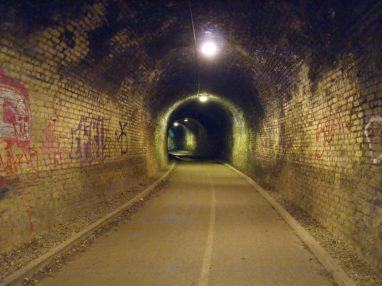
Colinton Tunnel
- Notable
- Art and culture venue
Language · 11 published
Nature site · Edinburgh
Reviewed by Elena Voss · Roavina Travel Editor
This place is a Park.
Colinton and Craiglockhart Dells form a wooded river corridor along the Water of Leith in southwest Edinburgh. Colinton Dell and Craiglockhart Dell sit beside one another, creating a continuous green route through an urban area. Steep wooded banks, flowing water, bridges, and riverside paths give the landscape the feel of a narrow gorge rather than a formal city park. The dells preserve a semi-natural section of the Water of Leith valley and offer a change of pace from Edinburgh’s stone streets. They suit walkers, photographers, birdwatchers, and travelers looking for accessible countryside character within the capital.
Checked 2026-08-26 · Source
The route passes through mixed deciduous woodland, with mature trees, shrubs, riverbank vegetation, and the Water of Leith at its centre. Footbridges cross the water, while the walkway alternates between surfaced sections and earth tracks. The disused Colinton Tunnel contains a mural installation that adds a strong artistic feature to the natural setting. Spylaw Park adjoins the Colinton side, and Craiglockhart Dell continues the riverside landscape westward. Benches provide places to pause, and the canopy creates shade during summer. The combination of water, woodland, bridges, and mural makes the dells varied despite their linear form.
Checked 2026-08-26 · Source
Walking through both dells takes approximately forty-five to seventy-five minutes at a steady pace, allowing for the route’s gradients, steps, and uneven surfaces. A short section can make a pleasant fifteen- to twenty-minute visit if you enter near Colinton or Craiglockhart and turn back. The dells connect with the wider Water of Leith Walkway, so walkers can extend the outing toward Colinton village, Slateford, or other riverside sections. Because the route is linear, plan either a return walk or a continuation to another access point if you do not want to retrace your steps.
Checked 2026-08-26 · Source
Each season gives the dells a different mood. Spring brings fresh growth, flowers, and active birdlife; summer offers deep woodland shade; autumn adds colour to the canopy; and winter opens views toward the river and structures hidden by leaves. Rain can leave earth sections muddy or slippery, while the gorge becomes dimmer earlier than open ground. Daylight is particularly useful for the tunnel, bridges, and narrower paths. Wear shoes with reliable grip and choose a route length that matches the weather. The dells are especially rewarding when you want nature without leaving Edinburgh.
Checked 2026-08-26 · Source
The dells are experienced as an open public walking landscape along the Water of Leith rather than as a ticketed attraction. There is no museum-style entrance sequence; visitors join the path from surrounding neighbourhood access points and walk through the woodland corridor. Carry what you need for the route, including water and weather protection. Colinton village provides places for refreshments beyond the woodland. If arriving by car, surrounding streets are part of the urban road network and may have ordinary parking restrictions, so the walk itself is easier to plan as a public-transport or neighbourhood walking stop.
Checked 2026-08-26 · Source
Approach from Colinton village for the eastern side, or from the Craiglockhart area for the western side. Both connect with the Water of Leith Walkway and can be reached from Edinburgh by local bus routes. The wider path also links toward Slateford and other riverside landmarks, making it possible to build a longer walking day. Nearby residential streets provide access rather than a single grand entrance. Walking and cycling are natural ways to experience the corridor, although narrow sections and varied surfaces require cyclists to slow down and share the route with pedestrians.
Checked 2026-08-26 · Source
The gorge has steep banks, exposed edges near the river, tree roots, steps, and surfaces that can become slippery after rain. High water may affect riverside sections during very wet weather. The tunnel and underpasses are darker than the open path, while mobile reception can be less dependable within the deeper valley. Walkers and cyclists share parts of the route, so keep to the side and leave room for others. Dogs should remain under control near wildlife, water, and steep edges. Good footwear, daylight, and a steady pace make the route more comfortable and safer.
Checked 2026-08-26 · Source
The dells provide a varied set of subjects: river reflections, wooded slopes, footbridges, seasonal leaves, textured paths, and the mural inside Colinton Tunnel. Canopy cover changes the light quickly, with soft conditions often helping woodland detail. A tripod can be useful for water movement, but narrow paths require you to keep equipment out of the way of walkers and cyclists. Wildlife photography rewards patience and distance rather than pursuit. The gorge limits views of the sky, so use the bends, banks, and bridges to create depth. Early and late daylight can bring gentle colour to the landscape.
Checked 2026-08-26 · Source
They are adjoining wooded sections of the Water of Leith valley, joined by riverside paths in southwest Edinburgh.
The route includes woodland, the Water of Leith, footbridges, riverside vegetation, Spylaw Park, and the mural in Colinton Tunnel.
A complete traverse usually takes about forty-five to seventy-five minutes, while a shorter section can be covered in fifteen to twenty minutes.
Cycling is possible on sections of the Water of Leith Walkway, but narrow paths, uneven surfaces, and pedestrians require a slow and considerate approach.
Choose shoes with good grip because the route includes earth tracks, steps, roots, gradients, and surfaces that may become muddy or slippery after rain.
It is a mural installation inside a disused railway tunnel on the Colinton side of the riverside landscape, providing an artistic highlight within the woodland walk.
Loading the interactive map…
The interactive map could not be loaded.
Last updated:
Source: OpenStreetMap contributors ·