

4 min walk
Queensferry Museum
- High
- Museum
Language · 11 published
Viewpoint · Edinburgh
Reviewed by Elena Voss · Roavina Travel Editor
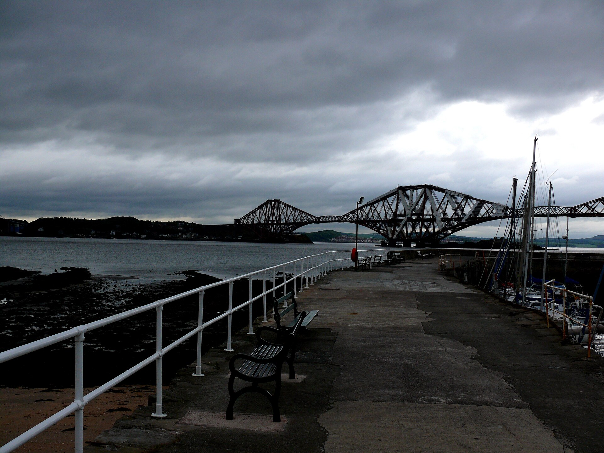
This place is a Viewpoint.
The Forth Bridges are three landmark crossings over the Firth of Forth near Edinburgh: the red steel Forth Bridge, completed in 1890; the Forth Road Bridge, opened in 1964; and the Queensferry Crossing, opened in 2016. Together they present three generations of bridge engineering in one landscape. The Forth Bridge is a UNESCO World Heritage Site and carries railway traffic. The group is best experienced as a landscape of infrastructure, water, villages and changing viewpoints rather than as a single enclosed attraction. The Forth Bridges comprise three distinct bridges spanning the Firth of Forth near Edinburgh: the Forth Bridge, a UNESCO World Heritage Site railway bridge completed in 1890; the Forth Road Bridge, a suspension bridge opened in 1964; and the Queensferry Crossing, a cable-stayed bridge opened in 2016.
Checked 2026-08-26 · Source
There is no public interior route through the bridge structures. The Forth Bridge operates as a railway bridge, while the Forth Road Bridge carries road traffic and has a pedestrian and cycle walkway. The Queensferry Crossing carries motorway traffic and excludes non-motorised users. The visitor experience takes place around the bridgeheads, harbours, coastal paths and viewpoints of South Queensferry and North Queensferry. Seasonal boat tours provide water-level perspectives beneath the spans. Walking between viewpoints reveals how differently the three structures meet the water and the surrounding shoreline.
Checked 2026-08-26 · Source
Allow at least thirty minutes for a single viewpoint and several hours for a fuller visit. A half-day works well for combining South Queensferry harbour, bridge photography, a coastal walk and time beside the Firth of Forth. A boat tour adds roughly one to two hours when operating. The best duration depends on whether you want one clear view or several changing perspectives. The bridges stretch across approximately 2.7 kilometres of water, so a complete appreciation comes from moving between viewpoints rather than waiting at one spot.
Checked 2026-08-26 · Source
Choose a clear, stable-weather period when visibility across the Firth of Forth is good. Summer gives the longest daylight for walking between viewpoints. Autumn and winter sunsets can place warm light behind the bridges from South Queensferry. Morning light can illuminate the structures from the north shore. Wind affects both comfort and pedestrian or cycle access on exposed routes. Wildlife and seabird activity around the firth can add interest at different times of year. Harbour and coastal viewpoints remain rewarding even when the sky changes quickly.
Checked 2026-08-26 · Source
Public viewpoints, harbours and coastal paths provide free ways to see the bridges. Walking or cycling across the Forth Road Bridge uses its dedicated non-motorised walkway. Any cost comes from reaching the area, parking or choosing a commercial boat tour rather than from viewing the bridges themselves. South Queensferry is the most convenient base for a combined harbour and bridge visit. The open landscape makes the bridges easy to appreciate without entering a ticketed attraction, although the experience changes considerably with weather, tide and light.
Checked 2026-08-26 · Source
South Queensferry is about sixteen kilometres west of Edinburgh city centre. Rail services reach Dalmeny station, from where walking connections lead towards bridge viewpoints. Buses connect Edinburgh with the bridgeheads and surrounding villages. Road access follows the A90 and M90. The Forth Road Bridge provides a pedestrian and cycle crossing, while the Queensferry Crossing is reserved for motor traffic. North Queensferry offers a different angle from the Fife side and can be reached by local roads. A walking plan should include the shoreline gradients and the distance between viewpoints.
Checked 2026-08-26 · Source
The bridge landscape combines active road, rail and maritime traffic. Stay on designated paths and keep away from restricted approaches. The Forth Road Bridge walkway is exposed to wind, traffic noise and vehicle movement. Coastal paths can be steep, while tidal conditions affect access close to the shoreline. Sheltered places are limited at open viewpoints. Parking and harbour streets become busier during popular photography periods. Railway traffic on the Forth Bridge is noisy and frequent. Respect private property, industrial operations and safety barriers around the water and bridge approaches.
Checked 2026-08-26 · Source
South Queensferry harbour is one of the strongest places to frame the three bridges together, with water and village buildings adding scale. The Forth Bridge rewards close views of its cantilever structure, while the Forth Road Bridge and Queensferry Crossing show contrasting suspension and cable-stayed designs. Sunrise, sunset and fast-moving cloud can transform the scene. Wide lenses help with the full landscape; telephoto lenses isolate structural details. Harbour reflections depend on tide and surface conditions. Keep equipment secure in wind and leave pedestrian routes clear when working from busy viewpoints.
Checked 2026-08-26 · Source
The Forth Road Bridge has a pedestrian and cycle walkway. The Queensferry Crossing excludes non-motorised traffic, and the Forth Bridge carries railway traffic.
Viewing the bridges from public harbours, coastal paths and viewpoints is free. Travel, parking and seasonal boat tours can involve separate costs.
Three major bridges cross the Firth of Forth at this location: the Forth Bridge, the Forth Road Bridge and the Queensferry Crossing.
Cars use the Forth Road Bridge and Queensferry Crossing. The Forth Bridge is a railway bridge and does not carry ordinary road traffic.
South Queensferry harbour and elevated coastal paths provide broad views in which the three bridges can be seen together across the firth.
Allow thirty minutes for one viewpoint, or several hours for multiple viewpoints, a harbour walk and photography. A boat tour adds roughly one to two hours when operating.
Loading the interactive map…
The interactive map could not be loaded.
Last updated:
Source: OpenStreetMap contributors ·