
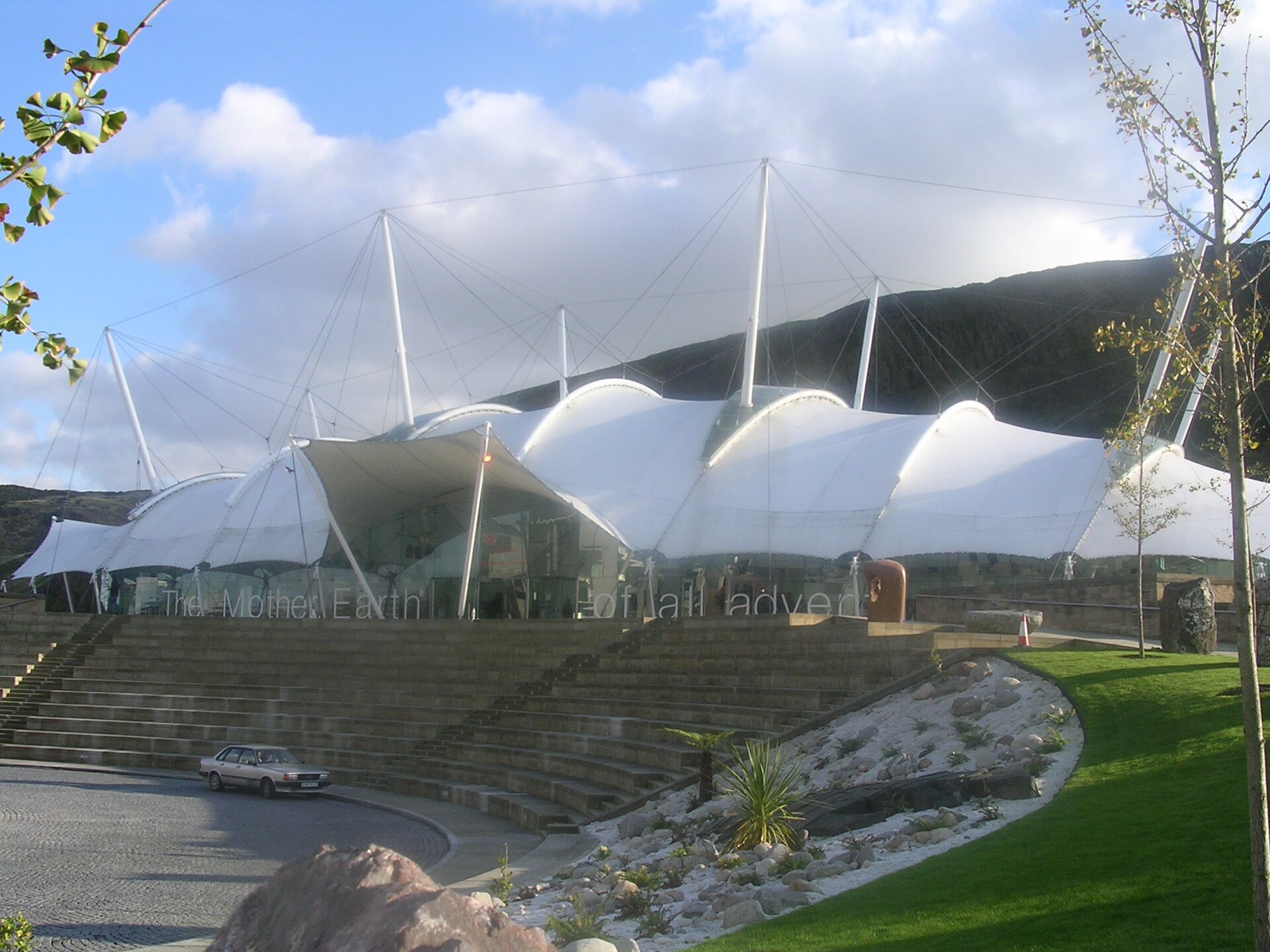
7 min walk
Dynamic Earth
- Must see
- Museum
Language · 11 published
Viewpoint · Edinburgh
Reviewed by Elena Voss · Roavina Travel Editor
This place is a Peak.
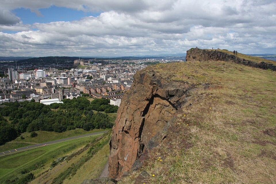
Salisbury Crags is a striking basalt cliff formation rising above Edinburgh city centre within Holyrood Park. Ancient volcanic activity created the hard rock ridge, while later glacial shaping helped form its steep faces and sloping ground. The Crags are among Edinburgh’s most recognisable natural landmarks, with views that connect the city’s historic centre to the wider Lothian landscape. Their exposed character makes the walk feel more open and rugged than an ordinary urban stroll. Salisbury Crags is a dramatic cliff formation of hard basalt rock rising above Edinburgh's city centre, forming part of Arthur's Seat and the broader Holyrood Park landscape. This geological ridge offers striking vertical faces and sloping scree paths, created by ancient volcanic activity and subsequent glacial shaping. The Crags represent one of Edinburgh's most distinctive natural landmarks, visible from numerous vantage points across the Scottish capital. The site holds historical significance for geological study, with notable research conducted here during the Scottish Enlightenment period. The lower paths and Radical Road accommodate families with appropriate supervision. Upper sections with steep drops demand careful assessment of individual children's capabilities and behaviour.
Checked 2026-08-26 · Source
The immediate area consists of exposed rock faces, rough paths, steep grassy slopes, scree and natural vegetation. There are no visitor-centre facilities or commercial attractions at the Crags themselves. The wider Holyrood Park landscape includes Arthur’s Seat, Piper’s Walk and St Margaret’s Loch. Birds use the cliff ledges, while gorse and scrub cover parts of the lower ground. The Radical Road runs along the base and gives the walk a strong historical and landscape connection. The Crags themselves contain exposed rock faces, rough walking paths, and steep grassy slopes. Visitors will find no built structures, visitor centres, or commercial facilities within the immediate cliff area.
Checked 2026-08-26 · Source
Allow about one to two hours for a walk focused on Salisbury Crags, depending on route, pace and stops for views. The Radical Road provides a relatively level section that takes roughly forty-five minutes one way. Reaching higher ground adds steeper walking and more time. Combining the Crags with Arthur’s Seat can turn the outing into a three- or four-hour visit. Rain and wind can slow progress considerably on exposed, uneven surfaces.
Checked 2026-08-26 · Source
Salisbury Crags forms part of Holyrood Park and is best approached in daylight, when the paths, slopes and cliff edges are easier to read. Summer offers longer evenings and generally more comfortable walking conditions, although the park is busier. Spring and autumn bring softer temperatures and fewer visitors. Winter can be atmospheric but daylight is shorter, and wind, rain or ice can make exposed sections harder. Early morning and late afternoon provide attractive light across the city.
Checked 2026-08-26 · Source
A walk to Salisbury Crags is a public outdoor experience with no ticketed attraction inside the cliff area. There are no entry barriers or payment stations on the common approaches. Your main expenses are therefore transport, food and any equipment needed for the weather. The open setting suits travellers who want a major Edinburgh view without arranging an indoor admission slot. Organised activities elsewhere in the park can have their own arrangements.
Checked 2026-08-26 · Source
The Crags stand east of Edinburgh’s Old Town, within an easy walk of the Royal Mile and the Palace of Holyroodhouse. Holyrood Road and Regent Road provide nearby bus connections, while Edinburgh Waverley station is roughly twenty minutes away on foot. Several park approaches lead towards the Crags, but they differ in gradient and surface. Limited parking is available near park entrances, and busy periods can make spaces difficult to find.
Checked 2026-08-26 · Source
Treat the upper slopes and cliff edges as serious walking terrain. Steep drops, loose scree and wet rock can make a short step hazardous, especially in strong wind or rain. Wear footwear with reliable grip and keep away from unprotected edges. Fog can reduce visibility quickly, while winter ice increases the risk of slipping. Stay on ground you can manage comfortably, and remember that the terrain becomes more demanding as you climb higher.
Checked 2026-08-26 · Source
Salisbury Crags gives photographers a compact way to combine geology, skyline and broad landscape views. From higher viewpoints, Edinburgh’s historic centre and the Firth of Forth create a wide city panorama. The rock faces provide strong foreground texture, while lower paths frame the cliffs against the sky. Overcast weather can bring out colour and detail in the stone and vegetation. Secure your footing before composing, particularly when using a tripod on exposed ground.
Checked 2026-08-26 · Source
The lower paths and Radical Road can suit families with close supervision. Steeper upper sections and unprotected drops require careful judgement about each child’s walking ability and behaviour.
The surrounding Holyrood Park includes Arthur’s Seat, Piper’s Walk and St Margaret’s Loch, alongside volcanic slopes, cliff faces, birds and natural vegetation.
Allow around one to two hours for the Crags themselves. A combined walk including Arthur’s Seat can take three or four hours, depending on route, pace and weather.
Yes, but shorter daylight, strong winds, rain and ice can make the exposed paths more difficult. Wear suitable footwear and choose ground that matches the conditions.
The Crags are an open outdoor landscape without ticket barriers or admission stations. Travellers may still spend money on transport, food or walking equipment.
Steep, uneven ground and exposed rocky paths create substantial barriers for wheelchair users. More level areas of Holyrood Park can provide views of the Crags from below.
Loading the interactive map…
The interactive map could not be loaded.

Last updated:
Source: OpenStreetMap contributors ·