

2 min walk
Armenian Heritage Park
- High
- Nature site
Language · 11 published
Nature site · Boston
Christopher Columbus Waterfront Park
Reviewed by Elena Voss · Roavina Travel Editor
| Monday | 00:00 – 23:59 |
|---|---|
| Tuesday | 00:00 – 23:59 |
| Wednesday | 00:00 – 23:59 |
| Thursday | 00:00 – 23:59 |
| Friday | 00:00 – 23:59 |
| Saturday | 00:00 – 23:59 |
| Sunday | 00:00 – 23:59 |
Parsed from OpenStreetMap opening hours on 2026-09-09.
This place is a Park.
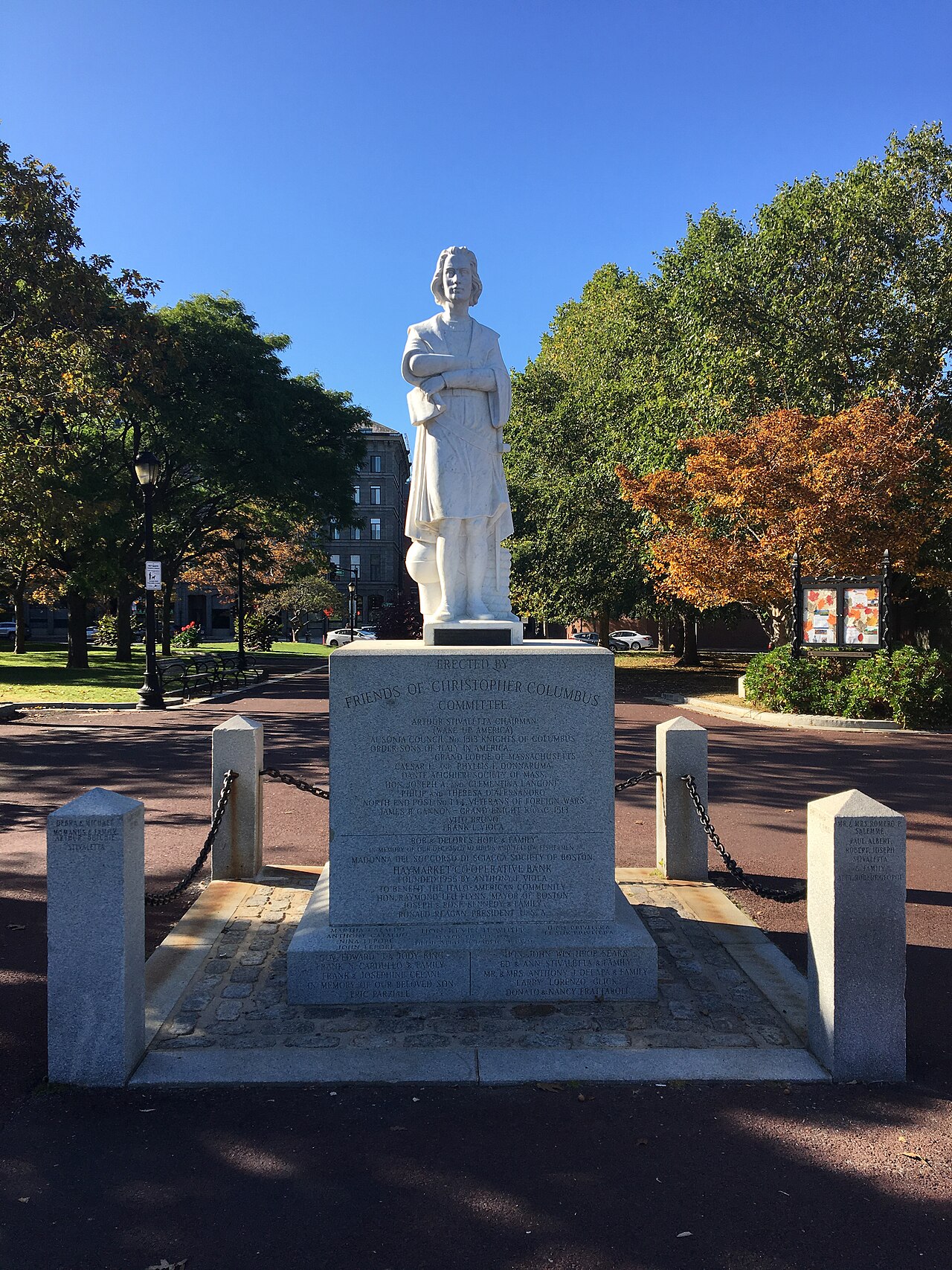
Christopher Columbus Waterfront Park is a public waterfront park in Boston's North End. It sits beside Boston Harbor and offers views toward the downtown skyline, making it a natural pause during a walk through the historic neighborhood. Lawns, paths, trees, and landscaped areas create an open setting for sitting, strolling, and watching harbor activity. The park also connects with Boston's Harborwalk, so travelers can use it as part of a longer waterfront route rather than treating it as an isolated attraction. Christopher Columbus Waterfront Park is a public waterfront park in Boston's North End neighborhood. The park occupies a prominent position along the harbor, offering views of Boston Harbor and the downtown skyline. It serves as a recreational green space for residents and visitors, connecting the North End to the waterfront. The park features open lawns, pathways, and landscaping typical of urban harbor parks. Its location makes it part of Boston's broader harborwalk system, providing pedestrian access along the water's edge in one of the city's oldest neighborhoods.
Checked 2026-08-26 · Source
The park's main features are its landscaped grounds, open lawns, pedestrian paths, seating areas, and position along the harbor. From the waterfront edge, visitors can watch maritime traffic and look across the water toward Boston's downtown skyline. Trees and plantings change with the seasons and provide some shade. The open design favors views and movement over enclosed attractions. Paths continue toward other waterfront spaces, creating a public corridor that links the North End with the broader harborfront.
Checked 2026-08-26 · Source
A brief stop can take about thirty minutes, while a relaxed visit may last up to two hours. Walkers often pause for harbor views before continuing along the Harborwalk or into the North End. Visitors looking for a quiet place to sit can stay longer, especially in pleasant weather. Because the park has no enclosed sequence of galleries or rooms, the right length depends on whether you want a viewpoint, a rest, or a longer waterfront stroll combined with neighborhood exploration.
Checked 2026-08-26 · Source
Warm-weather days bring the easiest conditions for using the lawns, paths, and seating areas. Spring and autumn offer milder temperatures and seasonal changes in the plantings. Winter visits remain possible, but the harbor edge can feel cold and windy, with snow or ice affecting paths. Morning and late afternoon provide attractive light across the water and skyline. The park works well at different times of day because its appeal comes from open views, harbor movement, and its connection with the surrounding North End.
Checked 2026-08-26 · Source
General entry to Christopher Columbus Waterfront Park is free. Visitors can use the grounds, paths, lawns, seating areas, and waterfront viewpoints without an admission ticket. The main cost associated with a visit may come from getting to the North End, particularly parking in the surrounding urban streets. Special events can change how parts of the park are used, but an ordinary walk or harbor pause is a straightforward public-space visit. Combine the park with nearby North End streets for a fuller Boston afternoon.
Checked 2026-08-26 · Source
Aquarium Station on the MBTA Blue Line provides nearby subway access. Bus routes also serve the surrounding North End and waterfront area. From downtown or the Financial District, walking is practical, and the Harborwalk offers a direct pedestrian approach along the water. Nearby docks serve water transportation, adding another possible arrival route. The North End's narrow streets and limited parking make walking or public transport more convenient than driving. Bicycle approaches can follow waterfront paths and city cycling routes.
Checked 2026-08-26 · Source
The harborfront is exposed to wind, spray, sun, and sudden changes in weather, so clothing for outdoor conditions makes the visit more comfortable. Summer can bring heavy visitor numbers and less space on lawns and paths. The open park has limited shelter from rain or strong sunlight. Keep children close to the water's edge and take care on slippery surfaces after snow or ice. Construction, maintenance, and event preparation can temporarily alter routes through the waterfront area.
Checked 2026-08-26 · Source
Christopher Columbus Waterfront Park is well suited to photographs of Boston Harbor, passing maritime traffic, and the downtown skyline. The open layout allows different viewpoints from paths, lawns, and the water's edge. Early and late daylight can add reflections and warmer color to the harbor, while changing weather creates different moods. Keep tripods and larger equipment clear of pedestrian routes, and include the surrounding North End or Harborwalk when you want stronger context.
Checked 2026-08-26 · Source
Yes. Christopher Columbus Waterfront Park and Christopher Columbus Park refer to the same Boston North End waterfront park.
You can walk through landscaped grounds, sit on the lawns or seating areas, follow waterfront paths, and view Boston Harbor, maritime traffic, and the downtown skyline.
Yes. General entry to the public park and its ordinary waterfront paths, lawns, and viewpoints is free.
Allow about thirty minutes for a viewpoint and short walk, or up to two hours for a relaxed waterfront visit.
Aquarium Station on the MBTA Blue Line is nearby, and bus routes serve the surrounding North End and waterfront area.
The park offers views of Boston Harbor, maritime traffic, the downtown skyline, landscaped grounds, and the Harborwalk.
Loading the interactive map…
The interactive map could not be loaded.
Last updated:
Source: OpenStreetMap contributors, Wikidata ·