
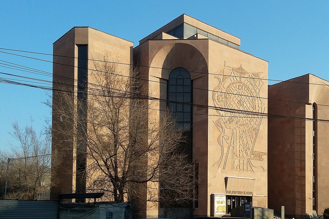
5 min walk
Yerevan History Museum
- Must see
- Museum
Language · 11 published
Historic monument · Yerevan
Կարմիր կամուրջ
Reviewed by Elena Voss · Roavina Travel Editor
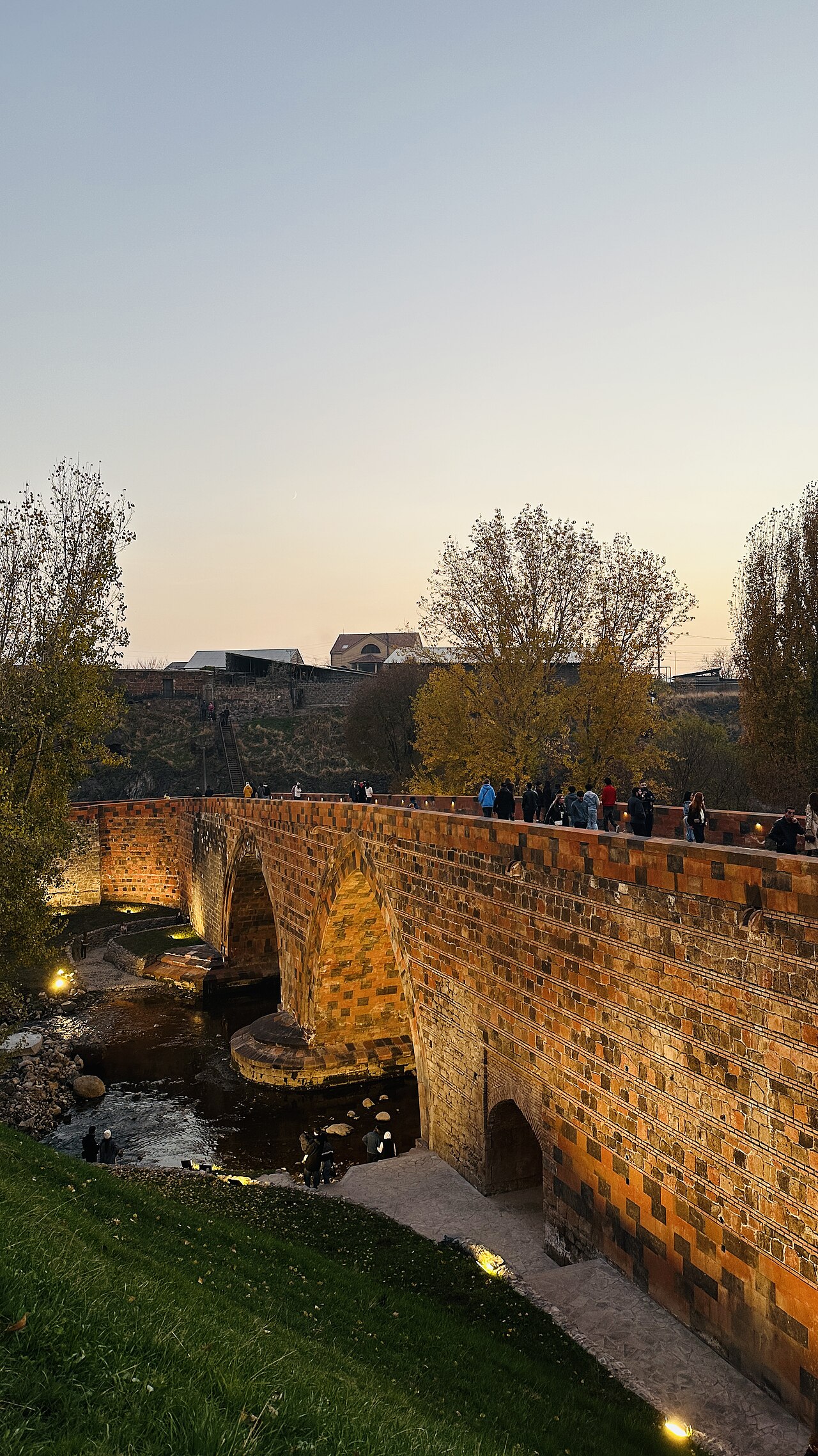
It opened in 1679. It is built of stone. It carries the cultural heritage monument in Armenia heritage designation.
Red Bridge, locally called Կարմիր կամուրջ, is a historic crossing over the Hrazdan River in Yerevan. Its setting combines a piece of transport infrastructure with the steep river gorge that cuts through the Armenian capital. The bridge takes its name from the reddish stone or brick associated with its construction. For travelers, it offers a compact way to encounter Yerevan’s older engineering landscape away from the formal galleries and museums of the city center. The bridge is most rewarding when treated as a brief heritage and landscape stop, with attention given both to its masonry and to the river valley around it.
Checked 2026-08-26 · Source
There is no enclosed interior to explore. The experience is entirely outdoors: the bridge deck, its supporting arches or piers, the reddish structural surfaces, and the Hrazdan gorge below. Look for the relationship between the crossing and the valley rather than expecting exhibition rooms, signs, or visitor facilities. The surrounding vegetation and exposed gorge walls add depth to views from the bridge and nearby approaches. The structure is the main attraction, while the river landscape supplies the broader context. Visitors interested in urban history can use the crossing to picture how earlier routes connected the two sides of Yerevan’s difficult terrain.
Checked 2026-08-26 · Source
Allow about fifteen to thirty minutes for a focused stop. That is enough time to take in the bridge from the approach, examine its masonry, cross if the route permits safe pedestrian movement, and make a few photographs of the gorge. Travelers with a strong interest in historic construction may stay longer to study the arches, surfaces, and relationship between the road and river. Red Bridge works best as one element in a wider Yerevan day, especially alongside other outdoor viewpoints or city neighborhoods. Its small scale means that the quality of the surrounding view matters more than the length of the visit.
Checked 2026-08-26 · Source
Visit in daylight, when the reddish structure, gorge walls, vegetation, and river valley can be seen clearly. Morning and late afternoon can give the masonry more texture and make the outdoor stop more comfortable than the hottest part of a Yerevan summer. Winter conditions may make surfaces cold or slippery, while summer heat can make an exposed walk tiring. The bridge is most useful in an itinerary when the weather supports outdoor observation. Because it is an infrastructure crossing rather than an enclosed attraction, the character of the visit depends strongly on daylight, traffic, and the condition of the immediate approach.
Checked 2026-08-26 · Source
Red Bridge is a public infrastructure landmark, so a visitor viewing the structure or using an available public crossing does not enter a ticketed museum or exhibition. There is no visitor center, guided-tour desk, or formal attraction experience described for the bridge. Plan it as a free outdoor sight rather than as a paid activity. The practical focus is reaching a safe viewing point and respecting the way the crossing functions for local movement. Its value comes from the historic structure and Hrazdan setting, not from admission-based facilities or organized visitor services.
Checked 2026-08-26 · Source
Red Bridge crosses the Hrazdan River in Yerevan and is easiest to understand as a gorge crossing rather than a conventional city-square landmark. Use the bridge name and OpenStreetMap location when orienting a taxi, walking route, or map search. The river valley can make approaches less direct than the city’s level central streets. A taxi can reduce the effort of finding the correct descent or approach, while a walk from another part of Yerevan should be planned around the gorge’s slopes and road layout. Once nearby, choose the approach that keeps you away from moving traffic and close to a clear view of the structure.
Checked 2026-08-26 · Source
Treat Red Bridge as an active crossing in a river gorge, not as a pedestrian plaza. Traffic may share the route, and the bridge edges or nearby slopes may not provide the comfort of a purpose-built promenade. Stay clear of vehicles, avoid stopping where movement is obstructed, and keep away from unprotected drops near the gorge. Wet, icy, or uneven surfaces can change the difficulty of the approach. The safest visit is a short daylight stop with attention on footing and traffic. If the immediate conditions feel unsuitable for walking or photography, enjoy the structure from a safer nearby viewpoint instead.
Checked 2026-08-26 · Source
Photograph the bridge as part of its landscape. A wider view can include the reddish crossing, the Hrazdan gorge, and the vegetation or urban slopes around it; closer frames can emphasize stonework, arches, and surface texture. Low-angle light in the morning or late afternoon can separate the bridge from darker gorge areas. On the deck, keep equipment compact and avoid blocking traffic or placing a tripod where it creates a hazard. The most useful images show why the bridge matters: its color, structure, and position linking the two sides of the river valley.
Checked 2026-08-26 · Source
Red Bridge crosses the Hrazdan River in Yerevan, with the crossing set within the city’s river gorge.
The name refers to the reddish stone or brick associated with the bridge’s construction.
You can see the bridge deck, its supporting structure, reddish masonry, the Hrazdan gorge, and the surrounding river-valley landscape.
A focused visit usually takes about fifteen to thirty minutes, with extra time useful for architectural details and photography.
No. Red Bridge is an exterior crossing, and its interest comes from the structure and the Hrazdan gorge around it.
Daylight is best, with morning or late-afternoon light bringing out the reddish masonry and the shape of the gorge.
Loading the interactive map…
The interactive map could not be loaded.
Last updated:
Source: OpenStreetMap contributors, Wikidata ·