
6 min walk · Alsergrund
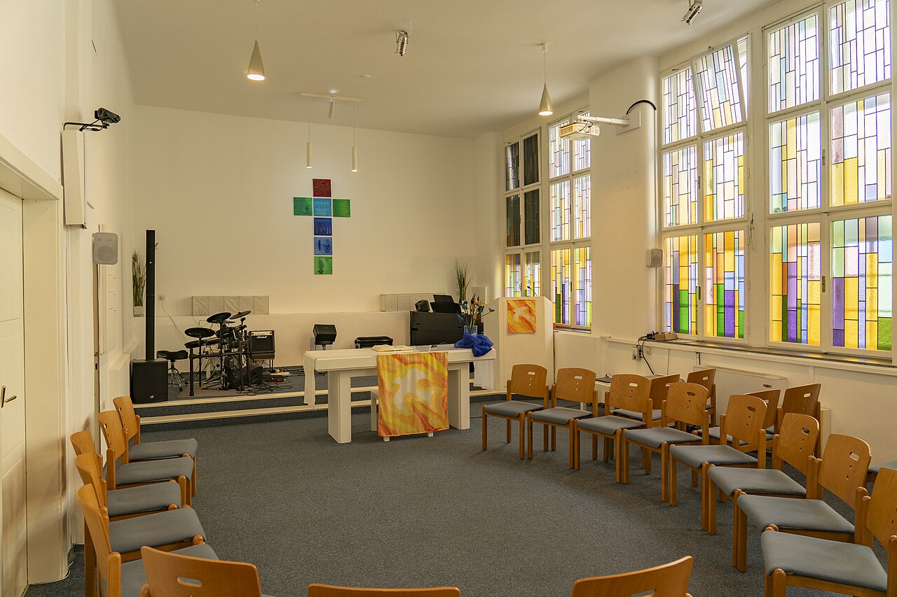
Messiaskapelle Alsergrund
- High
- Place of worship
Language · 11 published
Historic monument · Brigittenau, Vienna
Reviewed by Elena Voss · Roavina Travel Editor
| Monday | 00:00 – 23:59 |
|---|---|
| Tuesday | 00:00 – 23:59 |
| Wednesday | 00:00 – 23:59 |
| Thursday | 00:00 – 23:59 |
| Friday | 00:00 – 23:59 |
| Saturday | 00:00 – 23:59 |
| Sunday | 00:00 – 23:59 |
Parsed from OpenStreetMap opening hours on 2026-09-09.
Read from the OpenStreetMap access tags; anything not listed has no tag recorded.
Set the group type to family in the planner and the day window contracts to about three quarters of a solo day.
This place is a Attraction. It opened in 1946.
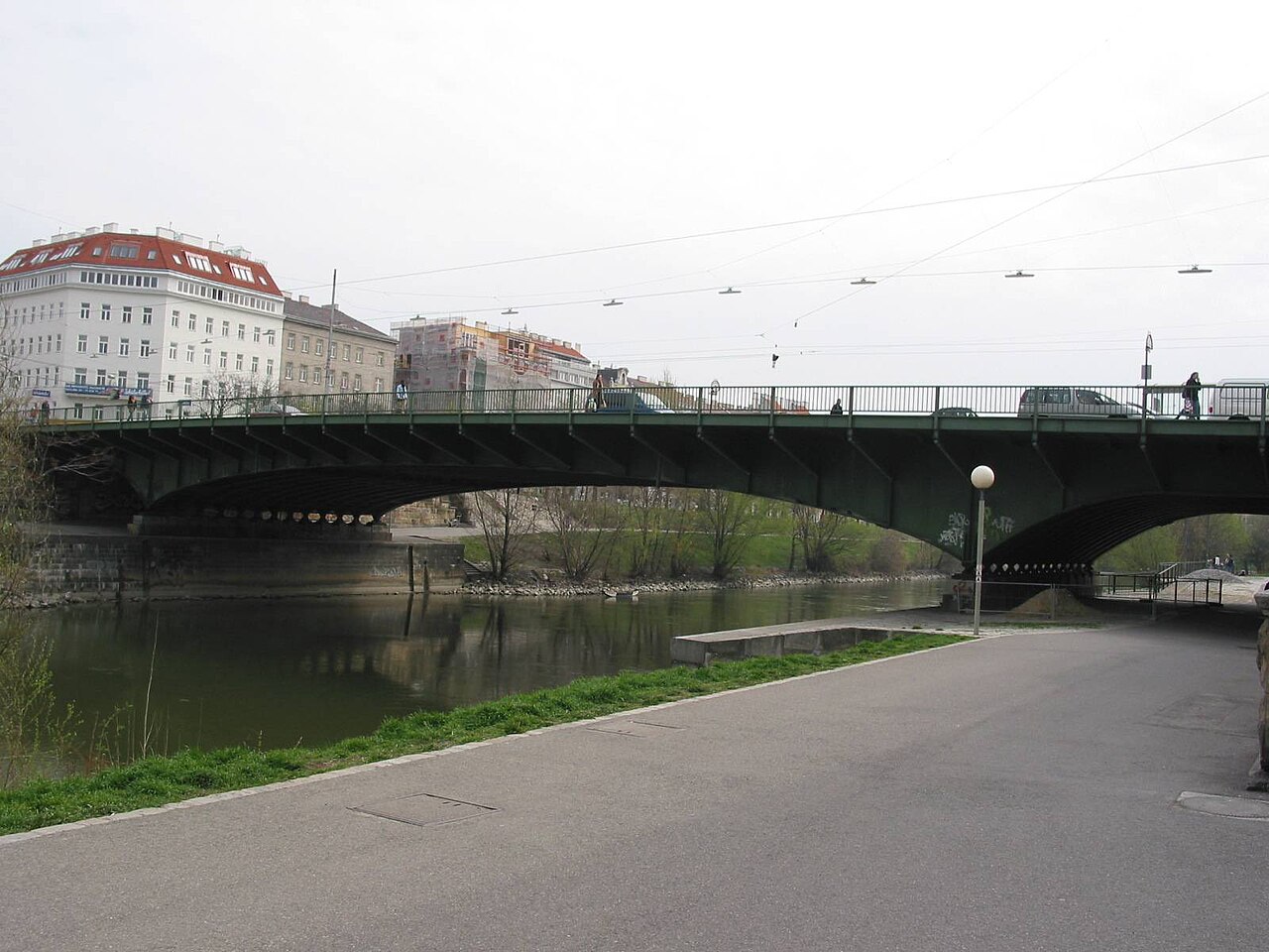
Friedensbrücke, or Peace Bridge, crosses the Danube Canal in Vienna. It is a working urban connection linking parts of the city for pedestrians, cyclists and vehicles. The bridge is most useful to travellers as a point within a larger canal-side route rather than as a ticketed monument. Crossing Friedensbrücke brings the urban character of the Danube Canal into view: water, traffic, riverside movement and the architecture of neighbouring districts meet in one short stretch. The bridge also provides a practical transition between the two banks, making it easy to include while exploring Vienna on foot or by bicycle. Friedensbrücke functions primarily as transportation infrastructure rather than a designated tourist destination. Visitors may appreciate it contextually within Danube Canal exploration.
Checked 2026-08-26 · Source
Friedensbrücke has no visitor interior. The experience takes place on the open bridge deck, where travellers use the pedestrian areas, observe the supporting structure and look along the Danube Canal. The crossing is defined by movement rather than rooms, exhibitions or enclosed displays. The canal views provide the main reason to pause, while the bridge itself supplies a useful foreground for photographs. Visitors can read the surrounding city through the crossing: one bank, the waterway and the opposite streetscape come together in a compact urban scene.
Checked 2026-08-26 · Source
Allow a few minutes to cross Friedensbrücke on foot, with additional time for canal views and photographs. The bridge does not require a long standalone visit, but it can become a useful pause in a broader walk beside the Danube Canal. Cyclists and drivers experience the crossing as part of their route, while pedestrians can slow down at suitable points without blocking other users. A short bridge stop works well between nearby streets, riverside paths and district exploration, especially when the aim is to understand Vienna’s urban relationship with the canal.
Checked 2026-08-26 · Source
Friedensbrücke can be crossed at any hour because it functions as public transport infrastructure rather than a controlled attraction. Daylight gives the clearest view of the canal and nearby buildings. Dawn and dusk bring softer reflections and changing colour, while evening turns the crossing into an urban night scene. Weather matters because the bridge is open to rain, cold and wind. Choose quieter periods when you want photographs or a slower look at the water, and remain aware that the bridge continues to serve everyday city movement throughout the day and night.
Checked 2026-08-26 · Source
Crossing Friedensbrücke itself is free. The bridge has no ticket barrier, admission desk or charge for pedestrians, cyclists or vehicles. Travel costs may still arise when reaching the surrounding area by public transport, and drivers should separate any local parking expense from the bridge crossing. No budget allocation is needed for access to the bridge as a public connection. This makes Friedensbrücke an easy addition to a Vienna walking day, particularly when the route already follows the Danube Canal or links the districts on either side.
Checked 2026-08-26 · Source
Reach Friedensbrücke from either bank of the Danube Canal using Vienna’s public transport network and nearby walking connections. The U-Bahn serves the surrounding area, while tram and bus routes operate through neighbouring districts. Cyclists can use canal-side routes to approach the bridge, and pedestrians can arrive along riverside walkways from either direction. Friedensbrücke is designed primarily for movement across the water, so treat it as a route point rather than a parking destination. A crossing can connect a canal walk with exploration on the opposite bank.
Checked 2026-08-26 · Source
Friedensbrücke carries several kinds of traffic, so keep to the appropriate pedestrian area and watch for bicycles, vehicles and changing movement around the crossing. The open deck offers little protection from rain, wind or winter cold, and wet or icy surfaces require slower steps. The Danube Canal is close to the bridge, so respect barriers and keep children near adults. At night, use ordinary city awareness and keep personal belongings secure. Temporary works can alter the route, making visible local signs important when approaching or crossing.
Checked 2026-08-26 · Source
Photograph Friedensbrücke as both a structure and a viewpoint over the Danube Canal. The bridge can frame the water, moving traffic and the architecture on the banks, while the canal’s straight lines create strong leading paths through a composition. Morning and evening light change the reflections and the appearance of the bridge surfaces. Night photography can emphasize urban illumination on the water. Keep equipment clear of pedestrian and cycle movement, and take care near the canal edge. The surrounding city gives context to every image made from the crossing.
Checked 2026-08-26 · Source
Friedensbrücke is a working Vienna bridge crossing the Danube Canal for pedestrians, cyclists and vehicles.
No. Crossing the bridge itself is free for pedestrians, cyclists and vehicles.
A walking crossing takes only a few minutes, with extra time useful for canal views and photographs.
The crossing gives views of the Danube Canal, the bridge structure and the urban architecture along both banks.
Yes. Friedensbrücke supports bicycle movement as part of Vienna’s urban transport network; cyclists should remain attentive to other users.
Dawn, dusk and evening offer different views of the canal, with softer reflections in low light and urban illumination after dark.
Loading the interactive map…
The interactive map could not be loaded.
Last updated:
Source: OpenStreetMap contributors, Wikidata ·