
3 min walk
English Bay
- Must see
- Nature site
Language · 11 published
Art and culture venue · Vancouver
Reviewed by Elena Voss · Roavina Travel Editor
Read from the OpenStreetMap access tags; anything not listed has no tag recorded.
Set the group type to family in the planner and the day window contracts to about three quarters of a solo day.
This place is a Artwork. It was established in 1986. It is built of stone.
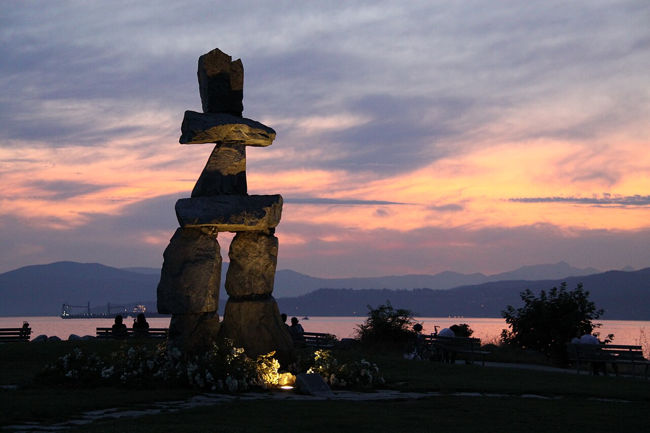
The English Bay Inukshuk is a stone waterfront landmark on Vancouver’s shoreline. An inukshuk is a human-made stone marker associated with Inuit and other Arctic peoples. This structure has become a recognizable point along the English Bay waterfront, where it stands against open water, mountain views and the city’s coastal landscape. Visit it as part of a shoreline walk, especially if you want a landmark with a strong visual connection to Vancouver’s outdoor setting. The English Bay Inukshuk is a waterfront landmark located on the shoreline of English Bay in Vancouver, British Columbia. An inukshuk is a human-made stone landmark used by the Inuit and other peoples of the Arctic region. This particular structure stands as a prominent cultural symbol and visual marker along Vancouver's coastal area. The installation serves as a recognizable point of orientation for visitors and residents, embodying connections to northern Indigenous heritage within an urban Pacific Northwest setting. Climbing on the structure is not appropriate. Visitors should observe from respectful distance to preserve the stone arrangement and honor its cultural significance.
Checked 2026-08-26 · Source
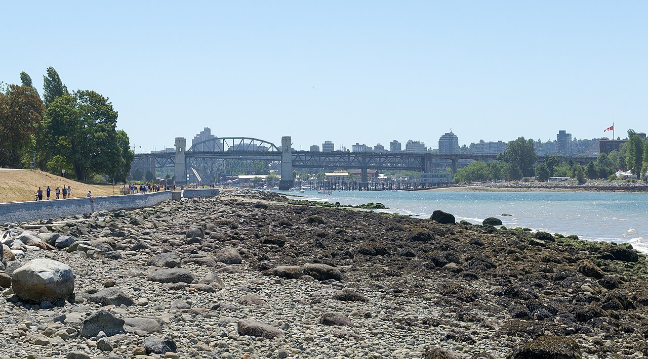
The Inukshuk is an exterior stone structure with no interior space to enter. Its setting is the open waterfront around English Bay, including beach, shoreline and paved promenade areas. The attraction comes from seeing the stone form in its coastal context rather than from an exhibition or enclosed facility. Walk around the nearby public space to take in the relationship between the landmark, the water, the beach and the wider Vancouver shoreline. The Inukshuk itself is an exterior stone structure with no interior space to enter. The surrounding area comprises public waterfront parkland along English Bay beach. Visitors will find open shoreline, sandy beach areas, and paved promenade walkways. The immediate vicinity includes natural coastal scenery with views across the water. No enclosed facilities, exhibitions, or constructed amenities are associated directly with the landmark.
Checked 2026-08-26 · Source
Allow fifteen to thirty minutes for viewing, photographs and a quiet look at the shoreline. Many visitors combine the landmark with a longer English Bay seawall walk, which can extend the outing to several hours. Sunset watching, changing weather and mountain views can all lengthen the stop. The Inukshuk is best treated as one memorable point within a broader waterfront route rather than as an enclosed attraction with a fixed programme.
Checked 2026-08-26 · Source
Evening is a popular time because the English Bay shoreline faces the western sky and provides sunset views. Summer brings longer daylight and generally more comfortable conditions for walking, while winter can bring dramatic cloud, rain and mountain scenery. The waterfront is exposed, so wind and sudden weather changes are possible in every season. Choose the timing that best suits your planned seawall walk and the light you want for photographs.
Checked 2026-08-26 · Source
Viewing the Inukshuk is free because the landmark stands in public waterfront space. There are no ticketed entrances or admission barriers at the structure. You may still spend money on transport, parking or commercial services in English Bay and the West End, but those costs are separate from seeing the landmark. Its open setting makes it easy to add to a Vancouver itinerary without reserving a dedicated attraction slot.
Checked 2026-08-26 · Source
Reach the Inukshuk along Vancouver’s seawall and English Bay waterfront paths. Buses serve the surrounding West End streets, including routes near Davie Street and Denman Street. The landmark is also walkable from downtown. Cycling is practical along the dedicated seawall route. Parking close to English Bay can be limited, especially on summer evenings and during major events, so a walking or transit-based approach suits the waterfront setting.
Checked 2026-08-26 · Source
The shoreline can include uneven ground, slippery rocks and strong wind. Wear footwear suited to outdoor paths and take care near the water. Crowds increase during summer evenings, fireworks and special events, which can make the seawall congested. Do not climb on or disturb the stones. Respect the landmark’s cultural meaning, leave space for other visitors and take extra care when returning after sunset, particularly in darker sections of the route.
Checked 2026-08-26 · Source
The Inukshuk photographs well with English Bay, open water and mountains behind it. At sunset, place the structure against the western sky for a silhouette; in morning light, its eastern side receives clearer illumination. Use the seawall for wider compositions and vary your distance to show both the stone form and the coastline. Wind and salt spray can affect equipment, while a respectful distance protects the structure and keeps the path clear.
Checked 2026-08-26 · Source
It is a stone waterfront landmark associated with the inukshuk tradition and located along Vancouver’s English Bay shoreline.
No. Visitors should observe the stone structure from a respectful distance and avoid climbing or disturbing it.
Yes. It stands in public waterfront space and can be viewed without an admission charge.
Allow fifteen to thirty minutes for the landmark itself, or longer if you continue along the English Bay seawall.
The landmark is beside the English Bay waterfront and Vancouver seawall path, which supports walking and cycling routes.
The English Bay shoreline faces the western sky, giving visitors open sunset views over the water and a strong setting for photographs.
Loading the interactive map…
The interactive map could not be loaded.

Last updated:
Source: OpenStreetMap contributors, Wikidata ·