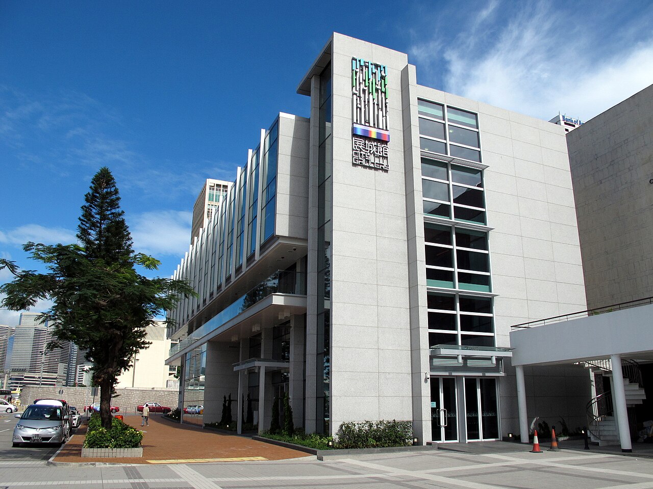
Hong Kong Planning and Infrastructure Exhibition Gallery, also called 展城館 or City Gallery, introduces visitors to the territory’s urban planning, infrastructure, transport networks, harbourfront projects, and future development. It is most useful for travellers who want to understand how Hong Kong’s dense landscape is shaped. The gallery provides a planning-focused counterpoint to viewpoints and historic attractions, helping visitors read the city as an engineered environment as well as a cultural one. The Hong Kong Planning and Infrastructure Exhibition Gallery, known locally as 展城館 City Gallery, is an exhibition facility in Hong Kong. It presents displays related to urban planning, infrastructure development, and the built environment of the territory. The gallery serves as a public information centre where visitors can learn about Hong Kong's strategic planning, major construction projects, and vision for future development. Its local name combines Chinese characters with the English name City Gallery.
Expect exhibition panels, scale models, multimedia material, and interactive elements explaining territorial strategies and major infrastructure. The subjects include movement through the city, harbourfront design, sustainability, land use, and the relationship between buildings and public space. Read the gallery as an explanation of Hong Kong’s physical growth. Models are particularly useful because they reveal connections between districts, transport corridors, reclaimed land, towers, and the harbour that are difficult to grasp from street level. The gallery contains exhibition materials concerning Hong Kong's planning and infrastructure. Displays typically cover territorial development strategies, transportation networks, harbourfront enhancements, and sustainable urban design. Visitors may encounter scale models, informational panels, multimedia presentations, and interactive elements illustrating planning concepts. The content reflects government perspectives on urban evolution. Visitors should expect planning-focused content rather than general historical or cultural displays. A flexible visit lets travellers connect Hong Kong Planning and Infrastructure Exhibition Gallery with the rest of the day without treating one room, viewpoint or photograph as the whole experience.
A focused visit can fit into a compact part of the day, while visitors interested in architecture, transport, or public policy may spend substantially longer with the models and explanatory material. Give yourself time to understand the larger diagrams before moving to individual projects. The gallery works well as a one-stop introduction before exploring Hong Kong’s harbourfront, rail connections, elevated roads, or contrasting urban neighbourhoods on foot.
Choose the gallery when you want an indoor cultural stop or when Hong Kong’s heat and rain make extended outdoor walking uncomfortable. A visit before a harbourfront walk can give the later scenery more meaning. The subject is technical, so go when you have enough attention to read plans and models rather than placing it between hurried photographs. It suits a structured sightseeing day built around the city’s changing urban landscape.
Plan the gallery as an educational exhibition rather than a commercial entertainment venue. Its value comes from understanding transport, land use, infrastructure, and the future shape of Hong Kong. Travellers with children can turn the models into a visual puzzle by tracing roads, railways, towers, and harbour edges. Adults interested in planning or architecture will find more depth in the diagrams and project explanations than in a quick walk-through.
Use the OSM location for City Gallery as the final navigation point and allow time for the approach through Hong Kong’s central urban fabric. The city’s MTR, bus, walking, and ferry connections make the wider area accessible, but the last part of the route may involve large crossings, underground passages, or busy streets. Plan the gallery together with nearby civic, harbourfront, or central-city stops rather than as an isolated destination.
The gallery concentrates on planning and infrastructure, so it may feel specialised if you prefer art, food, or historic interiors. Government planning language and technical diagrams reward patience. Give younger visitors concrete tasks such as finding a transport line or comparing old and new land uses. Crowded urban approaches can slow the journey, and the gallery’s usefulness depends on having enough time to read rather than treating it as a rapid photo stop.
The best images come from scale models, large planning diagrams, and views that show how infrastructure connects different parts of Hong Kong. Photograph from visitor areas and keep walkways clear. Models can be difficult to capture without reflections, so move patiently and avoid obstructing people reading nearby. A useful visual sequence pairs one overall image of the exhibition with close details of transport routes, harbour edges, or distinctive urban forms.
City Gallery explains Hong Kong’s urban planning, infrastructure, transport networks, harbourfront projects, land use, and future development.
What can I see inside?
Expect planning panels, scale models, multimedia material, and interactive displays about the territory’s built environment and infrastructure.
Who will enjoy the gallery most?
It suits travellers interested in architecture, transport, public space, sustainability, engineering, or the way Hong Kong’s dense districts fit together.
How should families approach the visit?
Invite children to trace roads, railways, towers, harbour edges, and district connections through the models and diagrams.
When does the gallery fit best in an itinerary?
Place it before a harbourfront or central-city walk so the exhibition gives physical context to the infrastructure and urban landscape you see outside.
What makes the gallery different from a general museum?
Its focus is Hong Kong’s planned environment: transport, land, buildings, public space, harbour development, and infrastructure rather than general art or history.