

2 min walk
Antonio Cisneros
- High
- Historic monument
Language · 11 published
Activity · Lima
Malecón de Miraflores
Reviewed by Elena Voss · Roavina Travel Editor
Read from the OpenStreetMap access tags; anything not listed has no tag recorded.
Set the group type to family in the planner and the day window contracts to about three quarters of a solo day.
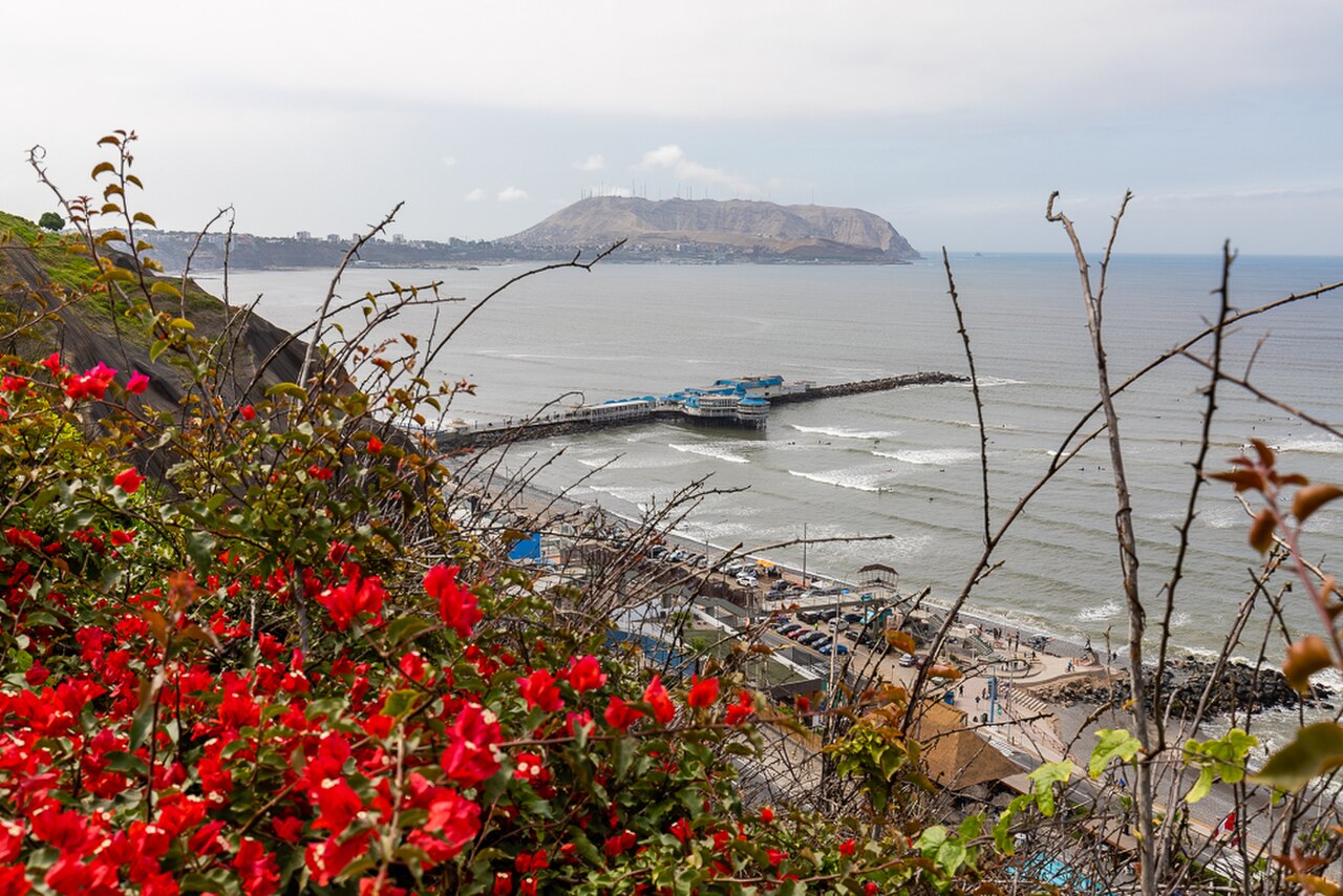
Miraflores Boardwalk, or Malecón de Miraflores, is a sequence of clifftop parks and promenades along Lima’s Pacific edge. The route links gardens, viewpoints, paved walking paths, and recreational spaces above the Costa Verde. It is one of the district’s defining public landscapes, offering residents and visitors an open coastal setting for walking, cycling, sea views, and relaxed time outdoors. The Malecón de Miraflores is a clifftop park sequence forming Lima's defining Pacific walk. This linear green corridor stretches along the coastal edge of the Miraflores district, comprising interconnected parks, gardens, and paved promenades overlooking the Pacific Ocean. The boardwalk serves as both recreational space and scenic overlook, drawing residents and visitors for walking, cycling, and contemplation of the dramatic cliff-sea interface that characterizes this portion of the Peruvian capital's coastline. Yes. Long paved paths, curb ramps, accessible toilets and seating provide step-free clifftop routes; beach access below uses steep ramps or stairs. No. Parque del Amor. The public clifftop parks and promenades are open 24 hours daily. Paragliding, events and maintenance can restrict individual lawns or paths. Walking and public parks are free; paragliding, bicycles, food and private attractions cost separately. Metropolitano buses stop at Ricardo Palma and 28 de Julio, followed by local buses or walks west to Parque del Amor and Larcomar. Yes. Yes. Yes. No. No. Parque del Amor.
Checked 2026-08-31 · Source
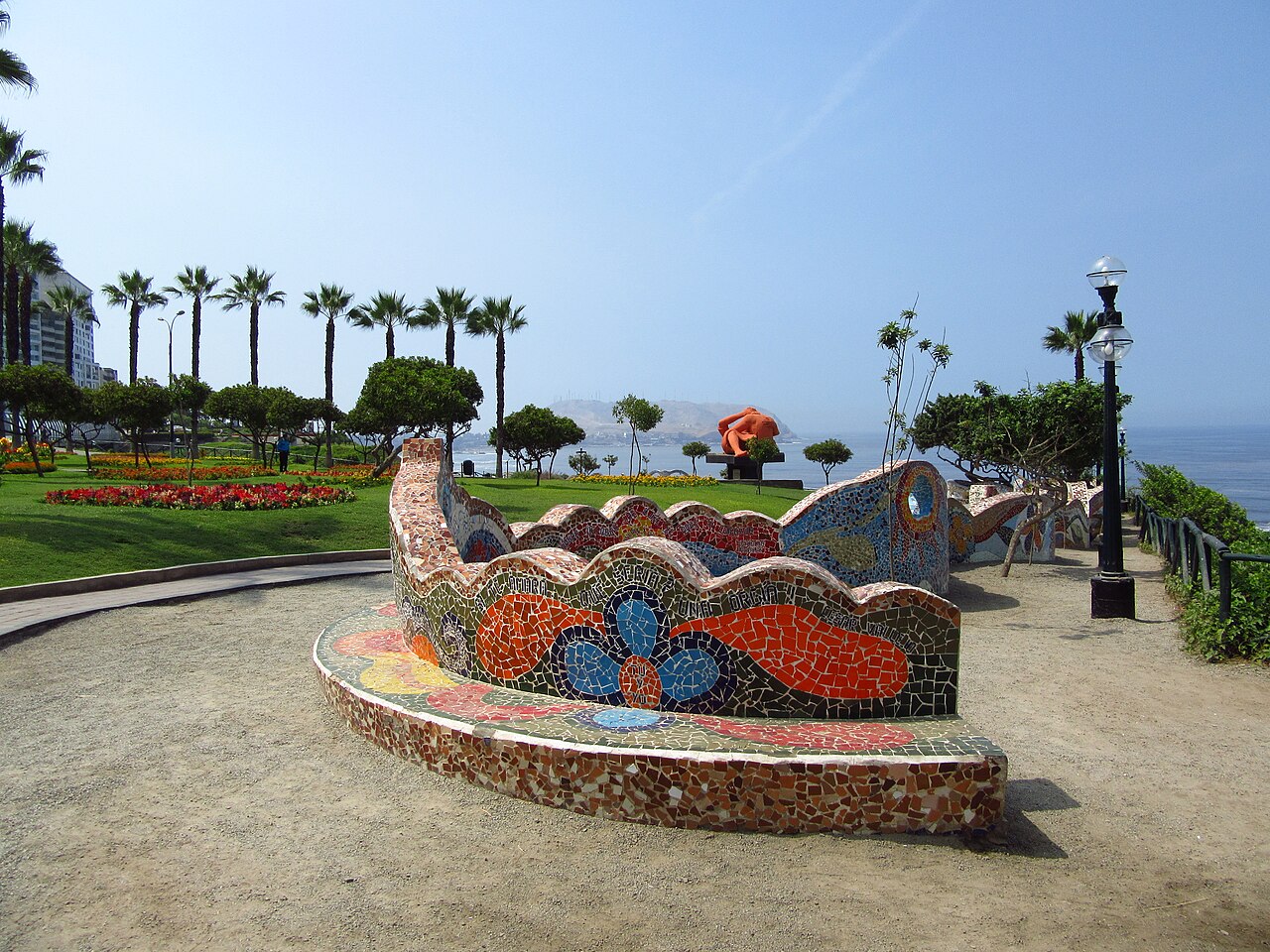
The boardwalk passes through connected parks with gardens, benches, exercise equipment, viewpoints, and routes for pedestrians and cyclists. Parque del Amor is the most recognisable landmark, with colourful mosaic work facing the Pacific. Paragliders use designated launch points along the cliffs. Larcomar is built into the cliff nearby, adding ocean-facing terraces, shops, and dining to the public coastal walk. The boardwalk contains gardens, viewpoints, and spaces for coastal recreation. Parque del Amor features mosaic work and overlooks the water. Parque Kennedy lies inland as a connected green space. The route incorporates exercise equipment, seating areas, and pathways for pedestrians and cyclists. Paragliders launch from designated points along the cliff edge.
Checked 2026-08-31 · Source
A leisurely walk through the main boardwalk sections takes about one to two hours. Many visitors extend the outing to half a day by stopping at Parque del Amor, watching the Pacific, visiting Larcomar, eating nearby, or cycling along the route. The linear layout makes it easy to spend only a short time at one viewpoint or linger across several parks according to the day’s pace.
Checked 2026-08-31 · Source
The public clifftop parks and promenades are open throughout the day and night. Morning brings softer light and quieter walking, while late afternoon places the Pacific horizon in warmer light before sunset. Coastal mist can create a muted atmosphere, especially when visibility is reduced. Events, maintenance, or paragliding activity may temporarily affect particular lawns, viewpoints, or sections of the route.
Checked 2026-08-31 · Source
Walking through the public parks and promenades is free. Activities and services connected with the route, including paragliding, bicycle use, food, and private attractions, can involve separate charges. Larcomar also operates as a commercial complex rather than part of the free public park itself. The boardwalk works well for a no-cost coastal walk, with paid experiences added according to personal interest.
Checked 2026-08-31 · Source
Metropolitano buses stop at Ricardo Palma and 28 de Julio. From either stop, continue by local bus or walk west toward Parque del Amor and Larcomar. Choose a named park as your destination because the boardwalk is a long sequence rather than one single entrance. The route’s clifftop paths connect naturally on foot, while the beach below belongs to a different, steeper level of the coast.
Checked 2026-08-31 · Source
The main clifftop routes use long paved paths, curb ramps, seating, and accessible toilets, creating step-free movement across much of the park sequence. Reaching the beach below is different: steep ramps or stairs make that descent more demanding. Watch the cliff edge, bicycles, crowds, and changing security conditions. Maintenance, events, and paragliding can temporarily alter how individual lawns or paths are used.
Checked 2026-08-31 · Source
The cliffs provide broad views over the Pacific and the Costa Verde beaches. Parque del Amor’s mosaic walls create colourful foreground detail, while paragliders add movement when they are active. Sunset faces the ocean, and morning mist can produce softer, more atmospheric images. Larcomar’s cliff-embedded structure offers architectural compositions. Gardens, flower beds, benches, and long paths provide smaller details between the wide coastal views.
Checked 2026-08-31 · Source
Walking through the public clifftop parks and promenades is free; paragliding, bicycles, food, and private attractions may cost separately.
The public clifftop parks and promenades are open day and night, although particular areas may be affected by events or maintenance.
Long paved paths, curb ramps, seating, and accessible toilets provide step-free routes across much of the clifftop park sequence.
No. Beach access below the cliffs uses steep ramps or stairs, unlike the more accessible paved routes along the clifftop.
No. Walking through the public parks is free, while paragliding is a separate paid activity.
Parque del Amor is the central landmark, recognised for its colourful mosaic work and Pacific-facing clifftop position.
Loading the interactive map…
The interactive map could not be loaded.
Last updated:
Source: OpenStreetMap contributors, Wikidata ·