34 min walk
Hua Beach
- Must see
- Nature site
Language · 11 published
Nature site · Phuket
Reviewed by Elena Voss · Roavina Travel Editor
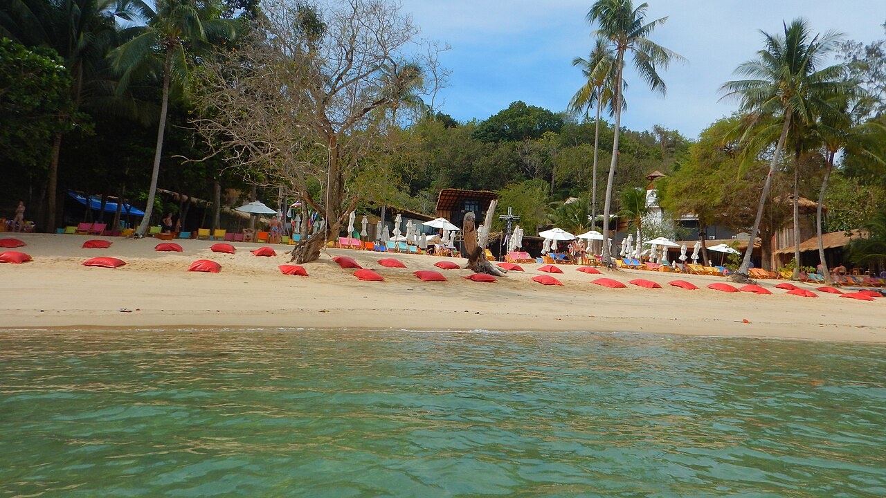
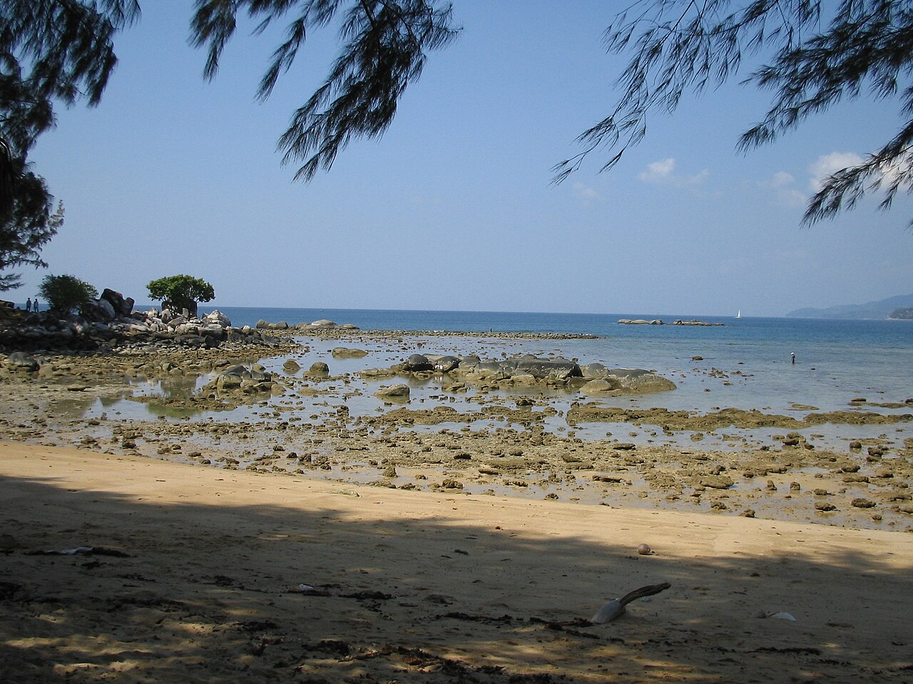
Nakalay Beach is a Phuket shoreline on the Andaman Sea, offering a coastal alternative to the island’s busiest resort beaches. It belongs in a west-coast day for travelers who want sand, tropical scenery, and time beside the water. The surrounding Phuket landscape combines beaches, hills, accommodation, and roads, while Nakalay provides a beach-focused stop that can be paired with other coastal viewpoints and settlements. Nakalay Beach is a coastal area on the island of Phuket, Thailand's largest island and a major tourist destination in the Andaman Sea. Phuket province encompasses the island and adjacent mainland areas, featuring numerous beaches, resorts, and visitor attractions. Nakalay Beach represents one of the many shoreline locations that contribute to Phuket's reputation as a beach tourism hub. The beach sits within the broader Phuket landscape of tropical coastline, limestone formations, and developed tourism infrastructure that has grown substantially since the late twentieth century. Swimming conditions depend on seasonal factors, weather, and local marine conditions. Visitors should assess conditions on arrival and exercise appropriate caution. Nakalay Beach is a Phuket coastal stop focused on sand, open water, tropical vegetation, shoreline walking, and a quieter beach experience than the island’s busiest resorts.
Checked 2026-08-26 · Source
Expect a natural beach setting of sand, coastal plants, and open water, with the wider Phuket environment adding hills, resort buildings, restaurants, and island services. The beach itself is best understood through simple outdoor activities rather than a collection of indoor sights. Swim when the sea is calm, walk the shoreline, sit with the view, and leave time to explore the broader coast by road. The immediate beach environment typically comprises sand shoreline, coastal vegetation, and adjacent waters. The province's beaches vary from highly developed with extensive facilities to more secluded locations. Visitors should expect standard tropical beach conditions with potential for marine life, tidal variations, and weather-dependent water clarity. The broader Phuket area offers additional attractions including temples, markets, and island excursions accessible from beach locations.
Checked 2026-08-26 · Source
Set aside two to four hours for Nakalay Beach if you want a proper coastal break. A shorter stop works for a quick look at the shoreline, while a longer visit allows swimming, walking, shade, and a meal in the surrounding area. Travelers combining Nakalay with several west-coast beaches should allow additional road time, especially during busy tourist periods when movement across Phuket slows.
Checked 2026-08-26 · Source
The dry season, broadly from November to April, is usually the easiest period for a beach itinerary on Phuket’s Andaman coast. From May to October, monsoon rain and rougher sea conditions can interrupt swimming and shoreline plans. Early morning and late afternoon bring gentler light and less intense heat than midday. December through February is a popular travel period, so roads and well-known coastal areas can feel busier then.
Checked 2026-08-26 · Source
Nakalay Beach is a beach outing, so plan for transport and personal spending rather than an attraction ticket. Costs may come from food, drinks, parking, or optional beach services around the coastal area. Keep public shoreline space distinct from resort facilities. Thai baht is useful for small purchases, while tourist districts increasingly accept electronic payment. A simple beach plan is easiest when you carry water and basic sun protection with you.
Checked 2026-08-26 · Source
Nakalay Beach is reached by road on Phuket Island. Taxis, hired cars, and rental vehicles are practical choices from Phuket Town, Patong, the airport, or another beach area. Shared trucks and tuk-tuks operate in parts of the island, though a direct journey is simpler when your destination is a specific coastal point. Motorbike travel requires suitable licensing, protective equipment, and care on busy or unfamiliar roads.
Checked 2026-08-26 · Source
Sea conditions can change with weather, tide, and monsoon swell, so stay within your ability and leave the water when waves strengthen. Protect skin from tropical sun and keep valuables close on the shore. Road traffic deserves attention when crossing or walking near access roads. Jellyfish and other marine life can occur in Thai coastal waters; give unfamiliar animals space. Keep personal belongings secure while swimming and avoid mixing alcohol with water activities.
Checked 2026-08-26 · Source
Photograph Nakalay through shoreline textures, sea colour, tropical vegetation, and the hills behind the beach. Early morning and late afternoon produce softer light and more comfortable working conditions. Overcast weather can create even tones for sand and water, while monsoon clouds add atmosphere to wide views. Protect equipment from spray and sand. Ask before photographing people, boats, homes, or resort spaces, and keep drones within Thai aviation rules.
Checked 2026-08-26 · Source
Nakalay Beach is a Phuket coastal stop focused on sand, open water, tropical vegetation, shoreline walking, and a quieter beach experience than the island’s busiest resorts.
November to April is broadly the drier period, while May to October brings more monsoon rain and rougher sea conditions.
Allow two to four hours for swimming, walking, relaxing, and enjoying the coastal setting, plus extra time for road travel between Phuket beaches.
Travel by taxi, hired car, or rental vehicle on Phuket’s road network; shared local transport is available in parts of the island.
Pack water, sun protection, swimwear, secure storage for valuables, and equipment protection against sand and sea spray.
Use the beach, shoreline textures, tropical plants, open water, hills, boats, and changing monsoon skies as subjects.
Loading the interactive map…
The interactive map could not be loaded.
Last updated:
Source: OpenStreetMap contributors, Wikidata ·