

01
1 hour
Gediz Delta
Gediz Deltası
Gediz Delta is a vast wetland on İzmir’s northwestern edge, spreading across the districts of Çiğli, Menemen, Karşıyaka and Foça.
- Must see
- Nature site
- Çiğli
Language · 11 published
City guide · Türkiye
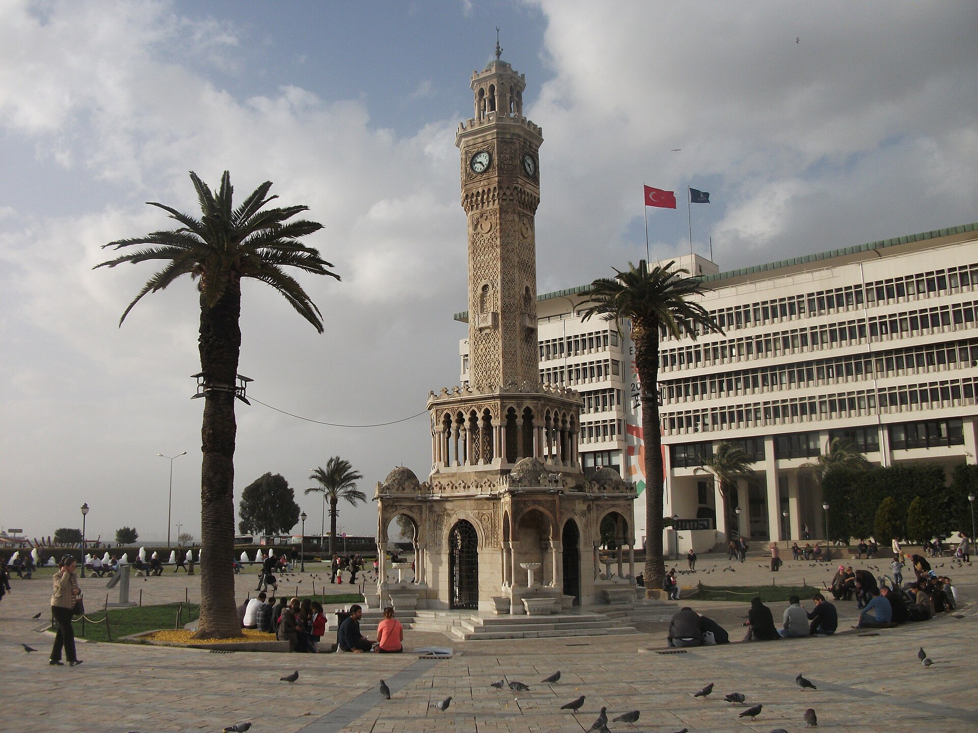
İzmir begins in Konak, where the İzmir Clock Tower stands beside Konak Square and the gulf waterfront. From here, Kemeraltı’s historic market streets lead inland through hans, shops, mosques and food stalls, while the coast opens into the broad Gulf of İzmir and the Kordon promenade. The city is also the natural base for western Türkiye’s major excursions: Selçuk and Ephesus to the south, Bergama and Pergamon to the north, and Çeşme, Urla and the peninsula coast to the west. İzmir therefore works as both an urban destination and a launch point for archaeology, villages, beaches and Aegean coastal landscapes.
Reviewed by Elena Voss · Roavina Travel Editor
Set your days, your pace and the hours you actually want to be out. The planner works around closing days and travel time, and leaves room to eat.
Ranked by importance — sitelinks, pageviews and heritage status, not editor preference.
14 places match
Category
Typical visit duration
Gediz Deltası
Gediz Delta is a vast wetland on İzmir’s northwestern edge, spreading across the districts of Çiğli, Menemen, Karşıyaka and Foça.

Kültürpark is İzmir’s major central urban park and fairground, established on 1 January 1936 under the leadership of Behçet Uz. Its 420,000-square-metre grounds combine mature greenery, public recreation, cultural attractions and event spaces in the centre of the city.

Ayasluğ
Ayasuluk Hill is the historic high ground above Selçuk, where several of the town’s most important monuments occupy one archaeological setting. A visit brings together St.

Kordonboyu
Kordon is İzmir’s bayfront promenade, stretching between Konak and Alsancak Port along the central shore of İzmir Bay. Its defining experience is movement beside open water: a continuous urban route where the bay, city frontage and everyday public life meet.
Yamanlar Dağı
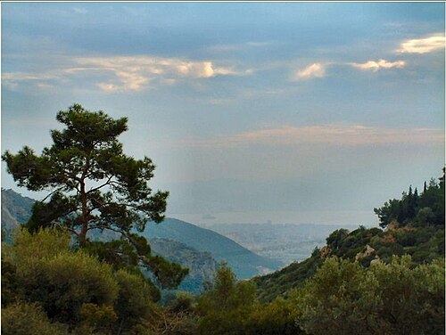
Mount Yamanlar is the mountain and nature-park setting identified by İzmir Governorate at Dededağı Tepe in Karşıyaka. Its identity comes from a forested, elevated landscape rather than a building with galleries, exhibits or a timed programme.
Kara Ada
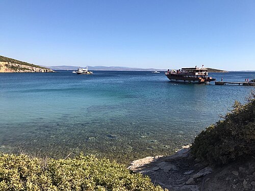
Eşek Island is a natural island off İzmir’s Çeşme Peninsula, on the eastern side of the Chios Strait, and is formerly known as Goni.
Çamaltı Tuzlası
Çamaltı Salt Pan is a working coastal salt-production landscape inside İzmir’s Gediz Delta, where shallow evaporation ponds, embankments and wetland habitats meet.
İnkaya Mağarası
İnkaya Cave is a dry cave west of Yelki village, on the eastern side of Kocadağ in Güzelbahçe, İzmir. Its documented underground length is 222 metres, and the deepest point is 30 metres below the entrance.
Gölcük
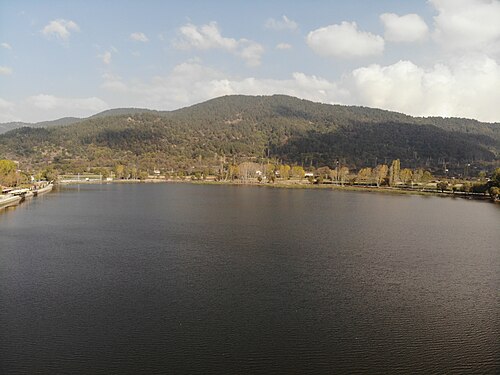
Lake Gölcük is an alluvial-dammed lake in a tectonically defined depression at Gölcük Mahallesi, Ödemiş, İzmir. It sits on the Bozdağlar Plateau at approximately 1,050 metres above sea level, while the surrounding plateau averages about 1,100 metres.
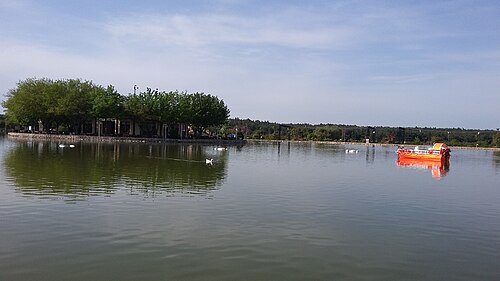
Buca Gölet is a public recreation facility in Belenbaşı Mevkii, near the Sebze Hali in Kaynaklar, within İzmir’s Buca district.
Gallesion
Mount Galesios is a 764-metre mountain north of Ephesus, on the northern bank of the Küçükmenderes River in İzmir Province. Galesion and Alamandağ are alternative names for the same peak.
Panayırdağ
Panayır Mountain is a 121-metre natural summit in Selçuk, İzmir, within the landscape around ancient Ephesus. It is a landform rather than a museum, enclosed attraction or constructed mountain park.
66 Evler Parkı is a neighbourhood green space in Yenikent Mahallesi, Urla, within İzmir Province.
Yedigöller
Buca Yedigöller is a neighbourhood recreation area in İzmir, set among the Çağdaş, İzkent, Karanfil, Gaziler and Murathan neighbourhoods.
Source: OpenStreetMap contributors, Wikidata ·
District boundaries come from OSM administrative relations, so a district page holds exactly the places inside it — plus, for the islands and the coast, the nearest district by proximity.
Use Konak as the central reference point. The Clock Tower, Konak Square, Yalı Mosque, government buildings and the entrance to Kemeraltı are concentrated here; the market continues inland and north-east, while the waterfront route runs towards Konak Pier, Alsancak and Kordon. The Gulf of İzmir divides the metropolitan area, with districts such as Karşıyaka on the northern shore and Balçova, Narlıdere and Güzelbahçe along the western shore. The province extends much farther than the centre. Selçuk and Ephesus lie south, Bergama lies north, and Çeşme and Urla lie west on the peninsula. Treat these outlying places as separate day-trip areas rather than neighbourhoods of the centre.
Checked 2026-09-02
İzmir’s integrated public-transport system combines İZBAN suburban rail, İzmir Metro, trams, ESHOT buses and İZDENİZ ferries, with İzmirim Kart used across the network. The Clock Tower, Konak, Kemeraltı and the central waterfront are easiest to experience as a walking circuit, with buses, rail and ferries extending the journey around the gulf. İZBAN is particularly useful for the airport and the southern corridor towards Selçuk; Ephesus itself is then reached from Selçuk using current local connections. Bergama, Çeşme, Urla and peninsula beaches require separate intercity or municipal transport planning. Check the relevant operator before travelling because routes and service frequencies can change.
Checked 2026-09-02
Begin at the İzmir Clock Tower in Konak, look across Konak Square towards the gulf, then walk through Kemeraltı and continue north along the waterfront towards Kordon. This route introduces İzmir’s principal historic, commercial and seaside settings in one connected visit.
İzmir is a practical base for a southern excursion to Selçuk and Ephesus. The Ministry of Culture and Tourism lists Ephesus as an archaeological site in Selçuk, İzmir Province. Check the current İZBAN and local transport information before travelling, and confirm the site’s current visitor information on the Ministry page.
Bergama is a substantial northern excursion centred on Pergamon. UNESCO describes the acropolis as the capital of the Hellenistic Attalid dynasty and part of a wider cultural landscape that includes the Asclepieion and later layers around modern Bergama. Plan it as a separate outing and verify current transport and site information before departure.
The main western options are Çeşme and Urla, together with the peninsula’s smaller coastal settlements and beaches. İzmir’s official destination material presents the province as a destination for Aegean coast, swimming and relaxation as well as history. Choose one coastal area for a day rather than trying to cover the entire peninsula.
Use İzmirim Kart with the city’s integrated buses, metro, suburban rail, trams and ferries. Walk between the central Konak sights, then use rail or sea transport for longer gulf-side journeys. For Bergama, Çeşme, Urla and beach areas, check the current intercity or municipal connection separately.
No official recommended stay length is recorded. Your duration depends on whether the plan covers only Konak, Kemeraltı and the gulf waterfront or adds separate excursions to Ephesus, Bergama, Çeşme or Urla. Those destinations are spread across the province, so each requires its own travel time and itinerary space.