

7 min walk
Olympia Theater
- Must see · Heritage site
- Art and culture venue
Language · 11 published
Nature site · Miami
Miami Circle at Brickell Point
Reviewed by Elena Voss · Roavina Travel Editor
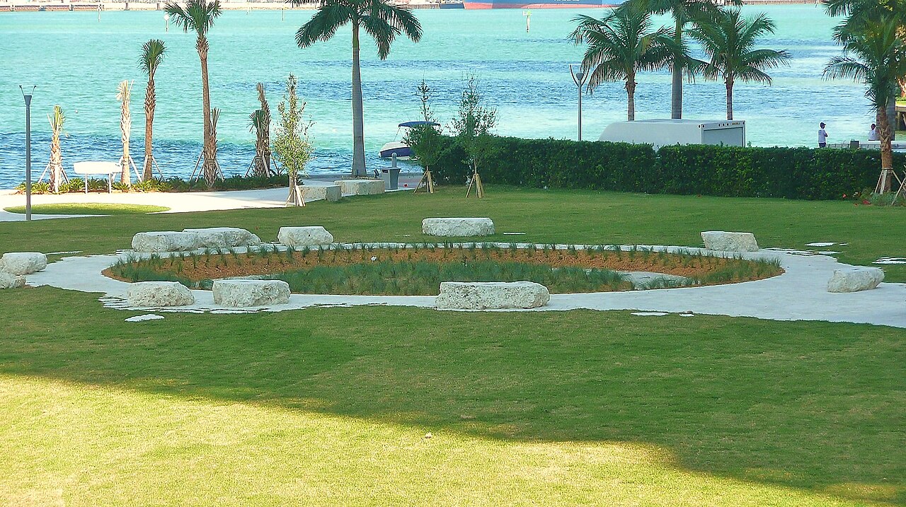
This place is a Park. It carries the National Historic Landmark heritage designation.
Miami Circle is an archaeological site at Brickell Point, on the southern bank of the Miami River in downtown Miami. The principal feature is a near-perfect circle cut into the limestone bedrock, measuring about 38 feet across. Archaeologists associate the site with the Tequesta people, the Indigenous inhabitants of southeastern Florida, and date it to roughly 2,000 years ago. The circle was uncovered in 1998 during construction work for a luxury apartment complex. Its survival creates an unusual contrast: prehistoric engineering occupies a small waterfront space surrounded by the towers, roads and activity of modern Brickell. Miami Circle is best understood as a compact heritage stop rather than a large museum or archaeological complex.
Checked 2026-08-26 · Source
The site preserves the exposed limestone formation and its distinctive pattern of 24 basins or holes together with hundreds of postholes. Visitors view the remains from an observation platform beneath a protective covering rather than walking across the archaeological surface. Interpretive panels explain the circle, its archaeological importance and the Tequesta people. The grounds around Brickell Point are landscaped and include native vegetation, giving the small site some visual separation from the surrounding city. Recovered objects were removed for study and curation, so the limestone circle itself is the central experience. The site is designated a National Historic Landmark, and the platform offers a direct view of the preserved feature.
Checked 2026-08-26 · Source
Allow about 15 to 30 minutes for Miami Circle. The observation platform and the compact archaeological remains can be seen quickly, while the interpretive panels add roughly ten minutes for visitors who want the historical context. Extra time is useful for photography, quiet observation or considering the relationship between the ancient site, the Miami River and the Brickell skyline. Miami Circle works especially well as a short stop during a downtown walk. Visitors can combine it with the riverfront, Brickell City Centre and nearby streets without needing to reserve a separate half-day. The site’s small scale makes the visit straightforward, but its significance rewards a slower look than its size initially suggests.
Checked 2026-08-26 · Source
Miami Circle is an outdoor site intended for daylight visits, and the exposed setting makes weather central to the experience. Winter generally brings milder temperatures and lower humidity, while summer can be hot, humid and affected by afternoon thunderstorms. Early morning and late afternoon reduce the strongest sun on the observation area. Overcast conditions can also make the limestone details easier to read. Because the platform offers little shelter, a brief visit is more comfortable when rain is not moving through the area. The surrounding Brickell district is active throughout the day, so visitors who want a quieter look at the circle may prefer an earlier arrival.
Checked 2026-08-26 · Source
Miami Circle is presented as an open public archaeological space rather than a commercial attraction with a ticketed entrance. The site has no described ticket booth or turnstile, and the visit is self-guided from the observation platform and interpretive signage. The archaeological remains are the attraction, while any cost connected with reaching Brickell Point would come from transport or parking rather than entry to the circle. Visitors should treat the place as a short public heritage stop and spend time reading the panels instead of expecting a staffed museum, retail area or scheduled performance.
Checked 2026-08-26 · Source
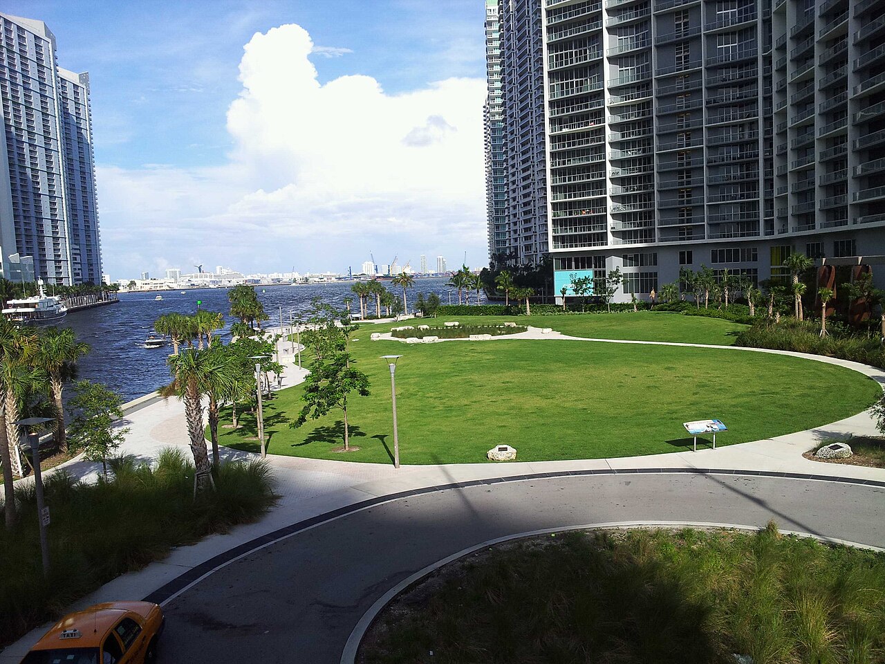
Miami Circle stands in the Brickell neighborhood at the mouth of the Miami River, where the river meets Biscayne Bay. The site is within walking distance of many downtown hotels, Brickell City Centre and the riverfront paths. Brickell Station is the nearby major public-transport hub, with Metrorail and Metromover connections serving the wider central area; buses also run through the district. Drivers can use nearby commercial garages or street spaces, with availability and rates varying by time. Bicycle lanes, pedestrian routes and extensive rideshare coverage make the dense urban setting practical for visitors arriving without a private vehicle.
Checked 2026-08-26 · Source
Protect the archaeological remains by staying on the observation platform and never touching or disturbing the limestone. Rain can make the platform slippery, and the exposed waterfront setting calls for water, sunscreen and a hat in strong sun. The Brickell streets carry heavy vehicle and pedestrian traffic, so crossings require attention. Children should remain close because the waterfront urban setting includes open edges and active paths. Evening light is reduced, and the site has no described on-site staff or security presence. Visitors with mobility needs should be aware that the platform design may limit access. Respect the place as both protected heritage and a public urban space.
Checked 2026-08-26 · Source
Personal photography is suited to Miami Circle, especially when the limestone pattern is visible through the protective covering. A wide-angle view can include the full circle, while closer images can show the basins and postholes. Early morning, late afternoon or overcast weather produces softer light than harsh midday sun, which can create deep shadows across the stone. The covering and observation barriers shape the available angles, so use the platform rather than trying to approach the remains. Interpretive panels can be photographed for personal reference. The surrounding skyscrapers, river and bay provide context that makes the site distinctive within Miami’s modern skyline.
Checked 2026-08-26 · Source
It is a prehistoric archaeological site at Brickell Point, consisting of a limestone circle about 38 feet in diameter with basins and hundreds of postholes.
The site is dated to approximately 2,000 years ago and is associated with the Tequesta people of southeastern Florida.
No. The remains are protected beneath a covering and viewed from an observation platform, so visitors stay off the archaeological surface.
Visitors can see the limestone circle, its 24 basins or holes, hundreds of postholes, protective covering and interpretive panels about the Tequesta people.
A focused visit usually takes about 15 to 30 minutes, including time on the observation platform and reading the interpretive panels.
Miami Circle is at Brickell Point in downtown Miami, on the southern bank of the Miami River near its meeting point with Biscayne Bay.
Loading the interactive map…
The interactive map could not be loaded.
Last updated:
Source: OpenStreetMap contributors, Wikidata ·