
14 min walk
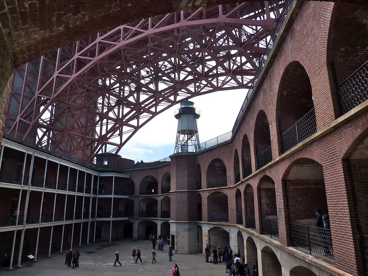
Fort Point
- Must see · Heritage site
- Historic monument
Historic monument · San Francisco
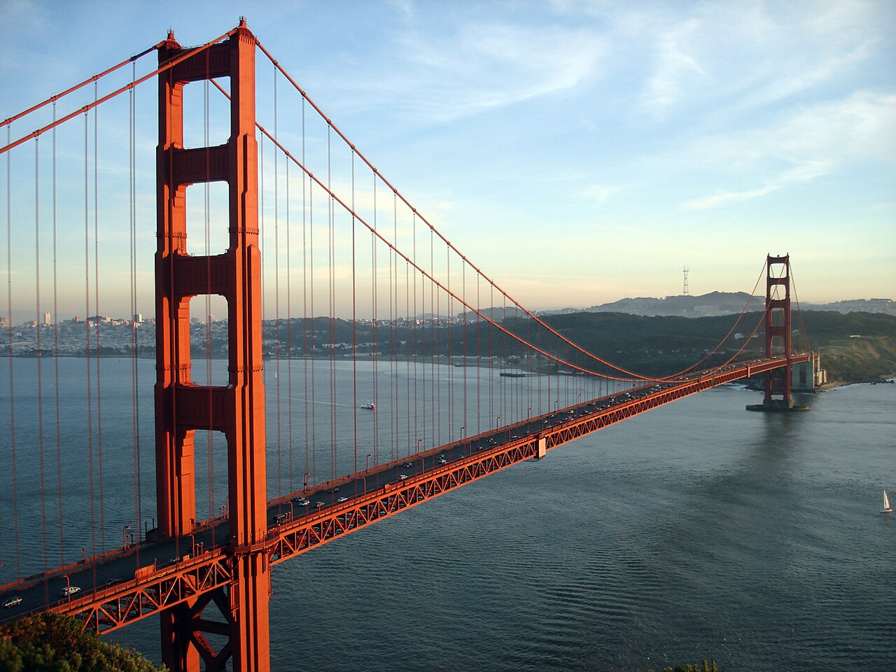
The Golden Gate Bridge is a suspension bridge spanning the Golden Gate strait, the channel connecting San Francisco Bay to the Pacific Ocean. Opened in 1937, it serves as a critical transportation link between San Francisco and Marin County. The structure is recognized internationally as an engineering landmark and symbol of the city. Its distinctive International Orange color was selected to enhance visibility in fog. The bridge carries vehicle traffic, pedestrians, and cyclists across its span. It remains both a functional piece of infrastructure and a globally photographed monument.
Checked 2026-08-28
The bridge consists of two main towers, suspension cables, a roadway deck, and pedestrian walkways on both sides. The east sidewalk accommodates pedestrians and cyclists during designated hours, while the west sidewalk typically serves cyclists. Vista points at the southern and northern ends offer viewing areas. The Bridge Pavilion at the southern end contains historical exhibits and merchandise. No enclosed building interiors or tower access for general visitors is routinely available. The structure itself is the primary feature, experienced through crossing, viewing, or photographing from surrounding areas.
Checked 2026-08-28
Crossing the bridge on foot covers approximately 1.7 miles one way between the two towers. Visitors should allow 45 minutes to over an hour for a leisurely round-trip walk, accounting for photography stops and weather conditions. Cycling across typically takes 15-25 minutes one way. Many visitors combine bridge crossing with exploration of nearby areas such as Crissy Field, the Presidio, or Marin Headlands. The duration of a visit varies substantially based on chosen activities, ranging from brief photo stops to half-day excursions incorporating multiple vantage points.
Checked 2026-08-28
San Francisco's characteristic fog frequently obscures the bridge, particularly during summer mornings. Clearer conditions often occur in afternoon hours and during autumn months. Visitors should verify current access schedules through official channels before planning. Weather conditions change rapidly; layering clothing is advisable regardless of season. Sunrise and sunset periods offer dramatic lighting for viewing, though fog interference remains possible. Midday typically provides the most reliable visibility, though crowds peak during this period. Check the operator's own site for the travel date before relying on a schedule or fare.
Checked 2026-08-28
The bridge charges tolls for southbound vehicle traffic only; northbound vehicles and pedestrian or cyclist crossings incur no fee. No general admission fee exists for walking or cycling across. The Bridge Pavilion exhibition may have separate arrangements. Visitors should consult official sources for current toll rates, payment methods, and any changes to fee structures. FasTrak and license plate billing systems operate for vehicles. Cash is not accepted at toll plazas. Golden Gate Bridge belongs in this actual displayed route because it remains one of the city's highest-ranked published stops. The useful visit keeps attention on the place itself and current conditions on arrival. Check the operator's own site for the travel date before relying on a schedule or fare.
Checked 2026-08-28
Multiple public transit options serve the bridge area. Golden Gate Transit buses stop at the southern and northern ends. San Francisco Muni routes connect to nearby neighborhoods. Parking exists at Crissy Field, the Welcome Center lot, and limited street spaces, though availability constrains during peak periods. Cycling approaches utilize the Presidio's trail network. Walking from the Marina District or Presidio is feasible for able visitors. Rideshare services can access designated drop points. The northern terminus connects to Sausalito and Marin County transit services.
Checked 2026-08-28
Sudden fog dramatically reduces visibility and temperature; carrying windproof layers is essential. The bridge surface can be slippery when wet. Strong winds affect stability, particularly for cyclists and lightweight visitors. Sidewalk congestion peaks midday and weekends; cyclists must exercise caution around pedestrians. No protective barriers separate sidewalks from traffic noise and spray. Emergency phones are positioned along the span. Visitors prone to vertigo should consider the height exposure. Cell phone service may be unreliable in fog conditions. Night crossing requires appropriate visibility precautions.
Checked 2026-08-28
Iconic viewpoints include Battery Spencer and Marin Headlands to the north, Crissy Field and Baker Beach to the south, and Fort Point at the bridge base. Morning light illuminates the east-facing surfaces; afternoon light favors western approaches. Fog creates atmospheric conditions but may obscure the structure entirely. Tripods face restrictions on sidewalks due to pedestrian flow. Long exposures of traffic trails require stable positioning at approved locations. The International Orange color registers distinctly against blue sky or fog. Night photography captures illuminated tower elements.
Checked 2026-08-28
Yes, a pedestrian walkway exists on the east side of the bridge, though current access hours and any seasonal variations are Not recorded.
Walking and cycling across the bridge is free. Southbound vehicle tolls apply. Specific current rates are Not recorded pending review.
Afternoon hours and autumn months generally offer clearer conditions, though San Francisco fog patterns remain unpredictable.
Not recorded. General public access to tower interiors is not routinely available.
Golden Gate Transit buses serve both bridge termini. San Francisco Muni connects to nearby areas. Specific route numbers and schedules should be verified with operators.
Specific accessibility features, elevator availability, and gradient information are Not recorded. Visitors should consult official sources for verified accessibility details.
Loading the interactive map…
The interactive map could not be loaded.
Last updated:
Source: OpenStreetMap contributors, Wikidata ·