

81 min walk
National Falls (Upper Falls)
- Notable
- Nature site
Language · 11 published
Nature site · Sydney
Reviewed by Elena Voss · Roavina Travel Editor
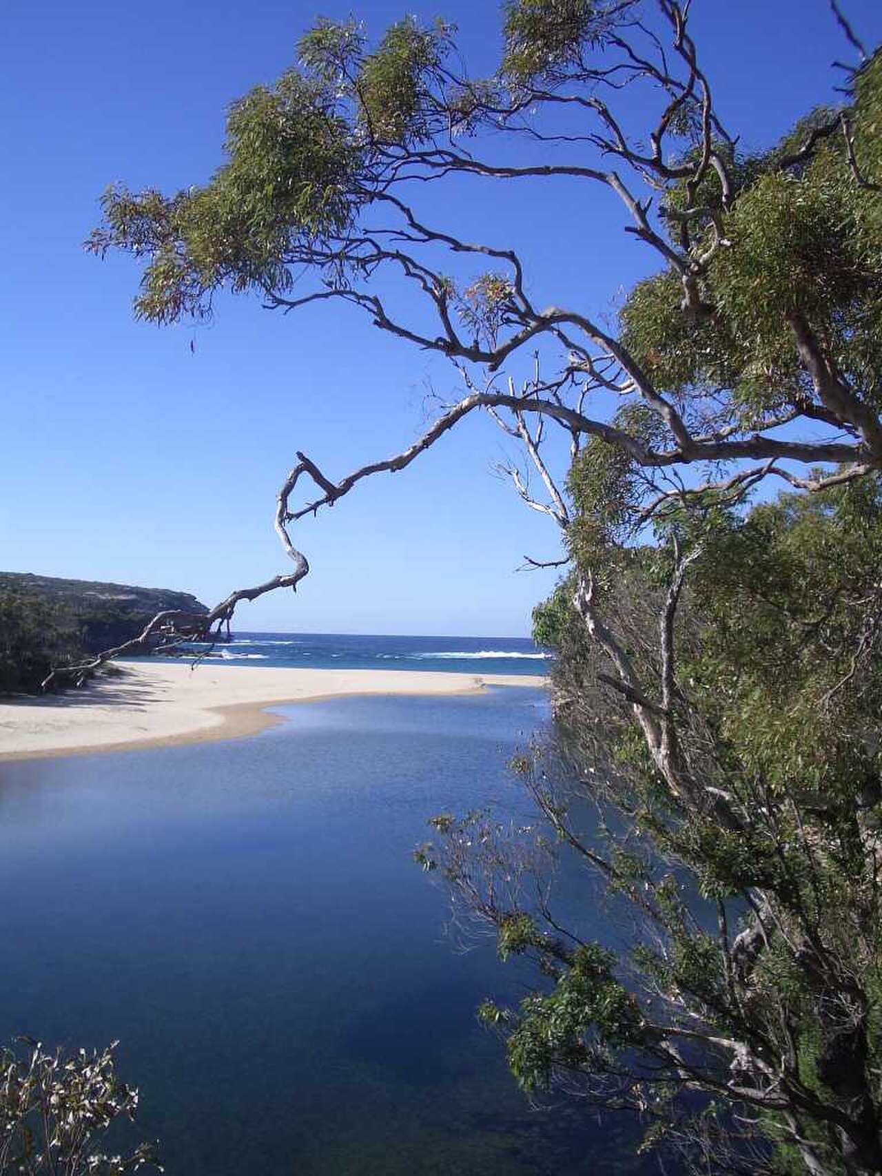
This place is a Nature reserve. It was established in 1879. It carries the listed on the Australian National Heritage List heritage designation. It is run by NSW National Parks and Wildlife Service.
Royal National Park is a large protected landscape on Sydney’s southern edge, stretching between eucalyptus forest, sandstone country, coastal heath and the Pacific shoreline. Established in 1879, it is recognised as one of the world’s oldest national parks. The park suits travellers who want beaches, bushland, cliffs and long coastal views within a day trip from the city. Its scale means the experience is outdoor exploration rather than a single attraction: choose a walking area, beach or viewpoint and allow time for changing terrain and weather. Royal National Park is a protected natural area on the southern fringe of metropolitan Sydney. Established in 1879, it holds status as one of the world's oldest national parks. The park encompasses coastal heathland, eucalyptus forest, sandstone cliffs, and beaches along the Tasman Sea. It lies within the documented city scope as a meaningful visitor destination for Sydney travellers seeking natural landscapes beyond the urban core. The park lies on the southern metropolitan fringe and is retained within the documented city scope as a meaningful Sydney visitor destination despite having no exact city POI pool match.
Checked 2026-08-26 · Source
The park’s best-known places include the Coast Track, Wattamolla lagoon and beach, Figure Eight Pools and Wedding Cake Rock. Audley provides picnic grounds and a visitor contact point among wooded valleys and waterways. Designated camping areas extend the visit beyond a single day. Coastal headlands offer broad Pacific views, while sheltered creeks and forest sections provide a different atmosphere. Plan around one main walk or coastal area rather than trying to cross the whole park quickly; distances between highlights can make an ambitious route tiring.
Checked 2026-08-26 · Source
A short visit can focus on one beach, lookout or walking track and take two to four hours. Reaching Figure Eight Pools or Wedding Cake Rock generally calls for several hours because the approach includes walking and coastal terrain. A drive between major areas can fit within roughly two hours when stops are brief, while the complete Coast Track is a multi-day undertaking. Add extra time for photographs, swimming, picnicking, navigation and a slower return if the ground is uneven.
Checked 2026-08-26 · Source
Summer brings warm weather and heavier use of beaches and popular coastal tracks. Winter is cooler and often more comfortable for sustained walking, although shorter daylight limits ambitious routes. Spring and autumn can offer a balanced combination of moderate temperatures and outdoor conditions. Rain changes track surfaces and creek crossings, while hot, dry weather increases bushfire risk. Start coastal walks with enough daylight for the return, and treat sea conditions and weather as part of the day’s route decision.
Checked 2026-08-26 · Source
Royal National Park uses a park-use fee system at designated entry points or through permits. Annual passes can suit visitors who plan repeated visits, while camping at designated grounds carries separate charges. The payment arrangement depends on how you enter and which facilities you use. Keep the visit practical by deciding whether you are making a brief stop, spending a beach day or camping overnight, since each plan can involve different costs and preparation.
Checked 2026-08-26 · Source
By car, the main approaches use Princes Highway turnoffs around Loftus, Waterfall and Otford. South Coast Line stations including Loftus, Engadine, Heathcote, Waterfall, Helensburgh, Otford and Stanwell Park provide access to different edges and walking routes, though the station-to-track distance varies. Regular buses do not run through the park interior. Cycling is possible on sealed roads and designated tracks, but the park’s hills and distances demand preparation. Water access exists at selected points but is not the usual arrival method.
Checked 2026-08-26 · Source
Ocean surge is a serious danger on coastal rock platforms, especially around Figure Eight Pools. Stay well back from cliff edges and unstable sandstone, and follow barriers and track signs. Bushfire conditions can affect access during hot, dry periods. Mobile coverage is patchy, so carry water, food and navigation essentials and tell someone your route. Natural water is untreated. Snakes and ticks occur in bushland, while track difficulty ranges from straightforward paths to demanding coastal walking.
Checked 2026-08-26 · Source
Royal National Park gives photographers several distinct settings: eucalyptus forest, sandstone formations, beaches, lagoons, cliffs and open Pacific horizons. Wedding Cake Rock and Figure Eight Pools are recognisable subjects, but both require careful positioning and attention to sea conditions. Early and late light can emphasise coastal relief, while changing cloud makes the exposed headlands feel different from the shaded valleys. Drone flights require appropriate authorisation in a national park, and commercial photography may require a permit.
Checked 2026-08-26 · Source
The park’s principal visitor areas include the Coast Track, Wattamolla lagoon and beach, Figure Eight Pools, Wedding Cake Rock and Audley’s picnic grounds. Each highlights a different combination of coast, forest, sandstone or sheltered water.
Wave surge and unexpected swells create serious hazards on the coastal rock platforms around Figure Eight Pools. Stay away from the water’s edge, follow track guidance and leave enough daylight for the return walk.
Designated camping areas are available within the park, and camping involves separate charges from ordinary park access. An overnight plan also requires food, water, suitable equipment and enough time for the chosen route.
South Coast Line stations such as Loftus, Waterfall, Helensburgh and Otford serve different park approaches. Some walking routes begin near stations, while other destinations require a longer connection on foot or by car.
Yes. Natural water sources in the park are untreated, and mobile phone coverage can be patchy. Carry enough drinking water for the route, together with food and navigation essentials.
Drone operation in the park requires specific authorisation. Treat the national-park setting as a regulated environment and use ground-based photography unless the necessary permission has been granted.
Loading the interactive map…
The interactive map could not be loaded.
Last updated:
Source: OpenStreetMap contributors, Wikidata ·