
14 min walk
Pedra Bonita
- Must see
- Viewpoint
Language · 11 published
Viewpoint · Rio de Janeiro
Reviewed by Elena Voss · Roavina Travel Editor
This place is a Attraction. It is built of granite. It carries the heritage asset listed by IPHAN heritage designation.
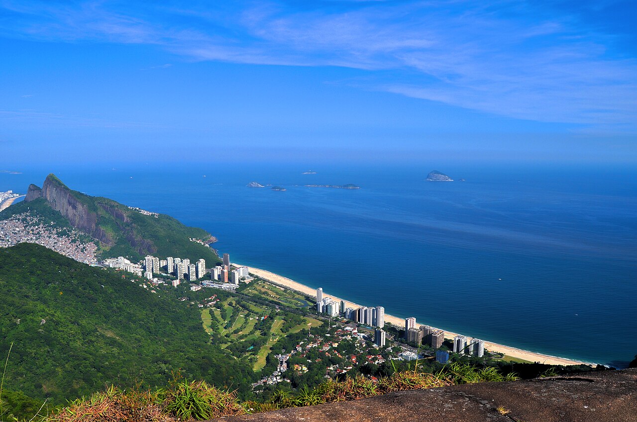
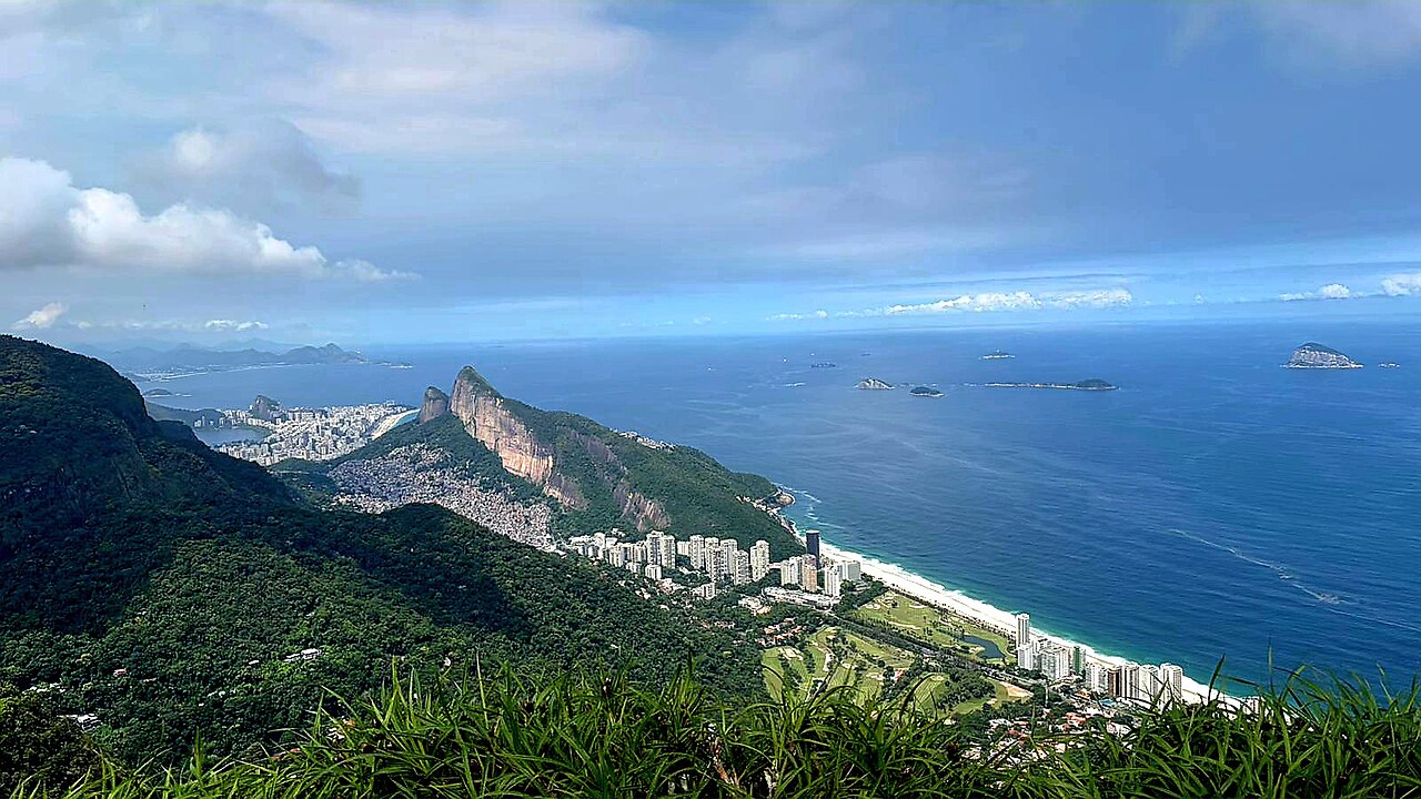
Pedra da Gávea, or Gavea Rock, is a massive coastal monolith rising above Atlantic Forest on Rio de Janeiro’s western side. Its distinctive granite profile makes it visible from many parts of the southern city, while the summit offers sweeping views toward the ocean, Barra da Tijuca, and the mountainous hinterland. Gavea Rock is a demanding natural landmark rather than a simple viewpoint. The attraction is the complete mountain experience: forest approach, steep rock, exposed terrain, and a high summit that reveals Rio’s dramatic relationship between coast, city, and mountains.
Checked 2026-08-26 · Source
Gavea Rock has no constructed interior or visitor exhibition. The route crosses Atlantic Forest, natural granite surfaces, and exposed summit rock. Hikers follow steep dirt and rock sections before reaching the final scramble, where hands and feet are needed on a steep rock face. A carved inscription on one face has a disputed origin, making it a subject of debate rather than an established historical feature. There are no visitor facilities at the summit. The experience depends on terrain, weather, physical effort, and the changing views gained during the ascent.
Checked 2026-08-26 · Source
Plan several hours for the round trip, with time for the forest approach, the technical final ascent, summit views, and a careful descent. A full morning or afternoon is a sensible minimum because pace varies with fitness, trail conditions, crowding, and the need to negotiate steep sections safely. Descent is not a quick afterthought: tired legs and slippery rock demand concentration. Add a weather buffer, particularly when clouds or rain may slow progress. Gavea Rock should be treated as the main activity of the half-day rather than a brief stop between city attractions.
Checked 2026-08-26 · Source
Early morning is the strongest choice for Gavea Rock because afternoon cloud can obscure summit views and heat increases the physical challenge. The period from approximately May through September generally brings more stable conditions, although mountain weather can change at any time of year. Rain makes the granite especially dangerous, and fog can remove the main reward of the climb. Choose a day with conditions suitable for exposed rock, begin with enough daylight for the return, and postpone the hike when wet weather threatens. Humidity and summer heat demand extra water and a slower pace.
Checked 2026-08-26 · Source
Gavea Rock is a natural hiking landmark reached through trail access rather than a conventional museum or monument entrance. The main investment is preparation for a demanding route: sturdy footwear, water, food, sun protection, rain protection, and enough time for a safe return. Some hikers use local guides, especially when unfamiliar with the trailhead or the upper scramble. The value of the excursion lies in the physical route and summit panorama, not in a formal visitor complex. Treat any guide arrangement as a separate service from the natural landmark itself.
Checked 2026-08-26 · Source
The trailhead area lies in São Conrado, reachable by road from Rio’s southern zone. Public buses serve the wider district, while a private vehicle, taxi, or rideshare can bring hikers near the starting area. Finding the route may require navigation through residential streets and locating a path entrance with limited visual prominence. Local trail knowledge is valuable for first-time hikers. Plan the return journey before beginning, since the trailhead does not function like a central transport hub. Mobile mapping helps with the approach but cannot replace awareness of the trail and its surroundings.
Checked 2026-08-26 · Source
Gavea Rock demands serious respect. The upper route includes steep exposed rock without guardrails, and wet granite becomes extremely slippery. The trail lacks the support infrastructure found at urban attractions, so carry all water, food, and basic emergency supplies. Solo hiking is a poor choice for this terrain; tell someone your route and expected return. Heat exhaustion, dehydration, insects, snakes, sudden rain, and cloud can all affect the climb. Previous scrambling experience is valuable for the final section. Turning back when conditions deteriorate is the correct response to a mountain hazard, not a failed visit.
Checked 2026-08-26 · Source
The summit rewards photographers with coastal views, forested slopes, Barra da Tijuca, and dramatic cloud formations when the atmosphere is clear. The forest approach offers close textures and canopy scenes, while the exposed rock shows the scale of the monolith. Safety must control every composition: stop only where footing is secure, and do not move toward an edge for a wider frame. Morning light is often clearer before haze develops. Protect cameras from sudden rain and humidity, and keep equipment light enough that it does not compromise balance during the scramble.
Checked 2026-08-26 · Source
No. The hike requires strong fitness, secure footing on steep terrain, and confidence with exposed scrambling on rock where a fall could cause serious injury.
A local guide can help with the difficult-to-find trailhead, route navigation, and safety on the technical upper section, especially for first-time hikers.
Carry plenty of water, high-energy food, sun protection, rain protection, and sturdy footwear with good grip. A charged phone and a named contact are also important.
The origin and authenticity of the carved inscription remain disputed. It is best treated as a debated feature rather than as settled historical evidence.
Rain greatly increases the danger on exposed granite. Postpone the climb when rock is wet, because slippery surfaces make the steep upper route hazardous.
The trail and summit have no visitor facilities. Carry the water and food you need, and prepare before leaving because the route provides no infrastructure.
Loading the interactive map…
The interactive map could not be loaded.
Last updated:
Source: OpenStreetMap contributors, Wikidata ·