CN Tower
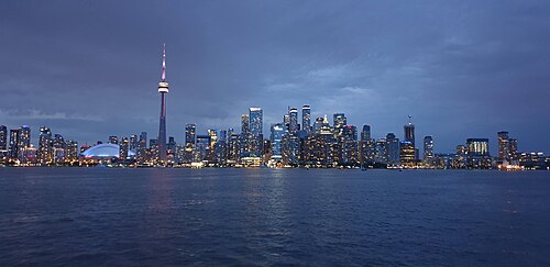
The CN Tower is Toronto's 553.33-metre communications and observation tower, built as a national engineering landmark and now operated as a ticketed visitor attraction.
- Must see
- Historic monument
Language · 11 published
City guide · Canada
Toronto is a city of neighbourhoods arranged around a compact downtown and long transit corridors. The City Centre contains the financial, entertainment and waterfront districts; Old Town lies east, the Westside extends through Queen West and beyond, and Midtown and Uptown follow the main north-south axes. Toronto Islands, Scarborough and Etobicoke are separate trips. Group downtown sights on foot and use the TTC for wider movement.
Reviewed by Elena Voss · Roavina Travel Editor
Set your days, your pace and the hours you actually want to be out. The planner works around closing days and travel time, and leaves room to eat.
Ranked by importance — sitelinks, pageviews and heritage status, not editor preference.
14 places match
Category
Typical visit duration
Interests
The CN Tower is Toronto's 553.33-metre communications and observation tower, built as a national engineering landmark and now operated as a ticketed visitor attraction.
St. Lawrence Market is a historic public market in Toronto, widely recognised as the city's most important food-hall destination.
Toronto’s Distillery District is a pedestrian heritage precinct shaped by surviving nineteenth-century distillery buildings, brick lanes, and industrial façades. Its identity comes from historic structures now occupied by galleries, shops, restaurants, public spaces, and seasonal programming.
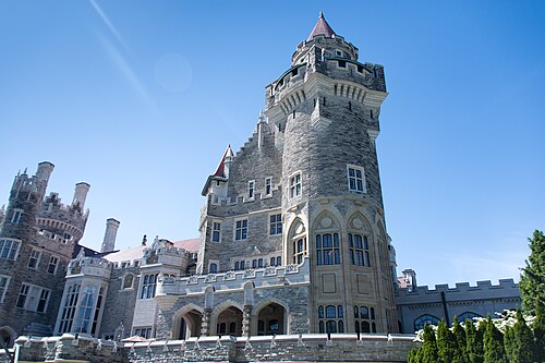
Casa Loma is a Gothic Revival style mansion and museum in Toronto, Ontario. Built in the early twentieth century, it stands as Toronto's singular castle museum and a major architecture destination.
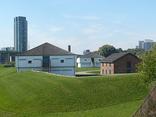
Fort York is Toronto’s surviving early-19th-century military site: a preserved garrison whose earthworks, buildings and waterfront setting make the city’s military beginnings tangible.
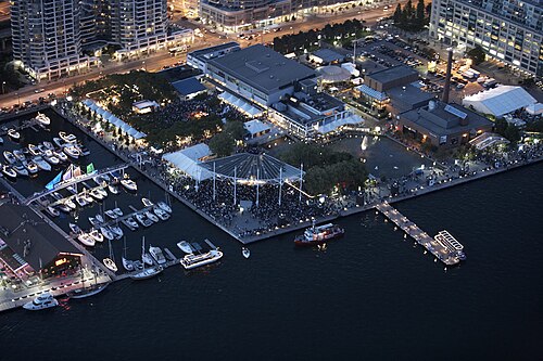
Harbourfront Centre is Toronto's principal waterfront arts and festival venue. It occupies a significant stretch of the city's Lake Ontario shoreline and serves as a major cultural hub for performing arts, visual arts, and community programming.
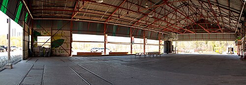
Evergreen Brick Works is a former brick-making complex in Toronto’s Don Valley, now a destination where industrial heritage, environmental learning, community activity, and the ravine landscape meet.
Nathan Phillips Square is Toronto's primary civic square, serving as the city's central public gathering space and a signature landmark. Located directly in front of Toronto City Hall, it functions as the symbolic heart of municipal governance and community celebration.
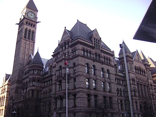
Old City Hall is Toronto’s former civic headquarters, a Richardsonian Romanesque landmark completed in 1899 at Queen Street West and Bay Street. Its clock tower and richly carved sandstone exterior make it one of downtown’s most recognisable historic buildings.
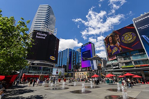
Sankofa Square
Sankofa Square is a central public plaza in Toronto’s entertainment district, at the prominent meeting point of Yonge Street and Dundas Street.
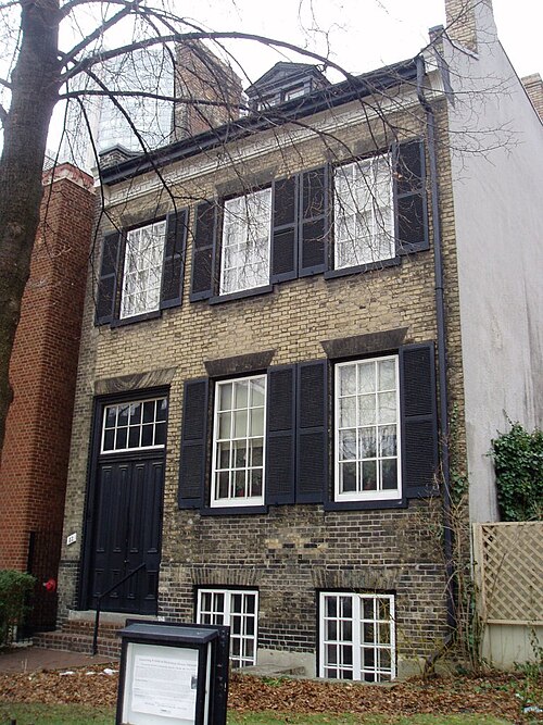
Mackenzie House is a compact historic house museum in downtown Toronto and the final home of William Lyon Mackenzie. Mackenzie was Toronto’s first mayor, a journalist, politician and reformer associated with Upper Canada’s democratic movement.
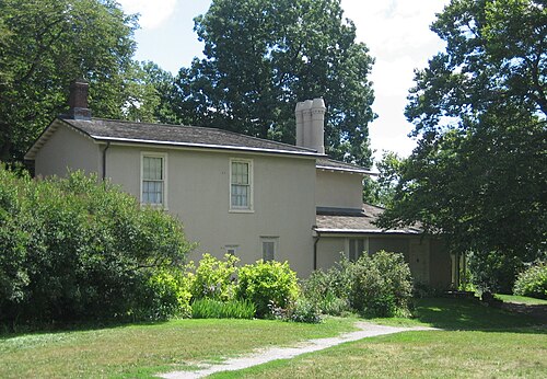
Colborne Lodge is a historic house museum within Toronto’s High Park. Built in 1836, it was the home of John George Howard, an architect and engineer who shaped the city’s early development.
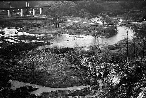
Todmorden Mills is a heritage site located in the Don Valley of Toronto, Ontario. It preserves the industrial and village history of the area, which was once a significant milling centre along the Don River.
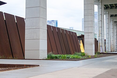
The Bentway is a public realm and arts space located beneath the elevated Gardiner Expressway in Toronto. It functions as a linear corridor connecting the historic Fort York district to the city's waterfront area.
Source: OpenStreetMap contributors, Wikidata ·
Lake Ontario forms Toronto's southern edge, with the downtown core immediately north of the waterfront. The Entertainment District and Financial District sit centrally; Old Town and the Distillery District are east, while Queen West, Ossington and High Park extend west. Midtown and Uptown follow Yonge Street north. The Toronto Islands require a ferry, and Scarborough and Etobicoke sit well outside the central walking area.
Checked 2026-08-26
Walk through the compact downtown and use the TTC subway, streetcars and buses for longer journeys. Streetcars are particularly useful across east-west neighbourhood corridors, while the subway handles the principal north-south and cross-city axes. The PATH provides an underground pedestrian network through the downtown core. Ferries serve the Toronto Islands, and regional rail is useful for airport and Greater Toronto connections.
Checked 2026-08-26
A fixed stay length is not recorded. Plan the downtown and waterfront first, then add neighbourhoods, Toronto Islands or an outer district according to your interests.
Yes. The City Centre, waterfront, Old Town and nearby westside districts are accessible on foot, with the TTC available for longer links.
Use a combination of walking and TTC subway, streetcar and bus services. The network connects downtown with neighbourhoods along the city's main corridors.
PATH is an underground pedestrian network through downtown Toronto. It links buildings and services and can provide a sheltered walking option in poor weather.
No. The islands are offshore and require a ferry or another authorised water connection. Treat them as a separate excursion from the downtown waterfront.