
3 min walk
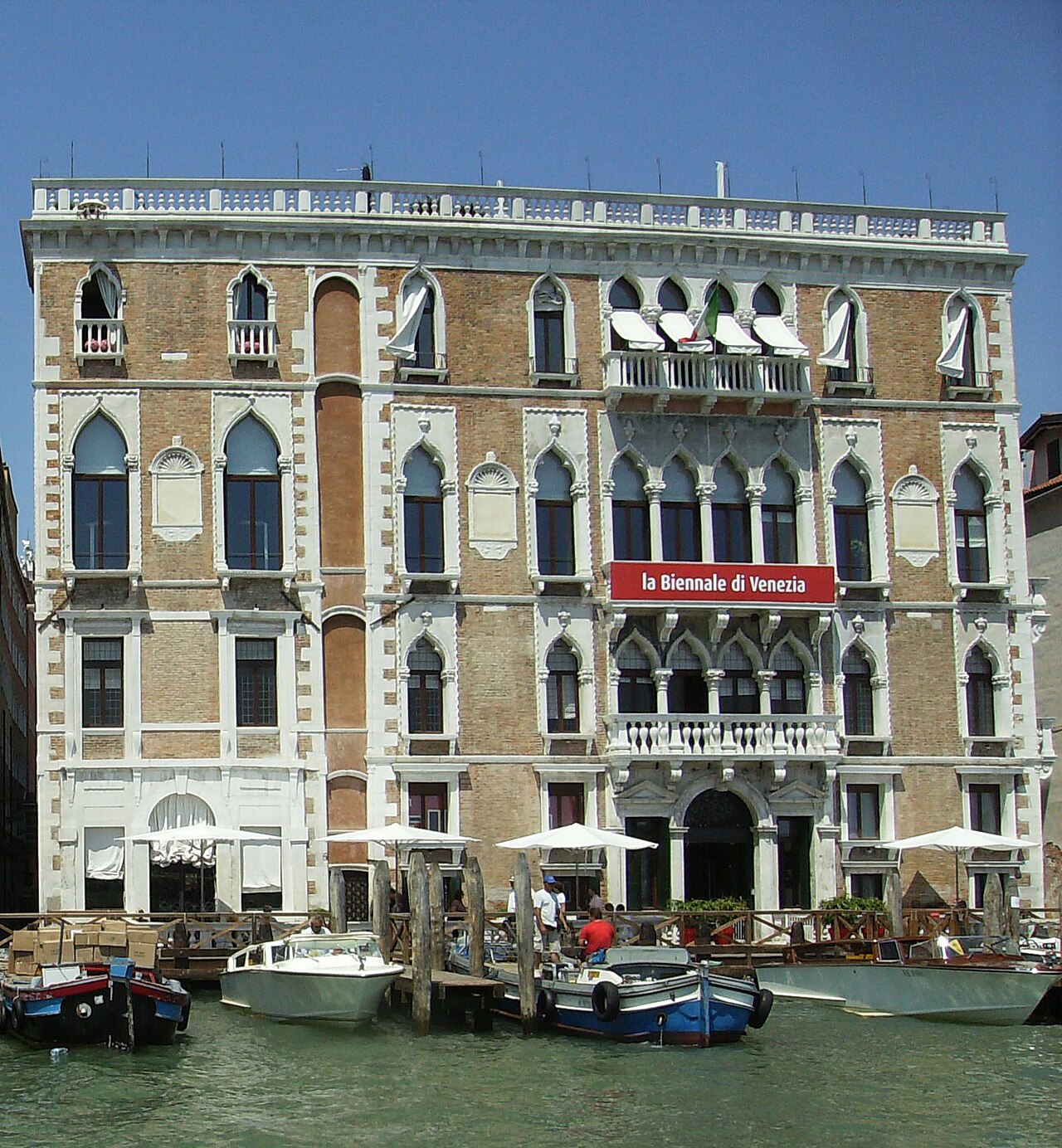
Ca' Giustinian
- Must see
- Historic monument
Language · 11 published
Art and culture venue · Venice
Reviewed by Elena Voss · Roavina Travel Editor

Read from the OpenStreetMap access tags; anything not listed has no tag recorded.
Set the group type to family in the planner and the day window contracts to about three quarters of a solo day.
This place is a Art gallery. It opened in 2009.
Punta della Dogana is the triangular tip between Venice’s Grand Canal and Giudecca Canal. The site takes its name from the customs house that controlled maritime trade into the Venetian Republic, and the historic building now houses a contemporary art museum. The point’s position gives the visit two distinct qualities: an interior experience shaped by changing installations and an exterior setting with broad views across the Bacino di San Marco toward San Giorgio Maggiore and the Doge’s Palace. Punta della Dogana is a triangular promontory at the entrance to Venice's Grand Canal, where the canal meets the Giudecca Canal. The name derives from the customs house that once stood here, controlling maritime trade into the Venetian Republic. Today, the historic building houses a contemporary art museum. The building occupies the historic customs house site and preserves that identity in its name, though the interior has been substantially converted for contemporary art use.
Checked 2026-08-26 · Source
The museum uses the former customs-house structure for temporary contemporary art exhibitions and installations. Adaptation preserved elements of the historic building, including brickwork and wooden roof beams, while creating rooms capable of holding modern works at different scales. The atmosphere changes with each programme: one exhibition may emphasise large installations, while another may reward close attention to individual pieces. The exterior point remains an important part of the experience, because the building’s geometry and water setting help explain why this location is so visually distinctive.
Checked 2026-08-26 · Source
Allow at least an hour for a compact visit, and longer when the exhibition contains work that rewards close attention. The gallery route is not physically extensive, but contemporary installations can slow the pace. Add time outside for the views across the meeting of the two canals and toward San Giorgio Maggiore. The approach from the Salute area also takes time on foot. Visitors combining Punta della Dogana with Palazzo Grassi should count both museum visits and the water or walking connection between them.
Checked 2026-08-26 · Source
Morning light can show the facade and surrounding water with crisp definition, while late afternoon brings a softer view across the basin. The point is exposed, so wind and weather influence the outdoor experience more than they do in Venice’s enclosed lanes. Use Punta della Dogana as an indoor-and-outdoor stop: enter for the exhibition, then pause at the tip for the views. Spring and autumn are comfortable seasons for combining the museum with a longer Dorsoduro walk.
Checked 2026-08-26 · Source
Punta della Dogana’s interior is a contemporary art museum, while the surrounding point provides the visual setting outside the galleries. Plan the museum visit as a distinct admission experience and reserve time to enjoy the exterior separately. The exhibition programme determines how much time the interior deserves, especially when installations occupy the building’s larger rooms. Visitors who also want Palazzo Grassi should organise the two as separate venues in the same art-focused day, with a realistic allowance for Venice’s bridges, lanes, and water connections.
Checked 2026-08-26 · Source
Punta della Dogana is at the end of Dorsoduro, beyond the Basilica of Santa Maria della Salute. The Salute vaporetto stop on Line 1 is the nearest named waterbus connection, followed by a short walk along the Grand Canal edge. From San Marco, walk across the Accademia Bridge and continue through Dorsoduro. Venice’s car-free layout means every land approach uses calli and fondamente. Water taxis can come close to the point, while a detailed map helps with the final turns.
Checked 2026-08-26 · Source
The exposed tip can be windy, and waves from passing boats can make the waterfront feel unsettled. Wet stone becomes slippery, so take care near the water and on the approach. The route includes the usual Venetian bridges and uneven paving. Inside, exhibition design may include low light, unusual floor surfaces, or rooms that feel disorienting. Keep the waterfront edge in view, particularly with children. Crowds and narrow paths make bulky luggage or large camera equipment inconvenient during the final walk.
Checked 2026-08-26 · Source
The exterior of Punta della Dogana is one of the strongest photographic subjects in this part of Venice. Frame the triangular building against the water, with San Giorgio Maggiore or the Doge’s Palace across the basin, and use the changing light to vary the result. Inside, follow the photography rules of the current exhibition and any staff instructions. Keep tripods and other equipment compact on the narrow approach. The crowded waterfront and passing boats make a clear, considerate position more useful than elaborate equipment.
Checked 2026-08-26 · Source
Punta della Dogana is a triangular Venetian promontory between the Grand Canal and Giudecca Canal, with a contemporary art museum in the former customs house.
The point offers views across the Bacino di San Marco toward San Giorgio Maggiore and the Doge’s Palace, with the historic building and surrounding waterways as the main visual subjects.
Use the Salute vaporetto stop on Line 1, walk from San Marco across the Accademia Bridge, or approach by water taxi.
Allow at least an hour for the museum and add outdoor time for the views and the walk from the Salute area.
Yes. Both venues present contemporary art, but they are separate stops connected by Venice’s walking and water-transport network.
Watch for wind, boat wake, slippery wet stone, uneven paving, Venetian bridges, and the exposed waterfront edge.
Loading the interactive map…
The interactive map could not be loaded.
Last updated:
Source: OpenStreetMap contributors, Wikidata ·