.jpg)
10 min walk
Tambomachay
- Must see · Heritage site
- Historic monument
Language · 11 published
Historic monument · Cusco
Reviewed by Elena Voss · Roavina Travel Editor
| Monday | 07:00 – 17:30 |
|---|---|
| Tuesday | 07:00 – 17:30 |
| Wednesday | 07:00 – 17:30 |
| Thursday | 07:00 – 17:30 |
| Friday | 07:00 – 17:30 |
| Saturday | 07:00 – 17:30 |
| Sunday | 07:00 – 17:30 |
Checked 2026-08-31 · Source
Read from the OpenStreetMap access tags; anything not listed has no tag recorded.
Set the group type to family in the planner and the day window contracts to about three quarters of a solo day.
This place is a Archaeological site. It carries the cultural heritage of Peru heritage designation.
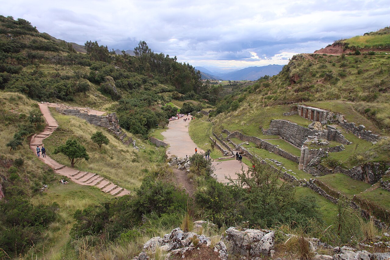
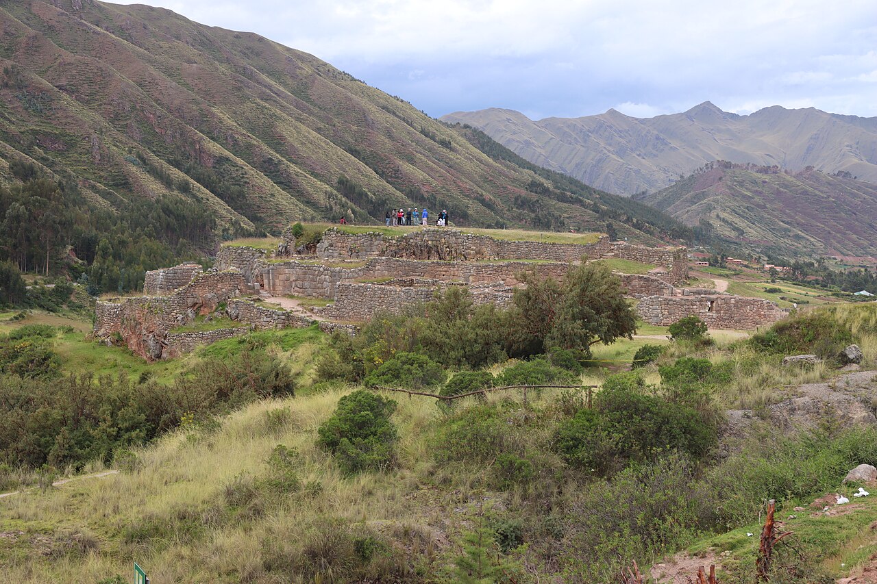
Puka Pukara is a small Inca archaeological site situated on the northern outskirts of Cusco, Peru. Its Quechua name translates to Red Fortress, referencing the distinctive reddish hue of its stonework. It occupies a strategic position overlooking the Cusco valley and the road leading to the Sacred Valley. The site forms part of the standard northern ruins circuit alongside Tambomachay, Qenqo, and Sacsayhuamán, typically visited in sequence by tourists exploring the region. Daily 07:00–17:30. The Dirección Desconcentrada de Cultura Cusco publishes these hours for Parque Arqueológico Nacional de Saqsaywaman, whose visitor route includes Puka Pukara. It lists daily operation and no regular closure day.
Checked 2026-08-31 · Source
The complex contains several terraced levels with walls, doorways, and enclosures built from irregularly shaped red limestone blocks. Visitors can observe the remains of rooms, passages, and plazas distributed across multiple platforms adapted to the hillside terrain. The construction quality is noticeably less refined than major Inca sites, suggesting practical rather than ceremonial priority. Water channels and storage niches are visible in some structures. The upper levels offer panoramic views of the surrounding Andean landscape. The Dirección Desconcentrada de Cultura Cusco publishes these hours for Parque Arqueológico Nacional de Saqsaywaman, whose visitor route includes Puka Pukara. It lists daily operation and no regular closure day.
Checked 2026-08-31 · Source
Most visitors spend approximately thirty to sixty minutes exploring Puka Pukara, depending on interest level and physical condition. The compact size permits a relatively quick circuit of the terraces and remaining structures. When combined with Tambomachay immediately uphill, the two sites typically require ninety minutes to two hours total. Tour groups following the northern ruins circuit allocate limited time here due to scheduling constraints. Independent travelers may linger longer for photography or contemplation. The official circuit enters through the main doorway, follows the right side of the monument to the viewpoint and exits along a lower path beside the Cusco–Pisaq road.
Checked 2026-08-31 · Source
Cusco's dry season from May to September generally offers more reliable conditions for visiting outdoor archaeological sites, with reduced rainfall and clearer skies. Morning hours typically provide softer light for observation and photography before afternoon cloud accumulation. The wet season from November to March brings heavier precipitation that may make paths slippery and reduce visibility. Daily 07:00–17:30. The official circuit enters through the main doorway, follows the right side of the monument to the viewpoint and exits along a lower path beside the Cusco–Pisaq road.
Checked 2026-08-31 · Source
Access to Puka Pukara requires the Cusco Tourist Ticket, which covers multiple archaeological sites and museums in the region. This combined ticket represents the standard entry mechanism rather than individual site pricing. Specific ticket categories, validity periods, and inclusions vary and should be confirmed at official points of sale. Admission is through the Cusco Tourist Ticket; no standalone Puka Pukara ticket is listed. Foreign adults can use the S/70 Circuit I partial ticket, valid for one day and covering Saqsayhuaman, Q’enqo, Puka Pukara and Tambomachay. The foreign-adult integral ticket costs S/130 and is valid for 10 days. Peruvian citizens and permanent residents pay S/40 for the Saqsayhuaman partial circuit or S/70 for the integral ticket. People born in or resident in the Cusco region enter free with DNI.
Checked 2026-08-31 · Source
Puka Pukara lies approximately seven kilometers northeast of Cusco's historic center along the paved road toward Pisac. The site sits immediately below Tambomachay, allowing sequential visits. Walking from central Cusco is possible but involves significant altitude gain and takes several hours, making it impractical for most visitors. MINCETUR identifies a paved tourist-bus journey from Cusco to Puka Pukara of 7.2 km and about 20 minutes. The Culture Ministry names the vehicular approach as Avenida Circunvalación through Molloqocha, Q’enqo and Huayllarqocha toward Puka Pukara on the Cusco–Pisaq road. The arrival area is beside that road, on its right-hand side when approaching from Cusco.
Checked 2026-08-31 · Source
The high altitude demands respect: symptoms of soroche may affect visitors recently arrived from lower elevations, necessitating gradual activity and hydration. Paths and terraces present uneven surfaces, loose stones, and drop-offs without guardrails, requiring careful foot placement especially in wet conditions. No on-site medical facilities exist. Sun exposure intensifies at this elevation regardless of perceived temperature, making protective clothing and sunscreen essential. The official circuit enters through the main doorway, follows the right side of the monument to the viewpoint and exits along a lower path beside the Cusco–Pisaq road.
Checked 2026-08-31 · Source
The red stonework offers distinctive textural opportunities, particularly in diffused morning light when contrast remains manageable. Wide-angle lenses accommodate the terraced architecture and landscape context, while telephoto options isolate wall details and geological features. The panoramic views toward Cusco and the valley reward elevation gain to upper platforms. No tripod restrictions are documented, though consideration for other visitors should guide equipment use. The adjacent road occasionally intrudes into compositions. The Quechua name means “Red Fortress,” referring to the reddish appearance associated with the site’s limestone and iron-rich ground. COSITUC places the site at 3,580 metres above sea level.
Checked 2026-08-31 · Source
The Quechua name means “Red Fortress,” referring to the reddish appearance associated with the site’s limestone and iron-rich ground.
COSITUC places the site at 3,580 metres above sea level.
COSITUC describes military-control and administrative functions, as well as accommodation for the Inca’s entourage while the ruler continued to Tambomachay.
The archaeological group includes a small plaza, rooms, fountains, a double-jamb entrance and two walls supporting an upper terrace.
The Culture Ministry’s documented circuit takes approximately 15 minutes and passes the monument’s main entrance, right-hand perimeter and viewpoint before reaching the lower exit.
Drone flights and photography or filming for commercial purposes require prior authorization from the Dirección Desconcentrada de Cultura Cusco.
Loading the interactive map…
The interactive map could not be loaded.
Last updated:
Source: OpenStreetMap contributors, Wikidata ·