
21 min walk
Achasan
- Must see
- Viewpoint
Language · 11 published
Historic monument · Seoul
아차산성
Reviewed by Elena Voss · Roavina Travel Editor
This place is a Archaeological site. It carries the Historic sites of South Korea heritage designation.
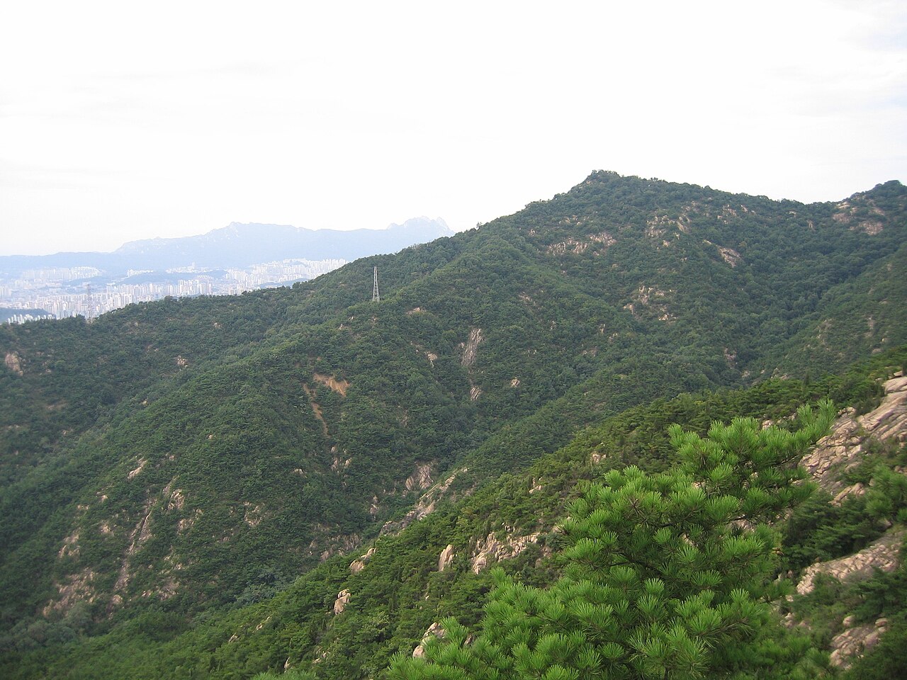
Achasanseong is a historic mountain fortress on Achasan Mountain in Seoul. Its defensive position links the site’s cultural interest with the surrounding terrain: the mountain itself forms part of the experience, not merely the setting. The fortress represents Korean military architecture shaped by elevation, visibility, and the use of natural slopes. Visitors come for a combination of heritage, walking, and landscape rather than for a single intact palace building. The site fits travelers who enjoy historical remains outdoors and are prepared for a mountain route with uneven ground and changing conditions.
Checked 2026-08-26 · Source
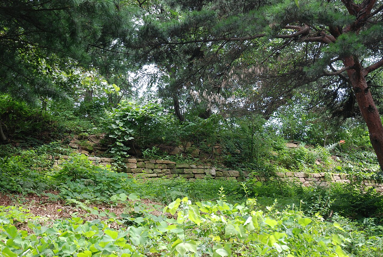
Achasanseong is experienced through its surviving fortress landscape: defensive wall remnants, stonework, mountain paths, and the relationship between built defenses and the slopes around them. Do not expect a palace interior filled with rooms and displays. The value lies in reading the terrain and recognizing how walls used the high ground for surveillance and protection. Vegetation, rock, and changing views form part of the site’s character. Move slowly enough to notice foundations, wall lines, and changes in elevation, while keeping clear of fragile remains and respecting the historic fabric.
Checked 2026-08-26 · Source
Allow several hours if you want to combine the fortress remains with a meaningful walk on Achasan Mountain. A shorter visit can focus on the nearest accessible sections, while a longer route gives more time for slopes, viewpoints, and close observation of the defensive landscape. Your pace depends on fitness, weather, footwear, and trail conditions. Start early enough to return before daylight fades. Build pauses into the route, particularly at steeper sections. Achasanseong is not a quick roadside monument; the mountain approach shapes both the effort and the reward.
Checked 2026-08-26 · Source
Spring and autumn offer comfortable conditions for a mountain heritage walk, with milder temperatures and seasonal scenery around the paths. Summer can bring heat, humidity, and rain, while winter may add cold, snow, or ice to exposed and uneven sections. Set out in daylight and allow time for the descent. After rain, mud and slick stone can slow the route. Choose a clear-weather day when you want distant views across Seoul, but remember that changing mountain conditions can still affect comfort. The best timing is the one that matches your walking ability and daylight.
Checked 2026-08-26 · Source
Achasanseong is a mountain fortress landscape rather than a conventional enclosed attraction. Plan the visit as an outdoor heritage walk, with time and equipment directed toward the trail and the remains. Carry water and suitable footwear, and keep a small reserve of daylight for returning from higher ground. The route’s physical demands matter more to the experience than adding a rapid sequence of nearby attractions. Avoid treating the site as a formal museum stop with a single entrance moment; the defensive walls, paths, and mountain setting are the things to explore.
Checked 2026-08-26 · Source
Reach the Achasan area through Seoul’s public transport network, then expect walking and an uphill approach toward the mountain fortress. Use Achasanseong and 아차산성 in a current navigation service to identify the route and the nearest practical trail approach. Subway, buses, and taxis can bring you into the surrounding urban area, but the final stage is a mountain walk rather than a vehicle journey to the remains. Save the route before leaving the city streets, and allow additional time for finding the trail and returning to transport after the visit.
Checked 2026-08-26 · Source
Uneven ground, steep sections, loose surfaces, and wet stone make sturdy footwear important at Achasanseong. Carry water because the mountain route should not be treated like a street-level attraction with services at every turn. Heat and humidity can drain energy in summer, while ice or snow can reduce footing in winter. Stay on established paths and do not climb or lean against historic walls. Keep distance from edges and tell someone your intended route if walking alone. Take wildlife and sudden weather changes in stride, and turn back when conditions exceed your comfort or ability.
Checked 2026-08-26 · Source
Achasanseong rewards photographs that show both the fortress remains and the mountain terrain that made the defensive position meaningful. Use wider compositions to connect wall lines, vegetation, slopes, and Seoul views; move closer for masonry and surviving structural details. Early morning and late afternoon light can give stonework more texture, while clear weather improves distant city views. Pause safely away from narrow paths before taking photographs. Keep equipment light for the climb, and avoid tripods or aerial equipment where they could obstruct walkers, damage vegetation, or conflict with site rules.
Checked 2026-08-26 · Source
Achasanseong is a historic mountain fortress on Achasan Mountain in Seoul, combining defensive remains, walking paths, and elevated landscape views.
Allow several hours for a route that includes the fortress landscape and a mountain walk. A shorter visit can focus on the nearest accessible remains.
The visit includes surviving defensive wall and stonework, mountain paths, vegetation, changing elevations, and views across the Seoul landscape.
Bring sturdy footwear, water, weather-appropriate clothing, and enough daylight for the return route. These basics matter because the site is reached on foot across mountain terrain.
It is better suited to a planned outdoor heritage walk than to a brief stop. The mountain approach and uneven paths form an important part of the experience.
Spring and autumn offer milder conditions for walking. Summer brings heat, humidity, and rain, while winter can bring cold, snow, or ice to the mountain paths.
Loading the interactive map…
The interactive map could not be loaded.
Last updated:
Source: OpenStreetMap contributors, Wikidata ·