2 min walk
N Seoul Tower
- Must see · Heritage site
- Historic monument
Language · 11 published
Viewpoint · Seoul
남산
Reviewed by Elena Voss · Roavina Travel Editor

This place is a Peak.
Namsan is a wooded mountain in central Seoul and one of the city’s most recognizable natural landmarks. Its slopes rise amid the capital’s dense neighborhoods, giving visitors a chance to combine urban sightseeing with a substantial outdoor walk. The mountain is closely associated with N Seoul Tower, panoramic viewpoints, trails, monuments, and the distinctive experience of looking across Seoul from a green hill at the center of the metropolis. Namsan is a prominent peak in central Seoul, South Korea, with the local name 남산. It rises within the city boundaries and forms a recognizable natural landmark visible from many districts. The mountain has cultural and historical associations with the capital, serving as a recreational and symbolic site for residents and visitors. Its slopes and summit area host several notable structures and viewpoints that draw consistent public interest throughout the year. The cable car provides mechanized ascent, but summit areas and observation decks may present accessibility challenges. Trail access is generally not suitable for wheelchairs or significant mobility limitations.
Checked 2026-08-26 · Source
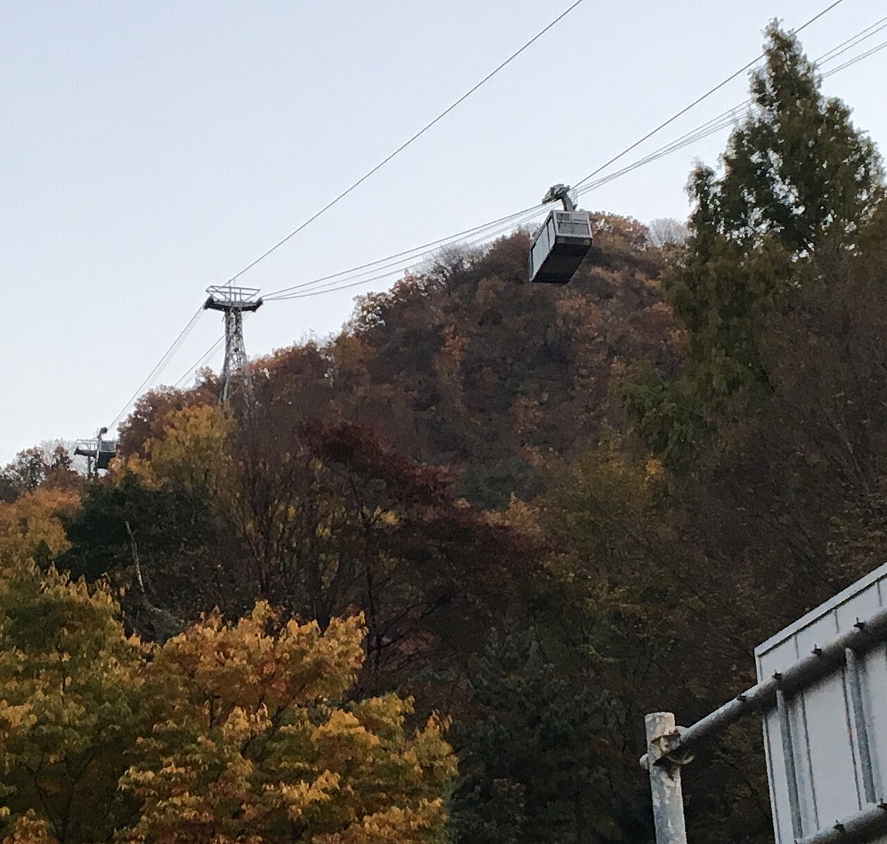
Namsan includes forested walking paths, landscaped park areas, exercise equipment, monuments, wooden pagoda structures, and remnants of fortress walls. N Seoul Tower rises above the summit and contains observation decks, restaurants, and retail spaces. A cable car links the lower mountain with the summit area, giving visitors an alternative to walking the full ascent. The mountain’s vegetation and city-facing clearings create a varied outing within central Seoul. The summit of Namsan contains N Seoul Tower, a communications and observation tower that dominates the skyline. The surrounding parkland includes walking trails, exercise equipment, and landscaped areas. Visitors encounter wooden pagoda structures, fortress wall remnants, and various monuments. The tower complex contains observation decks, restaurants, and retail spaces. Cable car infrastructure connects lower elevations to the summit. The mountain supports diverse vegetation and provides habitat for urban wildlife within the dense metropolitan environment. A flexible visit lets travellers connect Namsan with the rest of the day without treating one room, viewpoint or photograph as the whole experience.
Checked 2026-08-26 · Source
A half day suits visitors who want to walk through the park, reach the summit, spend time around N Seoul Tower, and enjoy the city views without rushing. The cable car shortens the ascent, while walking from neighborhoods such as Myeongdong or Itaewon creates a more active visit. Add time for observation decks, dining, illuminated views, or a slower return through the wooded trails.
Checked 2026-08-26 · Source
Spring brings flowering vegetation and mild walking conditions, while autumn adds colorful foliage and often clearer air. Summer can be humid and rainy, affecting trails and distant visibility. Winter makes the exposed summit colder and may leave icy sections on paths. Daytime is suited to the trails and landscape; evening is popular for illuminated city panoramas. Crowds tend to gather around the tower, viewpoints, and cable-car areas.
Checked 2026-08-26 · Source
The mountain paths and parkland form the freely experienced outdoor part of Namsan, while N Seoul Tower observation areas and the cable car are separate developed attractions. A visitor can therefore enjoy the mountain without choosing every paid feature, or build a fuller summit visit around the tower. Dining and retail are concentrated in the tower complex. Costs depend on which combination of walking, cable-car travel, and tower access you choose.
Checked 2026-08-26 · Source
Namsan can be approached on foot from Myeongdong, Itaewon, and neighboring central Seoul districts. Public buses reach areas near trailheads and the cable-car station. The cable car provides a mechanically assisted ascent from its lower terminal, while taxis are useful for reaching base areas. Private cars are less convenient because summit and mid-mountain parking is constrained. Choose the route according to whether you want a hike or a quick summit arrival.
Checked 2026-08-26 · Source
Trail surfaces vary from paved paths to uneven mountain sections, and slopes can be tiring. Summit viewpoints and cable-car terminals become crowded at busy times. Weather changes affect comfort and visibility, particularly during humid summer conditions. After dark, a trail descent requires more care on uneven surfaces, so the cable car or another developed route may be preferable when available. Carry water for the wooded approaches, where developed facilities are less concentrated.
Checked 2026-08-26 · Source
Namsan offers several distinct photographic subjects: the tower structure, wooded trails, fortress-wall remnants, and Seoul’s layered skyline. The summit is especially effective for wide city views, while evening brings a field of illuminated buildings. Spring foliage and autumn color change the mountain’s foreground character. Humid haze can reduce distant detail. Prime viewpoints become crowded, so patience and compact equipment help when photographing around railings and pedestrian areas.
Checked 2026-08-26 · Source
Namsan is known for its central wooded mountain, N Seoul Tower, walking trails, historic remnants, and panoramic views across Seoul.
Yes. The cable car provides a mechanically assisted ascent, and buses reach areas near lower trailheads and the cable-car station.
The summit area includes N Seoul Tower, observation facilities, restaurants, retail spaces, parkland, and broad views over Seoul.
A half day allows time for the trails, summit area, tower surroundings, viewpoints, and a relaxed ascent or descent.
Evening visits are popular for illuminated panoramas of Seoul, with the summit and tower providing the main developed viewpoints.
Myeongdong, Itaewon, and nearby central Seoul districts provide walking approaches with different distances and degrees of uphill effort.
Loading the interactive map…
The interactive map could not be loaded.
Last updated:
Source: OpenStreetMap contributors, Wikidata ·