
3 min walk
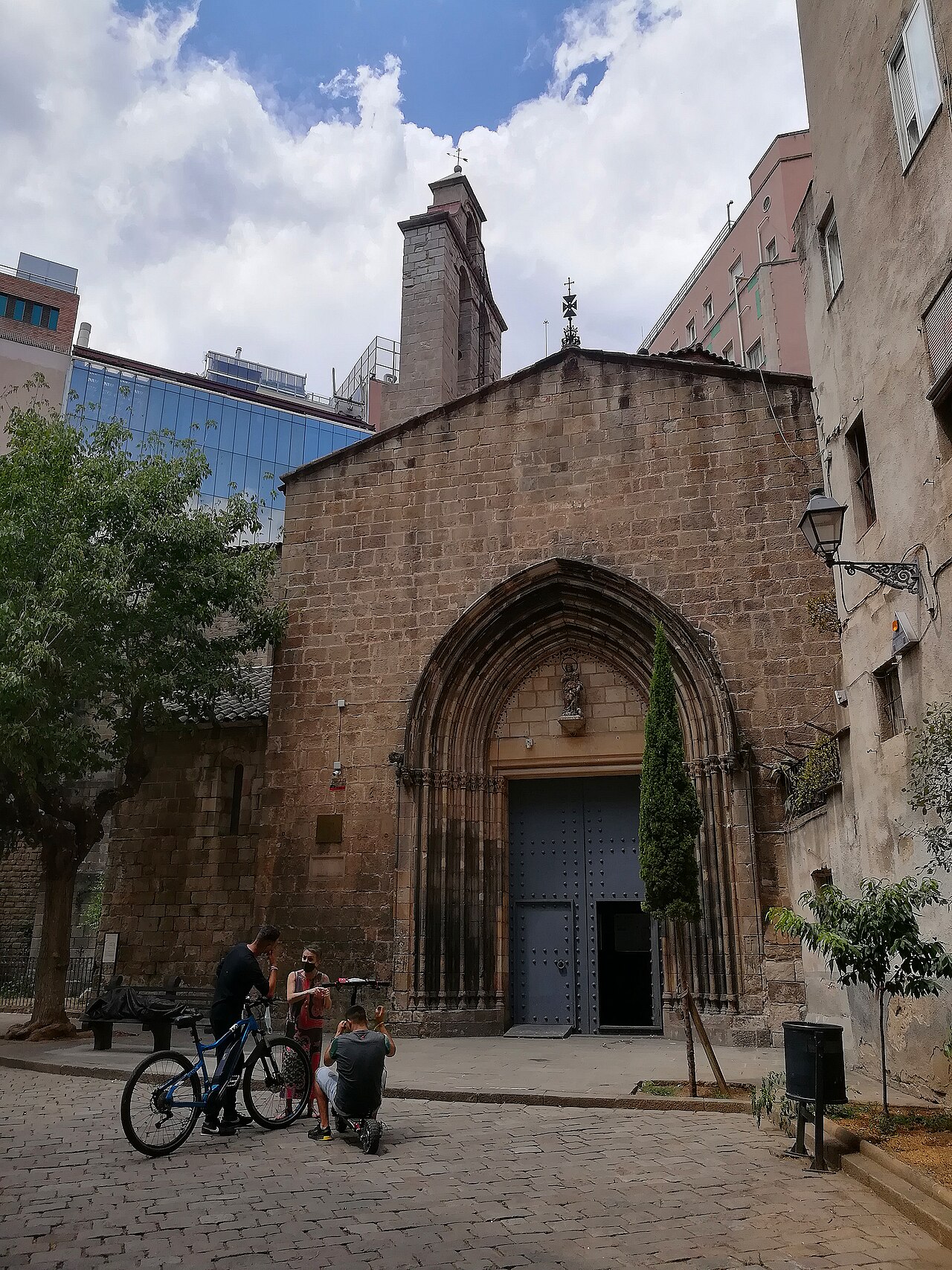
Church of Santa Ana
- Must see · Heritage site
- Place of worship
Language · 11 published
Historic monument · Barcelona
Via Sepulcral Romana
Closed today, Saturday. Next open Sunday at 11:00 — the planner will not place a stop here on a Saturday.
Plan around itReviewed by Elena Voss · Roavina Travel Editor
| Monday | Closed |
|---|---|
| Tuesday | 11:00 – 14:00 |
| Wednesday | Closed |
| Thursday | Closed |
| Friday | Closed |
| Saturday | Closed |
| Sunday | 11:00 – 19:00 |
Closed to visitors between 15:00 – 16:00
Parsed from OpenStreetMap opening hours on 2026-09-09.
This place is a Attraction. It carries the bien de interés cultural heritage designation. It is run by Museu d'Història de Barcelona.
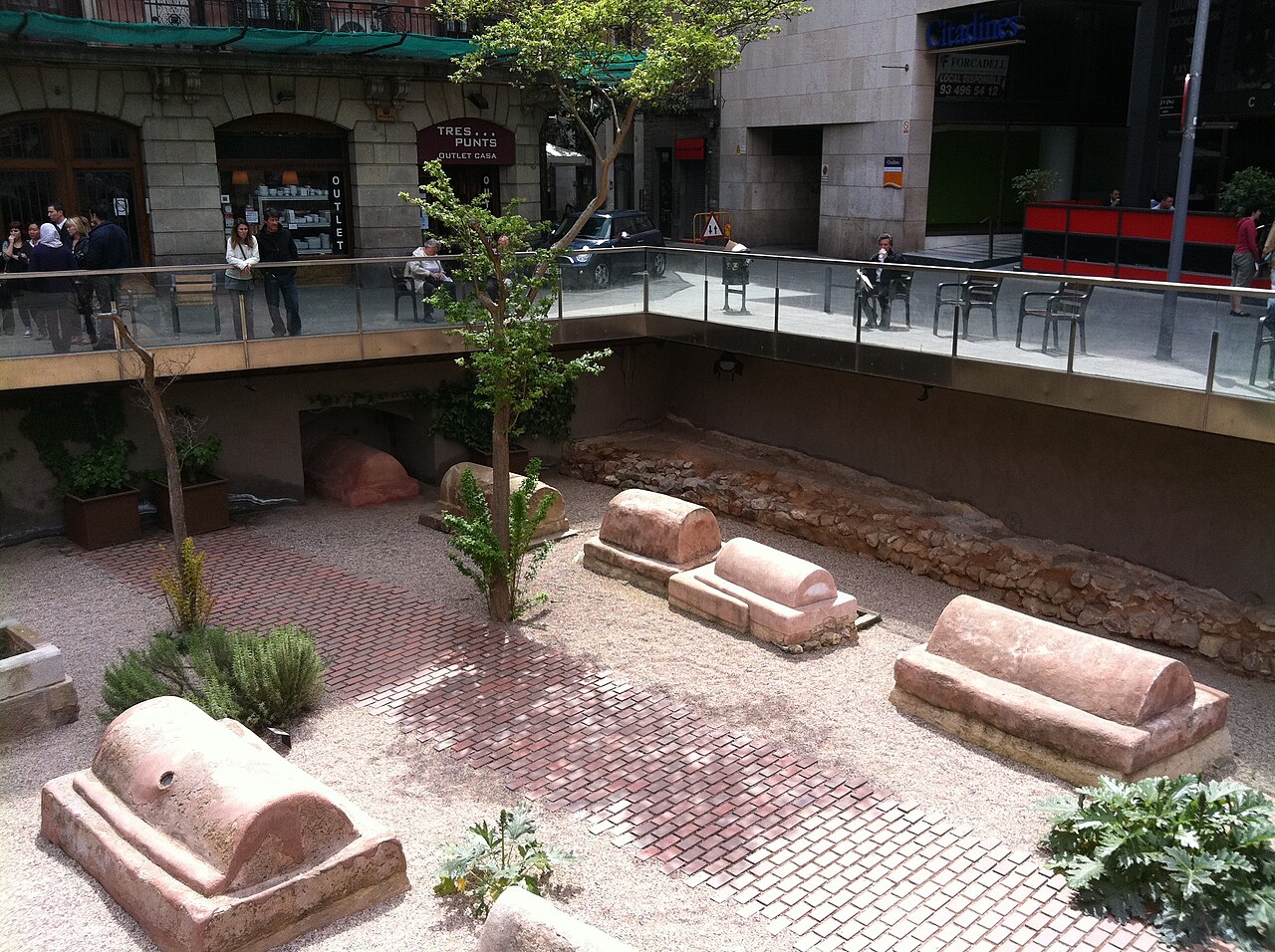
The Via sepulcral Romana de la plaça de la Vila de Madrid preserves part of a Roman funerary road in Barcelona's Ciutat Vella. The tombs stood outside the walls of Barcino, following Roman burial customs that placed cemeteries beyond the urban boundary. Today the remains offer a compact view of Barcelona's Roman origins beneath and around the historic city. Include the site in a Gothic Quarter archaeology walk, where the contrast between Roman burial monuments and later medieval streets makes the city's layered history especially clear. The Via Sepulcral Romana is an archaeological site preserving a section of Roman burial road. Located beneath the Plaça de la Vila de Madrid in Barcelona's Ciutat Vella district, it displays tombs and funerary monuments that lined the ancient approach to the Roman city of Barcino.
Checked 2026-08-26 · Source
The site presents stone funerary monuments and tomb structures arranged beside the ancient roadbed. Their position illustrates how travellers entering Barcino would have encountered burial monuments along the approach to the city. The remains are structural archaeological evidence rather than a furnished interior or a large collection gallery. Read the arrangement as a Roman necropolis: the road, burial plots and monuments together explain the relationship between movement, memory and the city beyond its walls. The compact presentation rewards attention to layout and construction.
Checked 2026-08-26 · Source
Allow around twenty to thirty minutes for a focused look at the visible Roman remains. The site is compact, so the visit centres on reading the road, tombs and funerary arrangement rather than moving through many rooms. Travellers with a strong interest in Roman archaeology can spend longer examining monument forms and construction. Combine the stop with other historic places in Ciutat Vella or the Gothic Quarter to turn a short archaeological encounter into a fuller half-day exploration of Barcelona's ancient and medieval layers.
Checked 2026-08-26 · Source
Place the Via sepulcral Romana within a daytime route through Barcelona's historic centre. The guide gives no fixed visitor timetable, so the site works best as one stop among several Roman and medieval sights. Morning can offer a calmer rhythm for studying the remains, while the surrounding Ciutat Vella remains useful throughout the day. The compact scale makes it easy to connect with nearby streets, plazas and archaeological landmarks. Plan enough outdoor walking time between stops, since the history is distributed across the old city.
Checked 2026-08-26 · Source
The guide describes the site as an archaeological presentation in Plaça de la Vila de Madrid but gives no admission amount or ticket structure. Treat it as a compact heritage stop within a wider Ciutat Vella itinerary. Its value lies in the preserved Roman road and funerary monuments, so you can combine it naturally with other historic sights rather than planning a separate excursion. Keep the visit flexible and allow room for the surrounding Gothic Quarter, where additional Roman remains and later architecture continue the same historical story.
Checked 2026-08-26 · Source
The Via sepulcral Romana lies at Plaça de la Vila de Madrid in Barcelona's historic core. Walking from the Cathedral or La Rambla is practical within the compact Ciutat Vella street network, and the surrounding Gothic Quarter is best explored on foot. Metro and bus services connect the wider district, though the guide does not name a nearest station or stop. Narrow lanes can make wayfinding slower than the map suggests. Build the site into a sequence of nearby historical stops instead of treating it as a remote destination.
Checked 2026-08-26 · Source
The archaeological setting calls for careful movement and respectful distance from the preserved remains. Ancient surfaces can be uneven, and the viewing area may feel confined, so wear practical shoes and move patiently. Keep personal belongings secure in a compact urban attraction. The guide does not detail mobility access or visitor facilities, making the wider route important when planning comfort breaks. Avoid touching stones or monuments, and give other visitors room to observe the funerary structures without obstruction.
Checked 2026-08-26 · Source
The Roman road and funerary monuments make strong subjects for close architectural and archaeological photography. Work with the available light and limited angles, and keep equipment compact so the viewing area remains clear. Avoid touching the remains while composing images, and follow any signs governing flash or other equipment. Wider photographs of Plaça de la Vila de Madrid can show how the Roman necropolis sits within modern Barcelona. A few carefully framed images will communicate the site's layout better than a long sequence of similar details.
Checked 2026-08-26 · Source
It preserves part of a Roman funerary road with stone tombs and burial monuments.
It is located at Plaça de la Vila de Madrid in Barcelona's Ciutat Vella.
Roman burial customs placed cemeteries outside the walls of the urban settlement.
A focused visit takes about twenty to thirty minutes.
The Gothic Quarter and the wider Ciutat Vella make natural companions for a Roman history walk.
Observe the roadbed, the orderly burial arrangement and the relationship between the monuments and ancient Barcino.
Loading the interactive map…
The interactive map could not be loaded.
Last updated:
Source: OpenStreetMap contributors, Wikidata ·