
3 min walk
Greek Theatre of Termessos
- High
- Historic monument
Language · 11 published
Historic monument · Antalya
Termessos
Reviewed by Elena Voss · Roavina Travel Editor
| Monday | 08:00 – 19:00 |
|---|---|
| Tuesday | 08:00 – 19:00 |
| Wednesday | 08:00 – 19:00 |
| Thursday | 08:00 – 19:00 |
| Friday | 08:00 – 19:00 |
| Saturday | 08:00 – 19:00 |
| Sunday | 08:00 – 19:00 |
Checked 2026-08-31 · Source
Read from the OpenStreetMap access tags; anything not listed has no tag recorded.
Set the group type to family in the planner and the day window contracts to about three quarters of a solo day.
This place is a Archaeological site.
Termessos is a Pisidian city on a natural platform about a thousand metres up the south-western flank of Güllük Dağı, the ancient Mount Solymos, in the Taurus range north-west of Antalya. The mountain behind it rises to 1,665 metres. Its people called themselves the Solymi, a name Homer attached to the region in the Bellerophon story, and the city is best known for what did not happen to it. Termessos has never been formally excavated. Daily 08:00–19:00. The ticket office closes at 17:00. The site is open every day, with no weekly closure day.
Checked 2026-08-31 · Source
The Ministry's own description walks the site in the order the path takes it. From the car park the climb begins, and the steps and monumental entrance of an Ionic temple built in the reign of Hadrian stand on the right-hand side. The drainage canals beside it are intact enough to read the sewerage network off them. Higher up, on level ground, stand the official buildings. The agora comes first. The ticket office closes at 17:00. The site is open every day, with no weekly closure day. General foreign-visitor admission is €3. Müzekart is valid for eligible Turkish citizens.
Checked 2026-08-31 · Source
Allow three hours. Neither the Ministry of Culture and Tourism nor the national park publishes a suggested visit length for Termessos, so three hours is this guide's judgement rather than a figure read off an official page. The time goes on the climb. Ninety minutes is enough to reach the agora and the theatre and come back down, and nothing more than that. General foreign-visitor admission is €3. Müzekart is valid for eligible Turkish citizens. Access to the archaeological remains requires an uphill footpath from the car park; the official description repeatedly directs visitors to continue climbing through the site.
Checked 2026-08-31 · Source
The site is open every day. The Ministry lists opening at 08.00 and closing at 19.00, with no closed day and no midday break, and the ticket office closing at 17.00. Go early. Winter is possible and often clear, but the mountain takes rain that the coast does not, and wet limestone underfoot turns slick. Daily 08:00–19:00. Access to the archaeological remains requires an uphill footpath from the car park; the official description repeatedly directs visitors to continue climbing through the site.
Checked 2026-08-31 · Source
Entry costs three euros for foreign visitors. That figure is the Ministry's own tariff, published by DÖSİMM, the revolving-fund directorate that sets museum and archaeological-site prices for the Ministry of Culture and Tourism, where the entry reads ANTALYA TERMESSOS ÖRENYERİ. It is charged per person. Termessos is not sold through the Ministry's e-ticket system. General foreign-visitor admission is €3. Müzekart is valid for eligible Turkish citizens. Access to the archaeological remains requires an uphill footpath from the car park; the official description repeatedly directs visitors to continue climbing through the site.
Checked 2026-08-31 · Source
A car is effectively necessary. The Ministry's own directions put the turning at the twenty-fourth kilometre of the Antalya–Korkuteli road, where a dedicated road leaves on the left and climbs into the national park, and the address it gives is Bayatbademleri, Güllük Dağı, Termessos Milli Parkı. Take the Antalya–Korkuteli highway and turn left onto the dedicated Termessus access road at kilometre 24, then continue to the car park. From the car park, reach the ruins on foot via the uphill trail. The responsible bodies' published arrival directions do not name a bus, tram or rail service to the site.
Checked 2026-08-31 · Source
This is an unexcavated mountain site with almost no infrastructure, and its hazards are physical rather than administrative. The ground is broken limestone and loose scree, and the rock-cut steps have been worn smooth by two thousand years of feet. Trainers are the minimum and boots with ankle support are better. Access to the archaeological remains requires an uphill footpath from the car park; the official description repeatedly directs visitors to continue climbing through the site. Termessus is open daily from 08:00 to 19:00. The ticket office closes at 17:00, two hours before the archaeological site closes.
Checked 2026-08-31 · Source
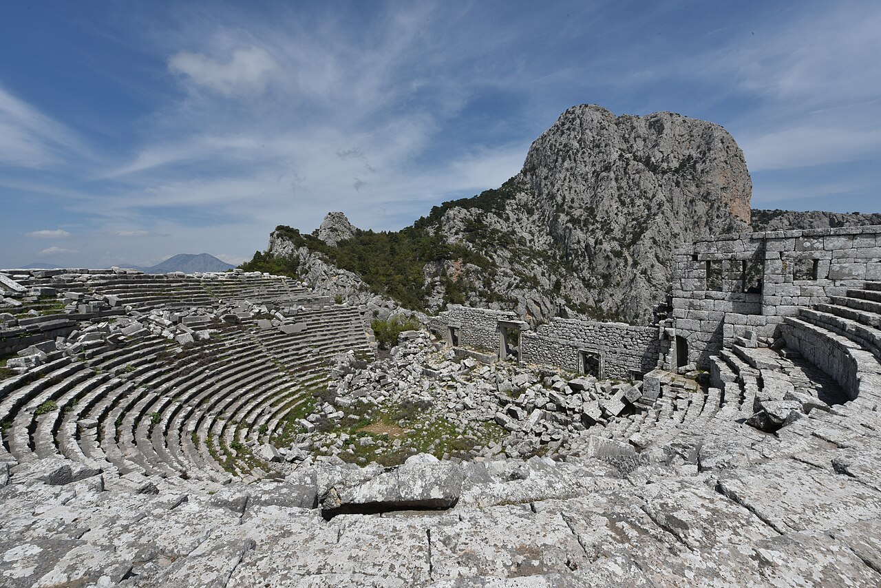
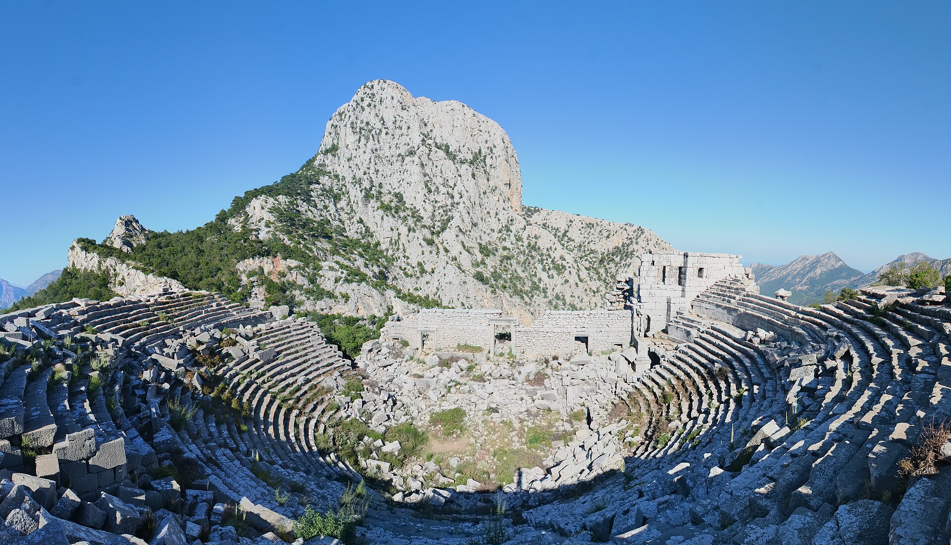
The theatre is the photograph almost everyone comes for, and it works because of what lies behind it rather than what stands in it: the seating is cut into the slope, and the gap where the stage building has fallen opens straight onto the Pamphylian plain and the Gulf of Antalya. Shoot it in the morning, with the sun behind the camera, when shadow still picks out the tiers of seats. The ticket office closes at 17:00, two hours before the archaeological site closes. No. The operator lists Termessus as open every day.
Checked 2026-08-31 · Source
Termessus is open daily from 08:00 to 19:00.
The ticket office closes at 17:00, two hours before the archaeological site closes.
No. The operator lists Termessus as open every day.
General foreign-visitor admission is €3; Müzekart is valid for eligible Turkish citizens.
Turn from the Antalya–Korkuteli highway onto the dedicated access road at kilometre 24, drive to the car park, then follow the uphill footpath to the ancient city.
The day-use area provides parking, toilets, a visitor centre, picnic tables, a buffet, drinking fountains, a prayer room and a children's playground.
Loading the interactive map…
The interactive map could not be loaded.
Last updated:
Source: OpenStreetMap contributors, Wikidata ·