
2 min walk · Fatih
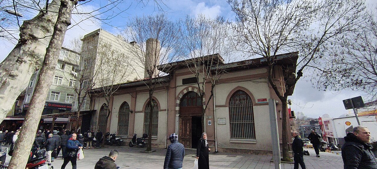
Tezgahçılar Mosque
- Notable · Heritage site
- Place of worship
Historic monument · Fatih, Istanbul
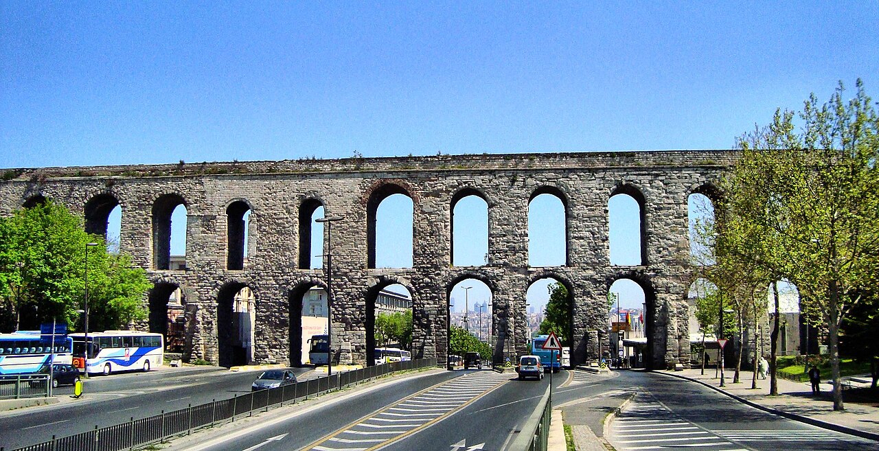
Bozdoğan Su Kemeri
| Monday | 00:00 – 23:59 |
|---|---|
| Tuesday | 00:00 – 23:59 |
| Wednesday | 00:00 – 23:59 |
| Thursday | 00:00 – 23:59 |
| Friday | 00:00 – 23:59 |
| Saturday | 00:00 – 23:59 |
| Sunday | 00:00 – 23:59 |
Checked 2026-08-31 · Source
| Per person | TRY 0.00 |
|---|
Checked 2026-08-31 · Source
Read from the OpenStreetMap access tags; anything not listed has no tag recorded.
Set the group type to family in the planner and the day window contracts to about three quarters of a solo day.
Bozdoğan Kemeri, the Aqueduct of Valens, is the surviving bridge of the water system that made a city of a million people possible on a peninsula with almost no rivers. Construction began under Constantius II, who reigned from 337 to 361, and the aqueduct was completed in 373 under the emperor Valens, whose name English attaches to it. Its first phase gathered water from springs at Danımandere and Pınarca along 268 kilometres of conduit, and a fifth-century extension added a further 451 kilometres reaching back to Vize, 120 kilometres away. Yes. It is viewed from public streets. Pavements and signal-controlled crossings provide step-free viewpoints, but traffic is heavy and visitors cannot enter or climb the masonry. Aqueduct of Valens: The aqueduct is an outdoor urban monument visible 24 hours daily; Atatürk Boulevard passes through its arches, while conservation or road works can restrict the pavements. Viewing the aqueduct from public streets is free. Pavements and signal-controlled crossings provide step-free viewpoints, but traffic is heavy and visitors cannot enter or climb the masonry. Vezneciler M2 station is a short walk south; frequent IETT buses use Atatürk Boulevard beneath the aqueduct. Operational facts for Aqueduct of Valens: The aqueduct is an outdoor urban monument visible 24 hours daily; Atatürk Boulevard passes through its arches, while conservation or road works can restrict the pavements. Viewing the aqueduct from public streets is free. Access and arrival for Aqueduct of Valens: Pavements and signal-controlled crossings provide step-free viewpoints, but traffic is heavy and visitors cannot enter or climb the masonry. Vezneciler M2 station is a short walk south; frequent IETT buses use Atatürk Boulevard beneath the aqueduct.
Checked 2026-08-31 · Source
There is no inside. The aqueduct is a wall of arches with a water channel along its spine, and every part of it that a visitor can reach is exterior. What rewards attention is the masonry itself, which is a legible record of sixteen centuries of patching. The arches are not uniform: the Turkish record notes that arches 18 to 73 are double-tiered while the rest carry a single tier. Ottoman sultans kept the line alive rather than treating it as a ruin. No regular hours apply to the outdoor monument. Vezneciler M2 station is a short walk south; frequent IETT buses use Atatürk Boulevard beneath the aqueduct.
Checked 2026-08-31 · Source
Twenty minutes is the honest figure, and it is a photo stop rather than a visit. Nothing here is enterable, there is no circuit to walk and no interior sequence to follow, so the time is spent choosing a vantage point, reading the masonry from that point, and crossing the road once to see the arches from the other side. No. The water channel and masonry are not a public walkway.
Checked 2026-08-31 · Source
The aqueduct is an outdoor urban monument visible 24 hours daily; Atatürk Boulevard passes through its arches, while conservation or road works can restrict the pavements. Worship, weather, restoration and events can replace ordinary access. Yes from pavement viewpoints and crossings, though traffic makes the setting demanding.
Checked 2026-08-31 · Source
Viewing the Aqueduct of Valens from Atatürk Boulevard and surrounding public pavements is free. There is no entrance gate, interior gallery or wall-top ticket. Road traffic passes through the surviving arches, so the practical visit uses street-level viewpoints. Guided walks cost separately and conservation barriers must remain clear even when they narrow the pavement.
Checked 2026-08-31 · Source
Vezneciler M2 station is a short walk south; frequent IETT buses use Atatürk Boulevard beneath the aqueduct. Use the named entrance, stop or pier because hills, controlled sites and narrow historic streets change the practical approach. Vezneciler on M2 is the nearest station.
Checked 2026-08-31 · Source
Pavements and signal-controlled crossings provide step-free viewpoints, but traffic is heavy and visitors cannot enter or climb the masonry. Yes. It is viewed from public streets. No regular hours apply to the outdoor monument. No. The water channel and masonry are not a public walkway. Historic surfaces, crowds and security remain relevant. The aqueduct is an outdoor urban monument visible 24 hours daily; Atatürk Boulevard passes through its arches, while conservation or road works can restrict the pavements.
Checked 2026-08-31 · Source
Saraçhane Park in the late afternoon is the vantage point worth walking to. From there the arches read as a receding line rather than a flat wall, the park's trees give a foreground that sets the scale, and the low sun rakes across the stonework so the different repair campaigns separate visually into their own tones. A wide lens is close to essential; anything long will only ever show three arches and lose the fact that this thing marches across a valley. Viewing the aqueduct from public streets is free.
Checked 2026-08-31 · Source
Yes. It is viewed from public streets.
No regular hours apply to the outdoor monument.
No. The water channel and masonry are not a public walkway.
Yes from pavement viewpoints and crossings, though traffic makes the setting demanding.
Yes. Atatürk Boulevard runs beneath surviving arches.
Vezneciler on M2 is the nearest station.
Loading the interactive map…
The interactive map could not be loaded.
Last updated:
Source: OpenStreetMap contributors, Wikidata ·