_(10772382303).jpg)
07
1 hour
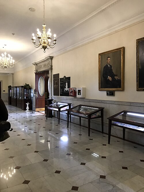
Massachusetts State House
The Massachusetts State House serves as the seat of government for the Commonwealth of Massachusetts.
- Must see
- Historic monument
City guide · United States
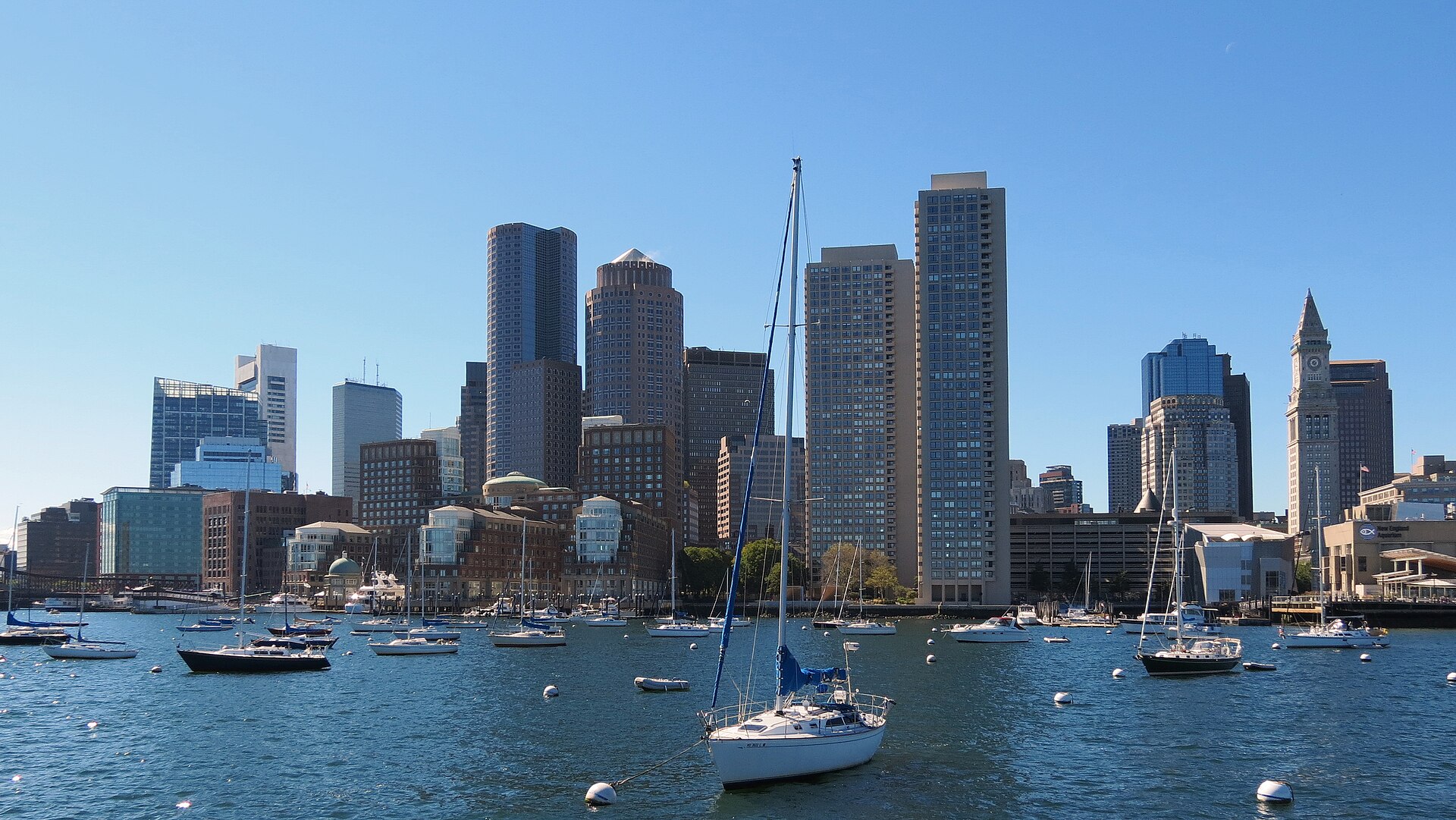
Boston is compact at its historic centre but extends into a network of distinct neighbourhoods and neighbouring municipalities. Downtown, Beacon Hill, Back Bay,...
Photograph · Robert Linsdell from St. Andrews, Canada · CC BY 2.0
Set your days, your pace and the hours you actually want to be out. The planner works around closing days and travel time, and leaves room to eat.
Reviewed by Elena Voss · Roavina Travel Editor
Boston is compact at its historic centre but extends into a network of distinct neighbourhoods and neighbouring municipalities. Downtown, Beacon Hill, Back Bay, the North End and the waterfront form the main walking core. Fenway, the Seaport and Jamaica Plain require separate trips, while Cambridge sits across the Charles River. Group the oldest central districts on foot and use the regional transit network for everything beyond them.
Checked 2026-08-26
September · September combines a 22.4°C mean high with Boston's lowest normal rain-day count, making it one of the city's strongest months.
Ranked by importance — sitelinks, pageviews and heritage status, not editor preference.
49 places match
Category
Typical visit duration
Interests
The Massachusetts State House serves as the seat of government for the Commonwealth of Massachusetts.
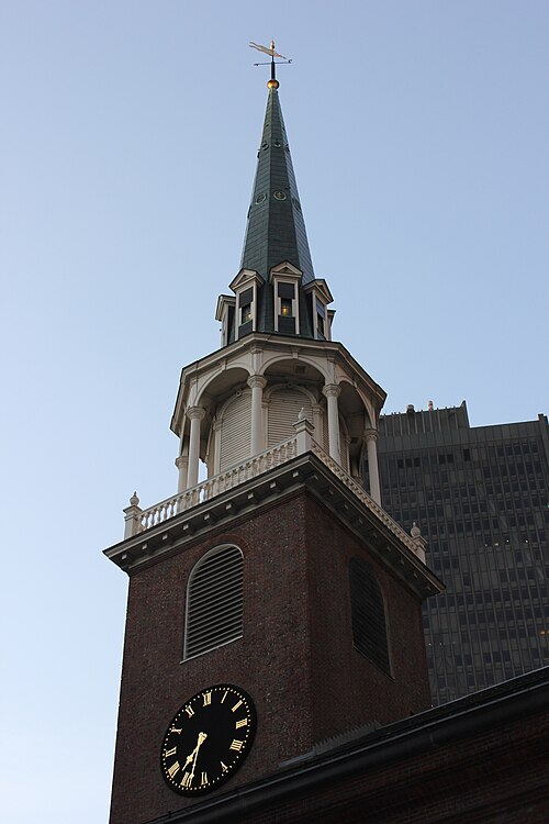
Old South Meeting House is a historic church building in Boston, Massachusetts. Built in 1729, it served as a Puritan meeting house and later became famous as a gathering place for political debate before the American Revolution.

The Prudential Tower is a 52-story skyscraper in Boston's Back Bay neighborhood, completed in 1964 as part of the larger Prudential Center complex.
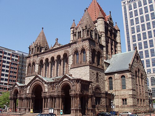
Trinity Church is a Richardsonian Romanesque landmark located on Copley Square in Boston. The building represents a significant example of 19th-century American church architecture, designed by Henry Hobson Richardson.
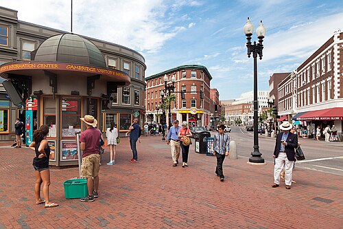
Harvard Square is a triangular plaza at the intersection of Massachusetts Avenue, Brattle Street, and John F. Kennedy Street in Cambridge, Massachusetts. It functions as the principal pedestrian and cultural hub surrounding Harvard University.
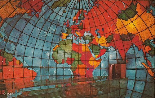
The Mapparium
Mapparium is a three-storey stained-glass globe inside the Christian Science complex in Boston’s Back Bay. Visitors enter the globe and stand within a world map, viewing countries, borders, and oceans from the inside of a hollow sphere.
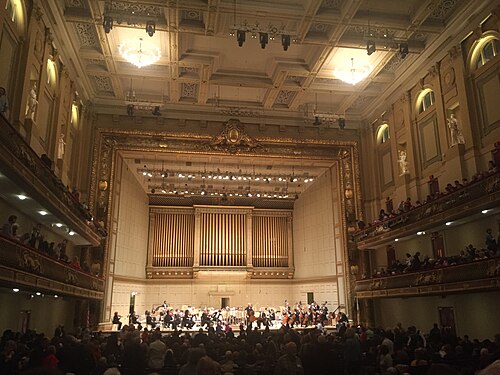
Symphony Hall is a concert hall in Boston, Massachusetts, serving as the home of the Boston Symphony Orchestra. The venue opened in 1900 and was designed by McKim, Mead & White.
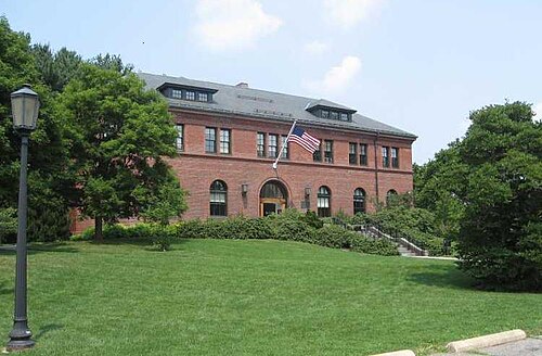
Arnold Arboretum is a botanical research institution and public park in Boston, Massachusetts. Established in 1872, it serves as Harvard University's living collection of woody plants.
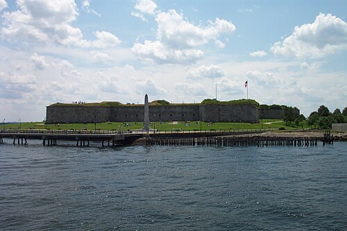
Castle Island is a 22-acre landmass connected to South Boston by a narrow causeway, forming a peninsula in Boston Harbor.
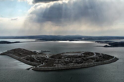
Spectacle Island is one of the Boston Harbor Islands, located in Massachusetts Bay. It is a publicly accessible island managed as part of the Boston Harbor Islands National and State Park.
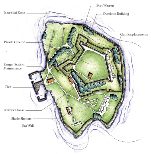
Georges Island is a harbor island in Boston Harbor, Massachusetts. The island is dominated by Fort Warren, a historic military fortification that played significant roles in American coastal defense.

The Charles River Esplanade is a central riverside park and outdoor-events landscape along the Boston shore of the Charles River. It functions as a linear public park system extending from the Boston Museum of Science to the Boston University Bridge.
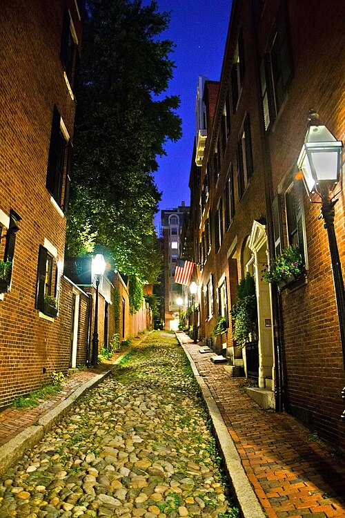
Acorn Street is a historic cobblestone lane in Boston's Beacon Hill neighborhood. It is widely regarded as one of the most photographed streets in the United States due to its distinctive Federal-style row houses, gas lamps, and narrow brick-paved thoroughfare.
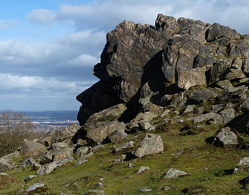
Beacon Hill is a historic residential neighbourhood in central Boston, Massachusetts. It sits directly north of Boston Common and the Boston Public Garden. The district is renowned for its well-preserved Federal-style rowhouses, narrow gaslit streets, and brick sidewalks.
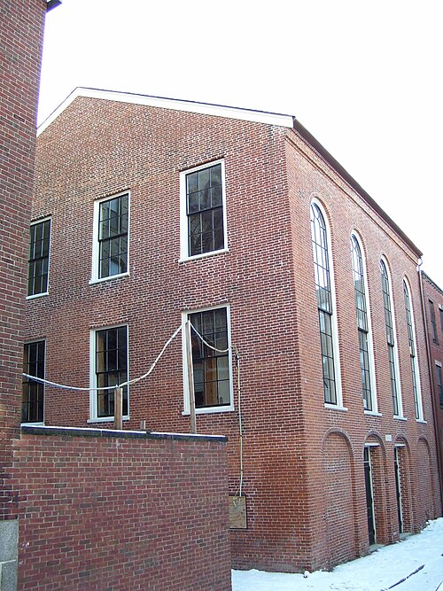
The African Meeting House is a historic church building on Beacon Hill in Boston, Massachusetts. Constructed in 1806, it is recognized as the oldest extant Black church building in the United States.
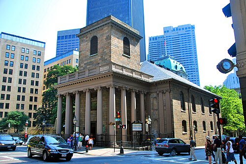
Kings Chapel
King's Chapel is a historic Anglican congregation in Boston, Massachusetts. Founded in 1686, it was the first Anglican church in New England during a period of Puritan dominance.
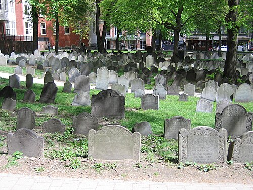
The Granary Burying Ground is a historic cemetery in Boston, Massachusetts. Established in 1660, it is the third-oldest cemetery in the city and holds significant importance in American history.
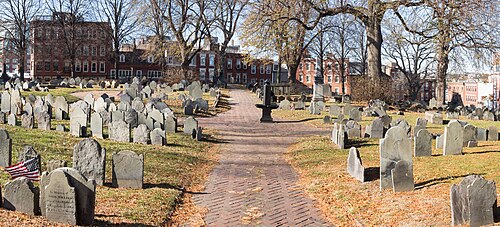
Copp's Hill Burying Ground is a historic colonial cemetery in Boston's North End. Established in 1659, it is the city's second-oldest burying ground.
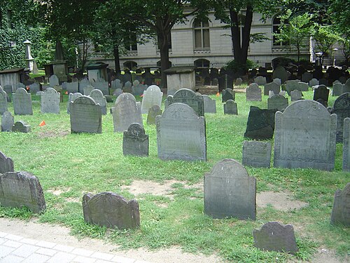
Kings Chapel Burying Ground
King's Chapel Burying Ground is Boston's oldest cemetery, established in 1630. It sits beside King's Chapel on Tremont Street along the Freedom Trail. The burying ground served as Boston's sole cemetery for three decades before additional burial grounds opened.
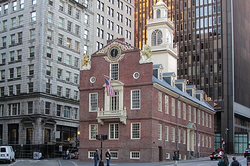
The Boston Massacre Site marks the location of the March 5, 1770 confrontation between British soldiers and colonists that resulted in five civilian deaths.
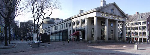
Quincy Market is a historic marketplace in downtown Boston, part of the larger Faneuil Hall Marketplace complex. Built in 1824-1826 and named after Mayor Josiah Quincy, it was designed by architect Alexander Parris.
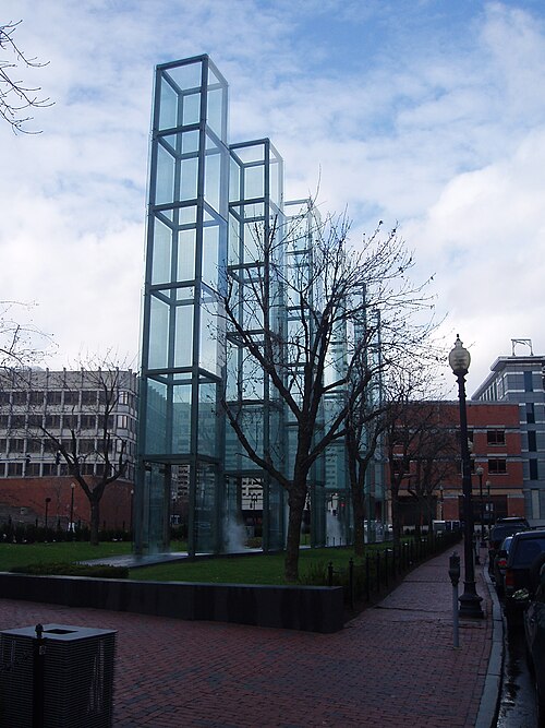
The New England Holocaust Memorial is a public memorial in Boston dedicated to the victims of the Holocaust. Located near Faneuil Hall and Union Street in the downtown area, it stands as a prominent civic memorial.
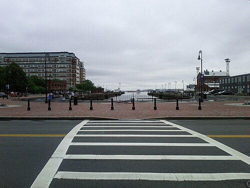
Charlestown Navy Yard is a historic naval shipyard in Boston, Massachusetts, operated as part of Boston National Historical Park by the National Park Service.
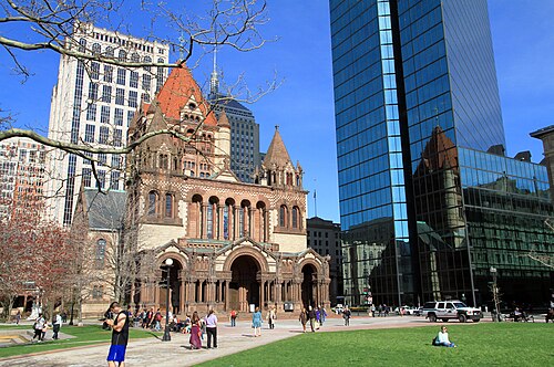
Copley Square is a public civic square in Boston's Back Bay neighborhood.
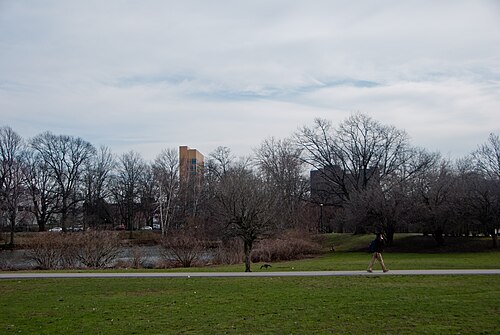
Back Bay Fens is a linear park in Boston's Emerald Necklace, the connected park system associated with landscape architect Frederick Law Olmsted.
Boston Common is the clearest orientation point. Beacon Hill rises to the north, Back Bay extends west along a regular grid, the North End and waterfront lie east, and the South End sits below the central core. Fenway is farther west and the Seaport lies across the Fort Point Channel. Cambridge and Somerville are separate cities but form part of the visitor geography through rapid-transit links across the Charles River.
Checked 2026-08-26
Walk through the historic centre and use the MBTA, locally called the T, for longer journeys. Subway lines connect downtown with Back Bay, Fenway, Cambridge and other neighbourhoods; buses and commuter rail extend the network, and the Silver Line links South Station, the Seaport and Logan Airport. Use the MBTA trip planner and current service alerts because diversions and accessibility conditions can change by station.
Checked 2026-08-26
A fixed stay length is not recorded. Plan the historic walking core first, then add Fenway, the Seaport, Cambridge or another neighbourhood according to your interests.
Yes. Boston Common, Beacon Hill, Downtown, the North End, Back Bay and much of the waterfront form a compact walking area, though outer districts need transit.
The T is the local name for the MBTA public transport network. Its subway, bus, commuter rail and ferry services connect the centre with the wider region.
No. Cambridge is a separate city across the Charles River, but rapid transit makes it part of the practical visitor geography for museums, universities and neighbourhood visits.
The Silver Line links Logan Airport with the Seaport and South Station. Check the MBTA trip planner for the current route, connection and accessibility information.